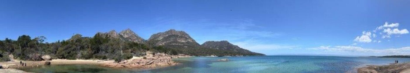

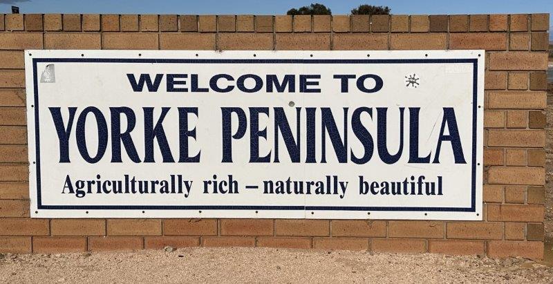
One of our most anticipated areas in South Australia was the Yorke Peninsula.
As we turned the corner into the Peninsula we found ourselves amongst grain farms. Our first observation in the Yorke was the friendliness of the locals. We have heard about the “country wave” and experienced it first hand in the Yorke. Drivers in oncoming cars, tractors or trucks would greet with a wave as they pass you.
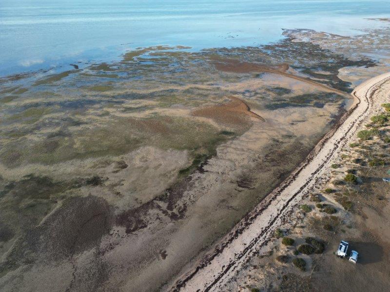
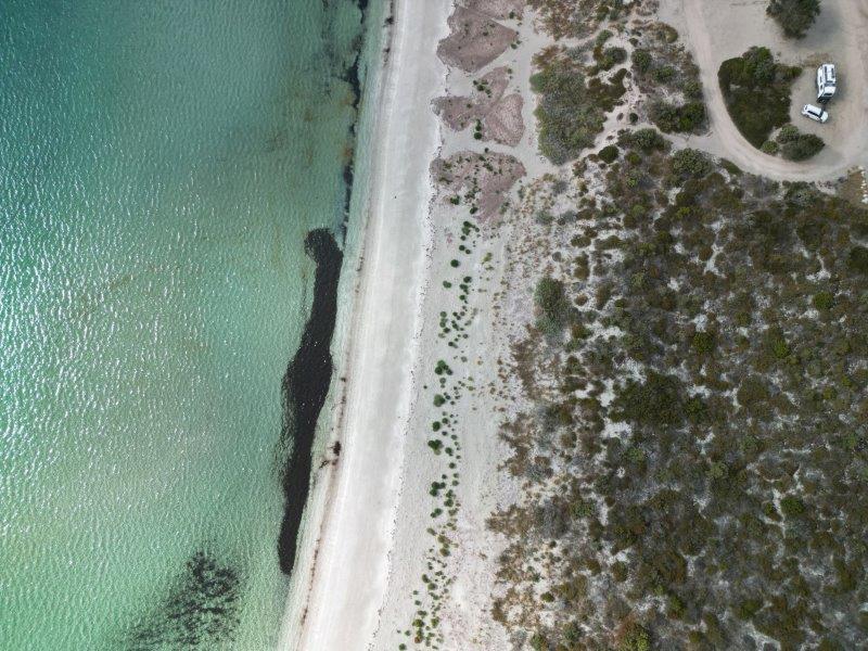
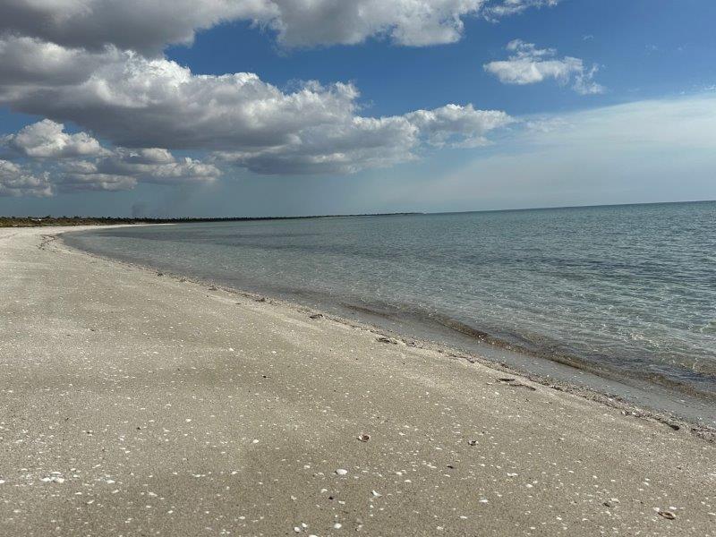
Parara Bush Camp was our first destination from where we explored the north eastern coast of the Yorke. Our site was on the beach, but at low tide the water was quite a walk.
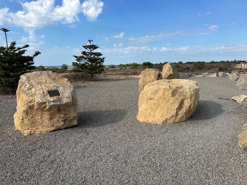
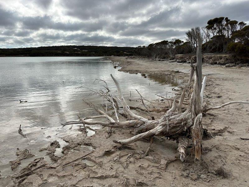
This beach is best known for the tragic beaching of seven Sperm Whales on 8 December 2014. A memorial was created simulating the whales’ positions along the coast with a bolder for each whale.
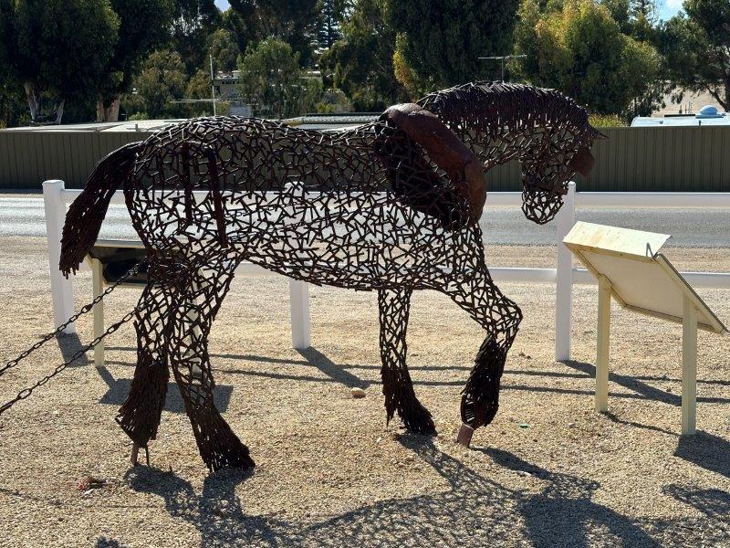
The first town we drove through, was Ardrossan. The town has massive silos and a wharf from where wheat, salt and dolomite were transported. We have noticed how tidy the town was before we leaned that it was awarded the tidy town award in 2019.
The town still celebrates the role of the working horses that carted grain to the port. The horse sculpture of “Neddy” is a tribute to blacksmiths and farriers that looked after the hooves of the horses.
The silo in the background was the largest silo in Australia when it was built in 1952. Many larger storage facilities has been built since.
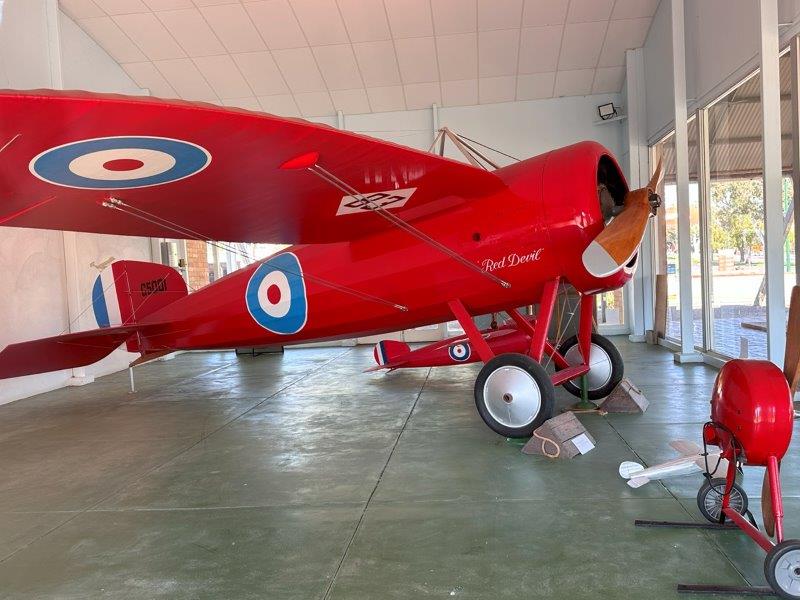
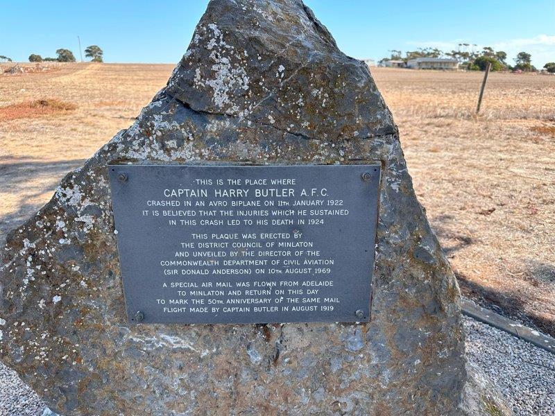
Just south of the center of the Yorke is the small town of Minlaton. On display in the town is the “Red Devil”. This plane was flown by Harry Butler. It was the first plane to transport airmail across water in the southern hemisphere.
Harry was a local and unfortunately crash landed just outside the town in 1922. A plague was later erected on the crash site.
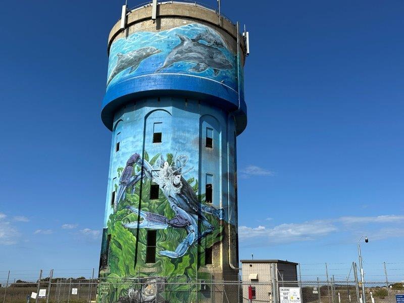
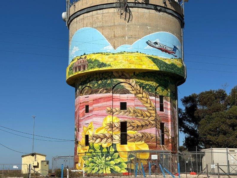
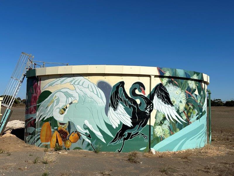
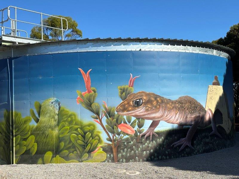
The Yorke is known for its water tower art and salt lakes. The southern Yorke Peninsula has established a water tower mural trail. As we explored the coastline we passed many painted water tanks and towers.
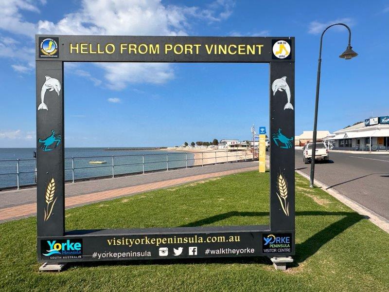
Port Vincent is a holiday playground and is known for its peaceful bay that attracts many fishos and boaties.
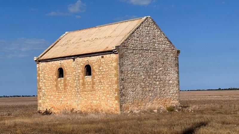
From Port Vincent we took the scenic gravel road north and passed the Hickman ruins.
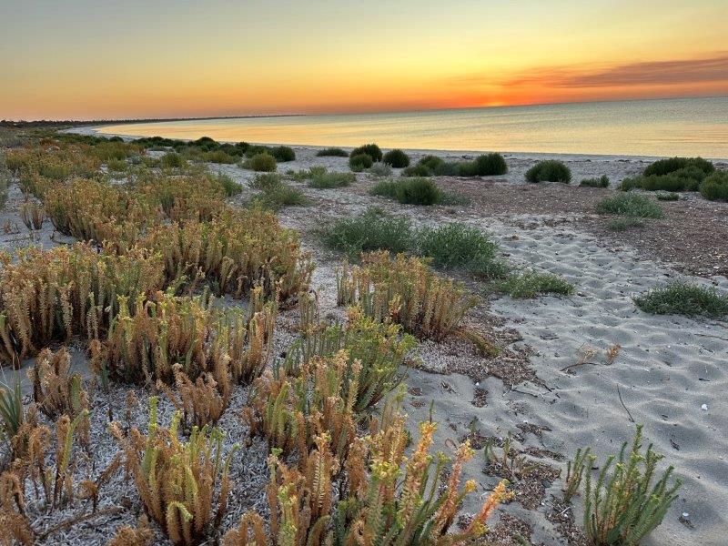
We moved camp to the southern part of the Yorke and settled at Burners Beach close to Point Turton.
Burners Beach was a perfect spot for long walks on the beach lined with incredible vegetation.

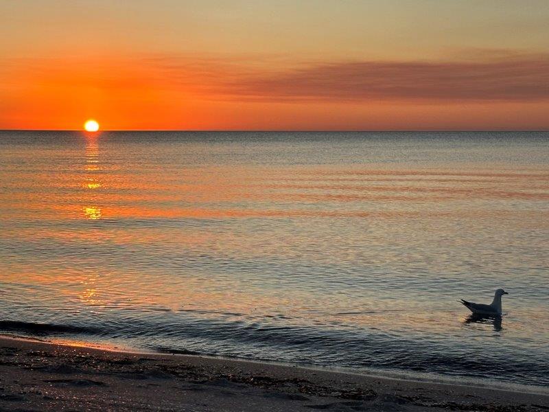
All fellow-campers moved their chairs to the beach at sunset and were never disappointed with the views.
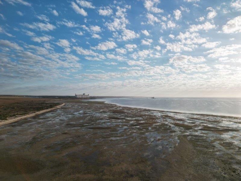
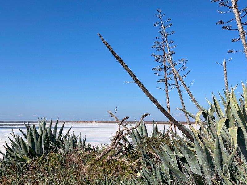
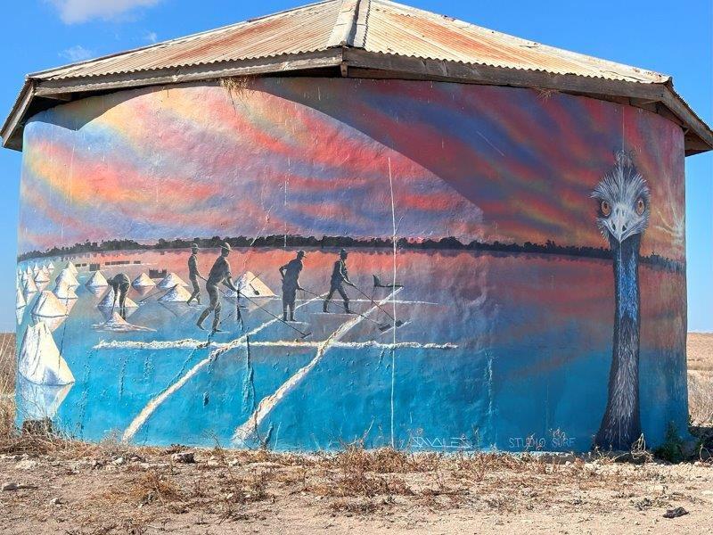
The southern part of the Yorke is know for its salt lakes. The area has a salt lake trail that you can easily drive in one day. We did not visit the lakes at the best time of the year, as most lakes were dry.
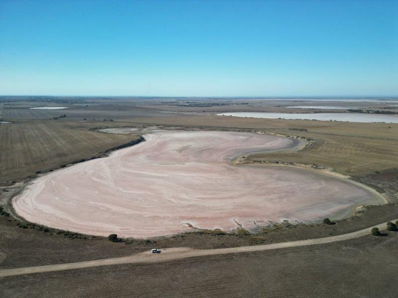
The colours of the lakes change based on the season. The higher the salinity levels in the water, the more vibrant the colours become. At the right time of the year, the salt lake trail rewards you with blue, orange and pink lakes. We could see some colouring on the edges, but lakes were predominantly white with a hint of pink.
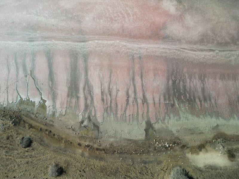
The largest lake we visited for the day was Lake Fowler, close to Yorketown. This lake has rich history dating back to the start of salt and gypsum mining in the area.
Back on the Yorke Peninsula water tower mural trail we passed many colourful water towers and tanks. The Yorketown water tower features the native flora of the Yorke.
Even this random water tank on a farm was pained to reflect the salt industry in the area.
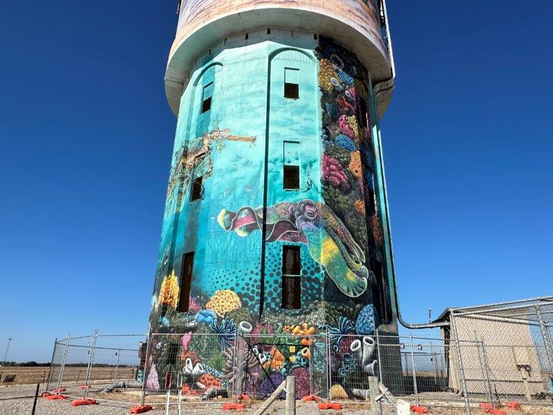
Edithburgh’s water tower reflect the abundance of sea life living under the local jetty.
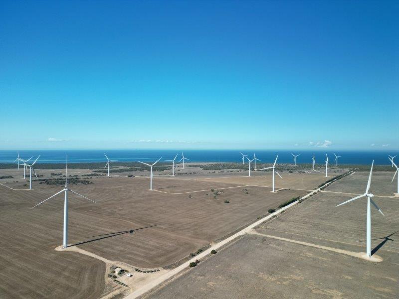
The Wattle Point Wind Farm is about 3km from Edithburgh. These 55 turbines have supplied the local grid with 91 megawatts since 2005. In 2005 it was the largest windfarm in Australia.
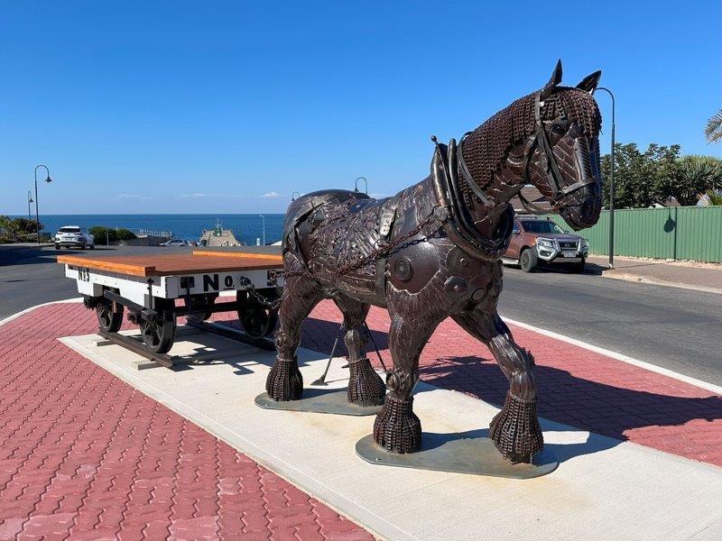
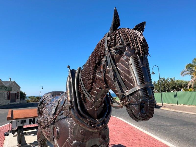
Just off the jetty of Edithburgh is a life size sculpture of Bonney, the Clydesdale horse. Clydesdales played a major role in getting cargo from land, along the jetty to ships.
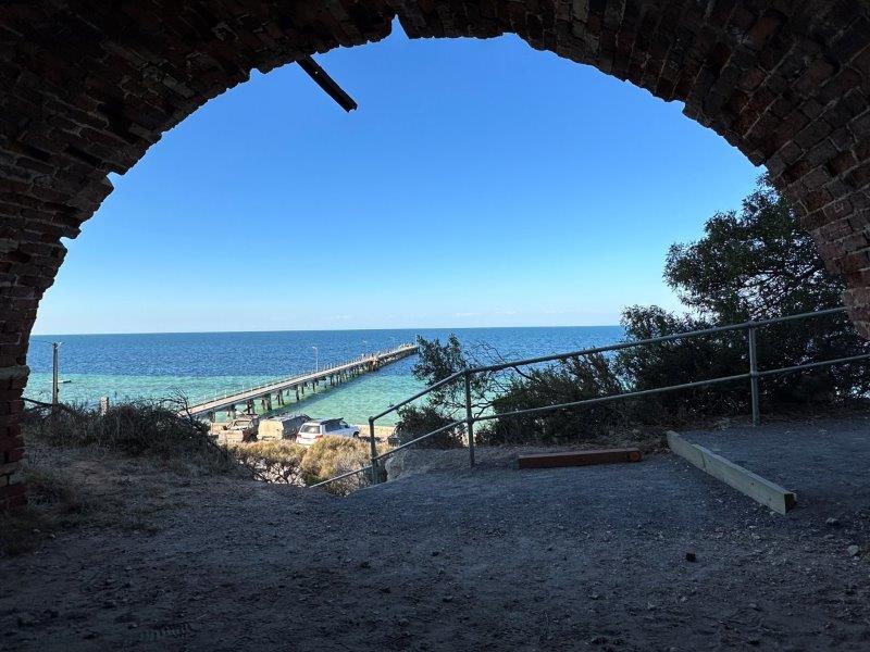
The Historic Lime Kiln at Wool Bay was great vantage point over the turquoise water in the bay. This was a great spot for lunch while soaking up the views. The contrast of the manmade 1910 kiln against the natural beauty of the bay, was hard to beat.
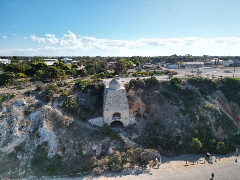

From inside the Kiln, you can see the 1882 jetty.
Wool Bay’s contribution to the water tower mural trail is a dam reflecting the local industries and some of the fauna and flora.
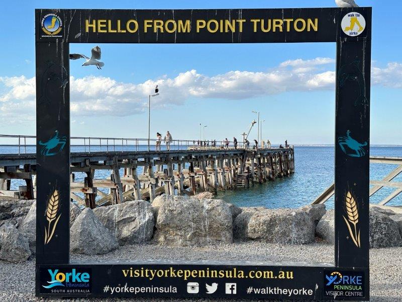
On the way back to the caravan at Burners Beach, we stopped in at Point Turton. This must be one of the most popular towns in this area for tourism. The caravan park was bursting at the seems with tourist wandering along the esplanade and on the jetty.
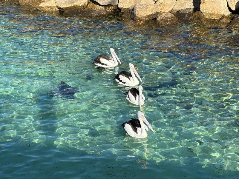
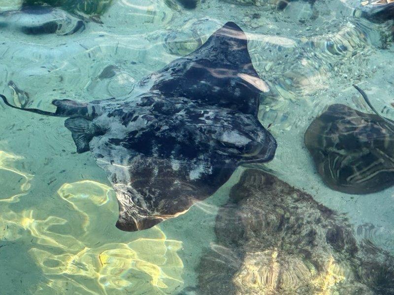
While at Point Turton, the Stingrays and Pelicans were passing under the jetty waiting for fish scraps from the fisherman.
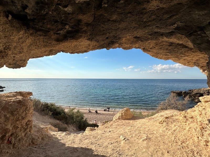
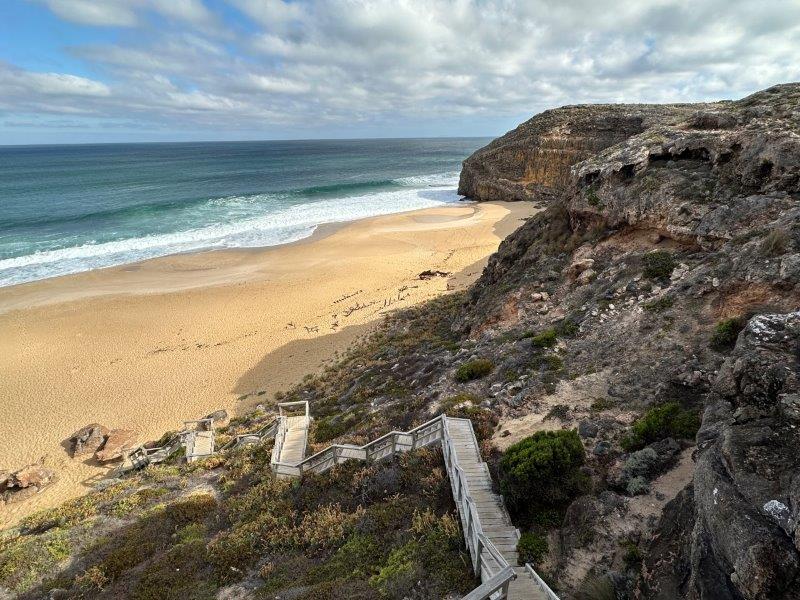
Just outside Port Turton is Magazine Bay Cave. This cave has a great view over the bay. The floor of the cave is covered with astro turf making it a great spot for a picnic.
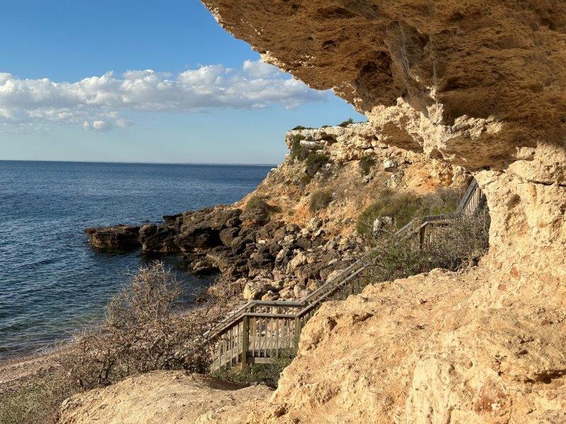
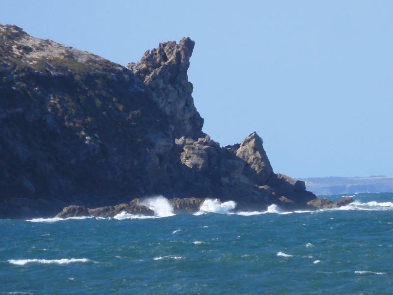
From Burners Beach we allocated a day for the Dhilba Guuranda-Innes National Park close to Marion Bay. After visiting the Information Centre, our first stop was Rhino Head Rock.
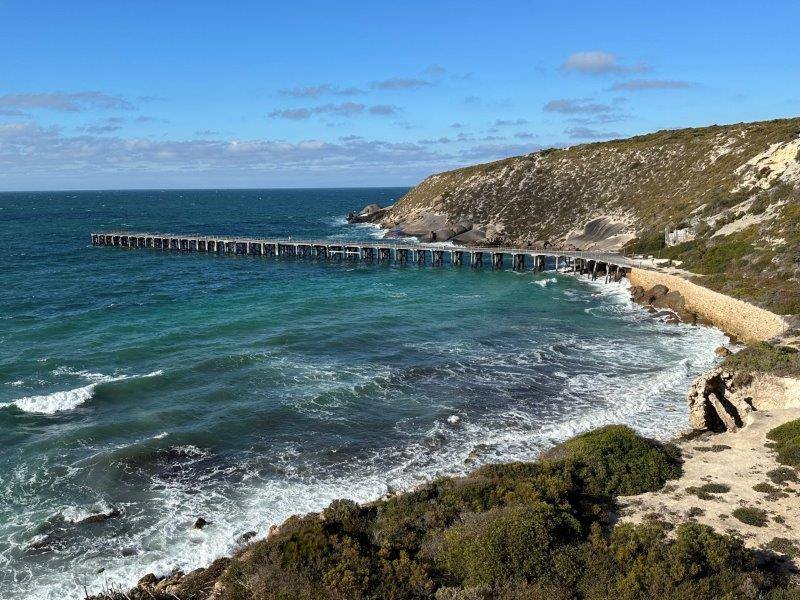
The Stenhouse Bay Historic Wharf is an icon in this national park.
The Ethel ship wreck was our next stop. Pieces of the metal carcass of the ship can be seen sticking out from the sand, looking down from the towering cliffs. This steel sailing ship weighed more the 700 tons. The 1876 ship ran ashore on a voyage from South Africa in 1904.
A passing steamer, the S.S. Ferret tried to save the Ethel in 1904. In the end they could only notify authorities. Ironically, the S.S. Ferret Steamer got shipwrecked on the same beach in 1920, 16 years later.
The small gypsum mining town of Inneston is in the national park. This desolated town got a second life with its restoration. Walking tracks were established through the historic town and you can even book into one of the resorts, to experience the town at night. On the way to the town we passed Inneston Lake.
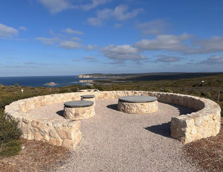
We were very impressed by the maintenance and continuous development of the park, with brand new lookouts and walking tracks.
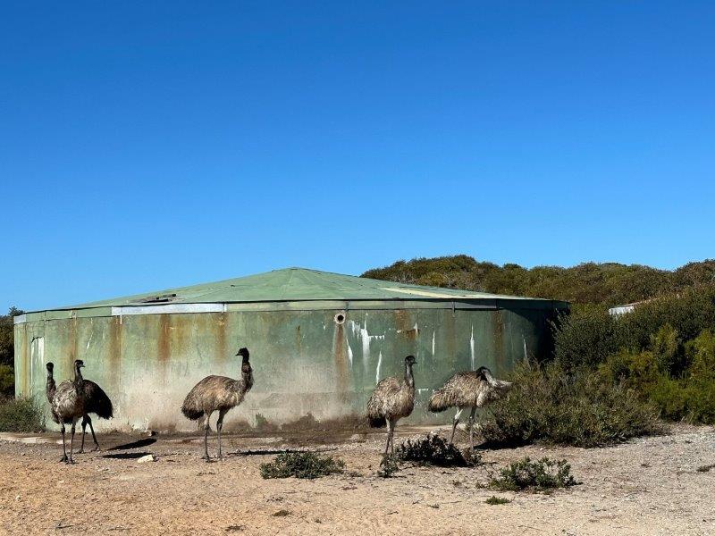
We took a photo of these emus in front of a water tank. It looks like a mural…
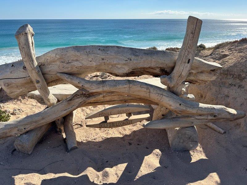
The Dolphins Lookout in Pondalowie Bay is located in the national park. This spot is one of South Australia’s top spots to see dolphins.
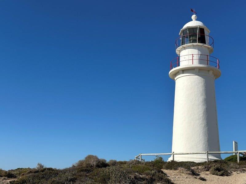
Our last stop on the way back to Burners Beach was Corny Point Lighthouse built with local limestone.
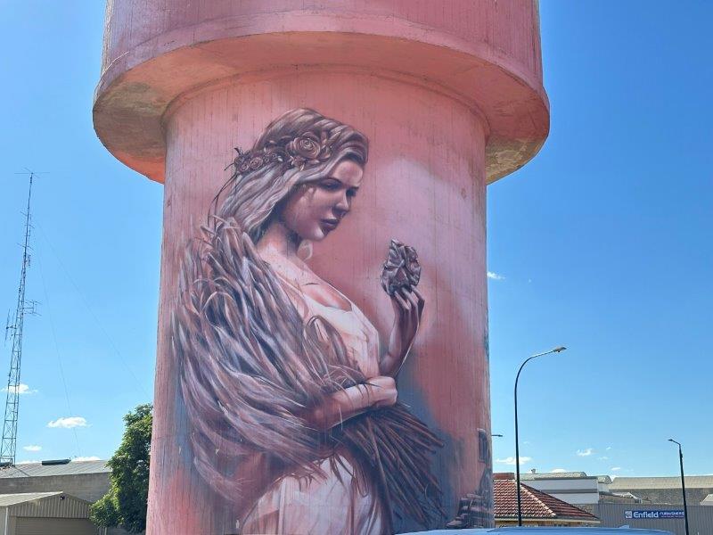
From Burners beach we headed north and stopped at Kadina Water Tower Art. The young girl has copper and wheat in her hands. The two products were important in the history of the region. This area is known as the Copper Coast.
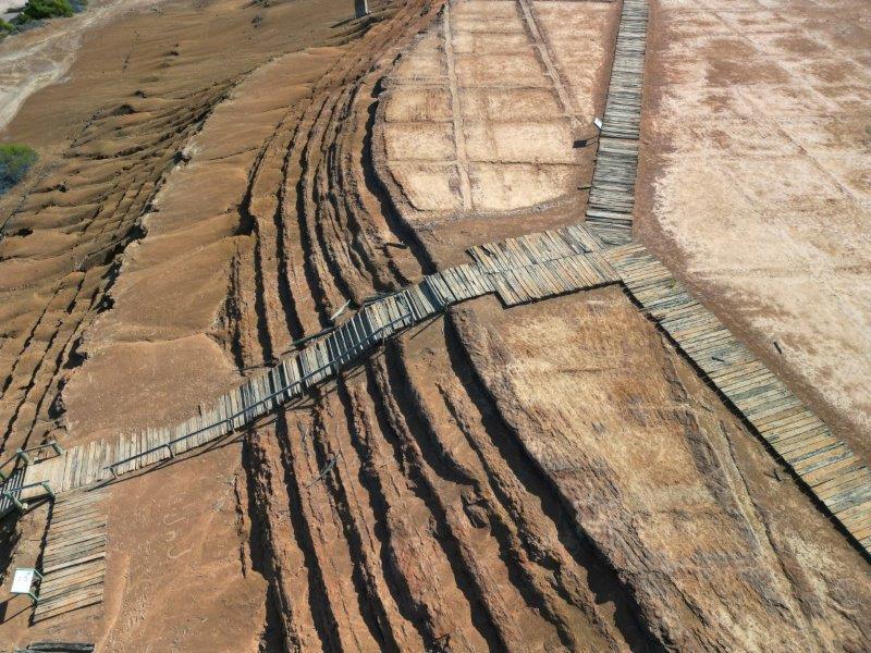
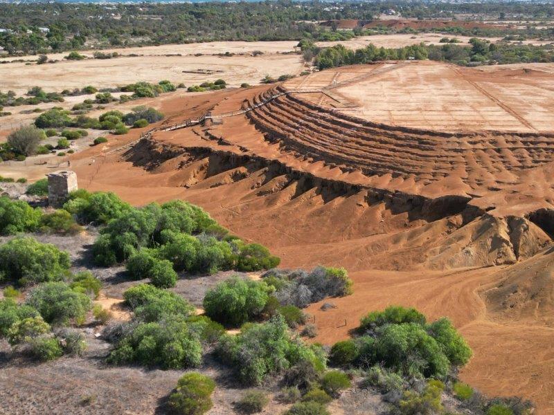
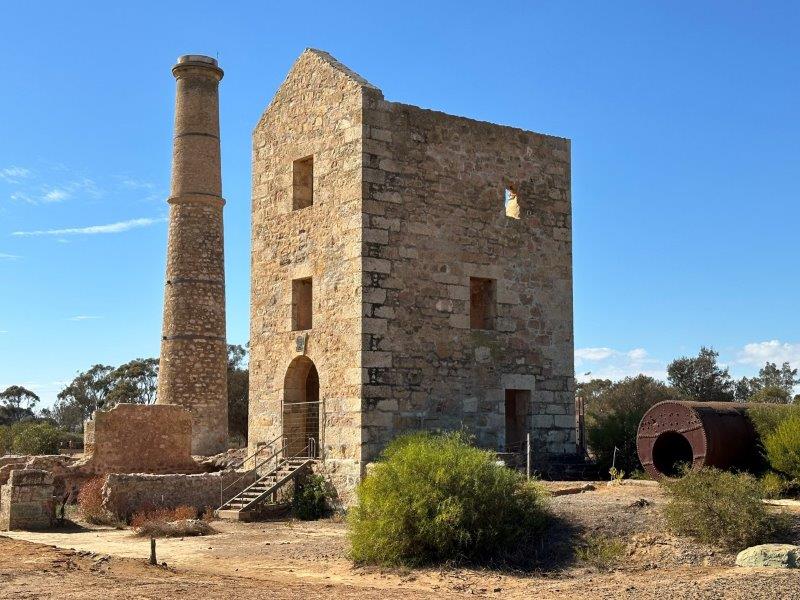
We stopped for two days in Moonta. The old copper mining sites are open to visitors. You can either follow the walking tracks or take the Moonta Mine Tourist Railway. Boardwalks takes you on top of the massive mounts of tailing resulting from the mining process.
The Hughes Enginehouse was used to remove underground water with pumps to enable mining below the groundwater level.
The day before we arrived, an Adelaide man walked his dog on the site. The puppy fell 8 meters down the shaft. The owner went down the shaft to rescue the pup and got stuck himself. It took the SES, Country Fire Service and South Australia Ambulance Service 4 hours to get the man and dog back to safety. This mammoth effort was reported on all news networks.
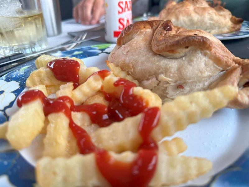
After copper was found near wombat burrows in the area, the copper rush started. Skilled miners emigrated from Cornwall. These new Cornish immigrants had a significant impact on the area. The Cornish Kitchen is well know for its traditional Cornish pies. These pies were common in the lunch boxes of the copper miners.
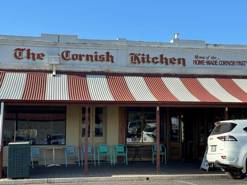
We had to taste these pies. Speaking to the staff in the kitchen and learned that the thick dough crust was used by the miners to hold the pies while they were eating it. The crusts were then discarded to avoid possible arsenic oxide dust contamination from their hands.
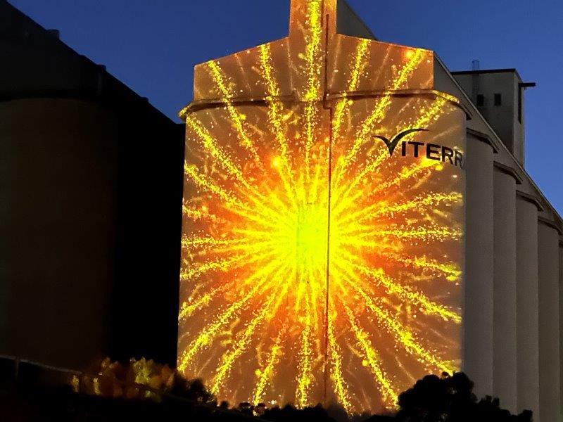
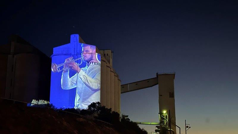
From Moonta we went to Wallaroo for the sunset on the Jetty and the light show on the silos.
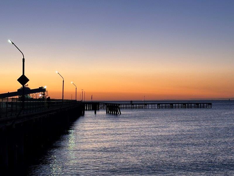
As the sun was setting the countdown on the silo started.
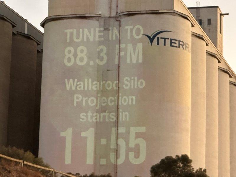
The light show tells the story of the Yorke Peninsula’s Copper Coast. The show reflects on the history and also introduces local events, things to do and work from local artists.
From Moonta we moved to Nelshaby. Nelshaby was our last campsite in the Yorke. From here we could explore the north western part of the Yorke.
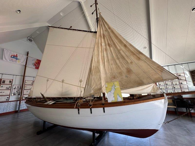
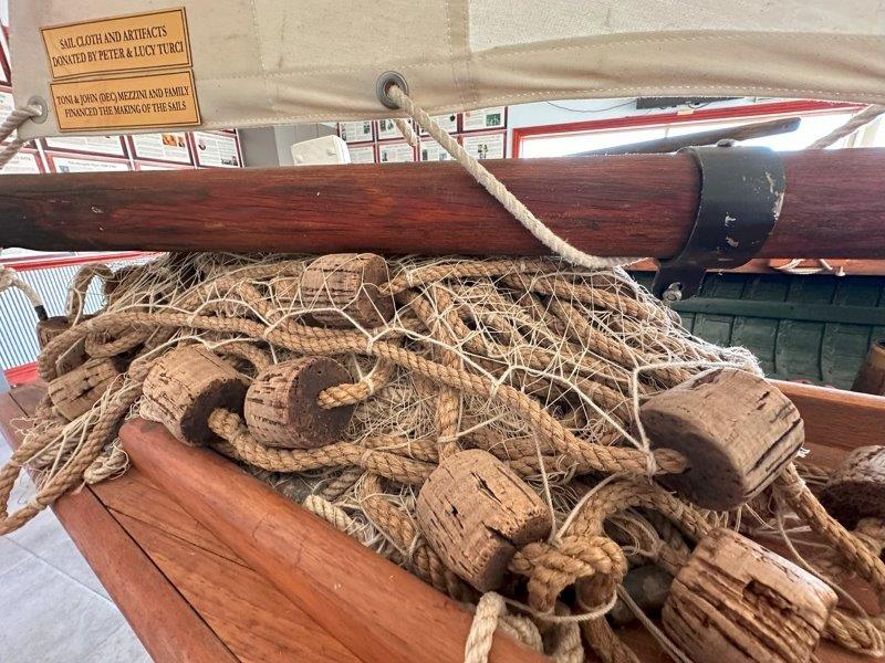
We visited the Molfettesi Fishing Boat Museum in Port Pirie. The museum has some fishing exhibitions but was mostly focused on the early Italian settlers and their influence on the local industries.
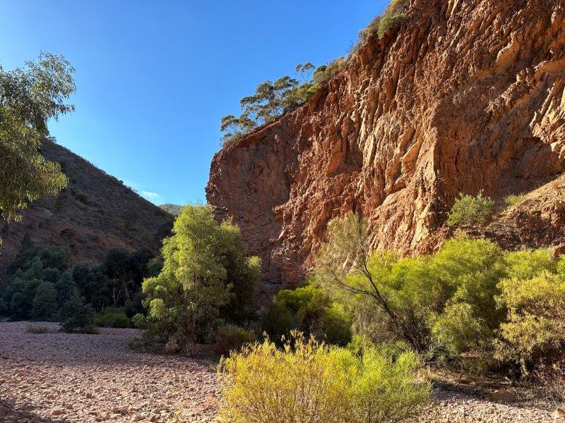
We did the Napperby and Telowie gorge walks while in the area.
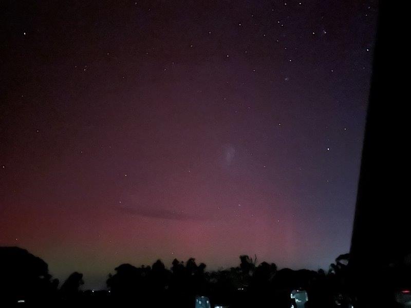
While camped up at Napperby, the Aurora Lights appeared on 12 May 2024.
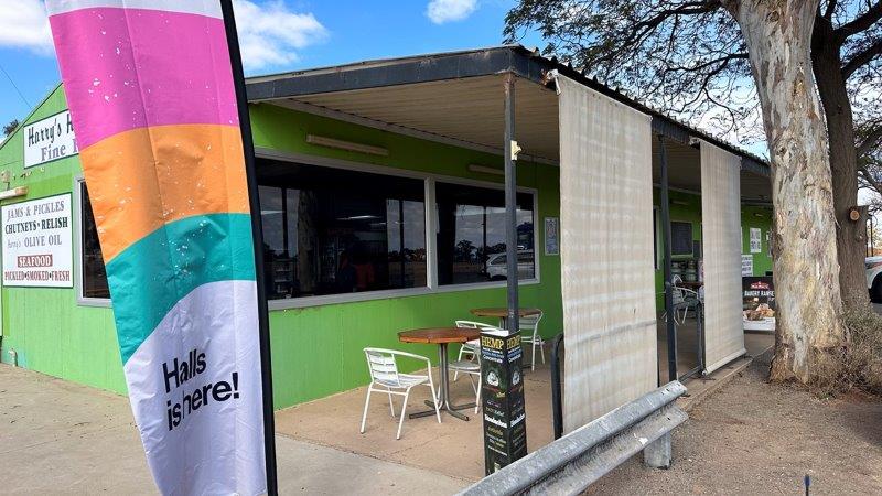
Just down the road from our campsite was Harry’s Home Made Fine Foods shop. The shop is a delicatessen selling smoked goods, salamis, pickled goods. sauces, jams, and olives. On the menu is a hamburger for every taste. For the more daring diners there were crocodile, camel, buffalo or kangaroo burgers.
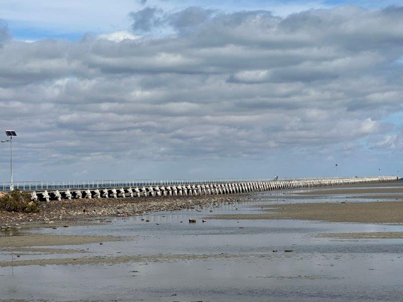
Our last stop in the Yorke Peninsula was the Port Germain’s 1676m jetty. At more than 130 years old it remains one of the longest wooden jetties in the southern hemisphere.
This concluded our trip in the Yorke Peninsula before heading further west into the Eyre Peninsula.