We spent a few months in Brisbane, catching up with friends and family. We also took this time to do a trip abroad and get the car and caravan serviced.
We repacked the caravan and removed anything we did not use during our previous trip. We were surprised at the amount of stuff we carted around for 37000km, without using it.
We also made a few changes to the setup and replaced the old Starlink V2 with the new Starlink Mini. The old Starlink required 240v input and was dependant on the inverter in the caravan. The new mini uses 12v and provides data and mobile access while traveling in the car.
After some precious time with family, we were back on the road. We decided to do a two week shake down trip close to Brisbane. This would allow us get any issues fixed, if required.
We spend a few days north-west of Brisbane, close to Lake Somerset.
We enjoyed a weekend with close friends at Jack’s Place Hipcamp. This site only allows self contained campers and it gave us the opportunity to test the off-grid capability.
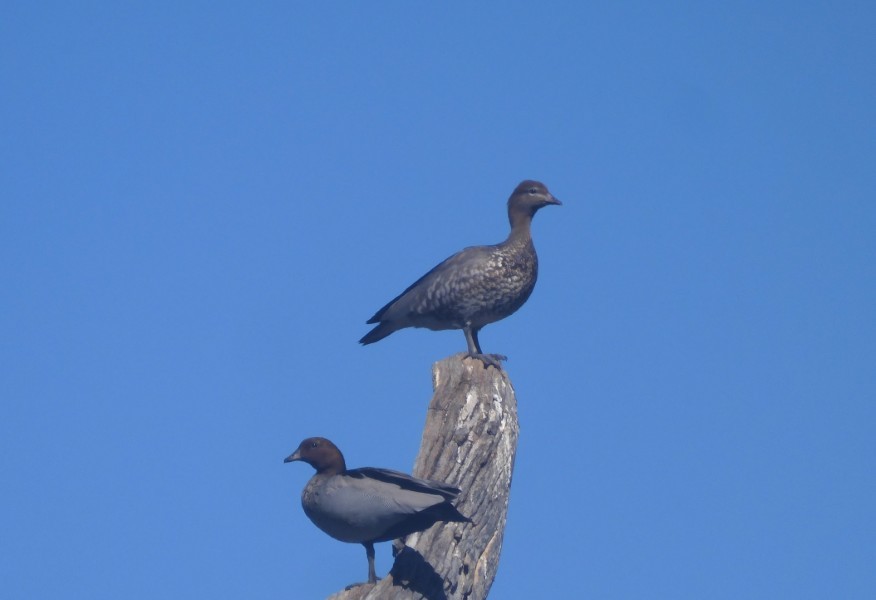
This camp is a twitchers paradise with many different bird species nesting right next to our campsite. We were surprised by the Australian Wood Ducks nesting high up in hollow, dry tree stumps.
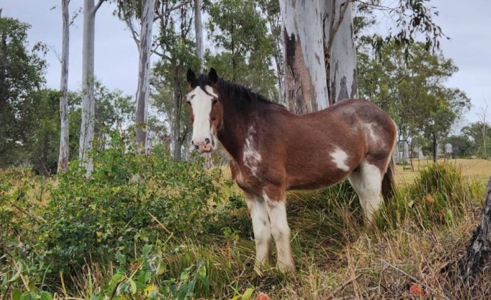
The two resident horses strolled through the campsite every morning, looking for a feed.
After the weekend at Jack’s Place we moved to Toogoolawah, where the weather started to turn foul.
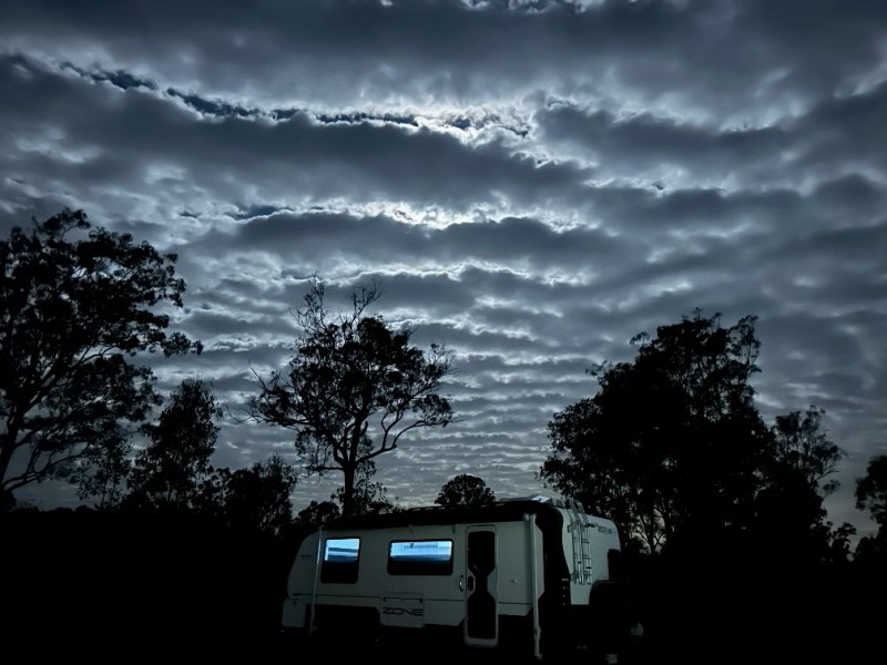
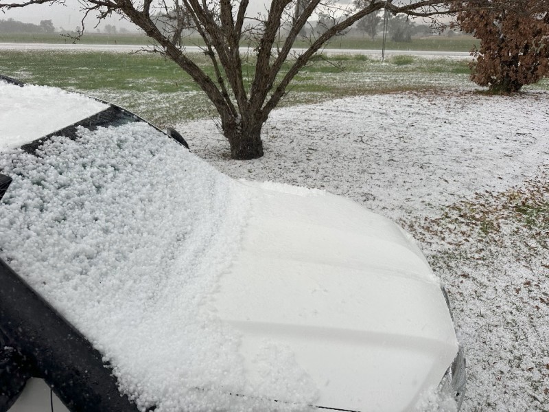
We received hail and storm warnings on our phones and they were not wrong…
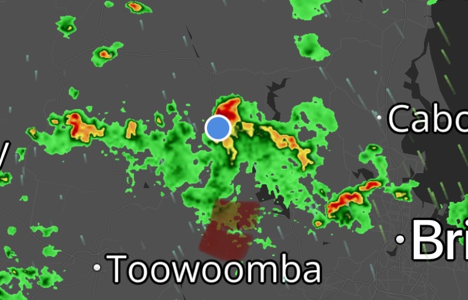
The next moment we found ourselves in a massive hail storm, luckily with no damage. The caravan ended up in a pool of water up the the wheel hubs.
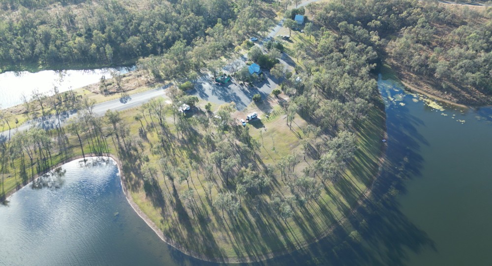
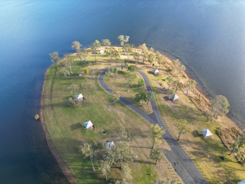
After Toogoolawah we spend our last weekend in the Brisbane area, at Lake Wivenhoe. We were booked on a powered site allowing us to test all the 240V appliances.
Lumley Hill campground is an old favourite and we were fortunate to meet up with a few long time fellow campers and close friends. Lumley Hill is on a small peninsula in the lake where the camping area runs into a day use area at the tip of the peninsula.
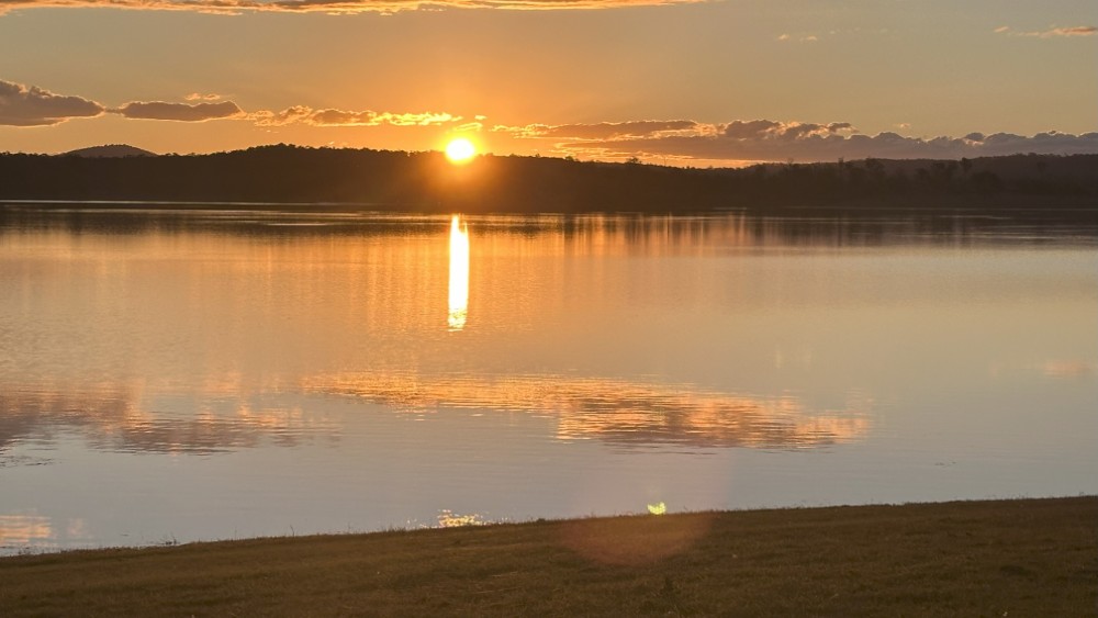
With sunset closing in, we moved to the water’s edge to enjoy the last sunset with fiends for a while.
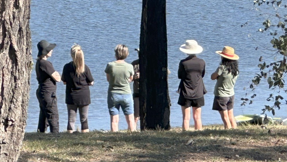
The sunsets at Wivenhoe never disappoint.
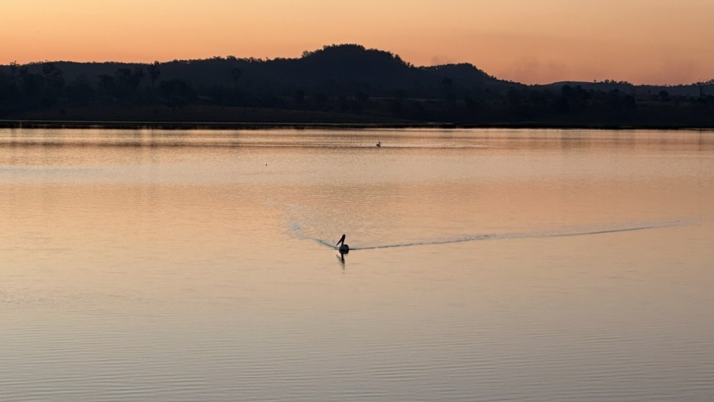
Even after the sunset, the pelicans were still cruising around.
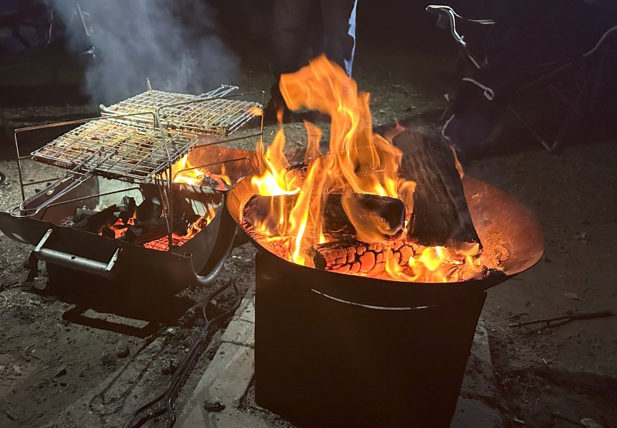
It was great to enjoy a campfire, braai and a few drinks with friends.
From Lake Wivenhoe we took the toll road past Toowoomba, towards Stanthorpe. Stanthorpe is know for low temperatures, fruit and wine production and generations of Italian heritage.
After we set up camp, we went to the Visitor Information Centre to plan our next few days.
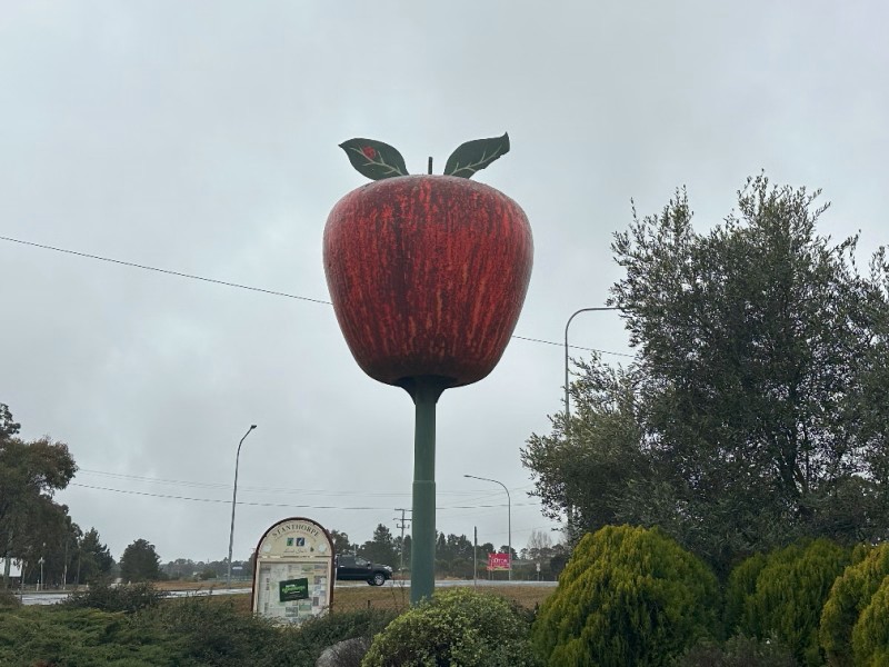
Our first stop was at The Big Apple in Thulimbah.
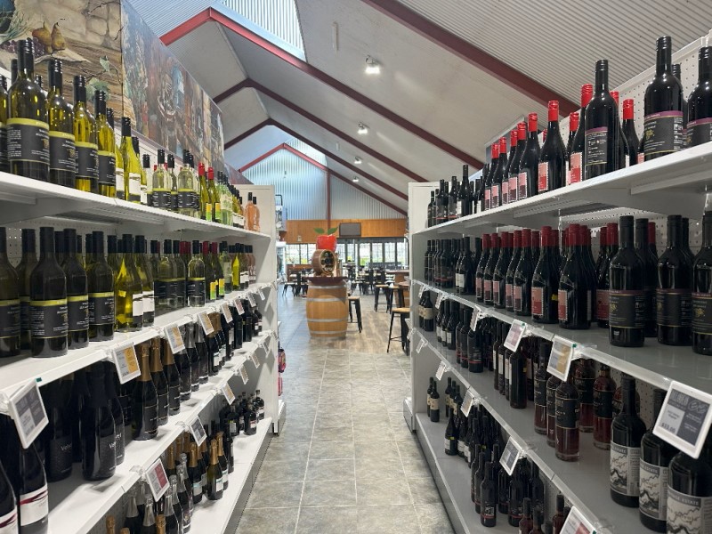
Just behind The Big Apple is a massive store with a restaurant. The store sells a variety of wine, pasta, cheese, coffee and olives.
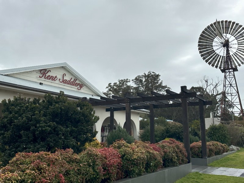
The next stop was Kent Saddlery. Lyle and Helen Kent worked in the saddlery industry since 1988 and established the Stanthorpe business 25 years later.
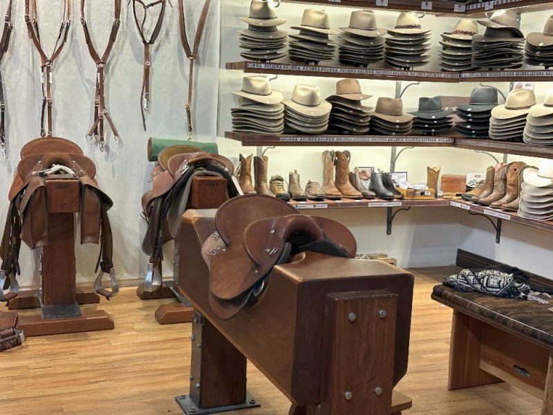
The saddlery offers a variety of leather products. The smell of leather as you walk in, creates a relaxed atmosphere, taking you back in time. No need for scented candles in this shop.
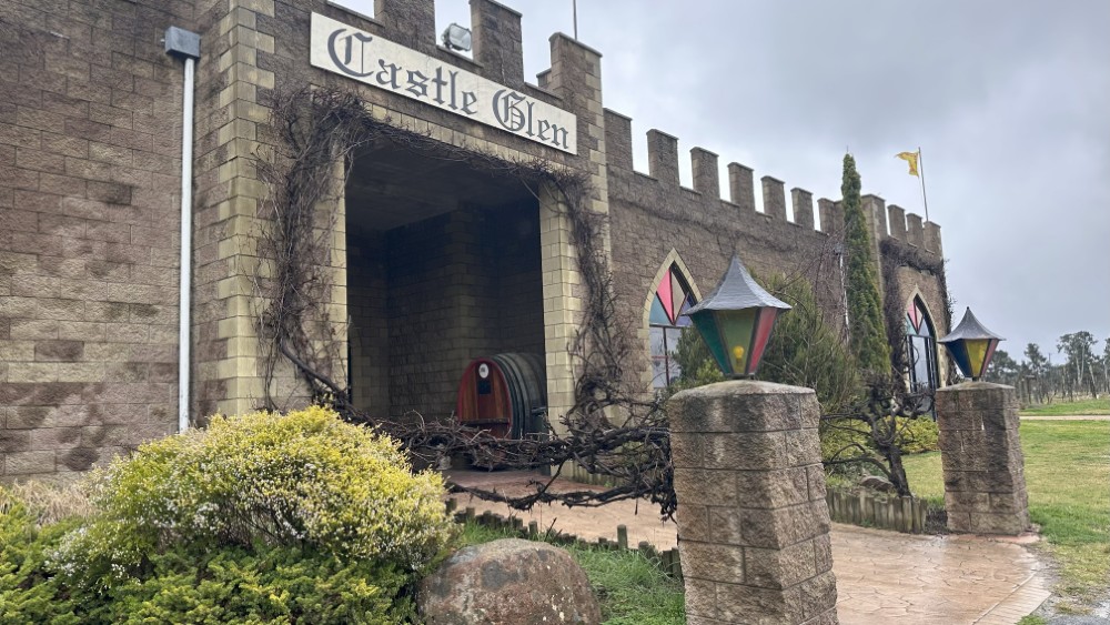
We made a quick stop at Castle Glen. Castle Glen has a variety of wine, liqueurs, spirits, beer and cider on offer.
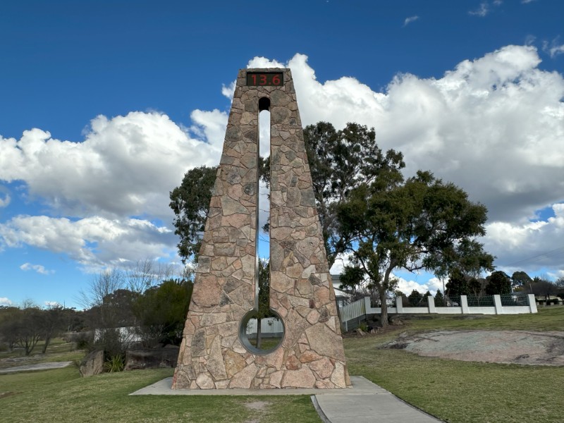
The Big Thermometer is close to the Stanthorpe Visitor Information Centre and stands 10m high. As Stanthorpe is the coldest town in Queensland, The Big Thermometer often features on the news and have seen temperatures of -10°C.
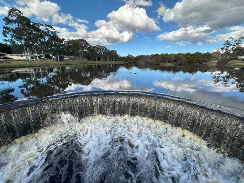
Quart Pot Creek runs past the thermometer. The creek is dammed up before Granite Street, overflowing into a waterfall feature.
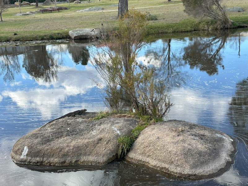
Quart Pot Creek runs through Rotary Park around large granite boulders. While we were there, an Australian Water Dragon was on a rock soaking up the sun.
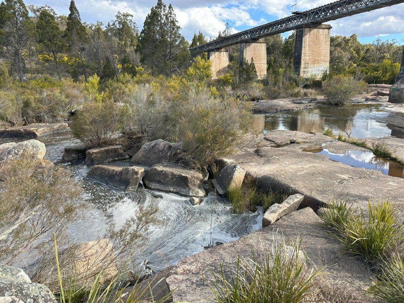
A short walking track upstream takes you to the historic Red Bridge, build in 1880. If you were looking for a red bridge you may walk past this 106m grey one, as it is no longer red in colour. You have to read the plaque on the bridge to know this is the Red Bridge.
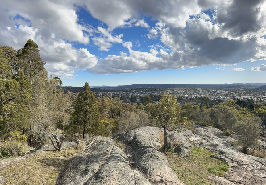
Our last stop before we went into town, was Mount Marlay Lookout.
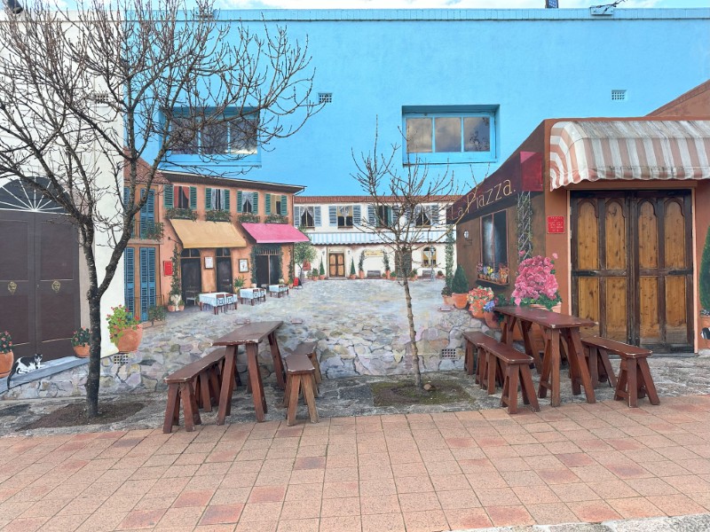
The centre of town has multiple murals and sculptures. The Italian Piazza Mural by Julie Brown, Dean Ford and Laurie Astill, was one of our favourites.
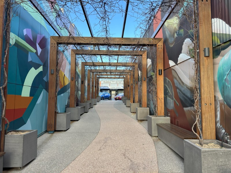
We also liked the Fromes Lane Mural.
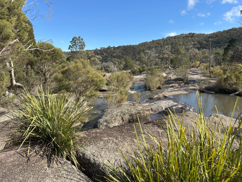
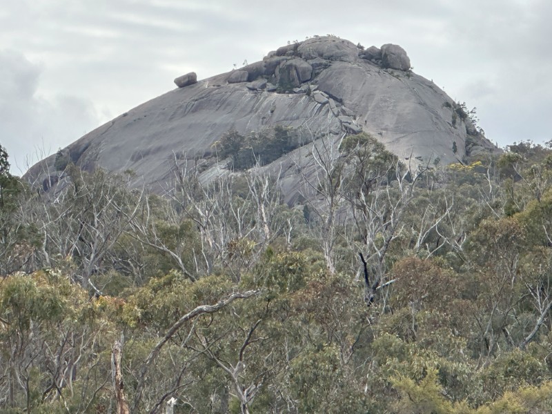
We kept the next day open to do a few walking tracks in Girraween National Park. The park is 35 kilometres south of Stanthorpe. A short walk from the carpark is Bald Rock Creek. The creek meanders through the granite.
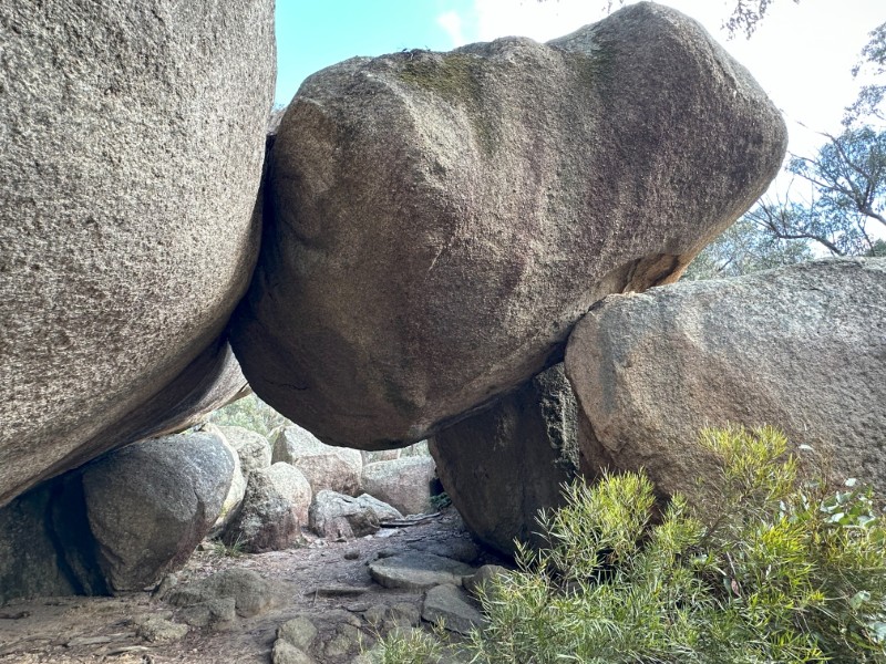
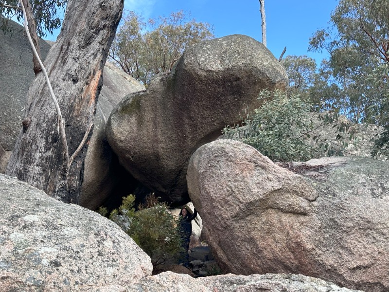
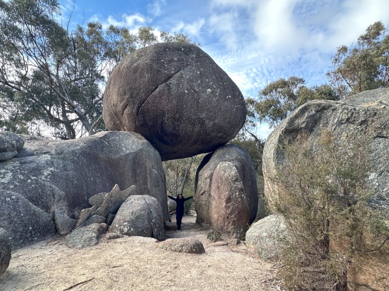
There are a few walking track options, starting from the carpark. We decided on three tracks, starting with the Granite Arch Track. The Pyramid was the first feature on track.
The track is well marked and an easy walk through the granite boulders.
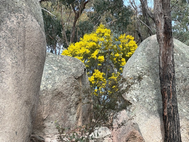
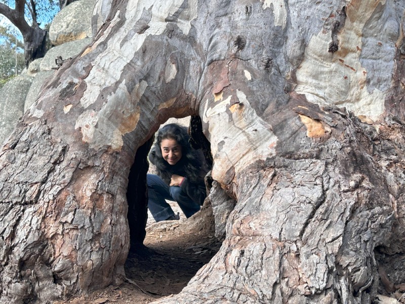
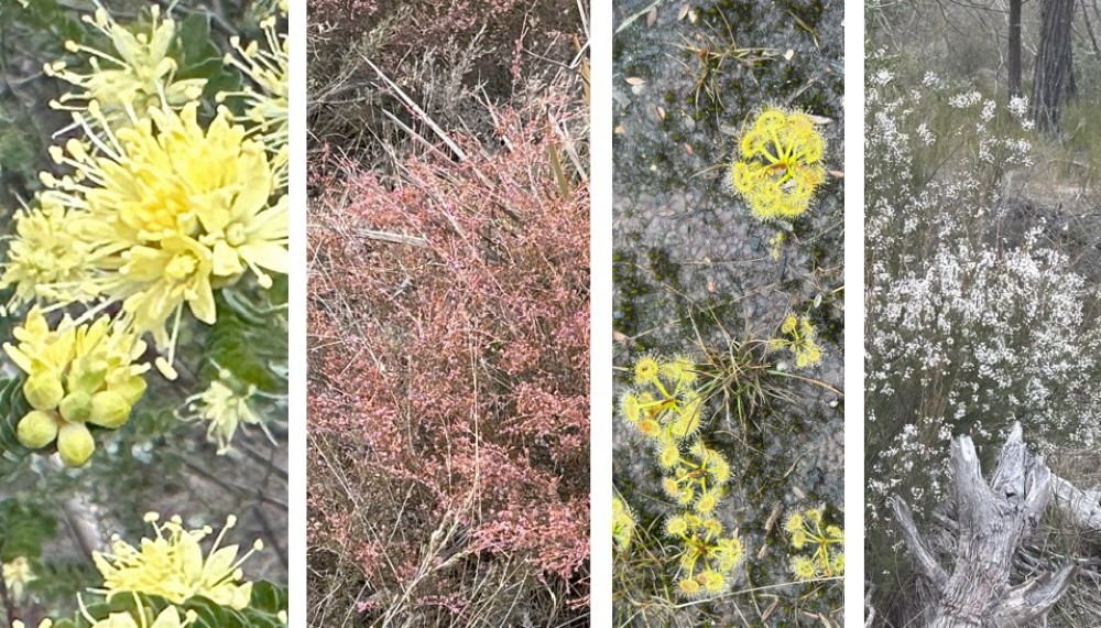
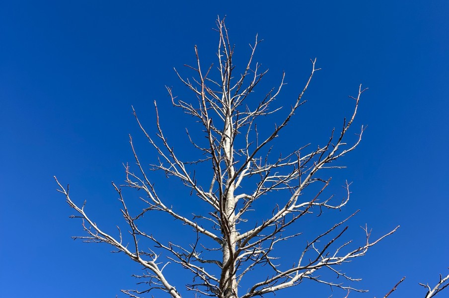
Along the track we stopped at a few massive trees, but despite our best efforts only saw a few wildflowers and birds.
We had to stop for a few photos at the arch.
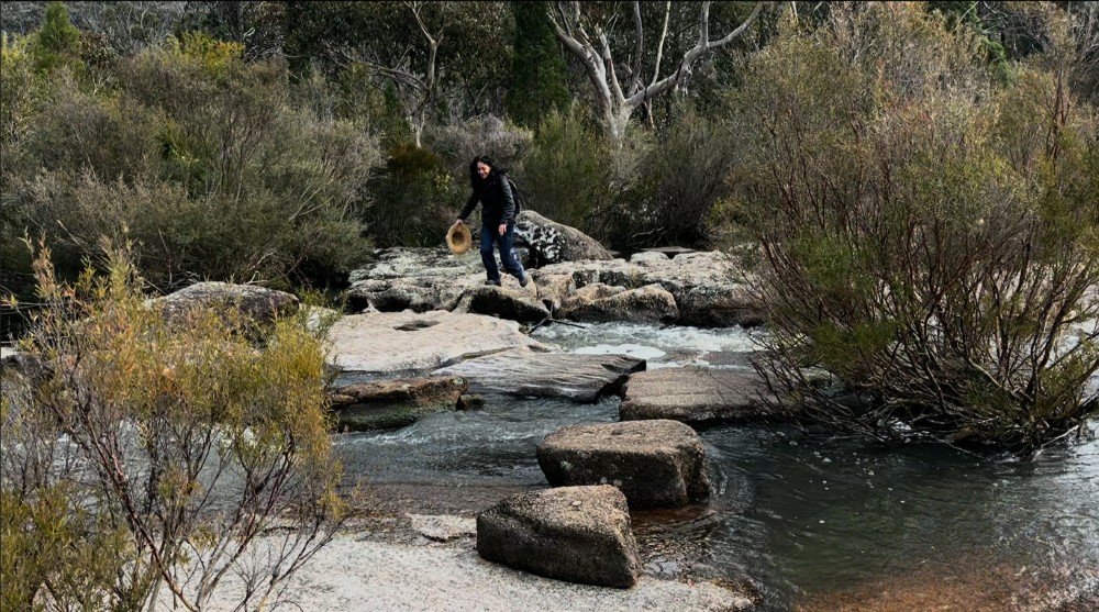
At the end of the track, was a quick scramble across Bald Rock Creek, before heading back to the starting point.
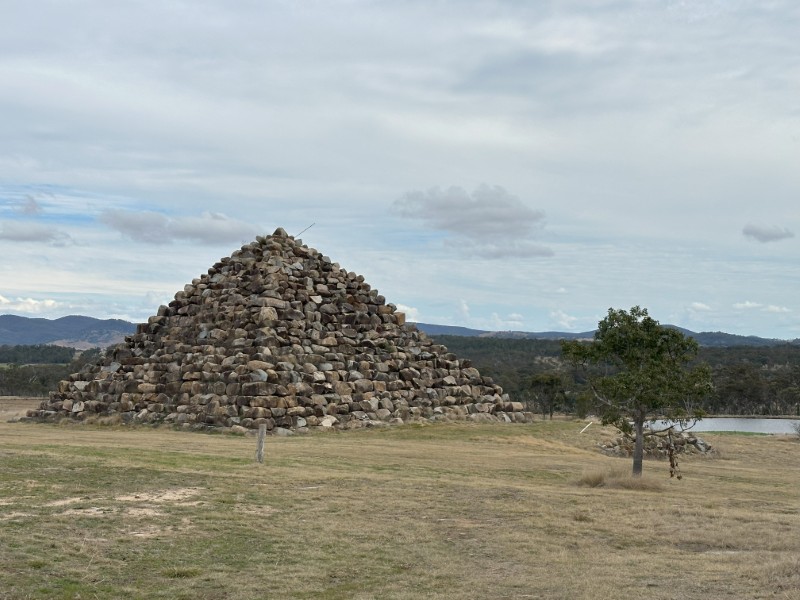
On the way back from Girraween we veered off the main road to visit the Ballandean Pyramid. This 15 meter man-made granite pyramid is part of Henty Estate. This was a nifty way to get rid of all the rocks unearthed on the farm. The owner Steward Morland, appointed a contractor to build the pyramid.
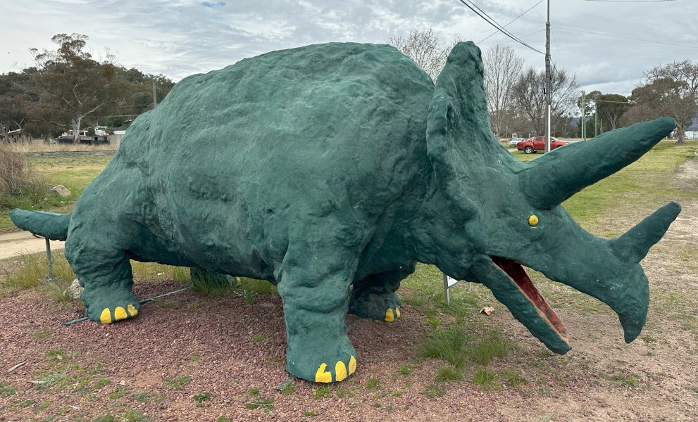
Back on the main road we stopped at The Big Dinosaur in Ballandean. This triceratops started it’s life in 1998 on a float during the Apple and Grape Harvest festival and found a permanent home at the station. It seems like this triceratops had a recent pedicure.
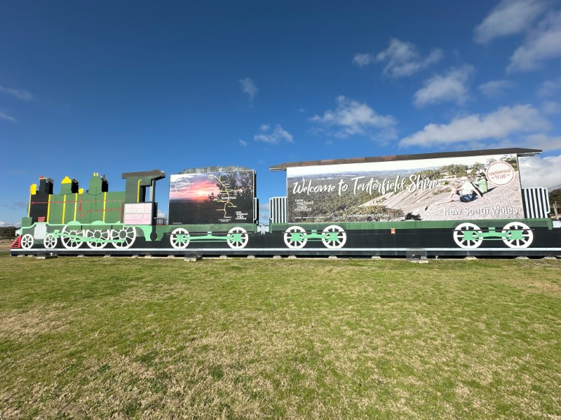
The next part of the trip took us over the Queensland/ New South Wales border. The colourful “Welcome to Tenterfield Shire” in Wallangarra signify the exit from Queensland.
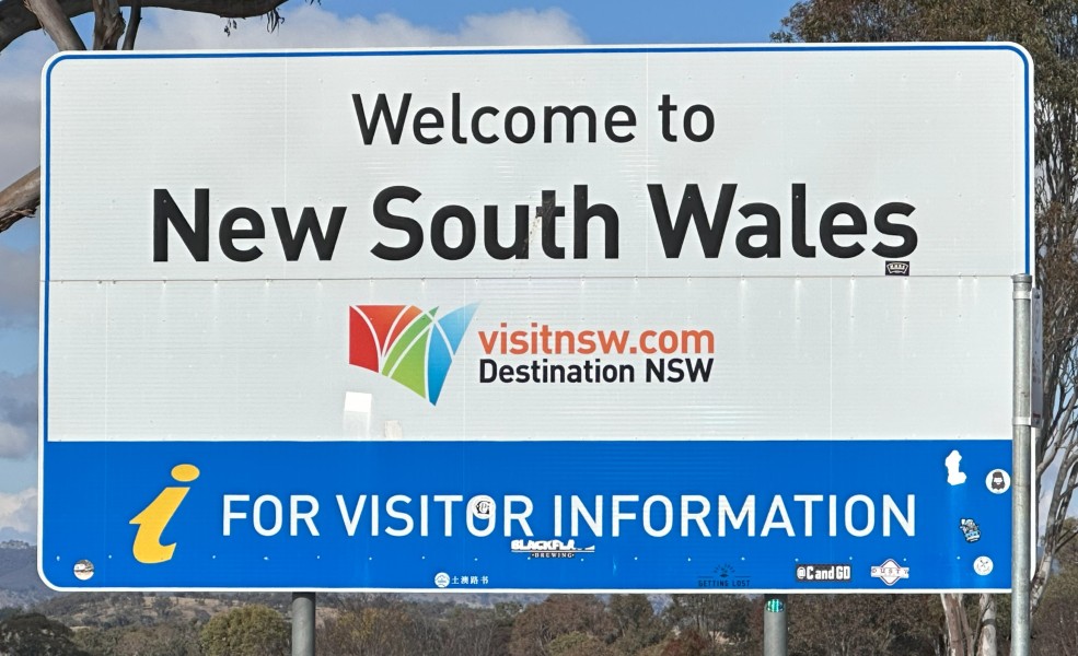
As we left Wallangarra we passed the New South Wales border sign.
This northern part of New South Wales is known as the New England region. Some of the roads in this area were closed in August 2025 due to a snow event. Massive trees dropped branches under the weight of the snow and the councils were still cleaning up the debris as we passed through the area.
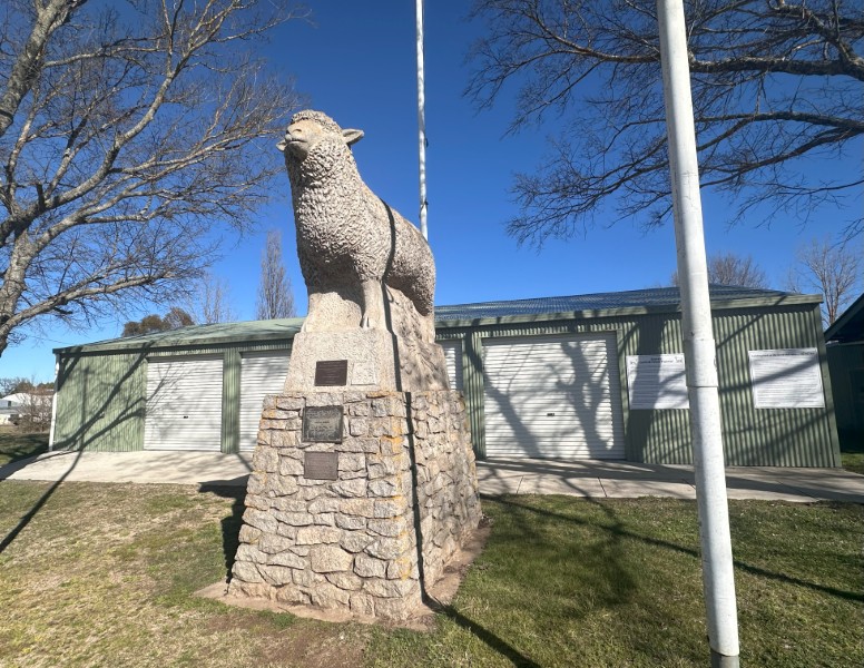
We followed the New England Highway in a southern direction. The Big Lamb in Guyra was on the main road and was built to promote the local lamb and potato industry.
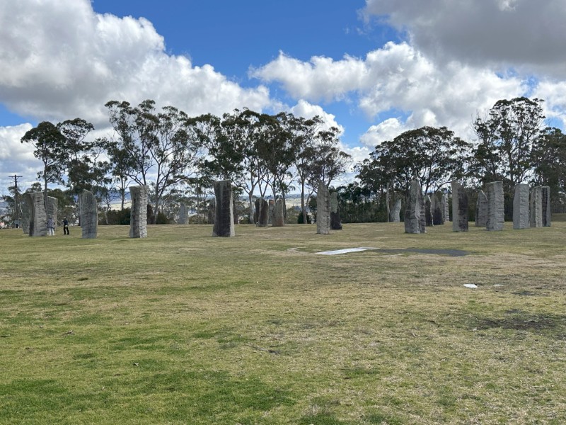
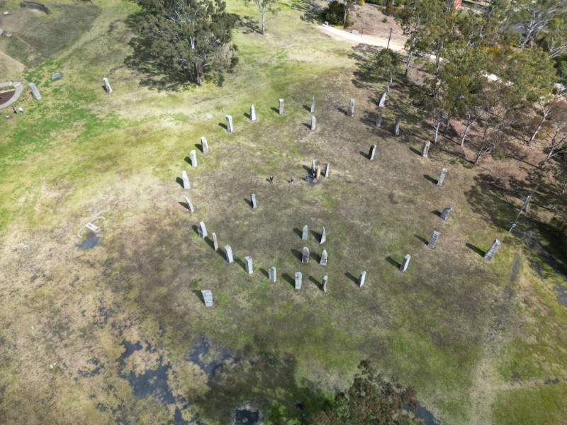
Our next stop was Australian Standing Stones in Glen Innes.
The original Calanais Standing Stones in Scotland apparently dates back to approximately 3000 BC. The Stonehenge in England was erected approximately 2000 years later.
In 1991 the Australian Standing Stones were constructed in Glen Innes to celebrate the celtic heritage of early settlers. The first 5m stone was pulled upright in 1991, by a local tug o’ war team in true celtic fashion.
As we headed south, the elevation on the New England Highway kept increasing until we reached the highest point on the tableland, Ben Lomond. Ben Lomond is the highest inhabitable locality in Australia at 1,370 meter elevation.
We decided to stay a few days in Ben Lomond and experienced very low temperatures.
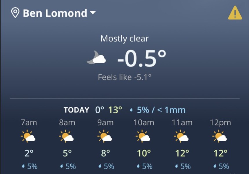
Looking out the window it was clear that we were in the midst of winter.
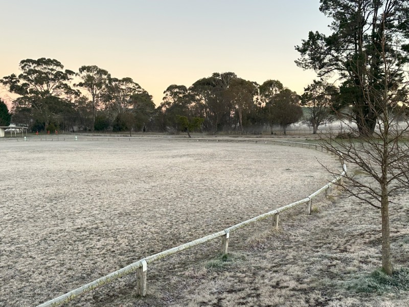
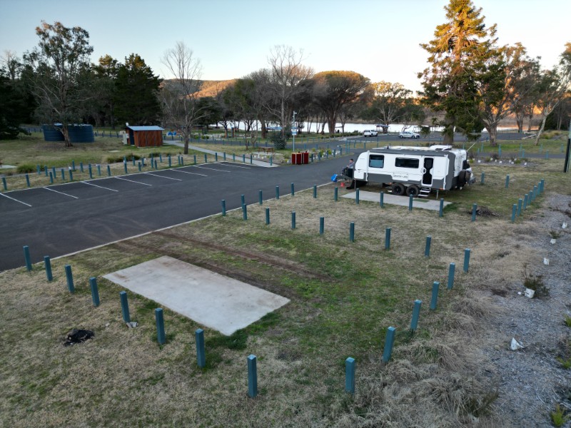
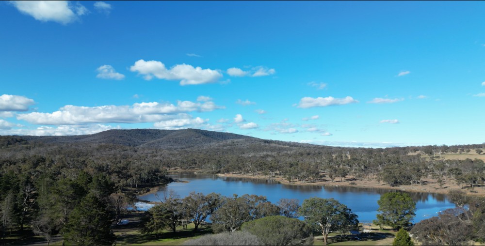
From Ben Lomond we descended to Armidale where we had a great camp next to the Dumaresq dam. This camp has fantastic facilities and was well maintained by the council. Best of all, it was a free camp.
There were a few hiking tracks around the dam. This recreational reserves is very popular with locals.
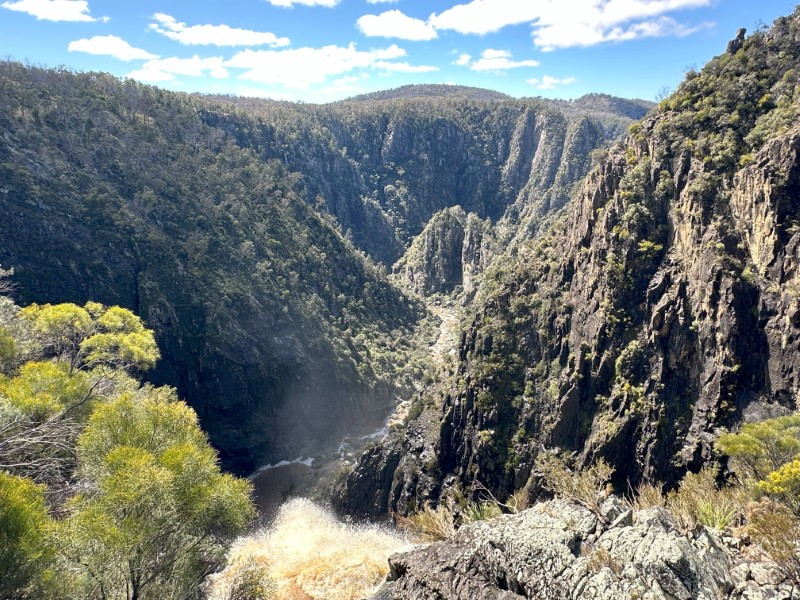
We used our site at the dam as a base to explore some of the local waterfalls and gorges. The 170km road linking Armidale to the coast, is known as the Waterfall Way. We have previously done most of the falls from Coffs Harbour. This was a great opportunity to visit the last three waterfalls we missed during our first trip.
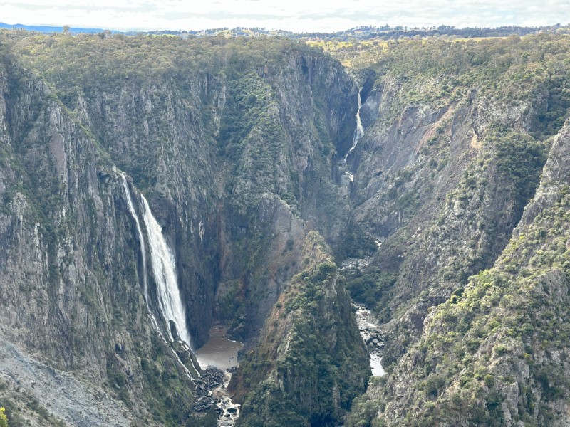
We started the day at Wollomombi Falls. This is one of Australia’s highest falls with fantastic views from the cantilevered viewing platform over the gorge. This is generally a single drop waterfall, but because of the wet weather we were spoiled with multiple drops.
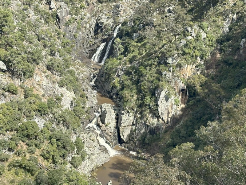
Our next stop was Bakers Creek Waterfall near Hillgrove. From the viewing platform we had good visibility of the multi level fall and the gorge.
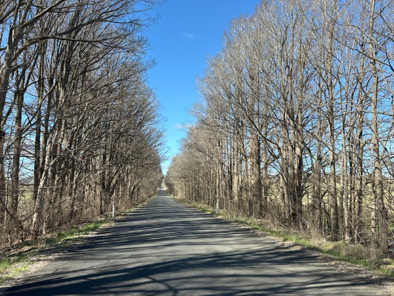
On our way to the last waterfall, we past the Dangarsleigh War Memorial and followed a tree-lined road to the Dangars Falls.
Dangers Falls have multiple walking tracks and was our favourite waterfall of the day.
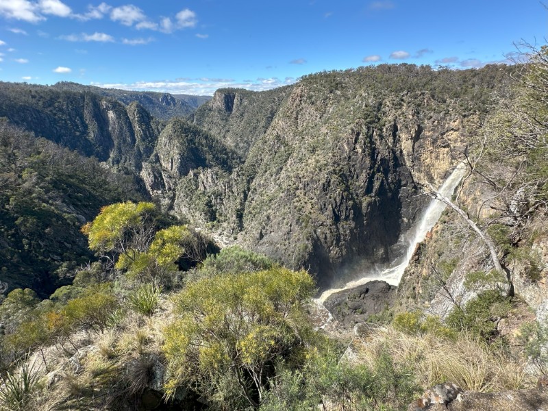
One of the walking tracks took us to the crest of the fall. The viewing platform is a few meters from where the water gushes over the rocks.
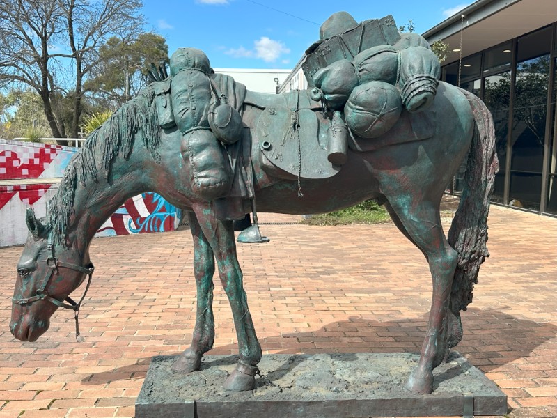
The next day we spend in Armidale. We visited the New England Regional Art Museum. At the entrance was the Equine Impedimenta sculpture (The Artist’s Mount) by Tim Storrier.
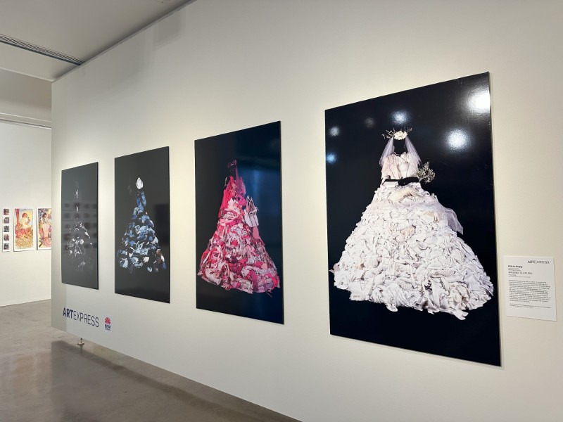
The Exhibition by Olivia Kiely, “Dressed to Excess” was designed to spark a dialogue on the environmental and social costs of fast fashion.
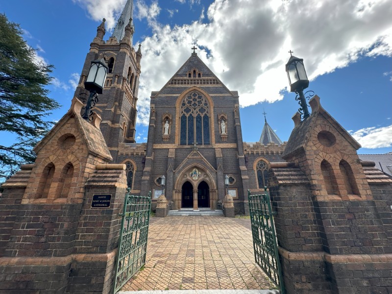
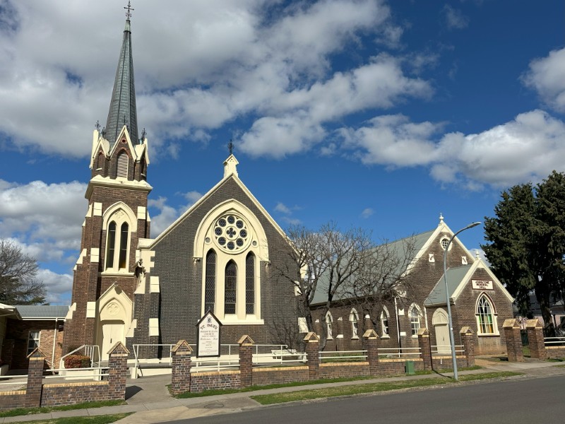
The historical walk through the town centre, provides an insight in the architecture of the early 1900’s. The old buildings around Central Park are predominantly churches. The Saint Mary & Joseph Catholic Cathedral was our first stop.
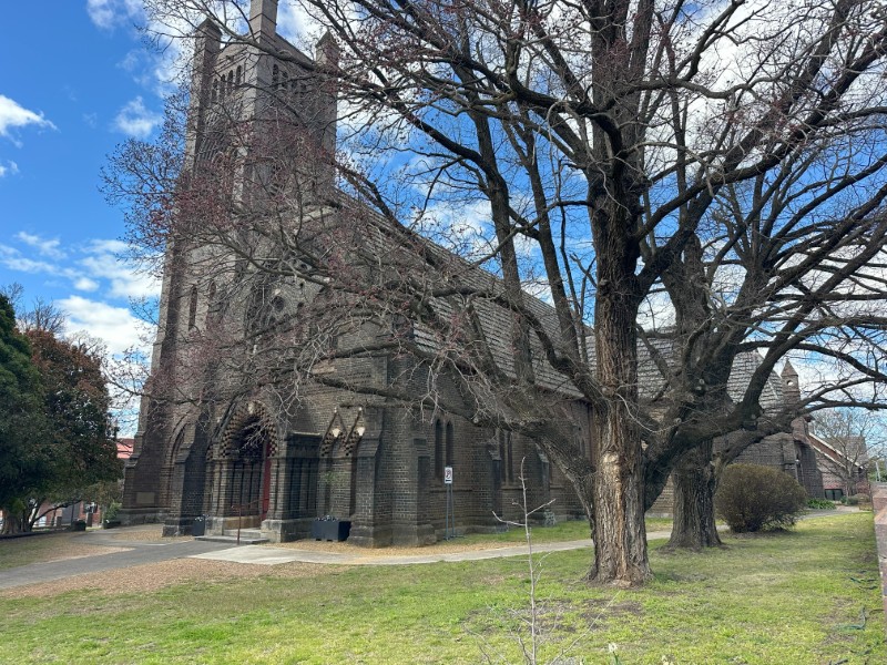
Just around the corner was St Peter’s Anglican Cathedral.
Around the next corner, St Paul’s Presbyterian Church.
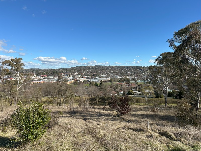
Our last stop for the day was the Drummond Apex Lookout.
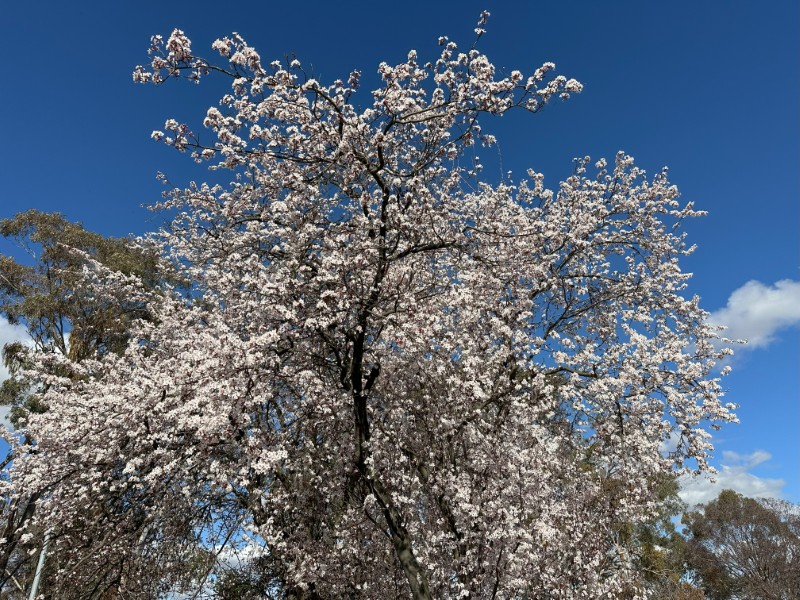
We had an extremely cold start to our second trip. As we were driving back to our campsite, we were hoping that the blooming trees announce spring and warmer weather.