
We followed the Savannah Way from the Northern Territory east to the Atherton Tablelands.
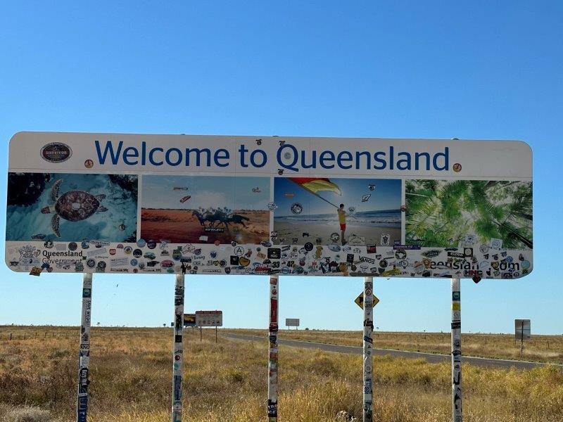
We crossed the border between the Northern Territory and Queensland, west of Camooweal. The stickers on the sign is evidence of a road well travelled.
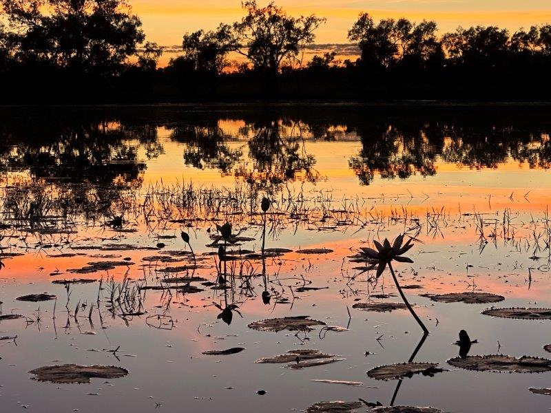
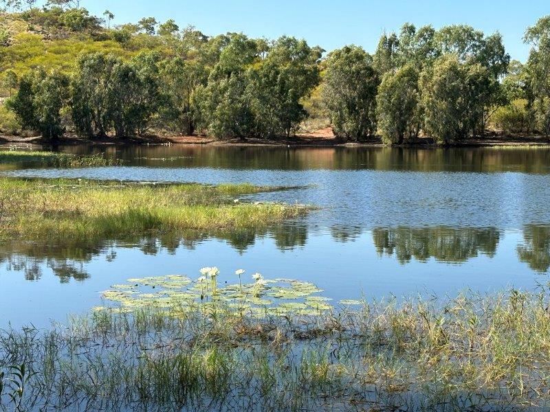
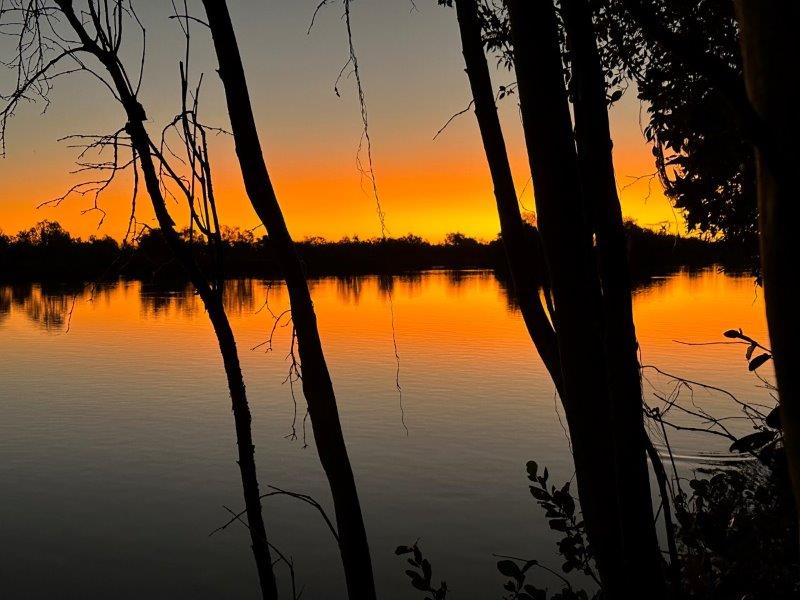
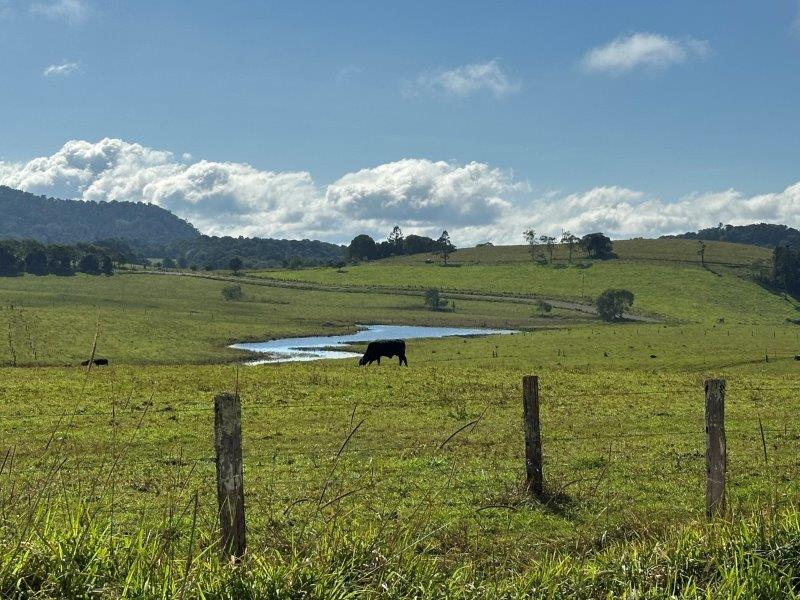
Camooweal was our first stop. We stayed at a free camp on the Georgina River. Our planned one night stopover, quickly turned to four nights. This spot was up there as one of our favourite camps. We have never seen such a variety of birdlife in one spot.
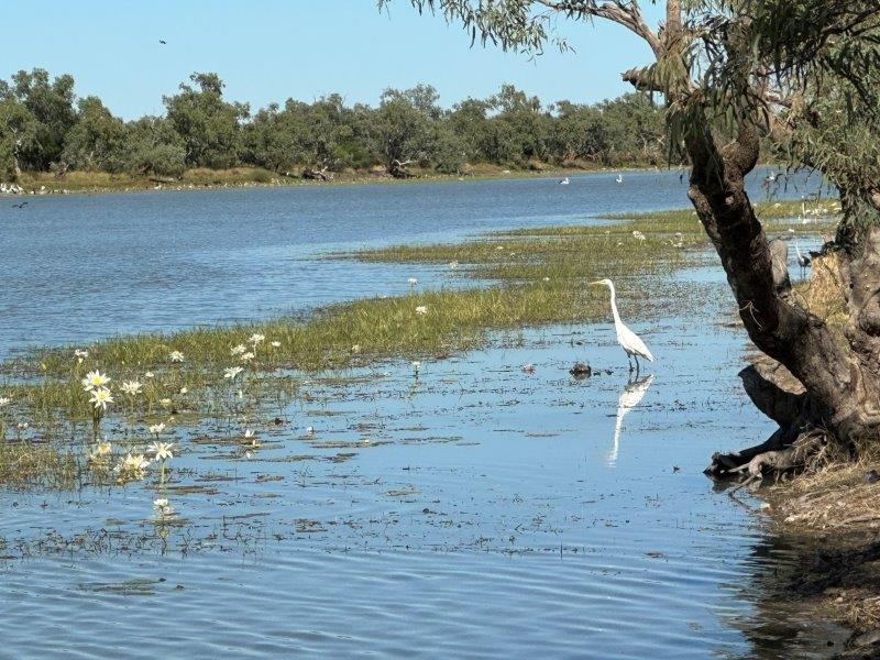
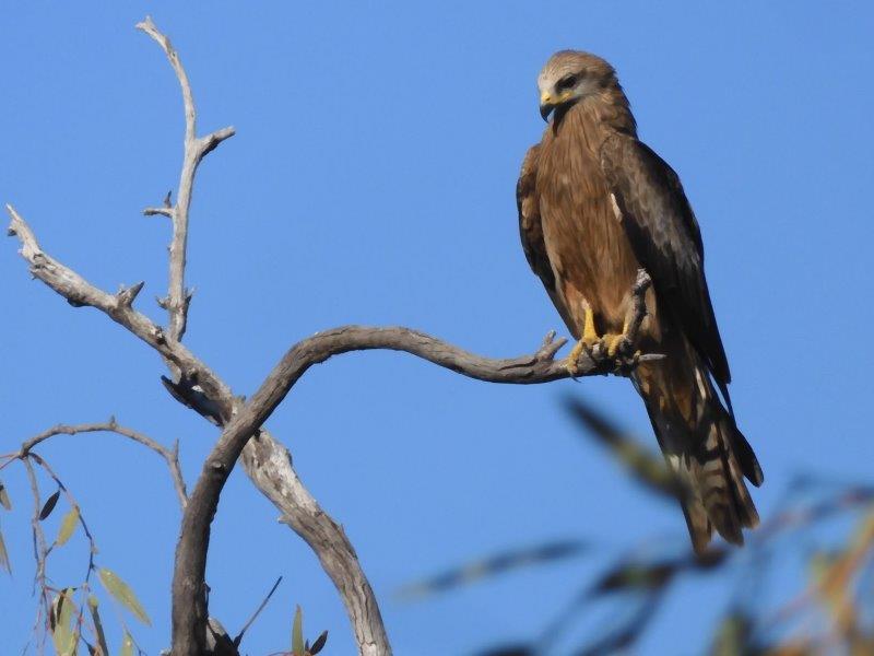
In addition to the water birds, the birds of pray were constantly sweeping the skies. This kite was nesting next to our campsite.
The tranquility of the water, easy campfires, great sunrises and sunsets, made for an unforgettable stay.

Our next stop was Mount Isa. The city is known for copper and zinc-lead-silver mining. The city is also referred to as the “oasis of the outback”, surrounded by desert.
There are many mining tours explaining the rich mining history of the area. Some tours are led by retired miners, having ingrained knowledge of the mining process.
We stayed behind the Irish Club in Mount Isa with easy access to the CBD and surrounding areas.
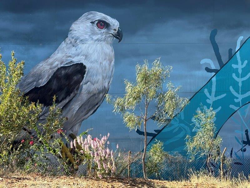
In the center of the city is a lookout adjacent to the town’s water tank. On the tank is a massive mural of a Black Shouldered Kite.
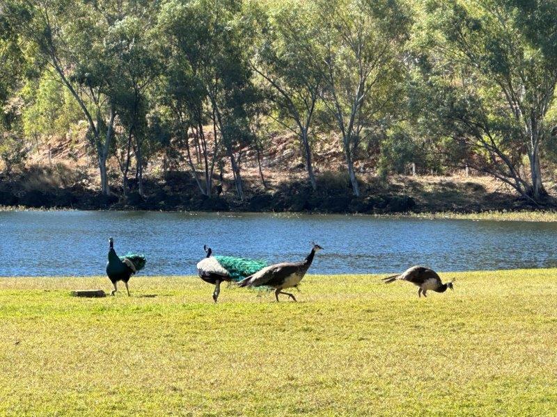
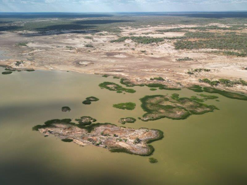
We visited Lake Moondarra just north-east of Mount Isa, for a picnic. This artificial lake was built in the Leichhardt river. We were surprised with the amount of peacocks around the lake. Just in the picnic area, we counted 14. The peacocks apparently originated from a former mine manager’s pet peacock named Percy.
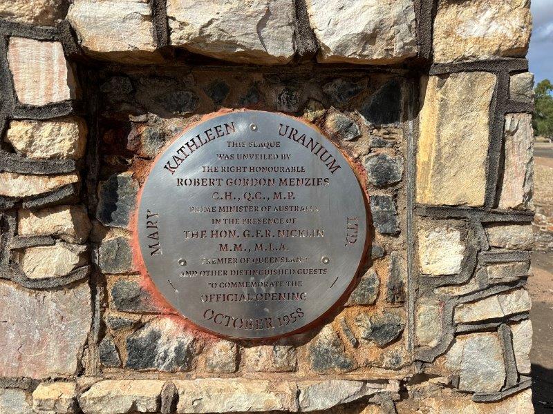
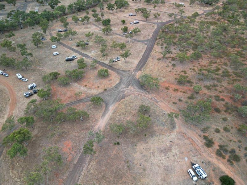
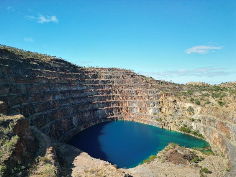
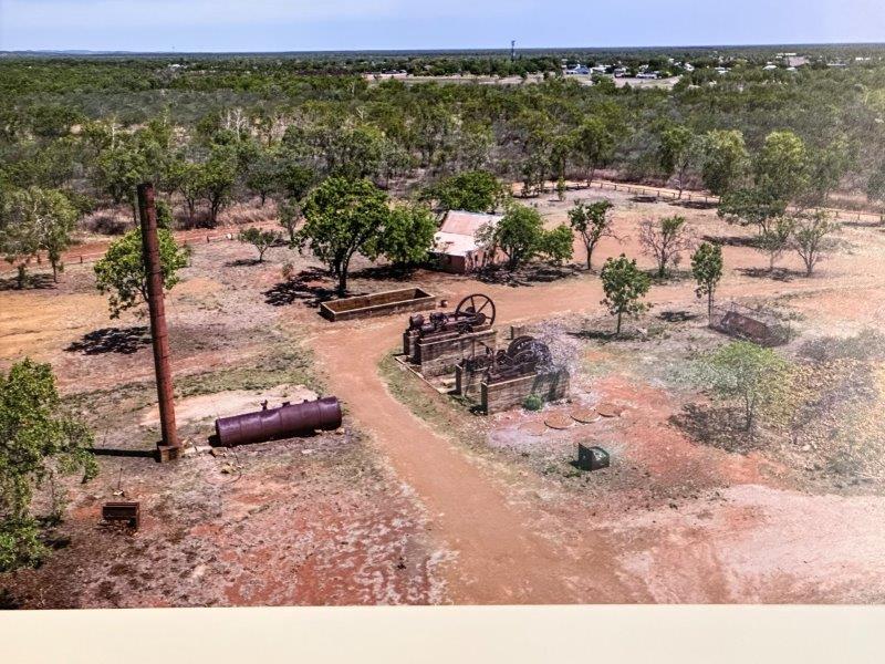
Half way between Mount Isa and Cloncurry is the abandoned uranium mining town, Mary Kathleen. Nestled in the Selwyn Range, the mine operated between 1956 and 1982. After the mining ceased, everything was sold on auction leaving behind a ghost town, reduced to foundations and a disintegrating road network. Today it has become a very popular free camp with thousands of travelers passing through.
We camped at the spot where the drive in cinema used to be in the bottom right hand corner of the photo below.
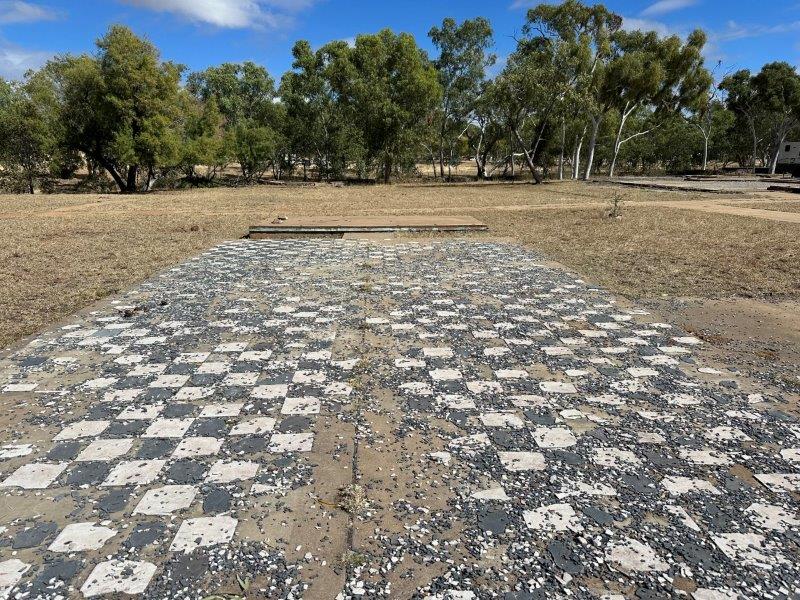
In the central business area the floors of the 10 businesses that serviced the town are still visible. The floor below was once the ANZ bank.
We drove up to the mine. Visitors are warned not to swim in the water as mild levels of radiation may still exist.
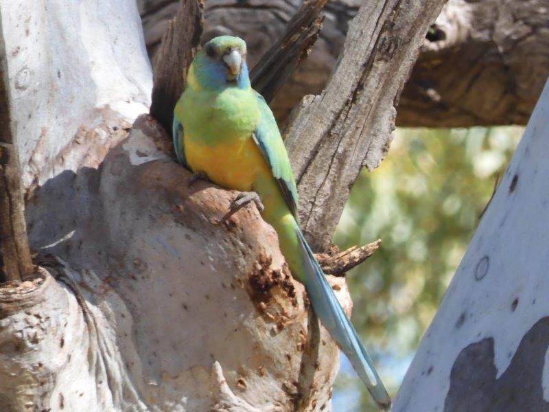
After a few days at Mary Kathleen we moved to Cloncurry. We stayed at Copper Mine Creek camp. The camp is wedged in between the river and the Chinese Cemetery. The birdlife at this camp was very impressive. This Australian ring neck fed its chicks above our van.
We spent one afternoon at Chinaman Creek Dam. The dam has a great day use area.
From Cloncurry we traveled north towards Normanton.
We stayed on the Norman River. This was the dustiest camp we have seen so far, despite being in the middle of floodplains.
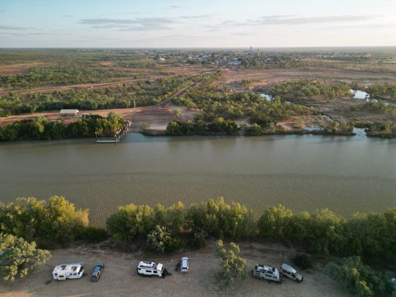
The camp is between the river and the Mutton Hole Wetlands Conservation Park.
We had a few great sunsets over the Norman River.
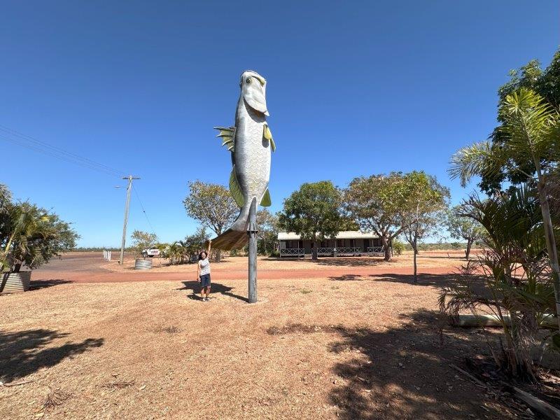
In town is a large Barramundi. This was the first sign we entered Barra country!
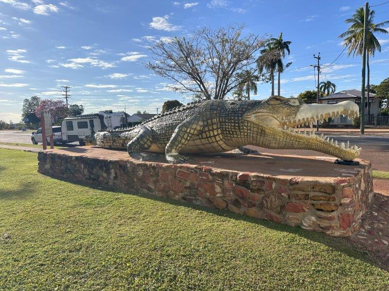
Krys the Croc is in the main street of the town, at the council offices. Krys is a life-size replica of a local 8.65m crocodile, shot on the McArthur river bank. This croc was killed with a single shot by Krystina Pawlowski, the famous Polish Crocodile hunter, in 1957. This size of the croc earned her a place in the Guinness Book of Records. In true Aussie fashion her nickname in the town became “One Shot”.
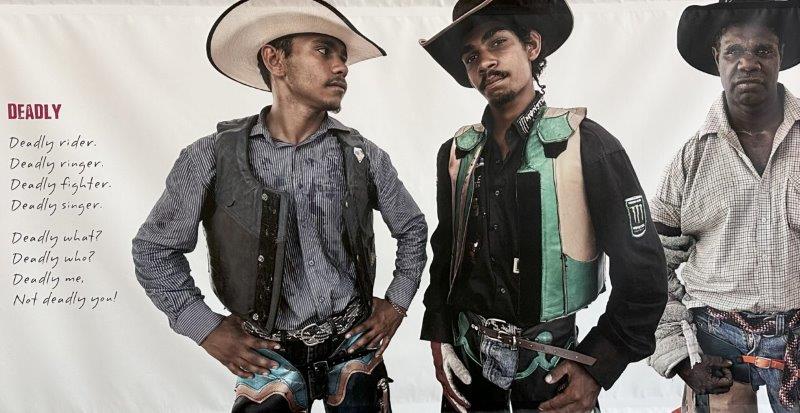
At the Information Centre in Normanton is a photographic display by David Prichard. Pictures display the local heroes, working the land and touring the rodeo circuits. Some of the photographs were finalists in the International Taylor Wessing Photography competition.
We did a daytrip north to Karumba. This small fishing town is in the Gulf Country, with the Gulf of Carpenteria to its north.
This remote town often gets completely cut off from the outside world, during the wet season. The roads has gone under water for periods up to 13 weeks in the past. When cut off, the only way to get supplies to the community is by chopper or barge.
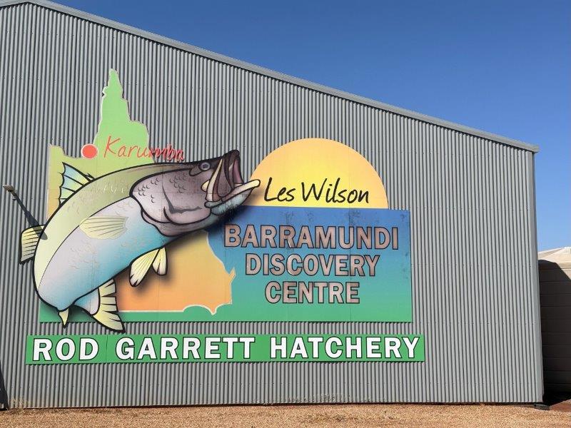
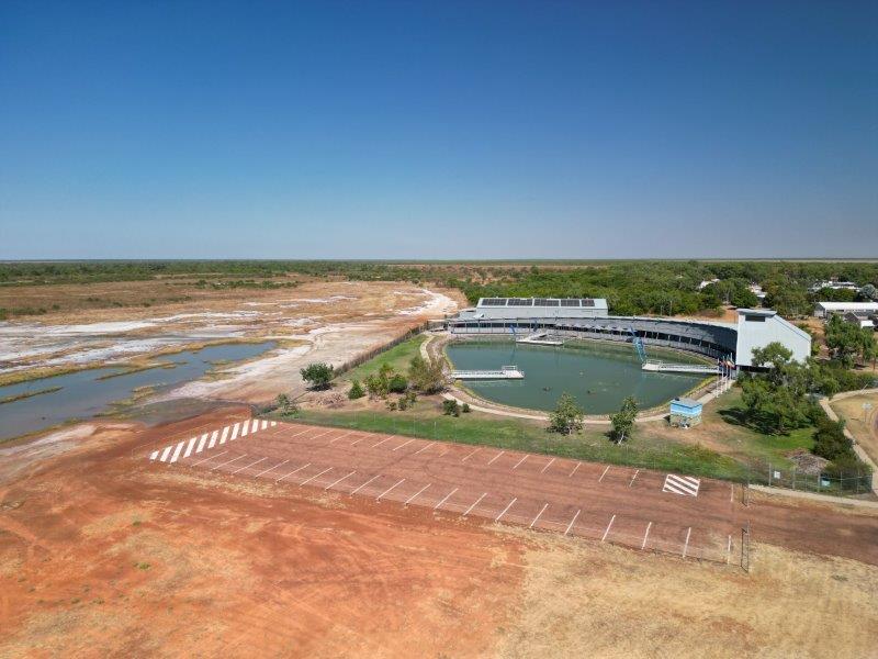
The town is synonymous with prawning and the elusive Barramundi. It also has a massive hatchery doubling as an information centre, promoting the local area and the Barra.
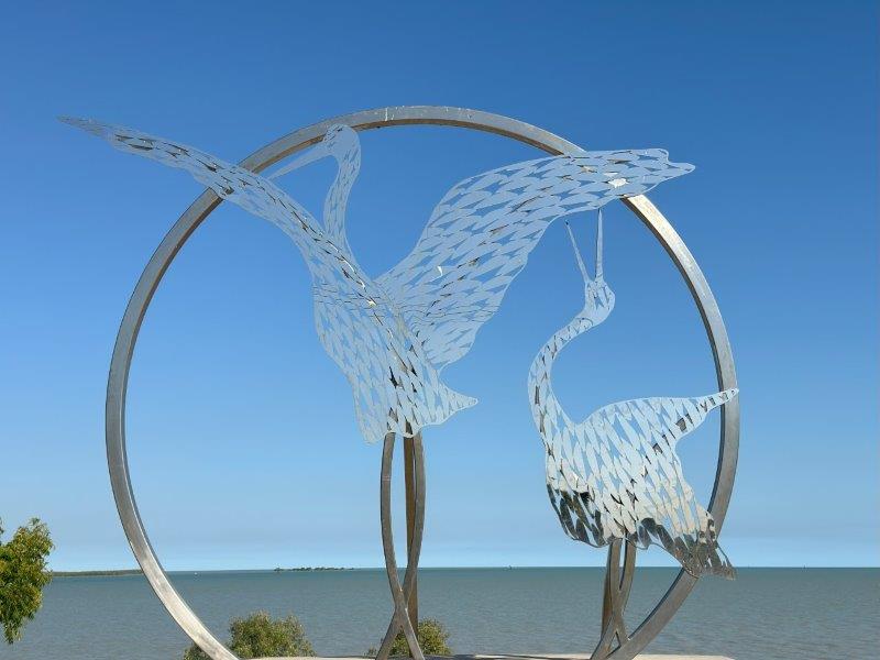
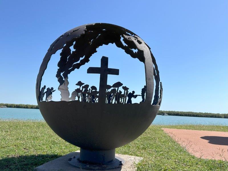
The Karumba foreshore has a few picnic spots linked by a Heritage Walk. The walk has many art and historic installations to browse through.
There are even a few restaurants and pubs on the way.
The foreshore opens up to the Gulf of Carpenteria. This gulf has only two tides per day compared to the normal four. This is referred to as a diurnal tide. The moons position relative to the earth creates this phenomena. The Gulf on Mexico and the Caribbean sea are examples of other places with only two tides.
In addition to the tidal quirk, Karumba’s morning glory cloud attracts visitors from around the world. This rolling cloud formation is rare and moves at about 40km/h in a north easterly direction. It forms in the morning, about four to six times a season. The season to see the morning glory is between late September and early November. Many adventurers ride, glide or surf the morning glory with a glider plane.

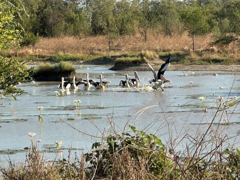
On the way back to Normanton we passed through wetlands. These floodplains are often impassable during the wet season.
The birdlife in these lakes attracts bird photographers and twitchers from across the country.

The Sawannah Way is a 2600km road, connecting Darwin and Cairns. We only traveled a small portion of the Sawannah Way from Normanton to Miliaa Millaa.
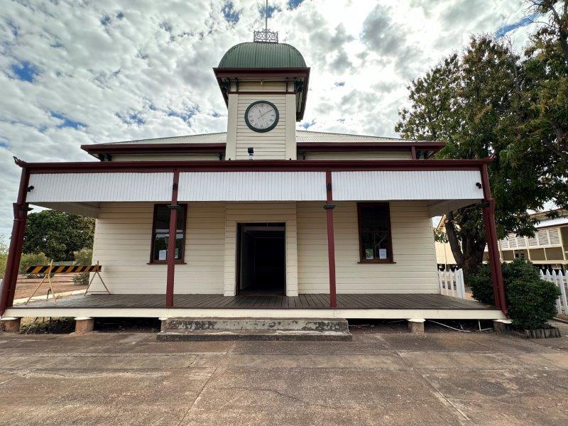
We passed trough the small mining town of Croydon.
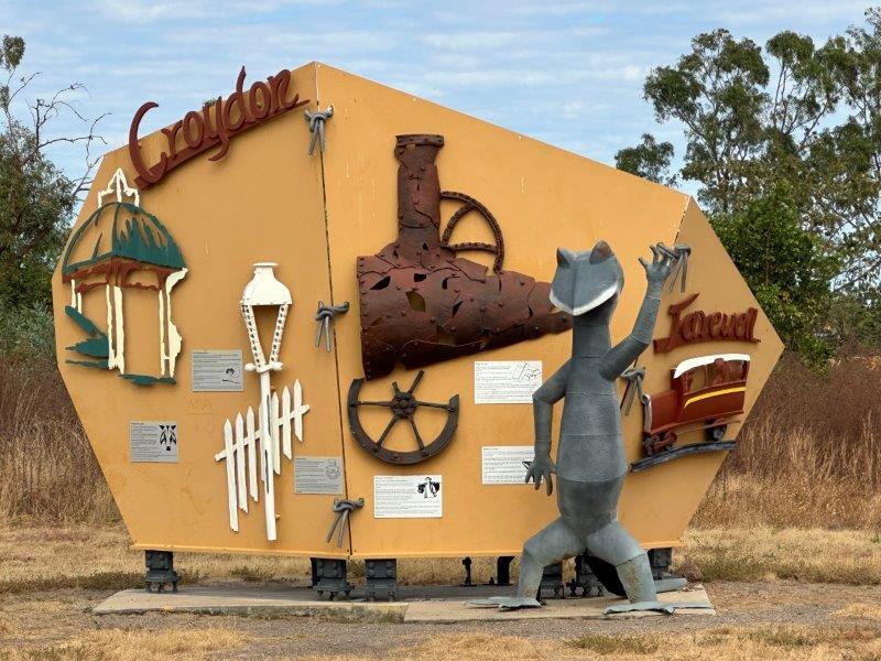
The flourishing gold mining town of Croydon was once the third largest town in Queensland. Some remanence of the mining history was preserved.
The old main street was converted to a historical precinct with a courthouse, police station and Town Hall. The Town Hall is shown below.
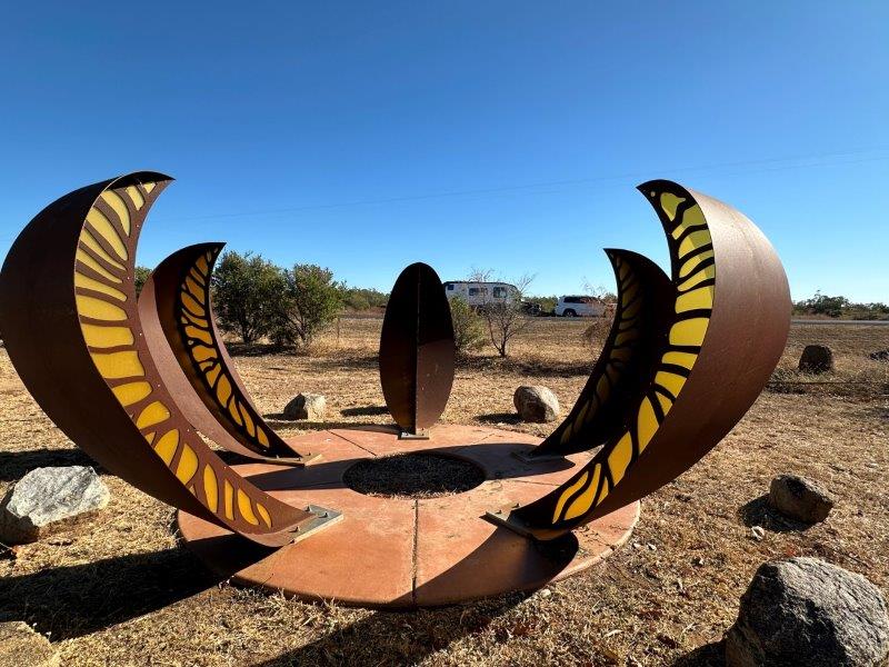
We had a quick stop at a park in Georgetown. In the park was a creation of Manning Daly, inspired by the kapok flower.
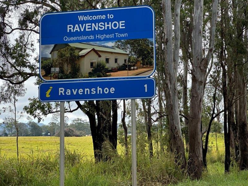
After Georgetown we left the Savannah Way, heading north into the Atherton Tablelands. We based ourselves just outside Ravenshoe, Queensland’s highest town. We had a chilly morning or two where the car was completely iced over.
Driving through the main street, we passed the Logging Memorial on the Tablelands. Logging was the main economic activity in this area in day gone by.
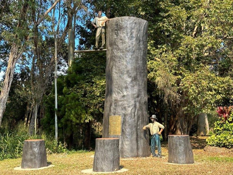
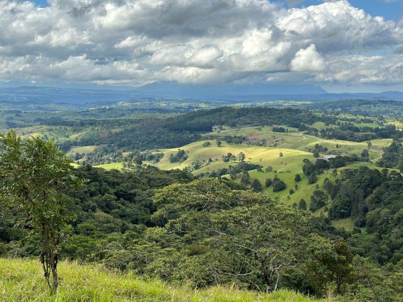
With logging, rainforests have given way to fertile agricultural land. Many of the remaining forests are now protected as national parks.
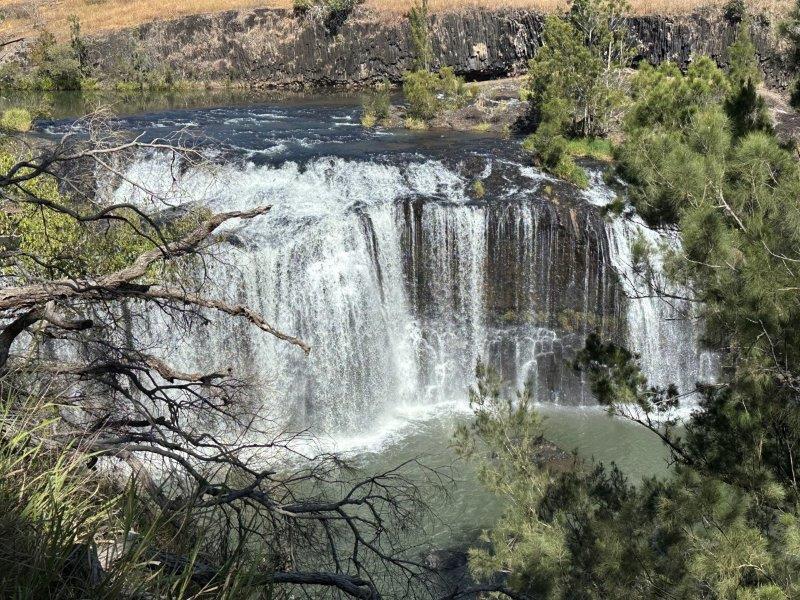
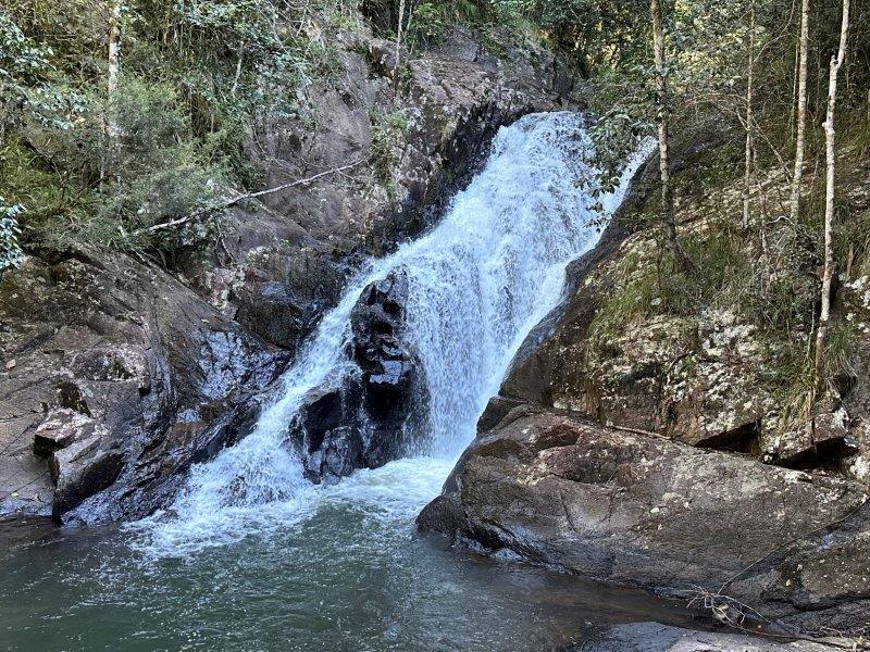
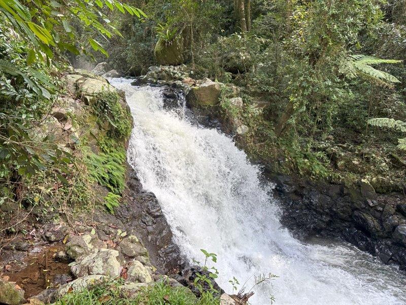
Atherton Tableland is know for it’s waterfalls. Big Millstream Falls National Park was our first stop. The Big Millstream Falls was the first of many waterfalls we visited in the next ten days.
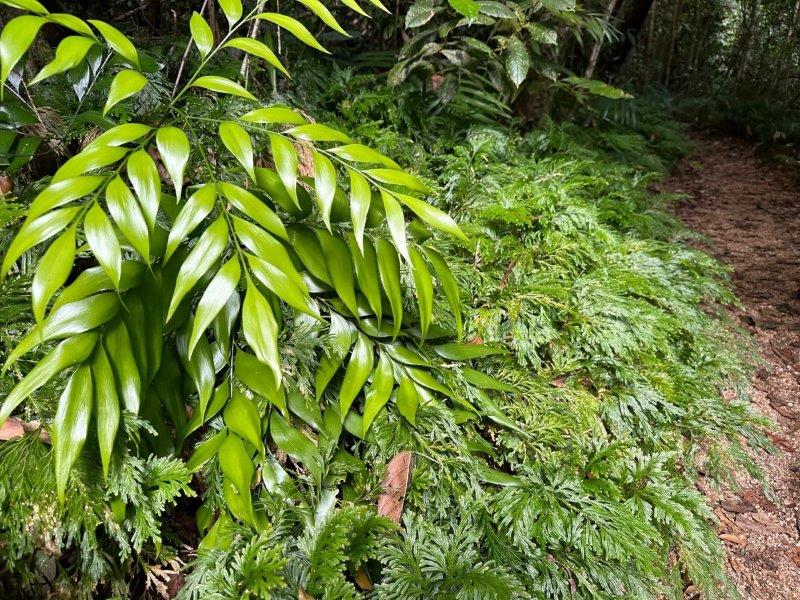
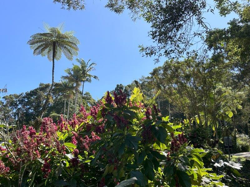
On our way to the next waterfall, we realised how wet and fertile the Tablelands are. We can understand why this is one of only 20 World Heritage Sites in Australia. It is spectacular!
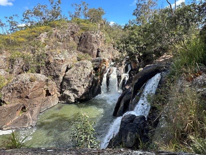
Little Millstream Falls was one of my favourites. As you are walking down to the base of the falls, the water of multiple falls dropping into the base, creates a rustling surround sound effect.
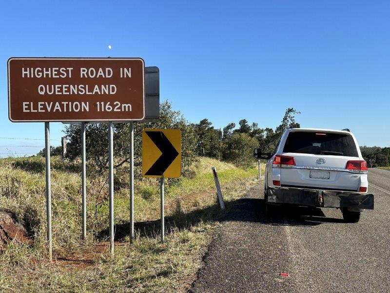
We took the highest road in Queensland on the way to the historic town of Herberton.
The Historic Village Herberton is the most visited tourist attraction in Herberton. The original village was rebuild with more than 60 buildings filled with antique items.
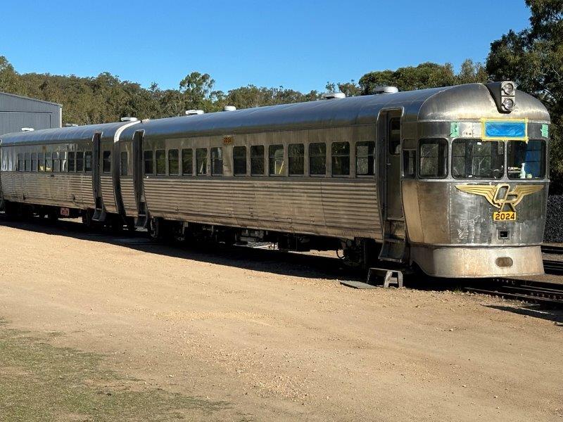
On the way out of the town, we visited the Historic Railway Station where trains are still being restored.
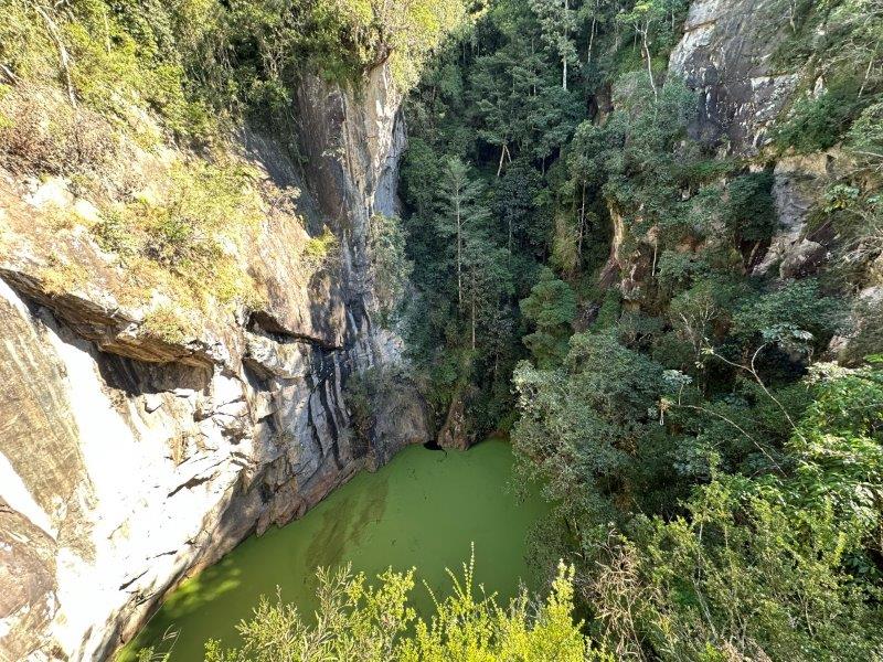
Close to Herberton we walked to Hall Falls and visited the Mount Hypipamee Crater.
The crater is in the Hugh Nelson Range. This crater is a 70m wide granite volcanic pipe. The drop to the water level is approximately 50m.
We dedicated the next day to visit the final falls on out list, in this area. Our first stop was the Souita Falls near Middlebrook.
From Middlebrook we took the road to Millaa Millaa and walked to the Zillie Falls.
On the way to the next falls we stopped at the Millaa Millaa lookout.
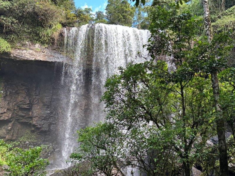
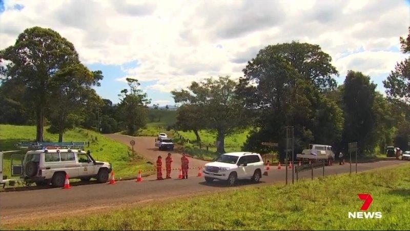
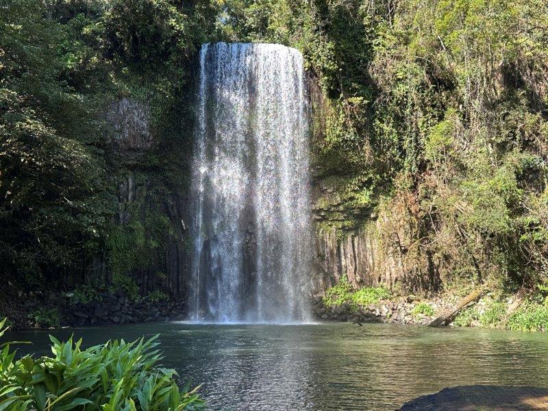
Our last stop for the day was the well-known Millaa Millaa Falls. The road in was blocked by emergency services. They were not prepared to explain the closure, but on Google was a news article about two visitors that drowned at the fall earlier the day. We headed back to the caravan. The tragic drownings were reported on the main news. The news coverage included our car stopping at the entrance and driving off after our discussion with the SES.
The next day was our last day in the area and we were relieved that the Millaa Millaa Falls reopened after the investigation. We went back to the falls in the morning. The falls were beautiful and you can understand why this falls was the backdrop for a few beer and shampoo commercials.
If there is a thing like waterfalled-out, we were close to it 🙂
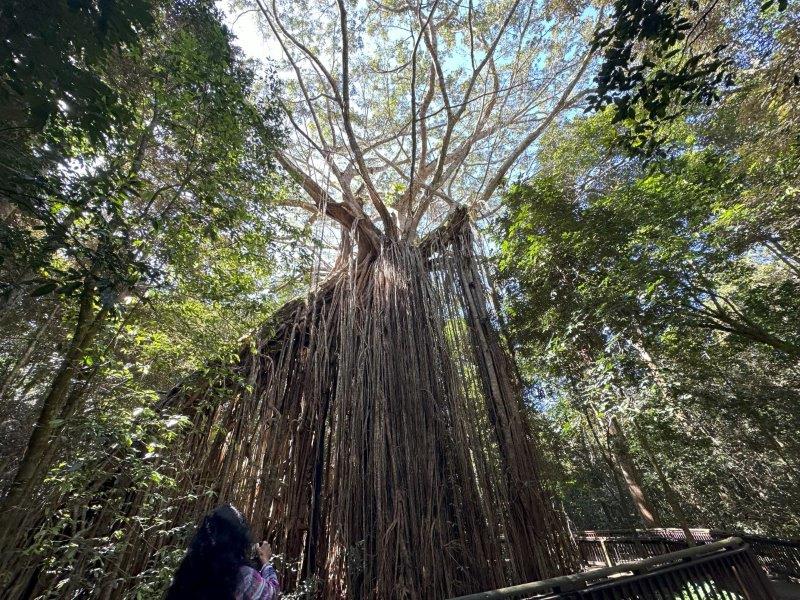
We had a packed program for our last day in this area. We wanted to get to Lake Tinaroo. On the way to the lake we visited Curtain Fig Tree National Park near Yungaburra. The tree dwarfed the trees around it.
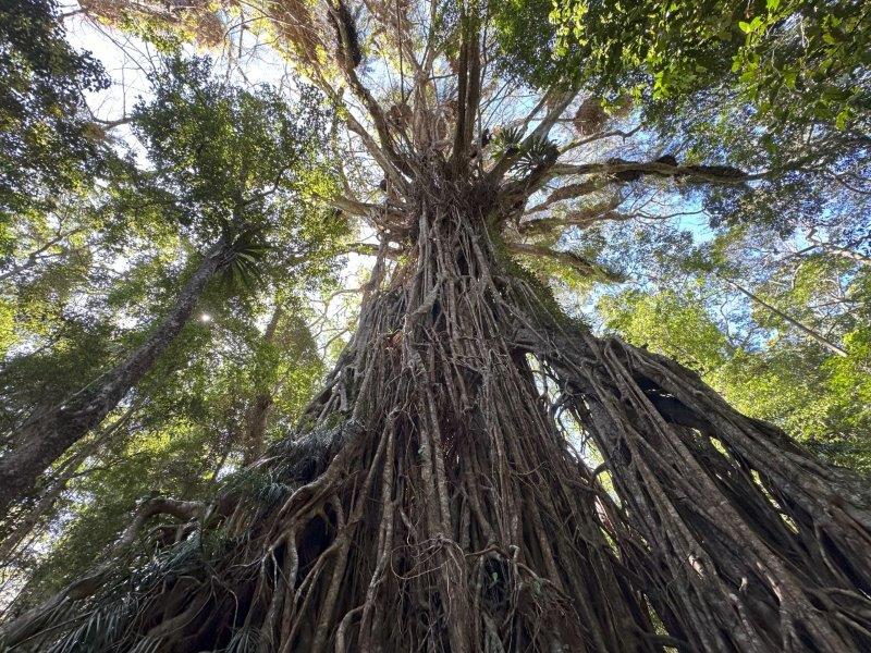
Close to the Curtain Fig Tree is the Danbulla National Park. The Danbulla National Park is home to the Cathedral Fig Tree. This tree has a hollow inside and as impressive as the Curtain Fig Tree.
We took a quick dive through the small town of Yungaburra and a short walk at the Peterson Creek. You need to cross the Lloyd’s Suspension Bridge to get to the picnic area.

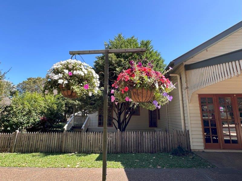
The main streets in Yungaburra is lined with hanging baskets of flowers. Very impressive!
Crater Lakes National Park has two sections – Lake Barrine and Lake Eacham.
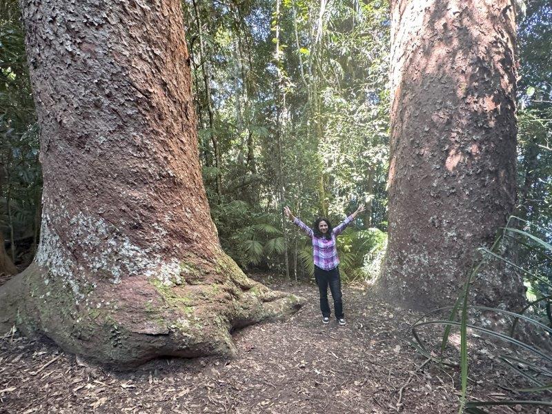
Lake Barrine is a tranquil place with a tearoom and tours on the lake in a massive glass covered boat. A walking track starting at the restaurant features these massive Rough Barked Kauri trees.
The gardens around the restaurant were meticulously manicured.
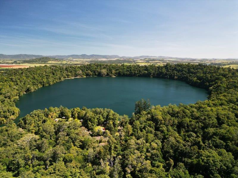
In the middle of the dense rainforest is Lake Eacham, a former volcanic crater.
On the way to lake Tinaroo we passed another volcanic crater, Lake Euramoo.
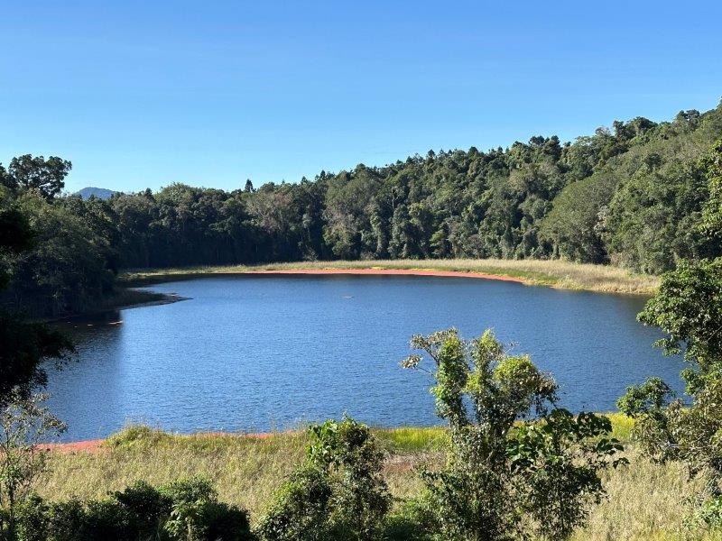
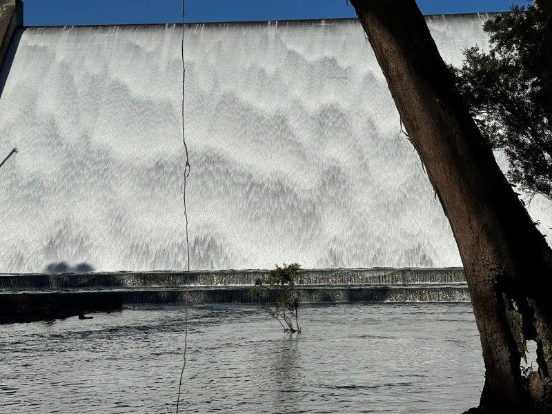
We drove around the massive Lake Tinaroo. On the way, we passed through a few camping spots and stopped at the dam wall which was spilling at the time.
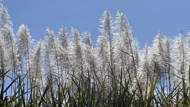
We left the area and headed to Atherton, the largest town in the Tablelands region, to stock up for the next leg of our trip. The town is surrounded by farms, predominantly sugarcane.
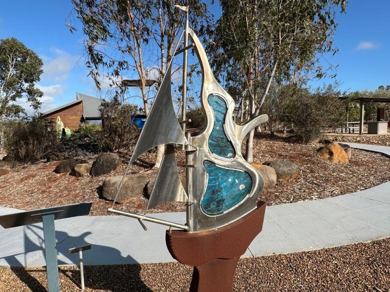
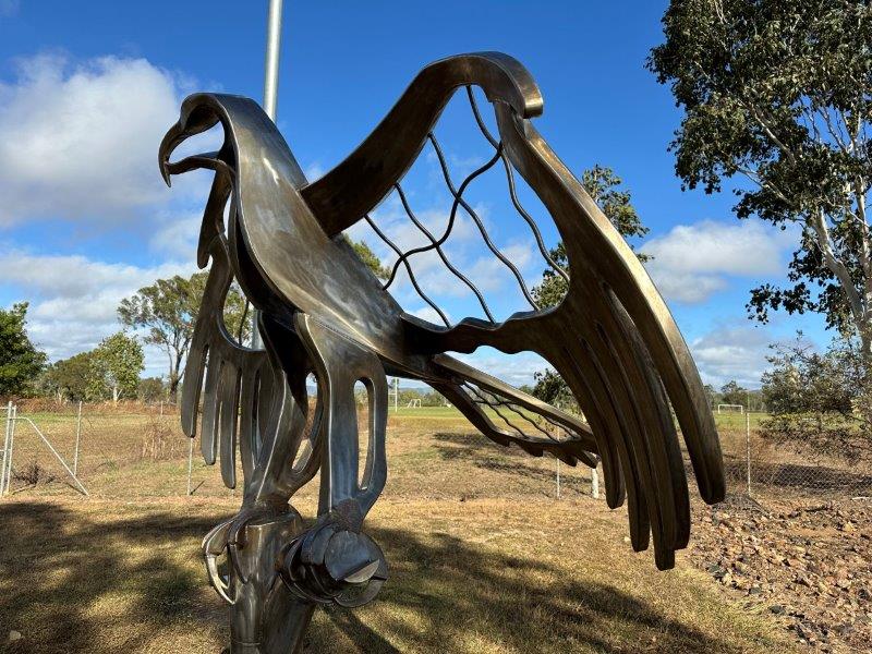
From Atherton, we headed to Lakeland and camped just outside of town.
The next morning we fueled up at Lakeland and walked through their picnic area with lots of quirky art on display.
And then the much anticipated sign, “Gateway to Cape York”.
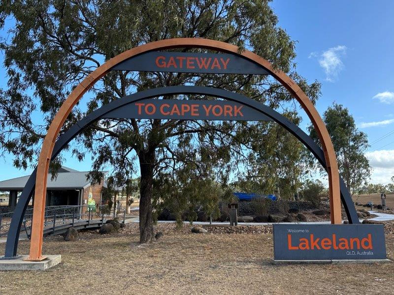
We have decided to take our caravan up the Cape York, the most northern point of Australia.