
In this blog we finish our travels in South Australia, before heading north.
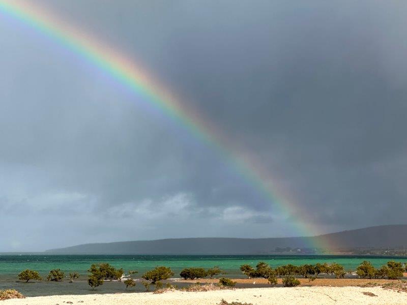
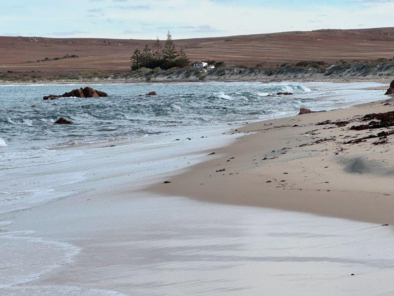
Our first stay was Shingle Beach Ridges campground at Fitzgerald Bay.
The pebbles or shingles form a ridge behind the campsite. This ridge is of geological significance and is listed as a State Heritage site for South Australia. The ridge received State Heritage recognition in May 2017. The ridge is almost three meters high and 10 meters wide and runs for a few kilometers.
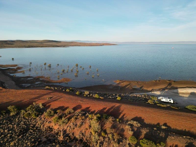
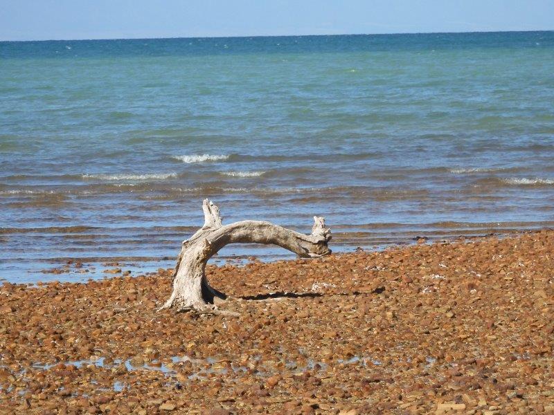
The reddish pebbles are exposed at low tide.
We were generally lucky with the weather while we were in South Australia, except at this campsite. We had rain and extreme winds, blowing our washing off the line.
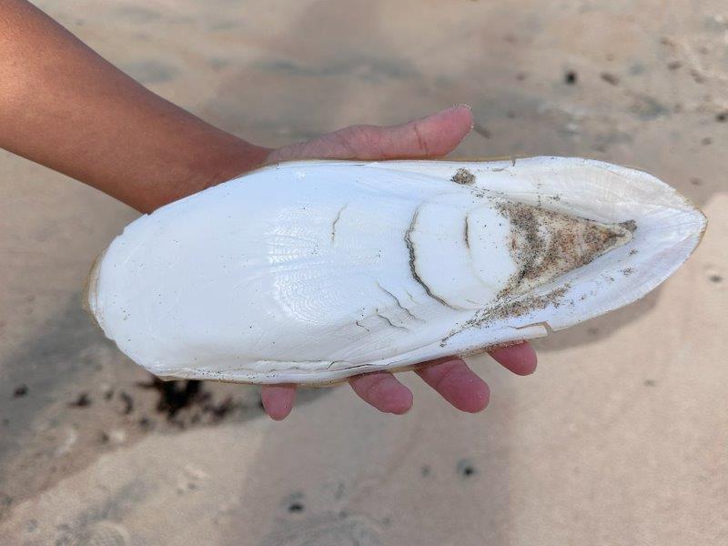
Other than the pebble beaches, this area is known for its cuttlefish. They are massive and plentiful.
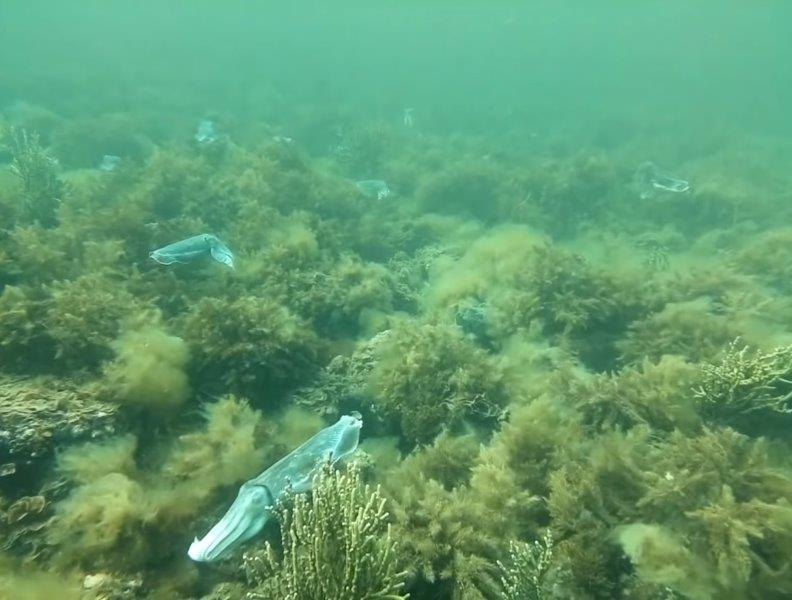
With massive, I mean the largest cuttlefish bones we have ever seen.
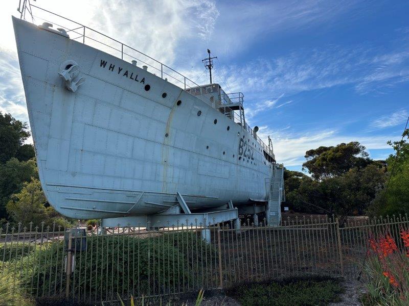
The closest town to camp was Whyalla. Whyalla is not just known for its iron ore mining, but was also home to the Australian Navy shipyards. Entering Whyalla the 1941 HMAS Whyalla stands testimony to Whyalla’s close ties with the navy. Many navy ships were built here.
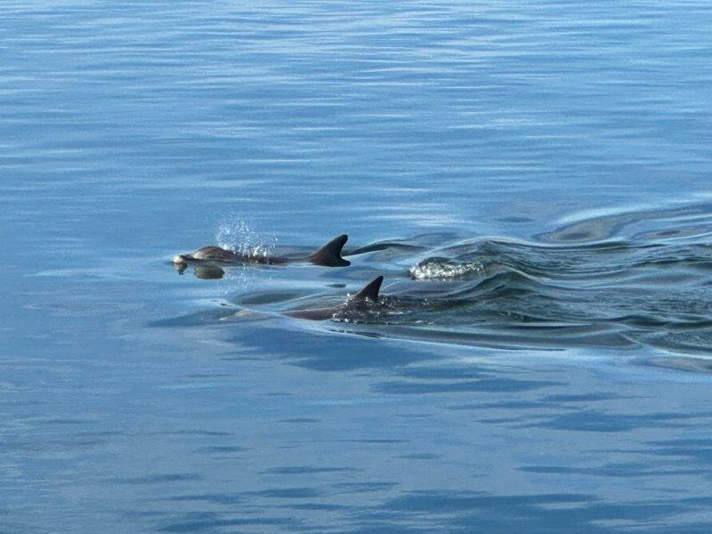
The harbour has a friendly pod of dolphins, undisturbed by the human activity around it.
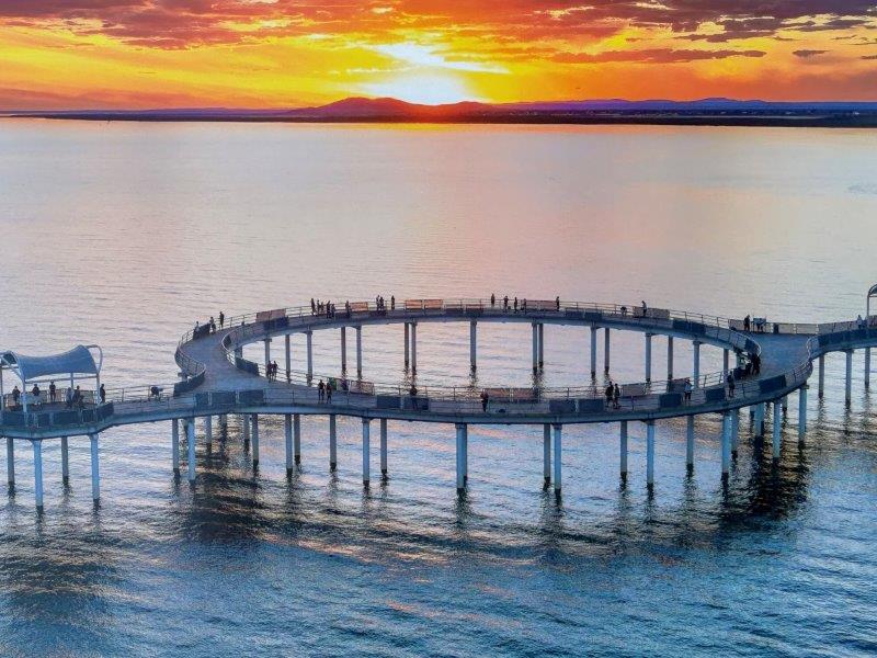
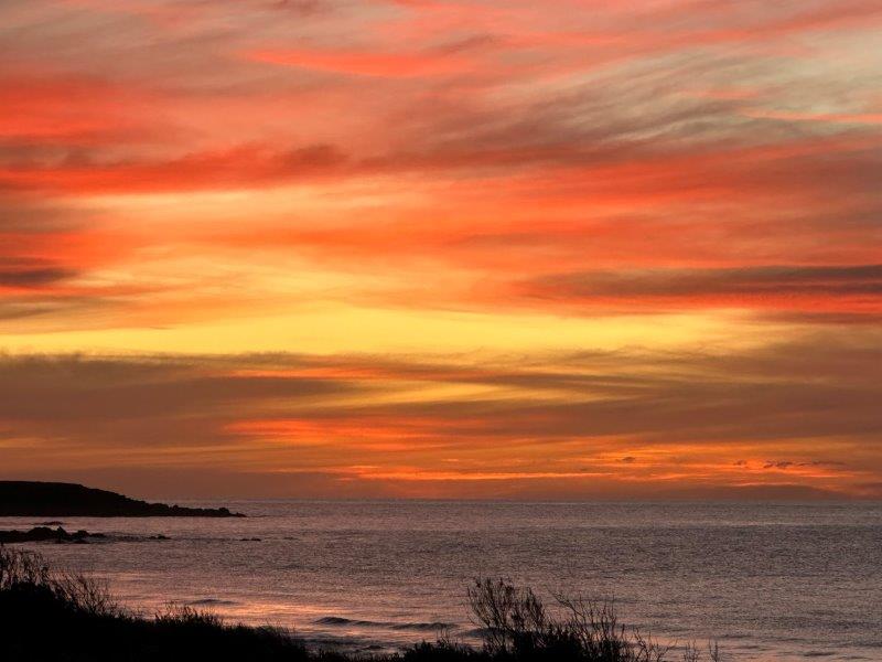
The sunsets in Whyalla are spectacular and this shot features on many billboards around town.
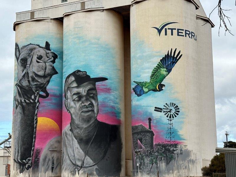
Besides the iron industry, farming plays an important role in the local economy. The silos at Cowell just south of Whyalla, depicts Lionel Deer, a local shearer. Lionel was an institution at the annual Christmas pageant with his camels. Diamantina was one of his camels that made it onto the silo.
We moved to our next camp on the Peninsula at Cowleys Beach. We had the place to ourselves.
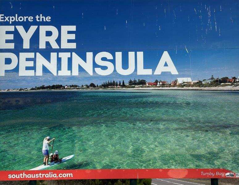
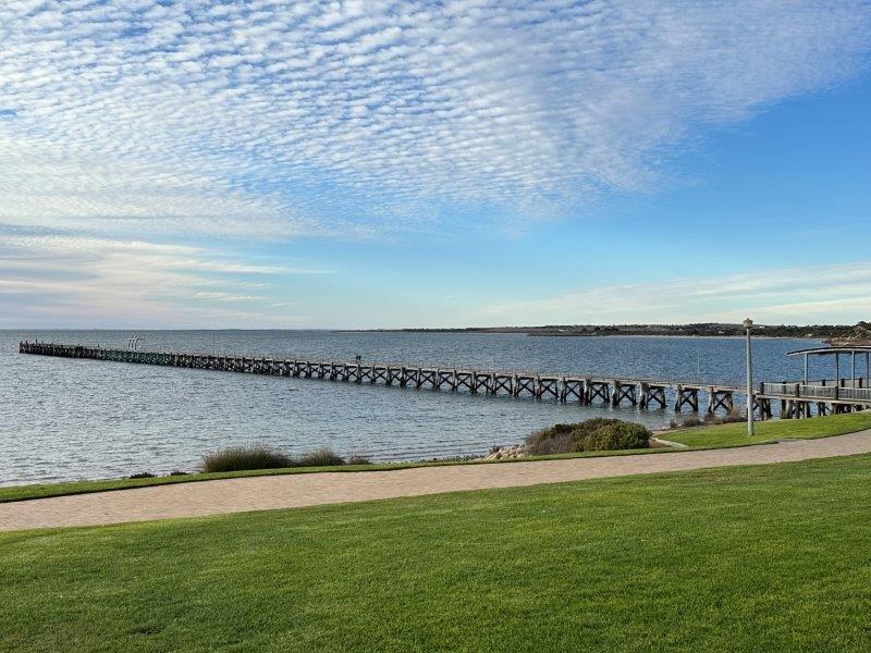
From our camp at Cowleys Beach we drove to Tumby Bay for a daytrip and to fill the water bladder. We have a 130 liter bladder and two jerry cans in the car allowing us to replenish the water in the caravan during extended off-grid stays.
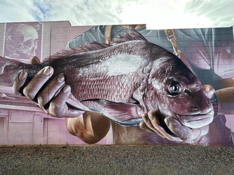
On the way in, we saw the silo art depicting two boys jumping off the Tumby Bay jetty.

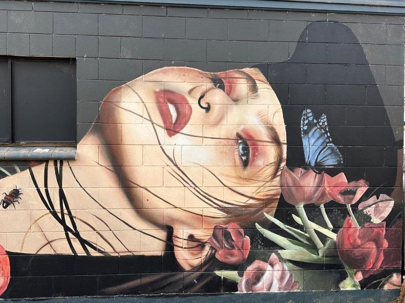
The murals in Tumby Bay were some of the best we have seen.
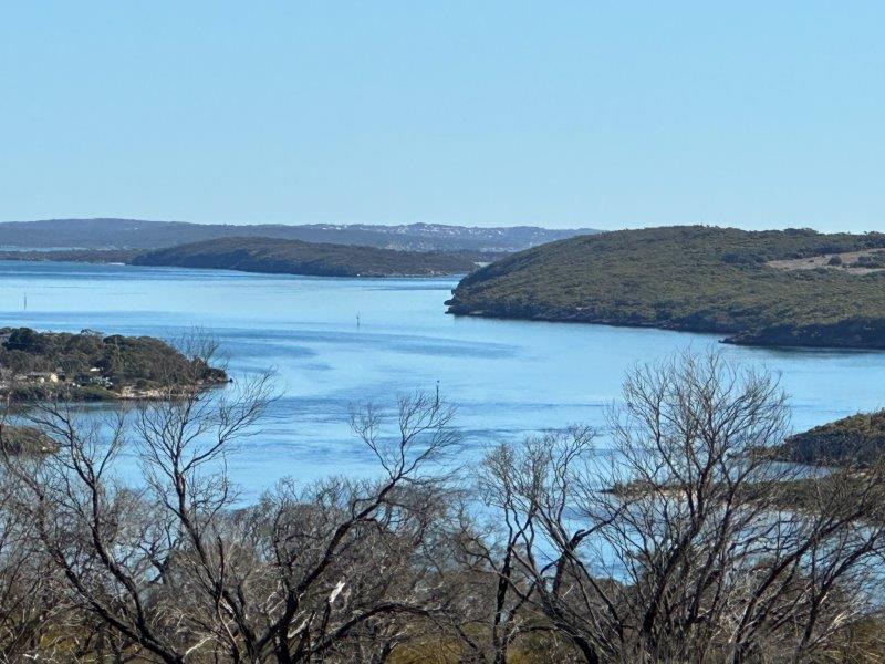
From Cowleys Beach we moved south, to Port Lincoln.

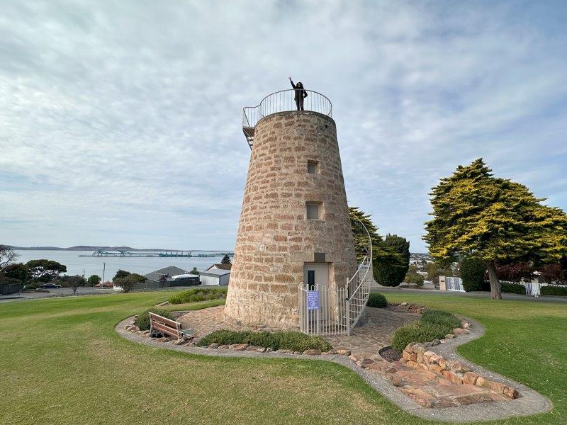
The oldest structure in Port Lincoln is the 1846 flour mill, that never milled any flour. Today the base of the mill has become a tourist attraction and a lookout over Port Lincoln.
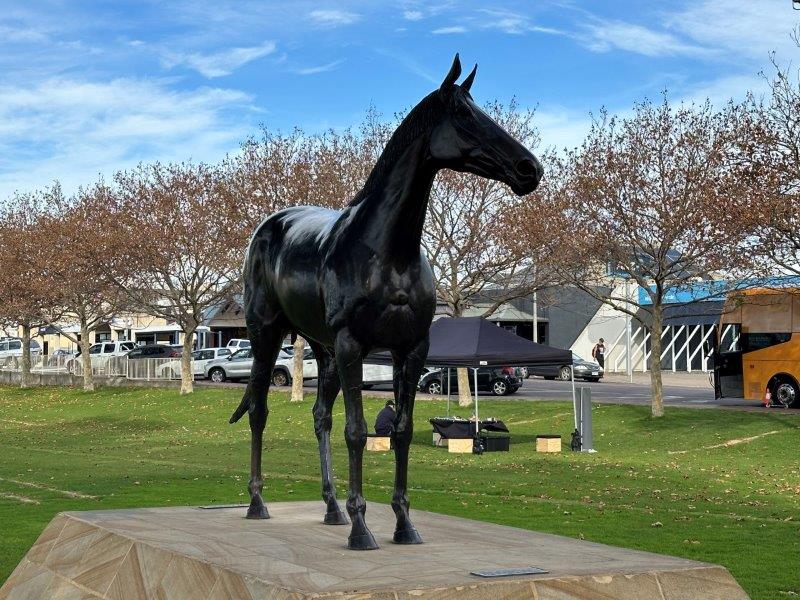
The life size statute of Makybe Diva to commemorate three consecutive Melbourne Cup wins, is on the esplanade of Port Lincoln. The owner of this champion racehorse is a local tuna tycoon, Tony Santic.
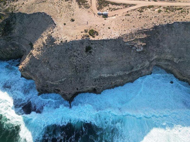
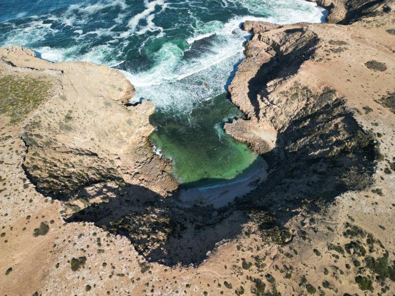
We spend a day exploring the area between Port Lincoln and the Whalers Way sanctuary. This scenic drive took us through arid landscapes, salt lakes, cliffs and eucalyptus bushland.
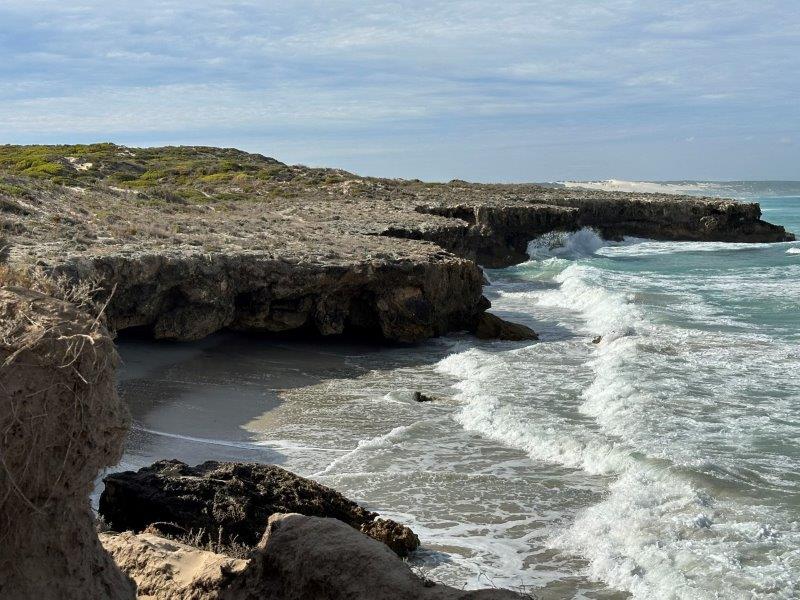
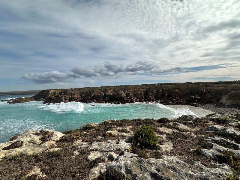
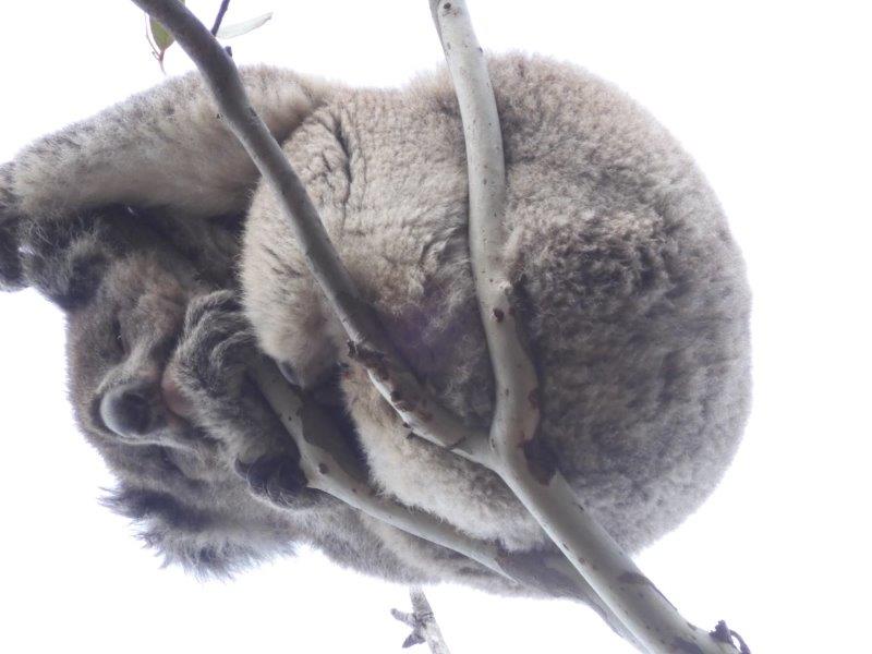
We were lucky to see a small colony of koalas on the way back to Port Lincoln.
From Port Lincoln we moved to Coffin Bay. We were curious about the name of the town. It turns out the well know explorer Matthew Flinders named the bay after his mate, Sir Isaac Coffin.
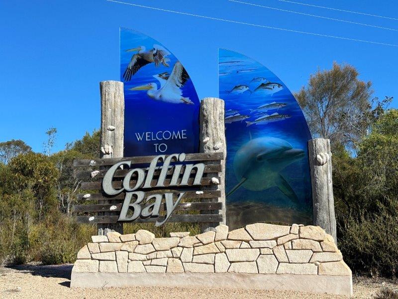
The water around Coffin Bay is synonymous with oysters. The tidal movement of aerated water creates ideal farming conditions for oysters.
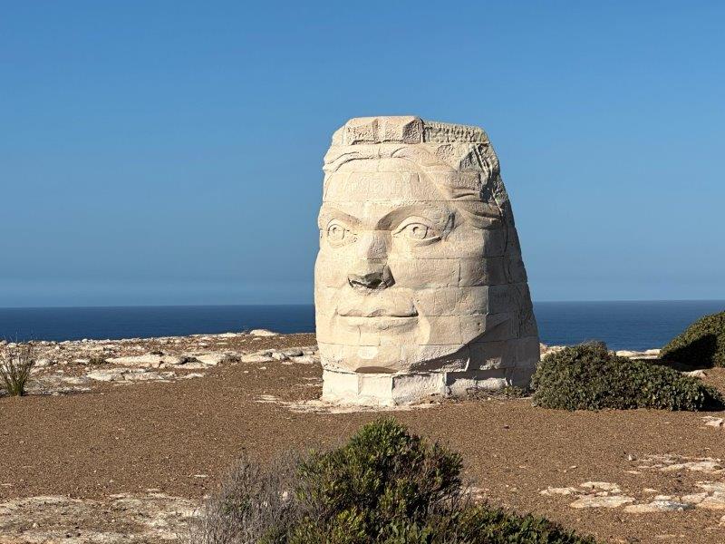
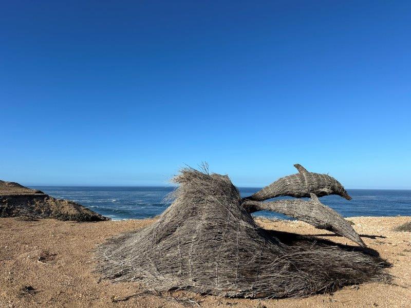
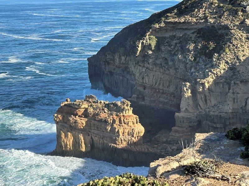
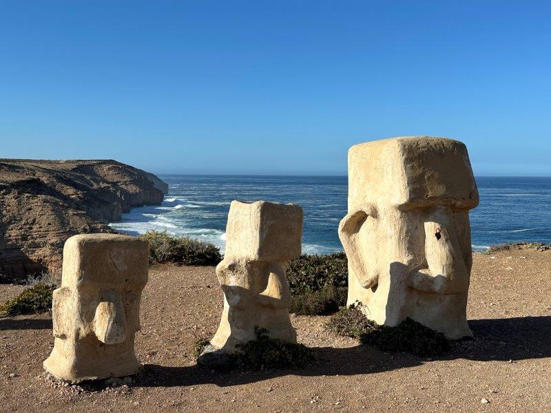
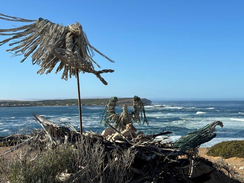
After a week in Coffin Bay we moved north to Streaky Bay. On the way to Streaky Bay we did the Clifftop Drive at Elliston. This elevated drive follows the coastline and provide panoramic views over rugged cliffs, pounding waves and surrounding islands. The drive is littered with bays, coves and sculptures along the way.
The Latvian statute of mother earth stands tall on the edge of the cliff.
The grass sculpture done by Dave Beaty represents a pod of dolphins catching a wave.
The Easter Island Statutes was another stop along the Clifftop Drive. We were very impressed with the parking provided for bigger rigs. We could park close to attractions with heaps of space to turn around.

The nesting eagles was was another sculpture towering over the horizon.
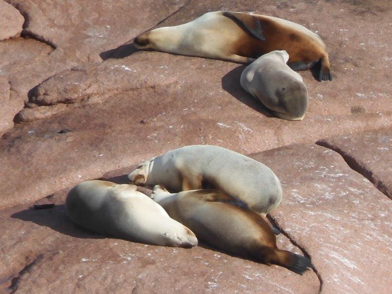
After setting up at Streaky Bay, we did two tourist drives the next day. Point Labatt sea lion colony is inaccessible from land but has a 50m high viewing platform for visitors.
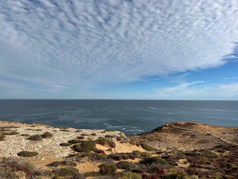
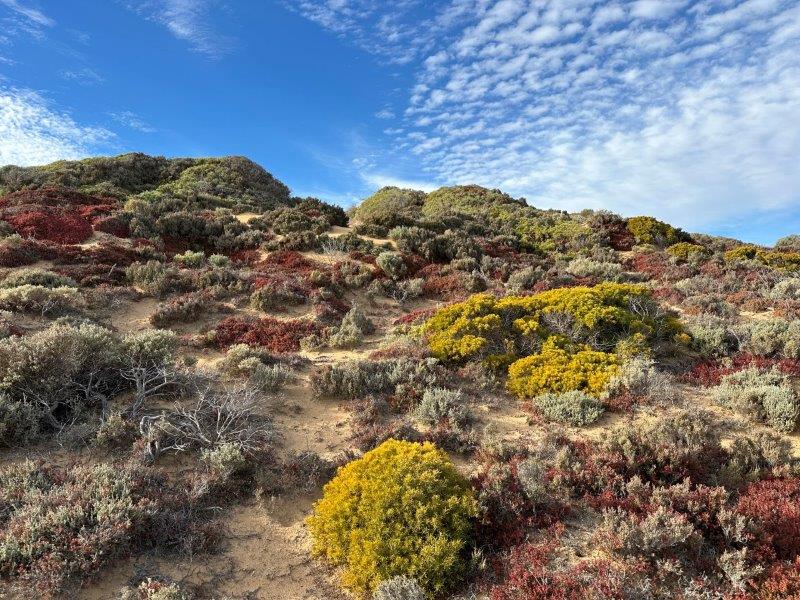
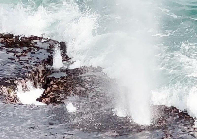
Our next trip was the Cape Bauer Loop Coastal Drive featuring the whistling rocks and blow holes. The walk to the viewing platform passes through sand dunes. At the time we visited, the boardwalk was lined with colourful vegetation.
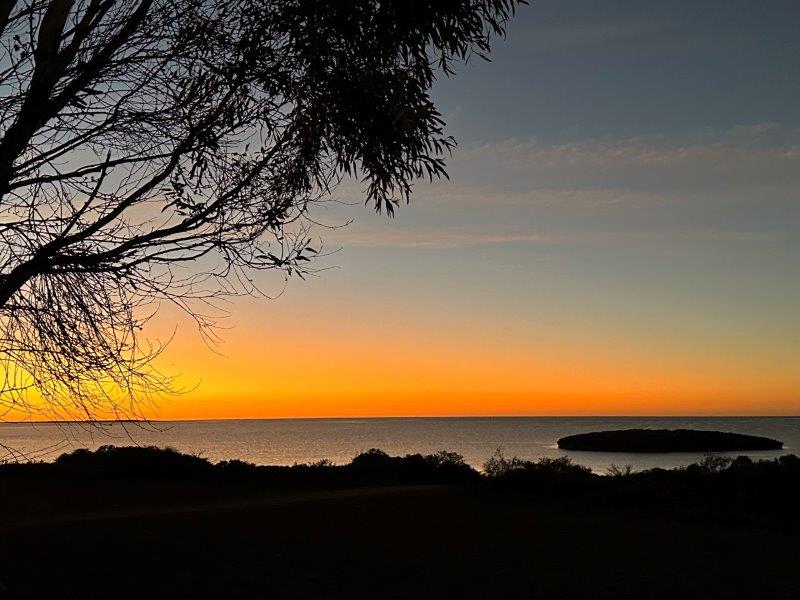
We spent time on the platform waiting for the perfect wave, as the tide came in.
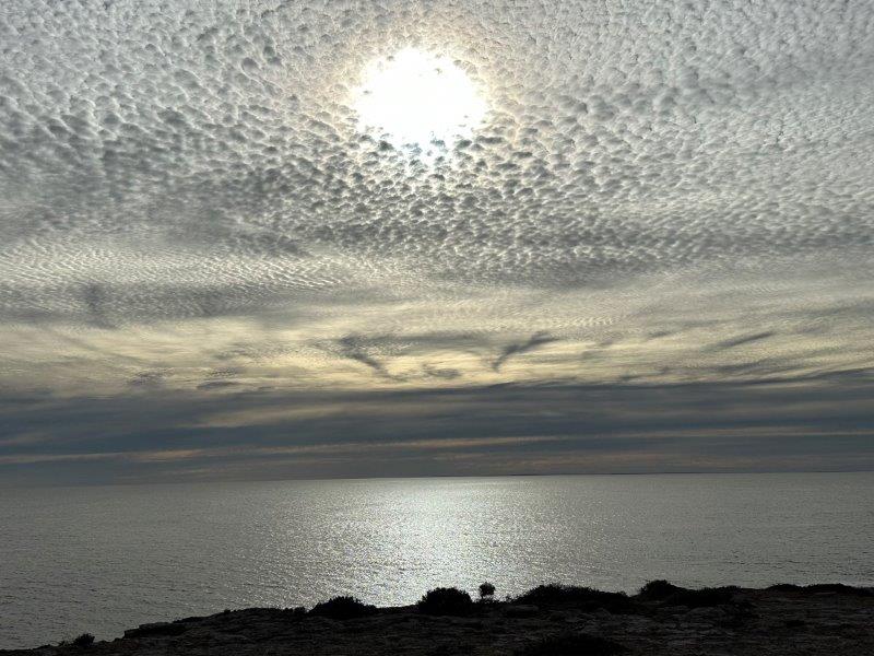
As we waited for the waves to roll in the sun slowly approached the horizon.
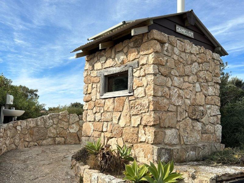
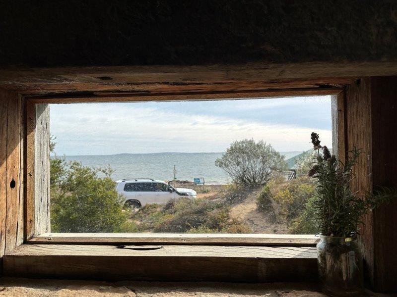
The next day we stumbled across a stone built long drop public toilet with the best view you can imagine.
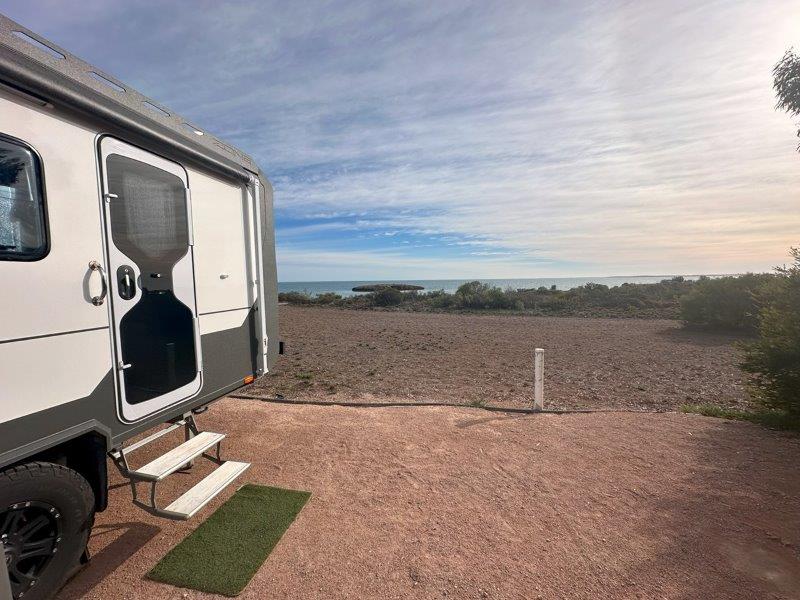
Our campsite at Streaky Bay backed onto the beach, with a small island in the background.
We had a few drinks with friends, enjoying the sunset. For us this was one of the last sunsets over the ocean for some time as we were getting ready to head north away from the coast.
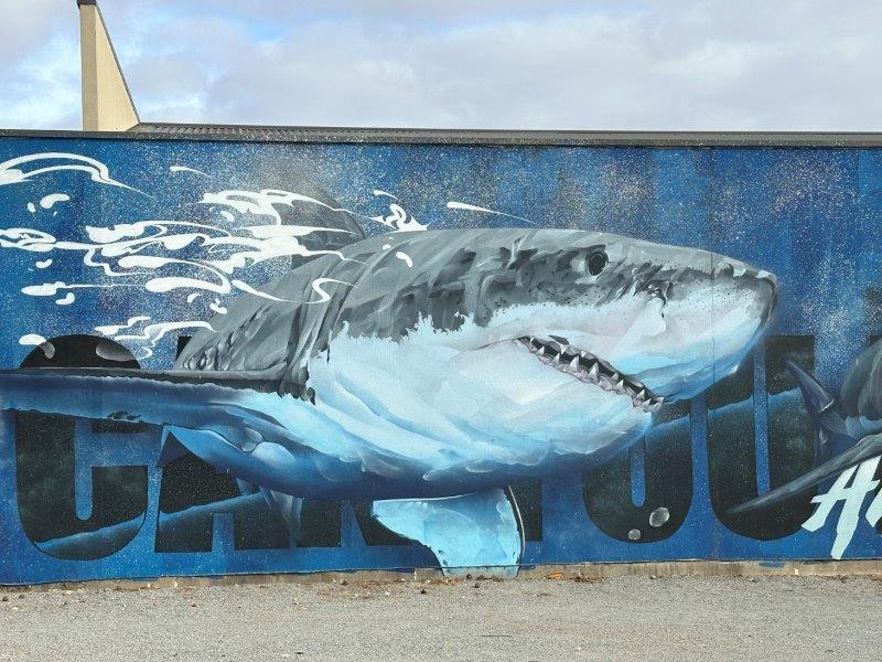
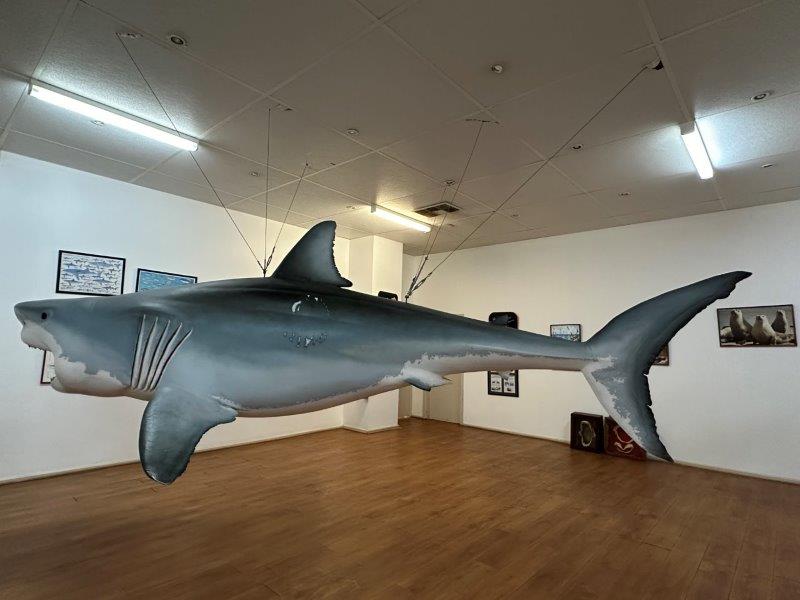
We tried to get a restaurant in Streaky Bay only to learn that the town is seasonal and many shops already closed. We ended up at the Shell service station, doubling as an information centre. Inside the roadhouse show room is a fiberglass replica of one of the largest Great White sharks ever caught. This 1520kg male was caught by a young fisho Dion Gilmore. This 5m shark took 3 hours to tow to the local jetty.
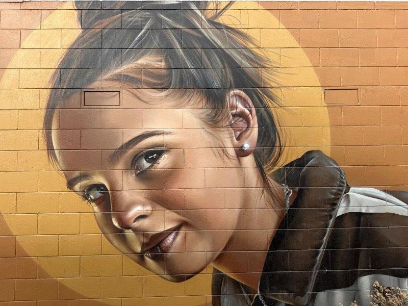
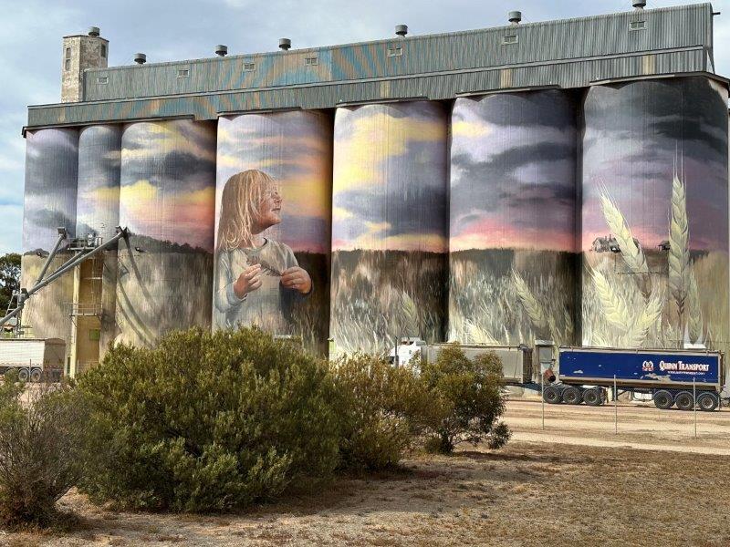
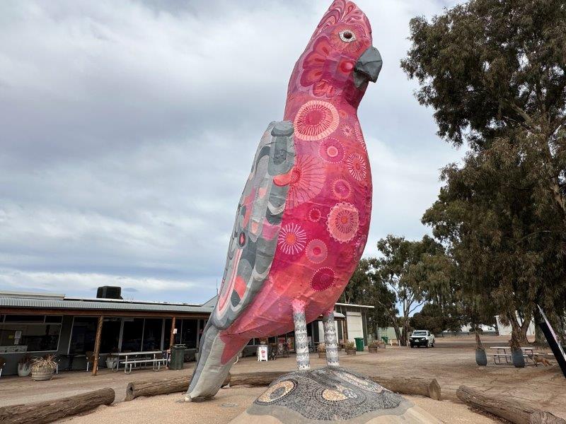
From Streaky Bay we headed east to Kimba where we experienced one of the best council run free camps. The campsite is close to the town center and other tourist attractions. In the distance we could see the silo art of a young girl in wheat fields at sunset.
The 8m Big Galah is just behind the silos at one of the restaurants.
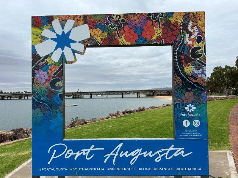
After Kimba we headed further east to Port Augusta to get some auto electrical work done, before starting our trip north. The earth on the car and caravan had to be upgraded to fix the electric brake system that synchronises the car and van’s braking.
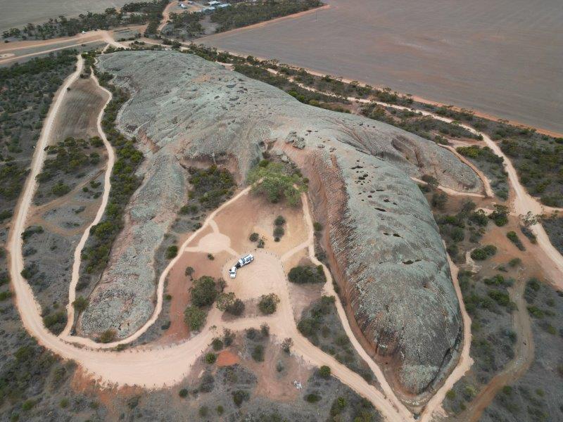
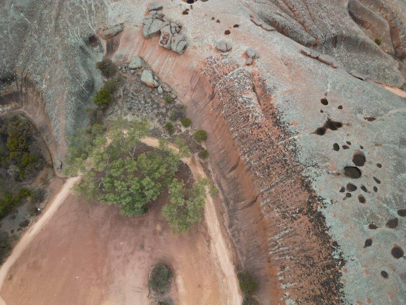
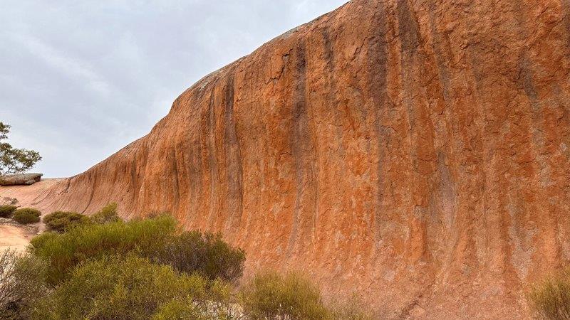
On the way to Port Augusta we took a detour on a dirt road to visit the Phildappa Rock near Minnipa. With the recent upgrades to the site, we could drive around the rock. The size of the car and caravan in the photo below, provides a perspective of the size of the rock.
While in Port Augusta, we finalised our plans for the next few months of our trip and decided to go north through the middle of Australia to the most northern point of the continent, Cape York. We stocked up on groceries, refuel the car and filled the water tanks before heading north.
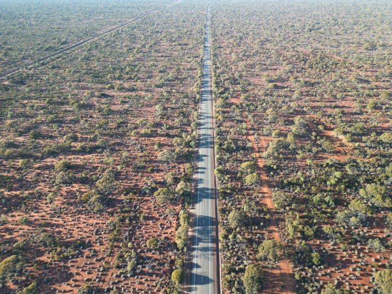
After Port Augusta we tackled the straight, quiet and hot Stuart Highway. As we travelled north the vegetation changed to Acacia shrublands and red dirt. Cattle grids across the highway mark the start of a new cattle station and our slow progress north.
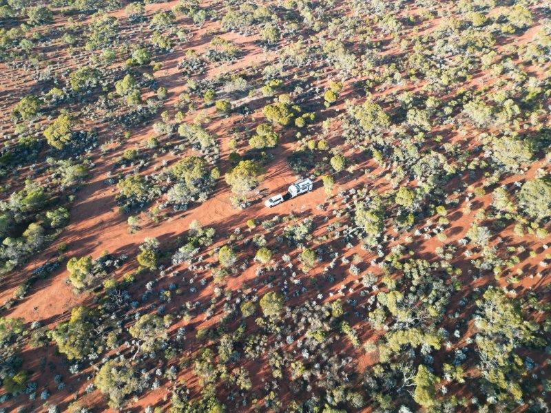
No issues with finding camping spots along this road, with bush camps right next to the highway. It was seldom that we shared these sites with fellow travelers.
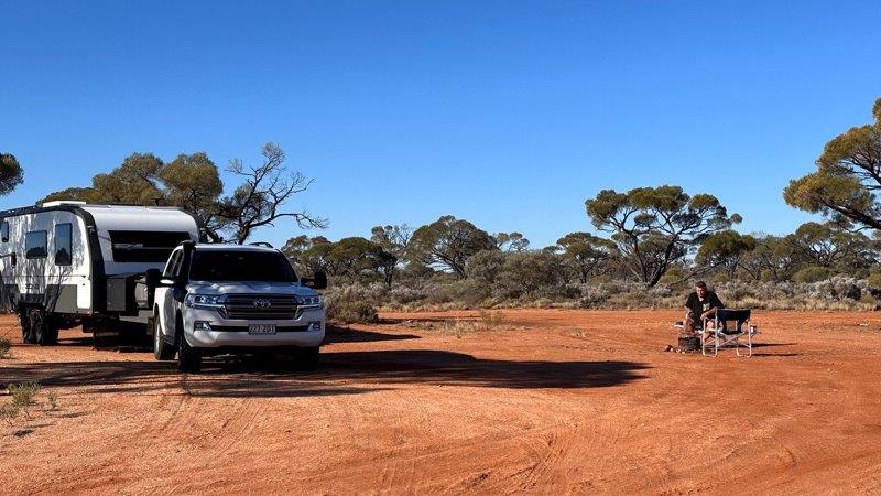
Many of the camps along the way had makeshift firepits for barbeques or camp ovens.
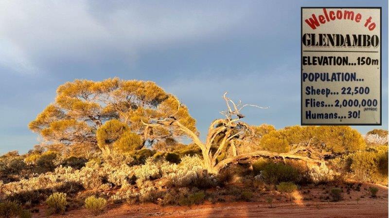
You do not see many humans on the the Stuart Highway, but cattle, sheep and flies made up for it. Close to our camp at Glendambo we saw the sign, inserted below. I think the 2 millions Glendambo flies all has a fieldtrip to our campsite. We chose to run inside the van for dinner after we finished cooking on the fire.
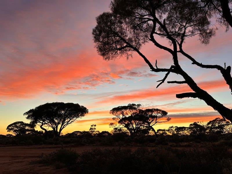
The sunsets in the northern part of South Australia are uninterrupted and vibrant red.
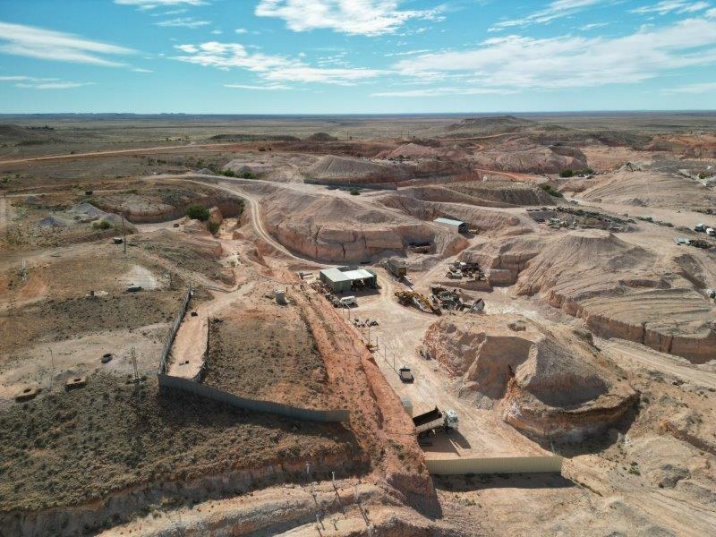
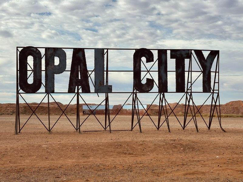
The last major town in South Australia, was Coober Pedy. You know you are there when the dugout and desolation starts.
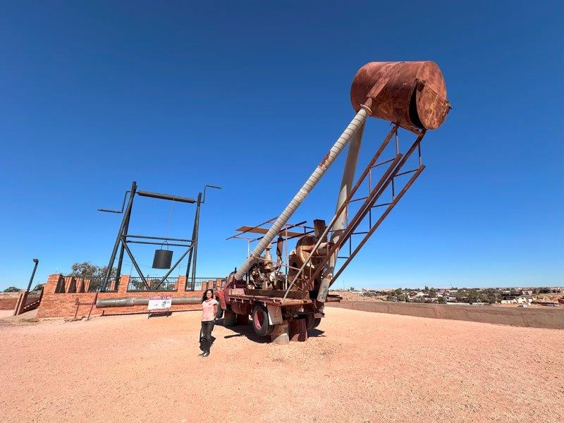
Upon entering into the town, we had to stop for a photo at the Blower Truck. We later leaned that these blowers on the back of the trucks were mobile vacuum cleaners. The truck and vacuum was taken to the opal mine shafts and could suck dirt from 30m below ground level. The blower truck was an early invention to remove the manual labour moving the dirt out of the shafts.

The main industry in Coober Pedy is Opal mining.
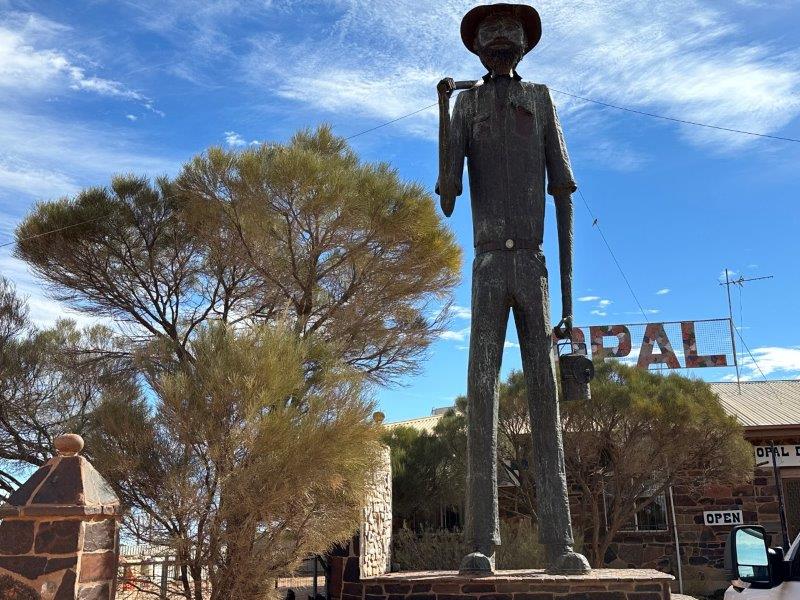
The town is quirky and the first stop was The Big Miner.
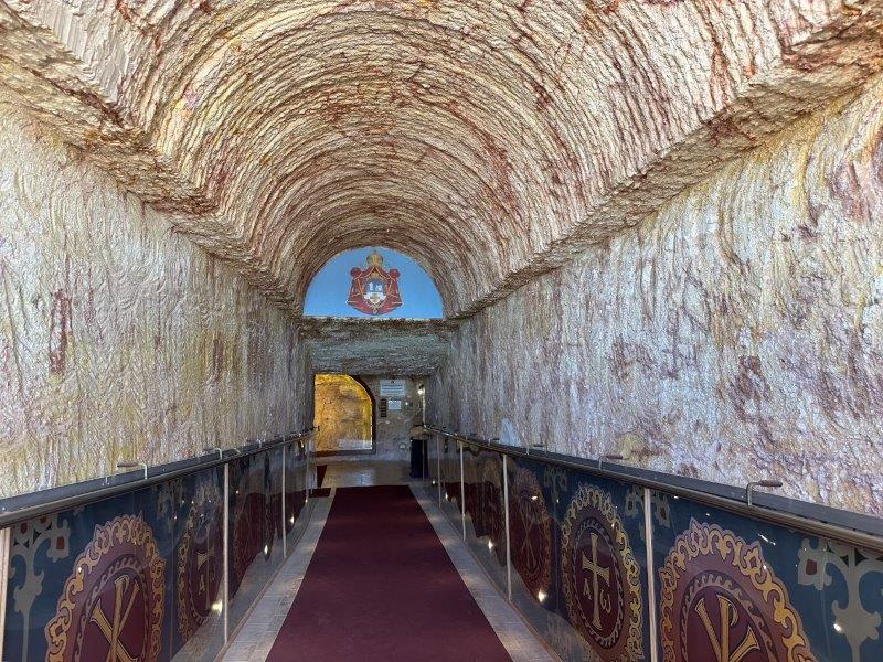
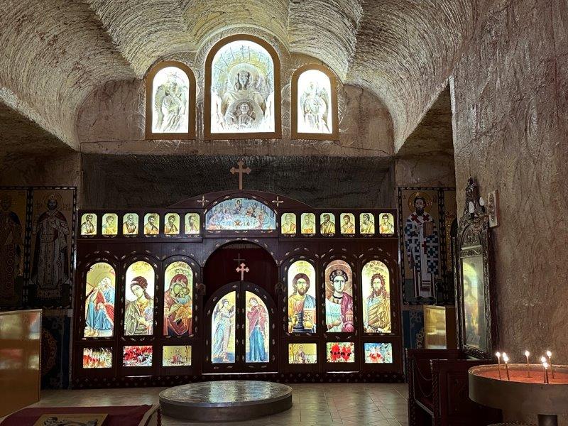
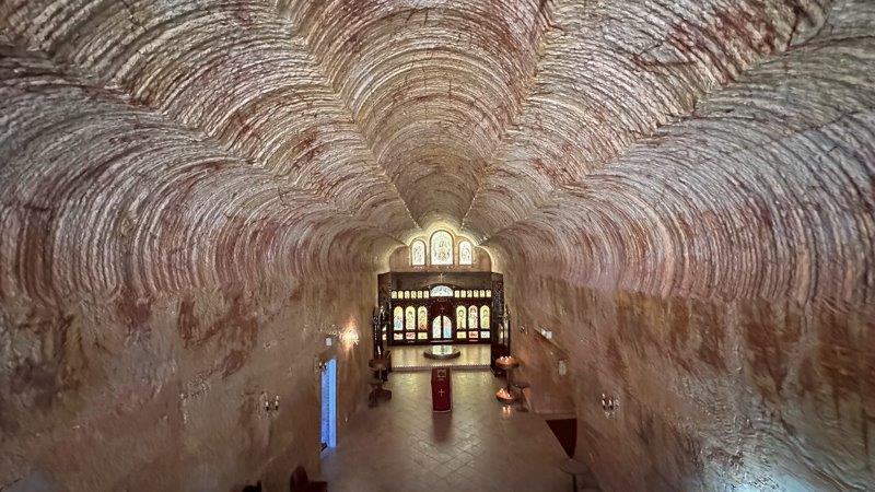
Due to the heat and climate, most of the houses are dug into the ground. For us, the best example of the underground buildings was the Serbian Orthodox Church.
At one of the highest points in town was The Big Winch with another blower truck. The highest point is a bit of an overstatement, as the town is mostly flat.
Around ever corner there is something that make you scratch your head, like a spaceship.

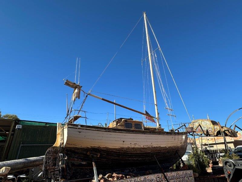
One of the opal traders has a yacht in front of his house. With the sea being thousands of kilometers away, it is no wonder local dubbed him Noah.
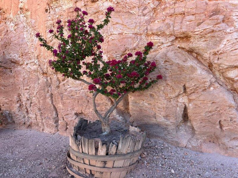
Why the photograph this bougainvillea? Well, because it was one of the only plants we saw in the town. This place is dry as a bone.
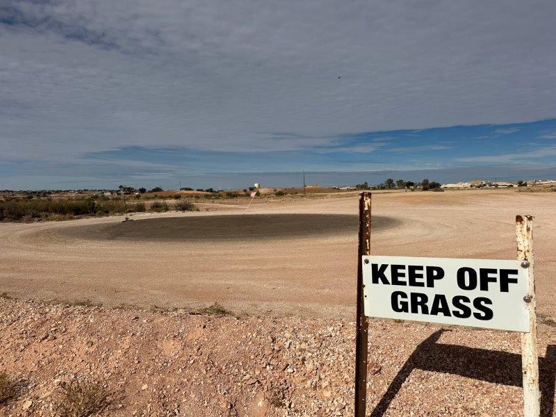
We went to the local golf course and there was no lawn on it. Even the greens were barren. Despite the absence of any lawn, they still had a cheeky sign stating; “Please stay off the grass” 🙂
Coober Pedy was our last town in South Australia before heading to the Northern Territory.