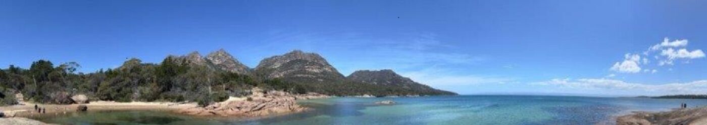
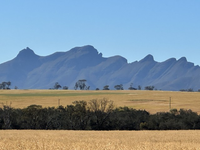
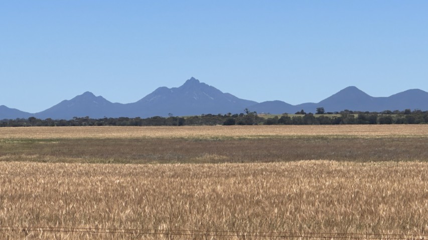
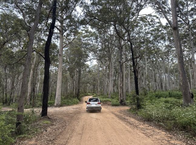
The only major mountain range in Western Australia is the Sterling Ranges. The range has many scenic drives taking you through the ancient geology. We took a few dirt tracks through the mountains and walked to a few vantage points. For us, the best views of the mountains were from a distance as it define the horizon.
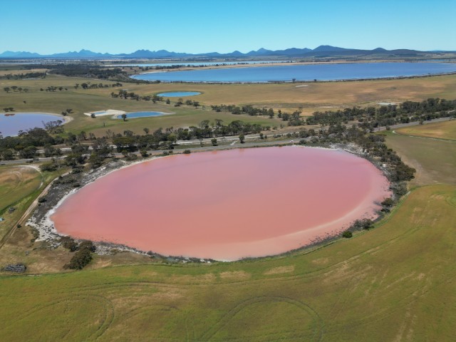
There are many lakes to the north-west of the Stirling Ranges. We have visited many supposedly pink lakes on our travels. To our disappointment, the lakes were either dry or the balance of microorganisms, such as dunaliella salina was to low. This streak of bad luck was about to change as we approached Cranbrook. We passed a proper pink lake with the Stirling Ranges in the background.
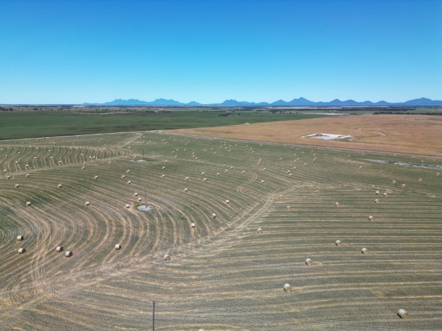
The road back to camp meandered through farmlands with the Stirling Ranges on the southern horizon.
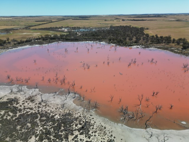
We were lucky to see a second pink lake on the same day. This farm lake had a few tree skeletons breaking through the pink surface.
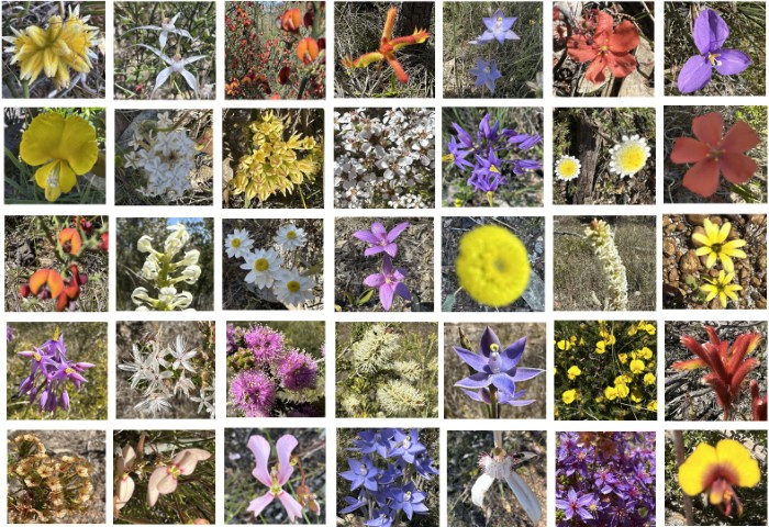
We stopped at the town of Cranbrook and did the Federation Wildflower Walk. It was way past the wildflower season, but we still saw a few flowers on the 2 kilometre loop walk.
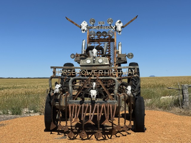
The Horsepower Highway weave through the farms and many farmers had vintage tractors and farming equipment on display at their gates. There were even a few creative installations made from farm scrap, like Mad Max.
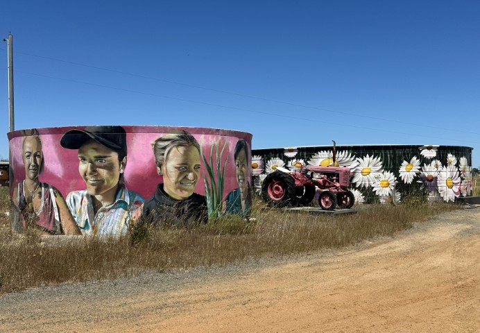
The Lucinda Pink Tractor and Tank Art were created to honour a few local woman serving the community. The ladies on the water tank includes firefighters, paramedics as well as local farmers. The creation by Jerome Davenport adds colour to a the long stretches of road.
After a few days exploring the area around the Stirling Ranges, we headed to Albany. We found a campsite on the beach, where we stayed a week. Even though the campsite was a fair drive from Albany, Cosy Corner East Campground was quiet and on the beach with no passing traffic. Exactly what we wanted.
Albany has a lot to offer, from blowholes and beautiful beaches to rich history covering early explorations and warfare.
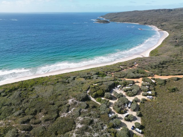
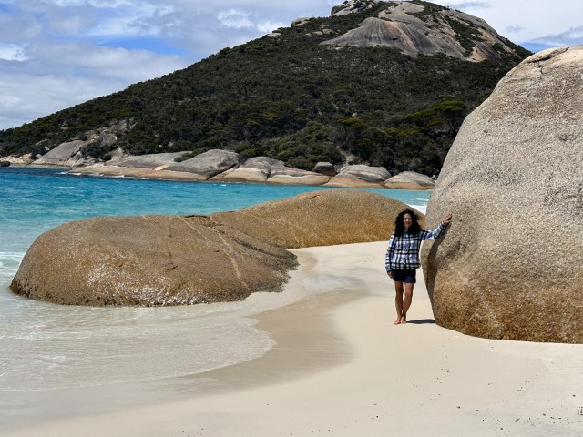
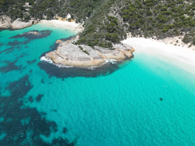
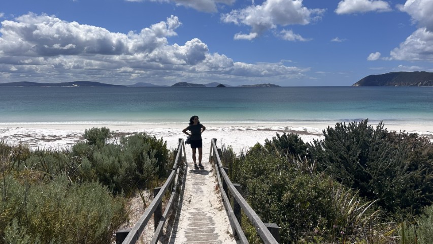
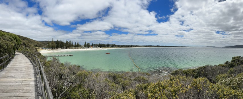
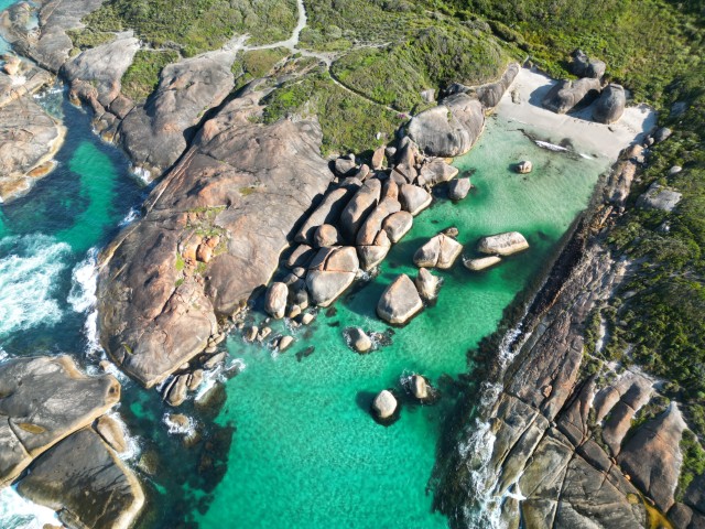
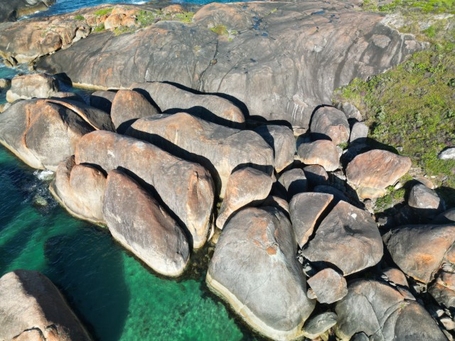
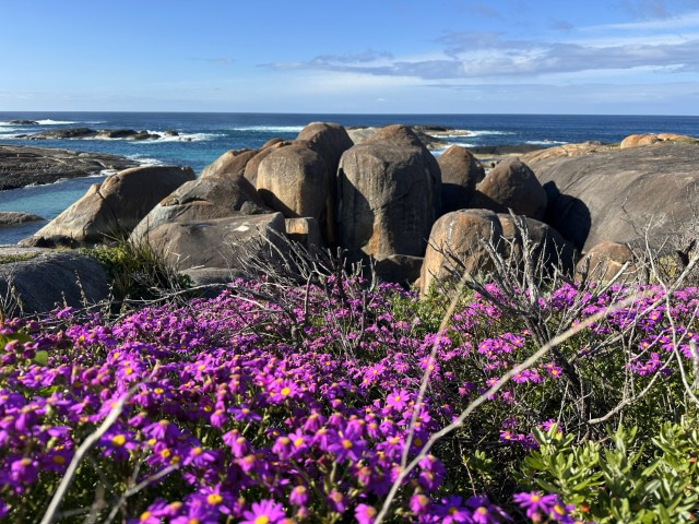
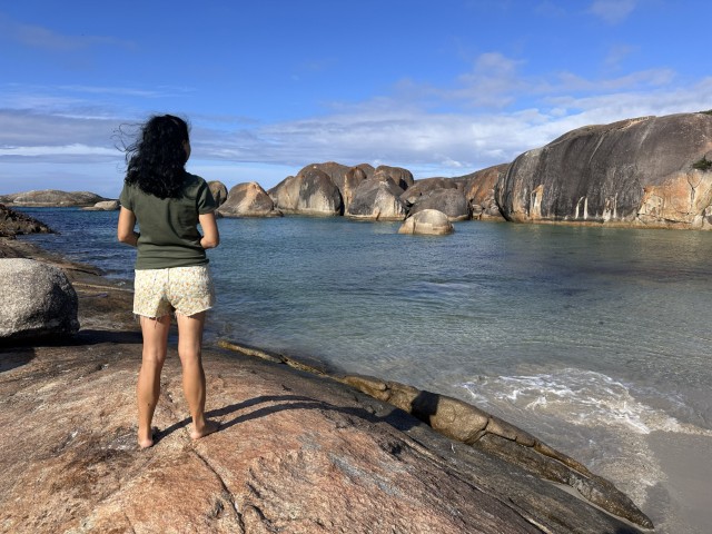
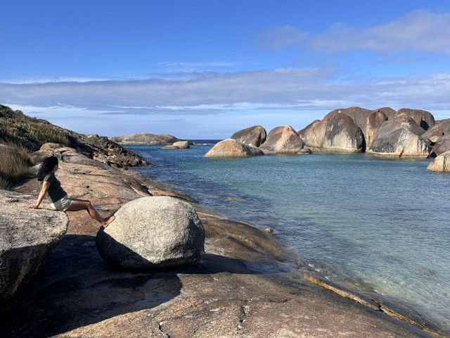
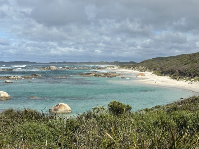
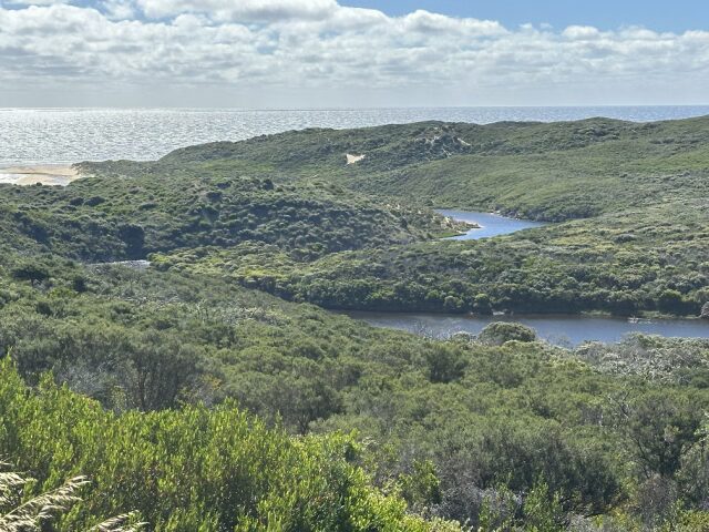
Little Beach and Waterfall beach are two beaches in Two Peoples Bay Nature Reserve. Little Beach is famous for its turquoise water and the bench-like granite rock formation in the middle.
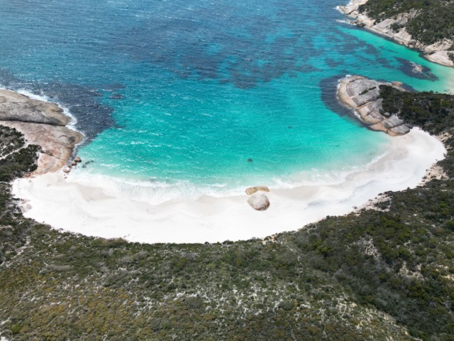
The granite rock looks small from the air but is massive when standing next to it.
We also followed the footpath over the granite rocks separating Little and Waterfall beach.
From Two Peoples Bay National Park we headed to Torndirrup National Park.
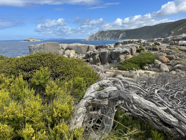
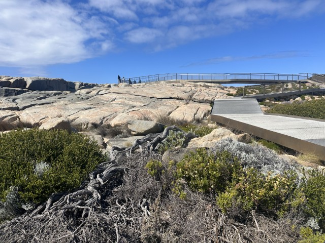
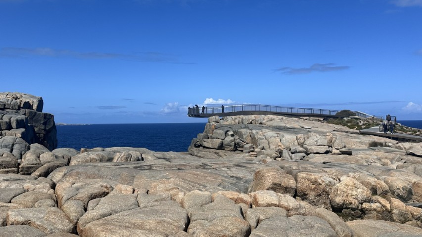
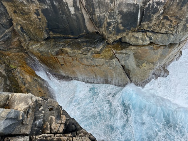
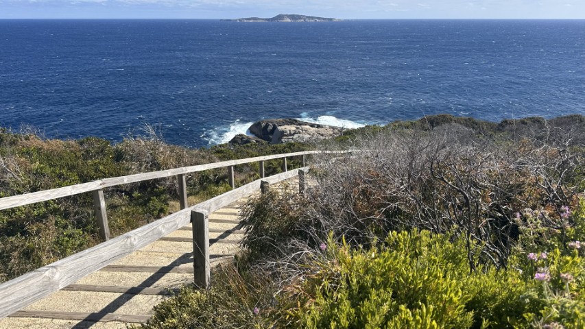
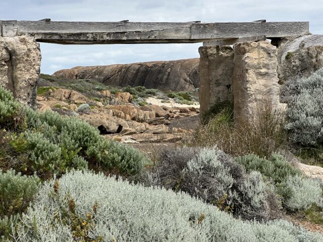
Torndirrup National Park is best known for the Gap and the Bridge. A concrete pathway from the carpark takes you to the lookout overhanging a massive gap in the rock face. From the Gap lookout, you look down on a 40m drop where the southern oceans pushes water into the gap resulting in a misty spray and a thundering noise.
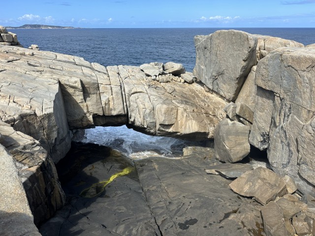
About 100m from The Gap is The Natural Bridge where water gushes under the bridge on high tide.
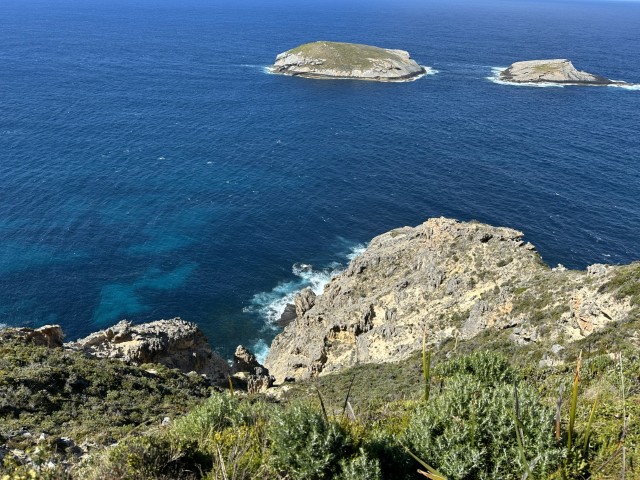
In the same national park is another lookout, Sharp Point. A short circular walking track took us to two different lookouts.
Our last point of interest in the Torndirrup National Park was the blowhole. To get to the blowhole is a steep 2km walk. We must have had the tides wrong as nothing was blowing while we were there.
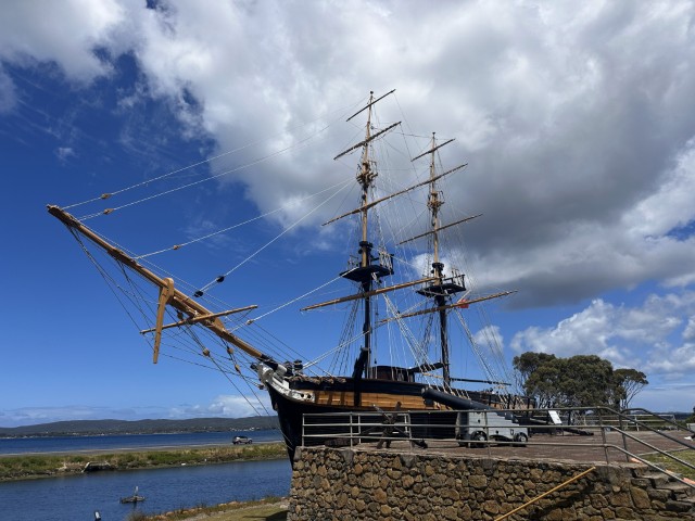
The next day we decided to explore Albany and visit a few shops to stock up on groceries. We started at the information centre where the The Brig Amity Replica stands tall, to welcome visitors. Visitors can explore the deck and walk the gangplank or pay a small fee to go down in the haul to see how convicts were transported in 1826.
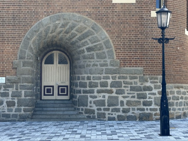
Albany has many beautiful old buildings with early colonial architecture on display. The old courthouse is just behind Dan Murphys.
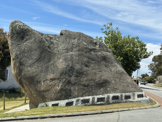
The dog rock has a history predating European settlement. Today the dog rock is in the middle of the business district. Many businesses around it, are named after the rock.
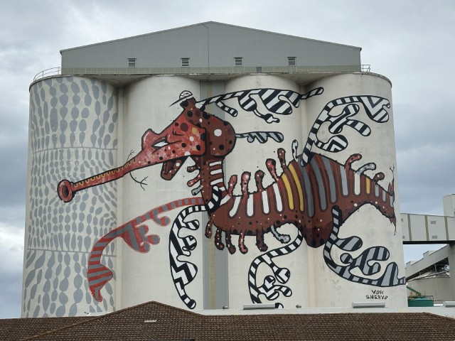
The next day we explored the south-eastern side of Albany towards Middleton beach. We passed the seahorse silo art.
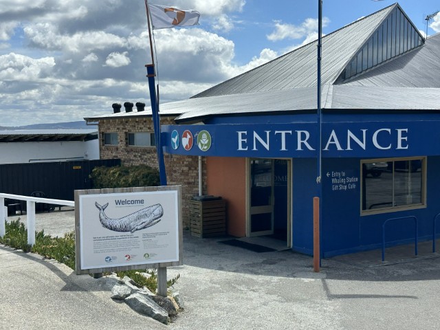
The old whaling station overlooks Frenchman’s Bay. The whaling station is one of the best kept historical whaling stations in the world. Exhibits of the last whaling boat, the processing decks and processing plant are all on display.
After the Whaling Station, we stopped at Goode Beach.
From Goode beach to Middleton we drove through Albany’s original faming community. The first British farm in Western Australia was established by Dr. Collie in 1827, farming strawberries in this area. The area is still referred to as Strawberry Hill. A boardwalk around the hill provides a great view over Middleton beach.
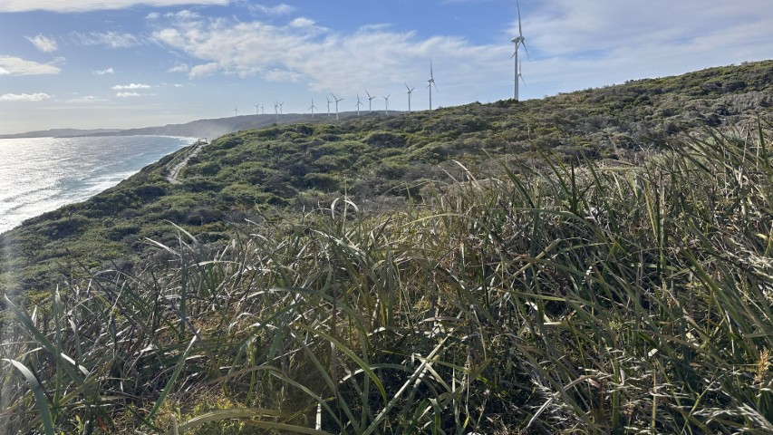
On the way back to our campsite we drove past the Albany Windfarm. The farm has 18 turbines, each standing 100m tall. These turbines apparently provide 70% of Albany’s power. When we were there, only a handful were operating.
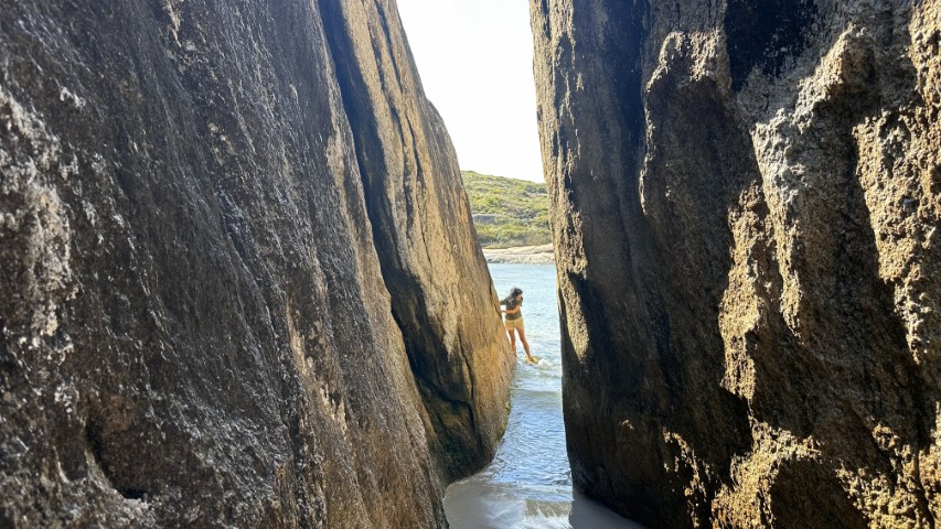
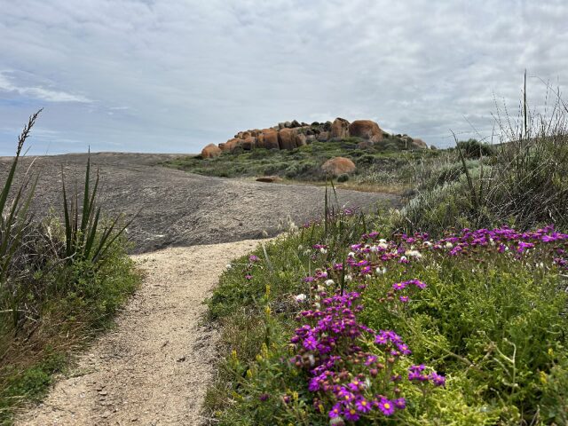
From Cosy Corner East we did a daytrip to William Bay National Park near Denmark, leaving early in the morning. Just outside Denmark is the popular Elephant Rocks. From the lookout at the carpark, we had a great view over the small secluded beach.
The walking track from the carpark has lovely views over the boulders shaped like herding elephants. At the end of the track are steep steps, taking you to a narrow rock passage.
When the waves pull back it is an easy walk through the rocks. When the water gushes in, you are wet up to your middle. Timing is important if you want to access the beach through the rocks, and stay dry. There is an alternative sandy track for those not keen to get wet. The alternative track takes you around the boulders onto the beach.
The benefit of being early was that we had the place to ourselves for almost 45minutes before beachgoers started arriving. What a great spot!
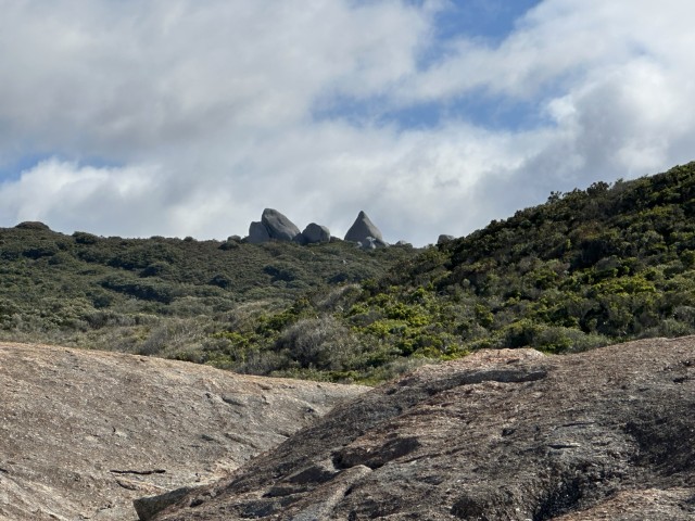
From Elephant Rocks there are two alternative tracks to access Green Pools. The one track takes you back through the carpark while the alternative track is a shortcut scrambling across the rocks. We took the second option. The track had great views over the giant granite boulders of Tower Hill with swooping black cockatoos coming in for a feed.
As you turn the corner from Elephant Rocks, Green Pools are straight ahead.
Still in William Bay National Park, our next stop was Waterfall Beach. The beach is lined with thick scrub on the way to the waterfall.
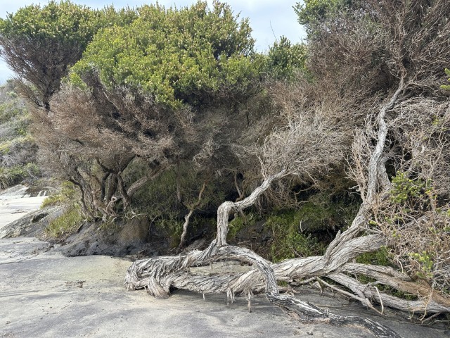
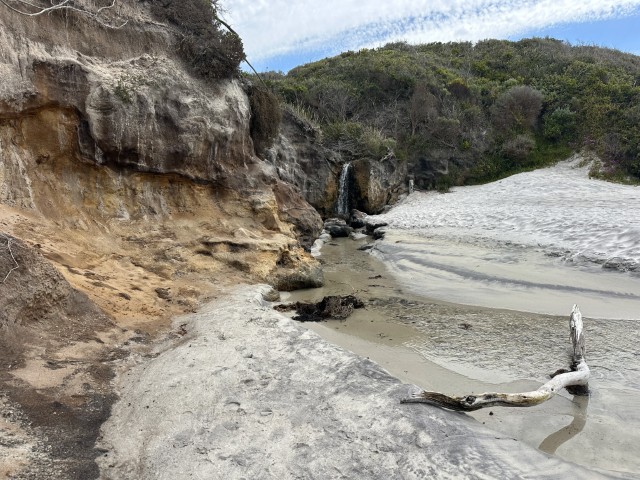
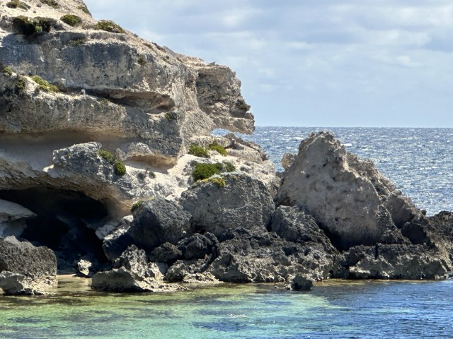
Along the way were caves, rock crevices and skeleton trees bordering the white beaches.

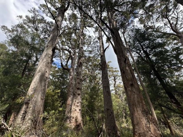
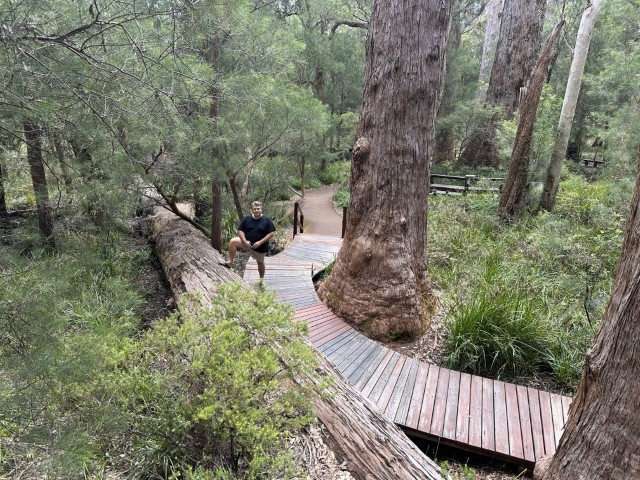
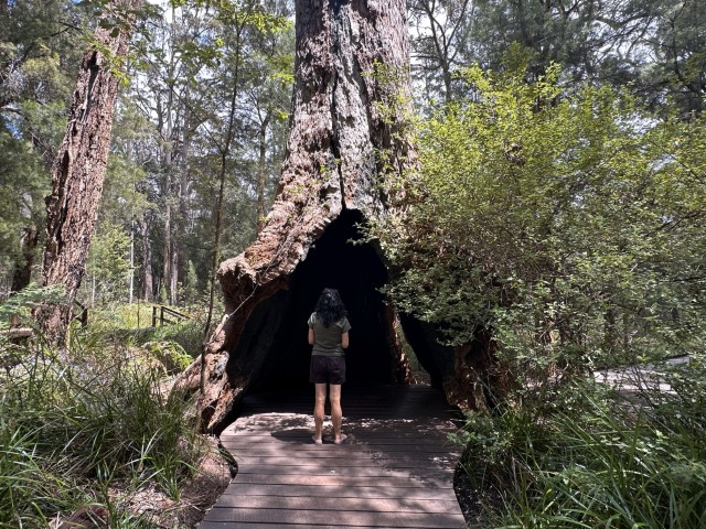
We did a separate daytrip to the Valley of the Giants. This iconic attraction is known for a cluster of massive red tingle trees. The Walpole Wilderness Area is the only place in the world where red tingle trees grow. Amongst these eucalyptus giants is an information centre, a treetop walk and a boardwalk to explore these 75m tall giants in its natural habitat.
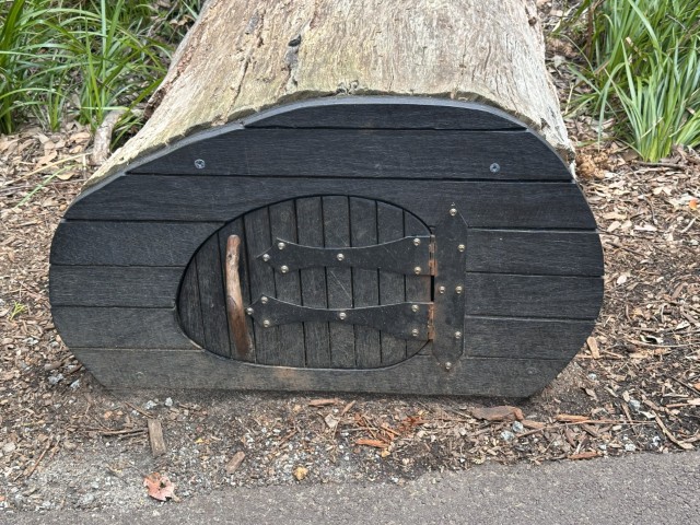
Small hobbit-like homes were created along the boardwalk. A few of the fallen trees were converted into fairy homes. Very excited young ones were running along the boardwalk to find and open the little black doors.
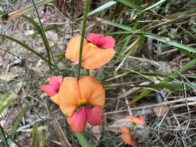
The Flame Pea, also known as the heart-leaf flame pea flourishes under the shady Tingle Tree canopy.
The boardwalk meanders through the forest with a few interesting features and cul-de-sacs, along the way.
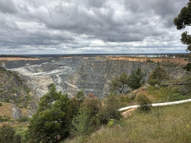
On our way in the direction of Margret River, we decided to spend a few days at Greenbushes. Greenbushes has a long history in forestry and mining. Today the area is known for lithium and tantalite mining.
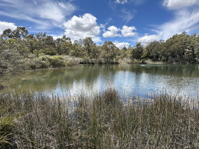
Greenbushes pool is a historic spring fed billabong. The pool is in the Norm Lindsay Reserve and was once a very popular swimming hole in the town’s early days.
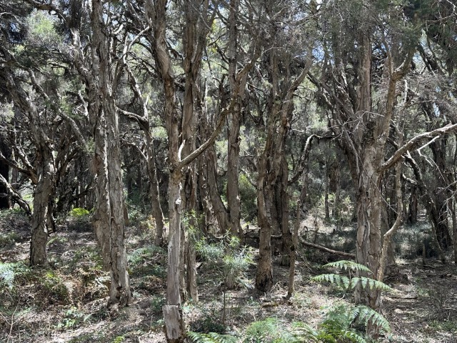
We walked the tracks circumventing the pool in the Norm Lindsay Reserve. The boardwalk takes you through a paperbark forest.
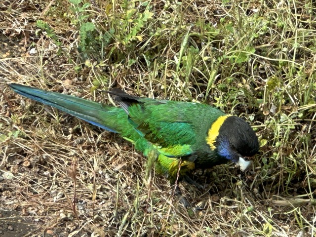
We camped at the Greenbushes Sport Complex during our stay. The Australian Ringneck Parrots woke us up each morning.
Greenbushes has a few small shops with the essentials, but Bridgetown is the closest major town.
We visited Bridgetown a few times during our stay at Greenbushes. The town has a few humorous murals promoting the town’s main features. We certainly found out why Bridgetown is referred to as Fridgetown by the locals. This elevated town is cold.
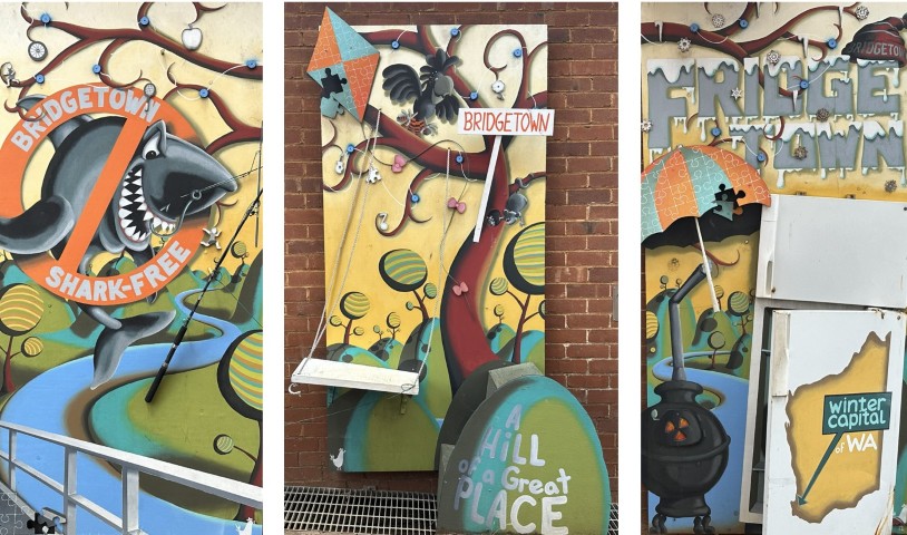
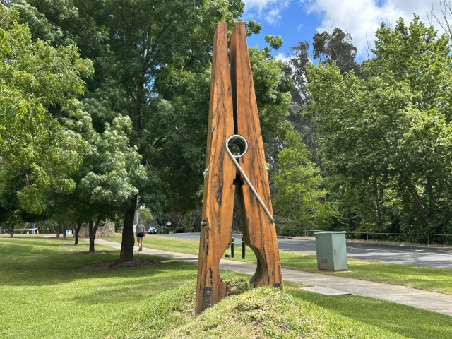
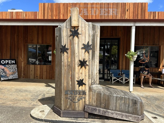
Bridgetown is also home to The Giant Peg and The Big Cowboy Boot.
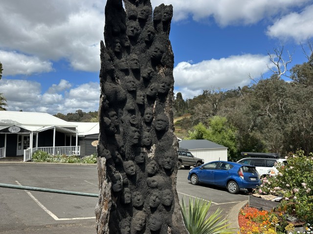
The Ashes to Ashes creation by Kim Perrier, is on display in the main street.
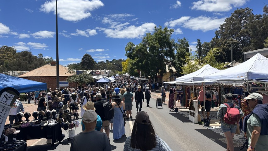
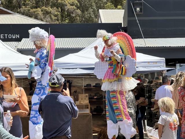
We also timed our visit well to coincide with the annual Blues Festival. We spend the day amongst market stalls and buskers. This small town came to life with friendly locals and lots to see and do.
From Greenbushes, we headed to the Western Australia’s wine region. We could not think of a better place to base ourselves than amongst the vineyards. We stayed at Glenbrae Gardens.
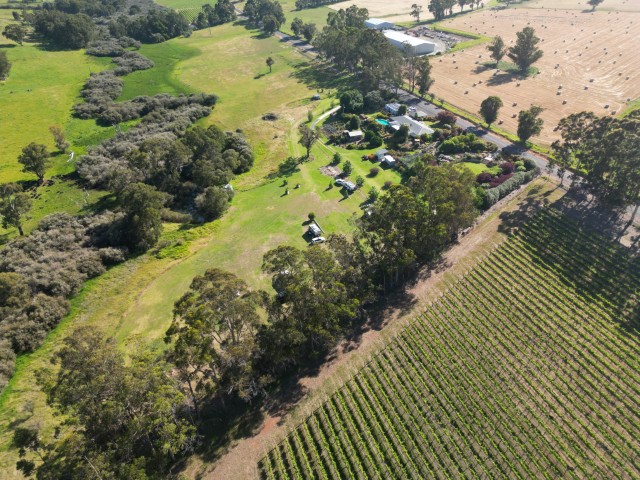
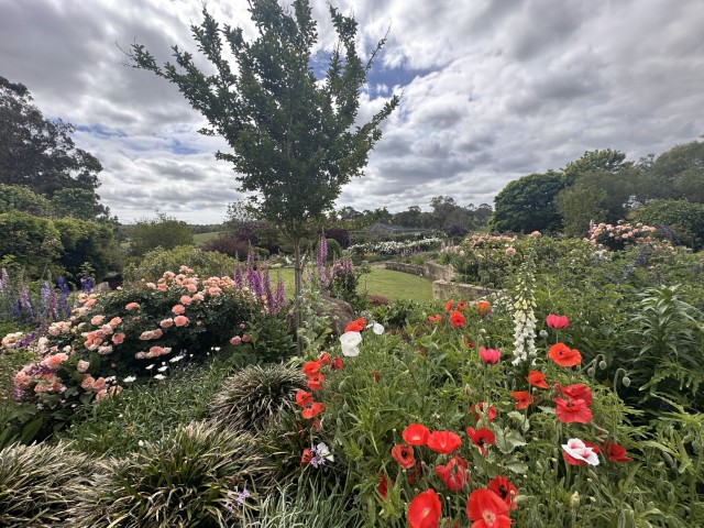
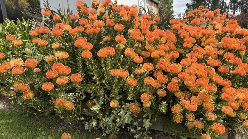
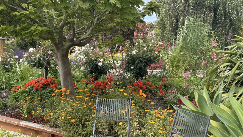
Glenbrae Gardens is known for its magnificent gardens hosting many special events in the Margaret River area. The camp sites are adjacent to the gardens and campers are welcome to access the gardens.
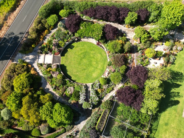
Narrow waking paths takes you through the gardens. The variety of flowers and birdlife, was incredible.
While at Glenbrae Gardens we explored the areas south of Margaret River.
Our first stop was Surfers Point at Prevelly near Margaret River. This surf beach is one of the Big Wave locations in the world on par with Hawaii. This may be the reason for the annual World Surf League’s Margret River Pro between March and April. While we were there it was difficult to believe it is a surfing destination based on the glass-off we experienced.
The Margaret River mouths into the sea close to Surfers Point.
We followed the coast south to the most south-western point of the mainland. We chose the scenic Boranup forest drive rather than the bitumen road.
Hamelin Bay is known for the stingrays playing in the shallows. No such luck when we were there.
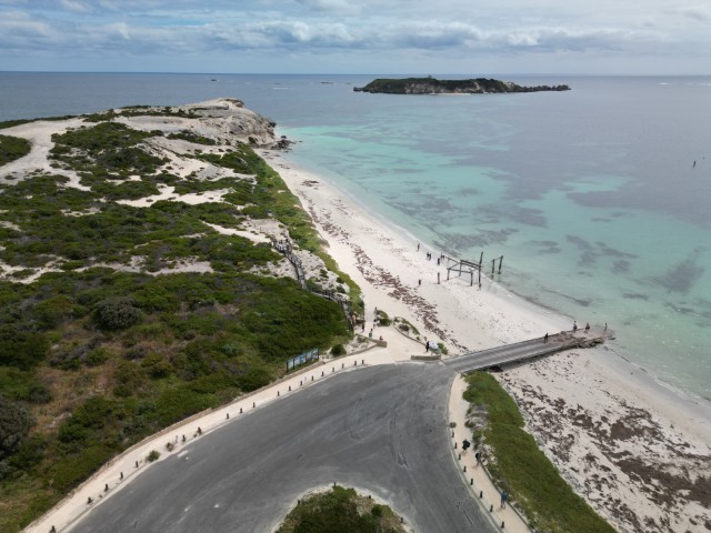
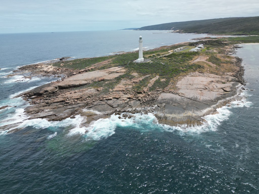
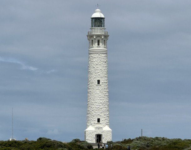
On the most south-western point is Cape Leeuwin Lighthouse, surrounded by various walking tracks and the original waterwheel, used to build the lighthouse.
The waterwheel used to pump the water to build the lighthouse is a popular tourist attraction. The water wheel became encrusted in limestone after exposure to mineral rich spring water for decades.
Cape Leeuwin Lighthouse is the tallest lighthouse on mainland Australia, standing proud where the Indian and Southern Oceans meet.

Cape Leeuwin Lighthouse was built in 1895, using local limestone. The lighthouse still does what it was intended to do… saving lives. The lighthouse was modernised in 2022 and is fully automated.
The visit to Cape Leeuwin Lighthouse mark the completion of the southern coast of Western Australia. From this most south-western point we started going north on the west coast.