
After completing our South Australia trip, we headed north. The road north cut straight through the middle of Australia.
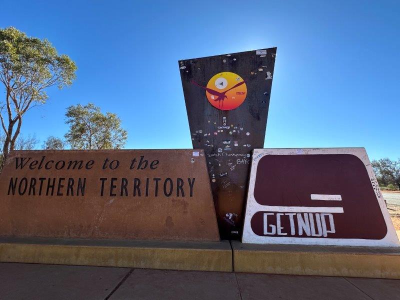
It all started with the sign “Welcome to the Northern Territory”.
Similar to the northern parts of South Australia, there were heaps of free camps next to the Stuart Highway.
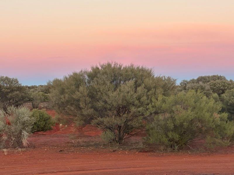
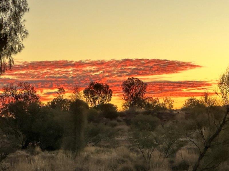
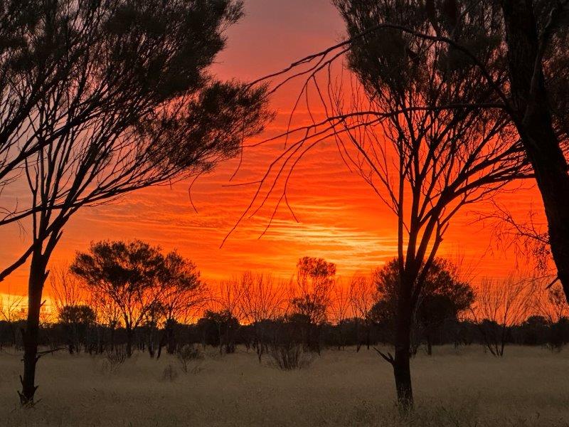
After long drive-days we were rewarded with beautiful outback sunsets.
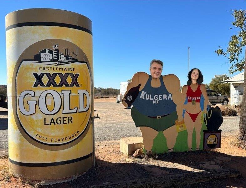
Kulgera was our first stop to fuel up. Kulgera did not offer much to see, other than the Big XXXX Beer Can.
Our next stop was Ghan and we will not forget the fuel price. The highest fuel price to date, at $2.79 per liter.
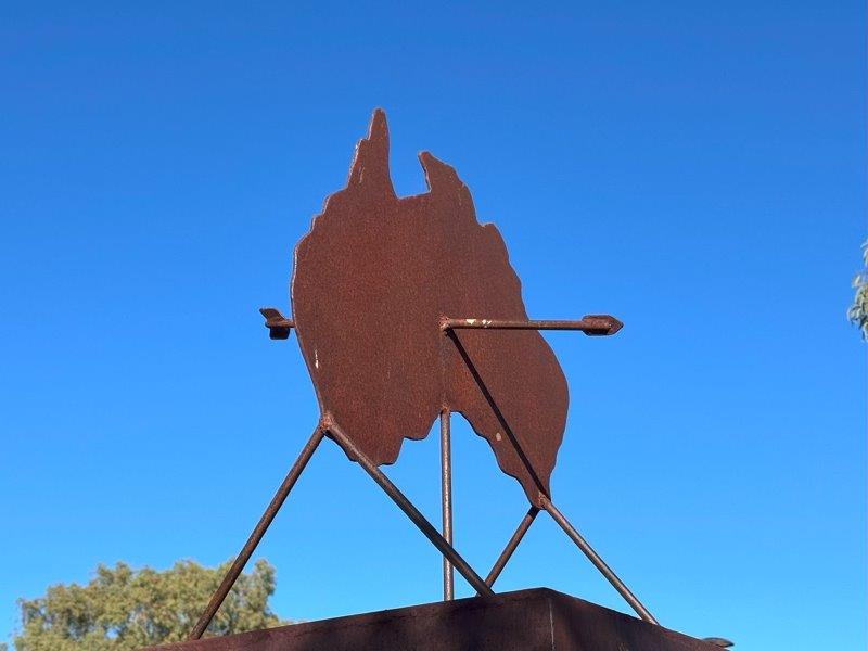
Ghan is also the centre of the Australian continent. You can argue about the correct mathematical formula to calculate the centre. The Centre of Gravity method, or the furtherest point from the sea, or the median point, or the Lambert gravitational centre or the Johnston Geogetic station, are all options. To further complicate the equation it may differ from low to high tide. For us this sign stating it is the centre, was good enough.
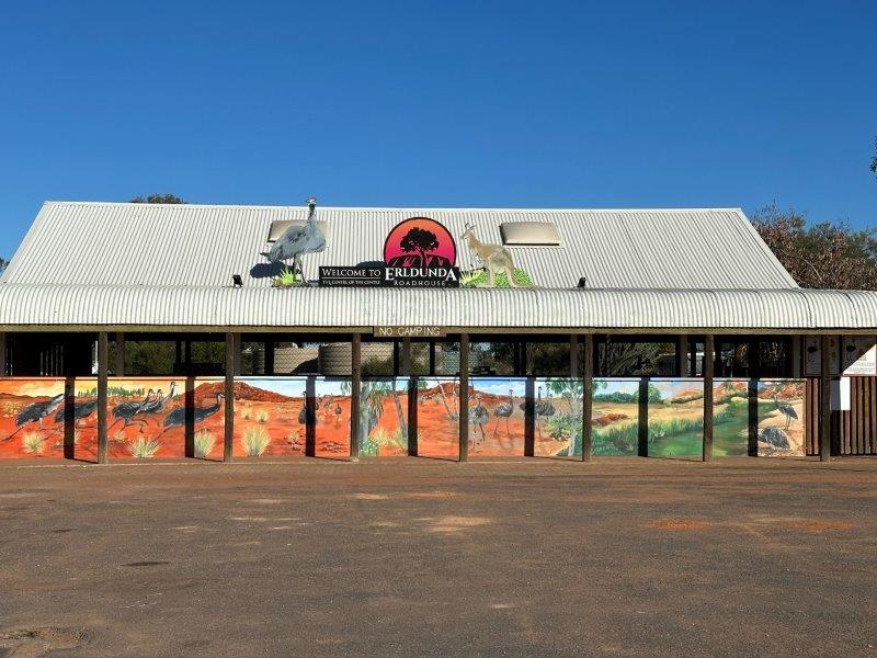
Despite Ghan’s remoteness it had fuel, a roadhouse and great amenities.
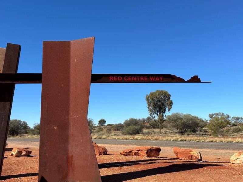
From Gahn we took the Red Centre Way and headed west in the direction of Uluru.
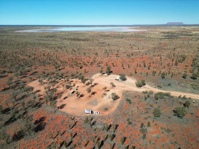
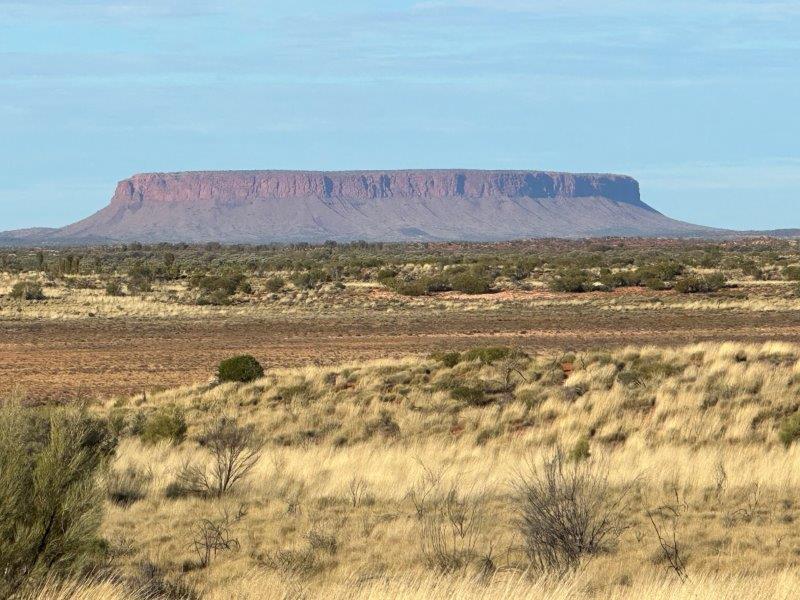
On the way to Uluru we camped at Petermann Rest Stop. In the distance was a salt lake and our first glimpse of Mount Connor.
Many visitors confuse Mount Connor with Uluru. Mount Connor is often referred to as fake Uluru or Fooluru.
Just across the road from Petermann Rest Stop was a short track overlooking the salt lakes.
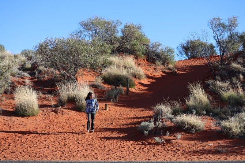
Petermann Rest Stop did not disappoint and we had another great sunset.
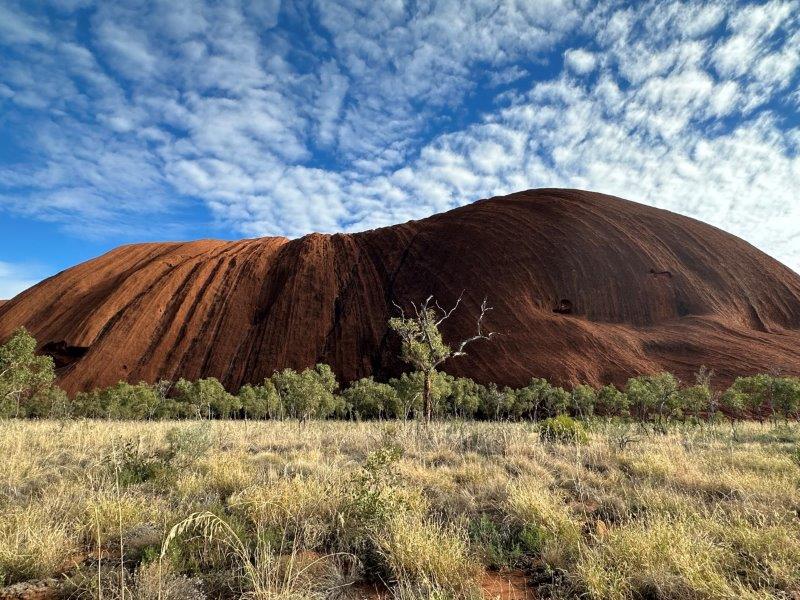
Early the next morning, we arrived at the closest town to Uluru, Yulara. After setting up camp at Yulara, we explored the small settlement before heading to Uluru for sunset. This was a highlight for us. There is a massive single row car sunset viewing area. Despite the 50 cars in the carpark we had our own private area behind the car to stretch out.
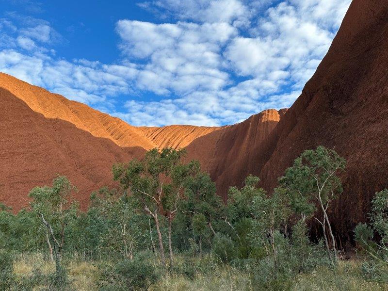
The changing colours of the rock as the sun set, was spectacular.

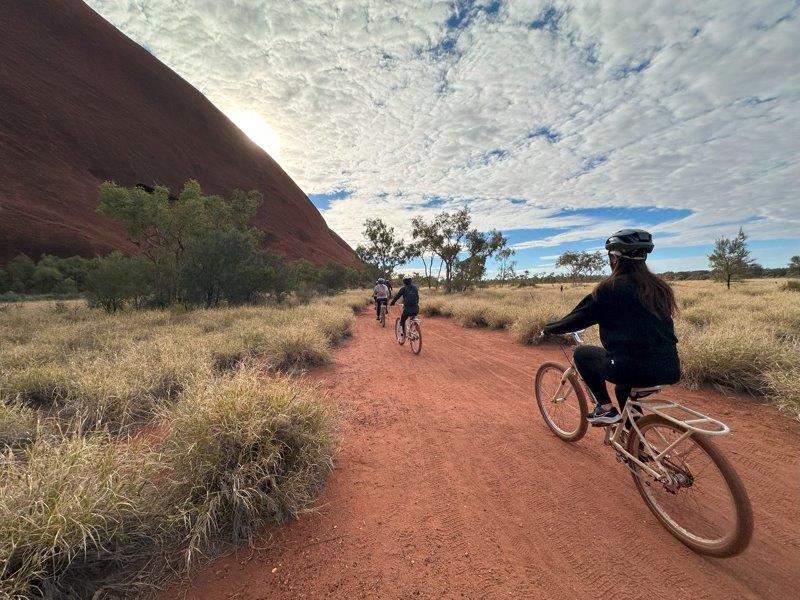
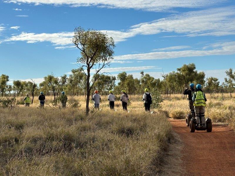
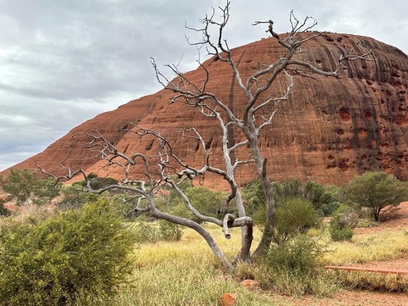
We had a 3-day pass to enter Uluru-Kata Tjuta National Park. There are many activities and ways to experience this massive sandstone monolith. There are a few flight options, bicycles, segways or you can walk the 12km around it.
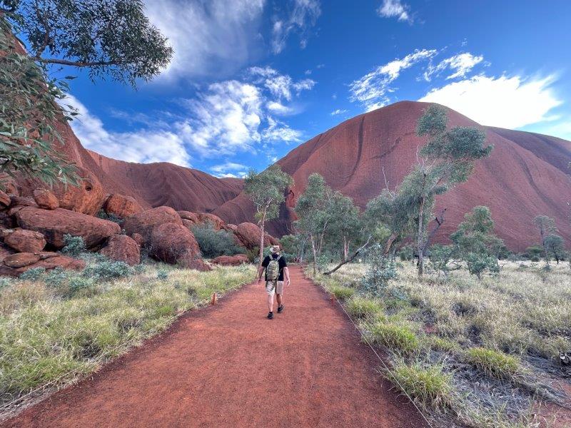
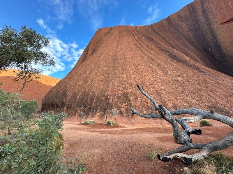
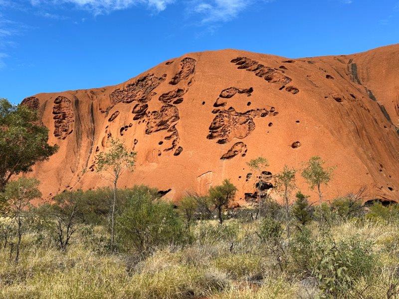
As you walk around the rock, every corner exposes different features, textures and colours.
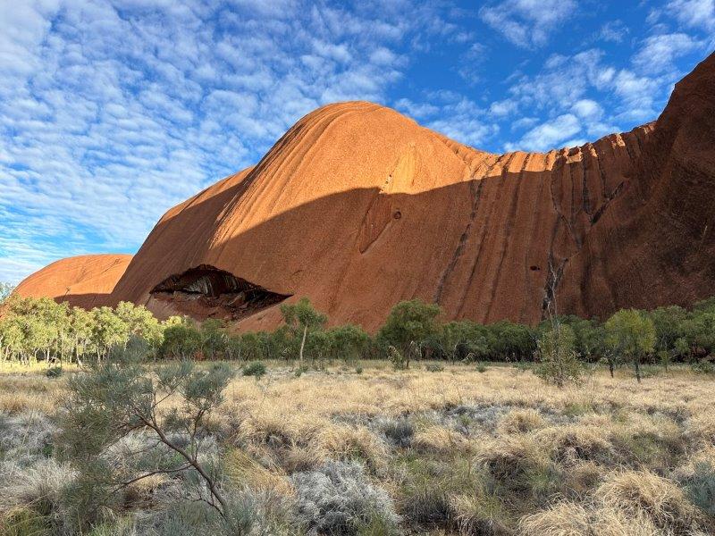
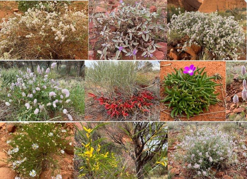
We were surprised by the sheer size of the rock and the vegetation around it.
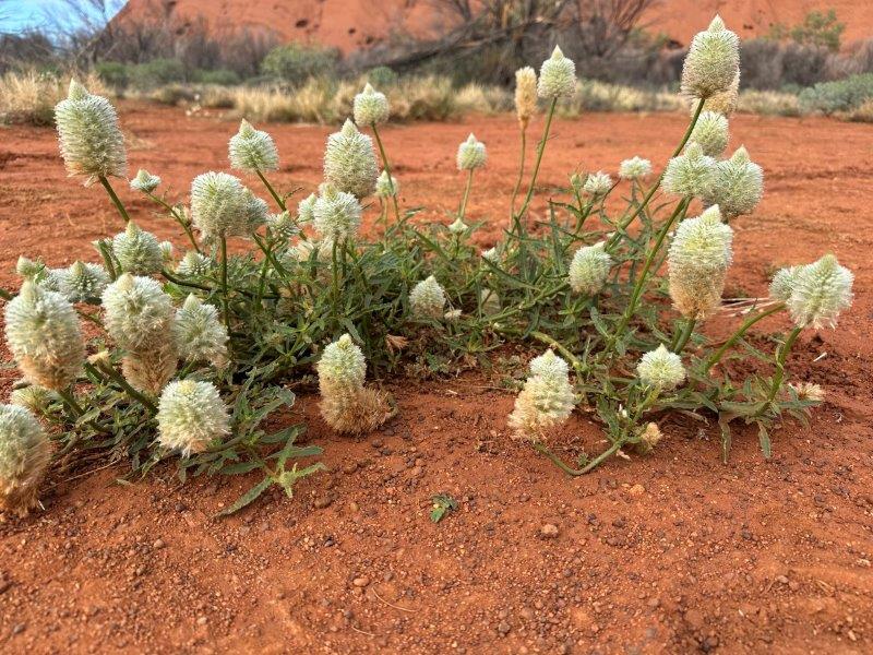
The mula-mula plants were in full bloom while we were there.
We also visited some of the culturally significant sites that provided shelter and water to ancient settlements and explorers.
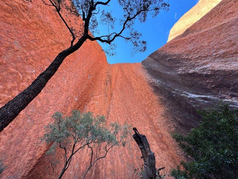
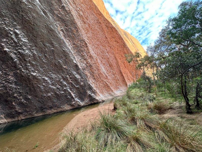
The walk guides you past a few magnificent scenes.
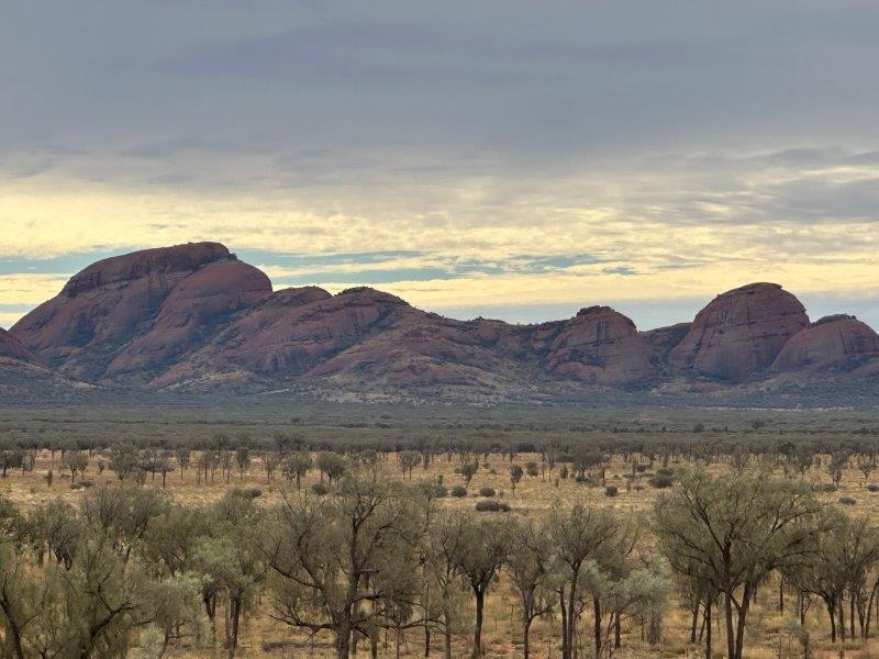
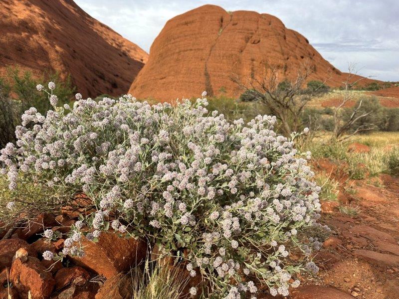
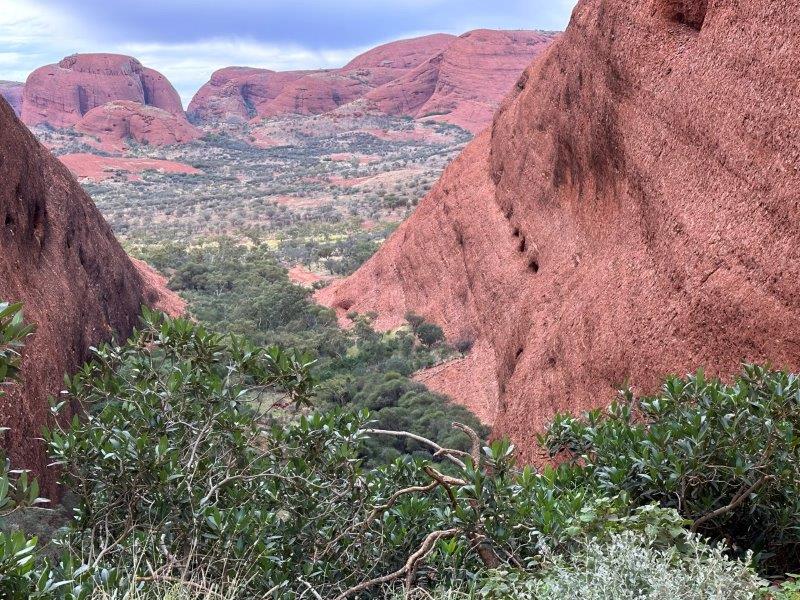
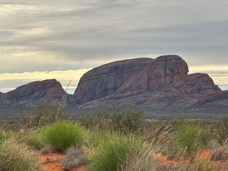
The next day we drove 30 kilometers past Uluru to visit Mount Olga. Mount Olga is also in the Uluru-Kata Tjuta National Park. We were keen to do the two main walking tracks in the Olgas.
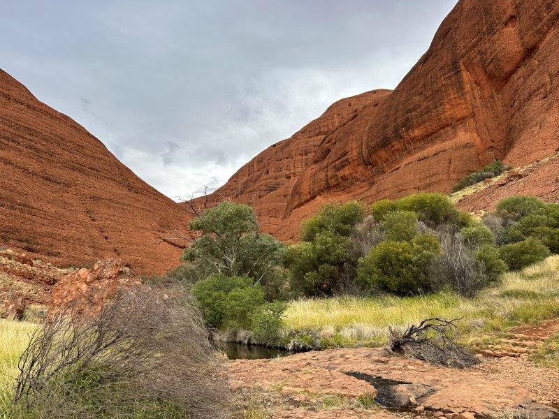
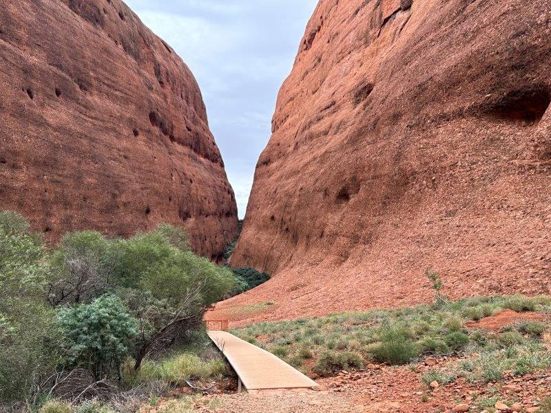
The first walking track was The Valley of the Winds Walk. This was a beautiful 7.4km loop trail.
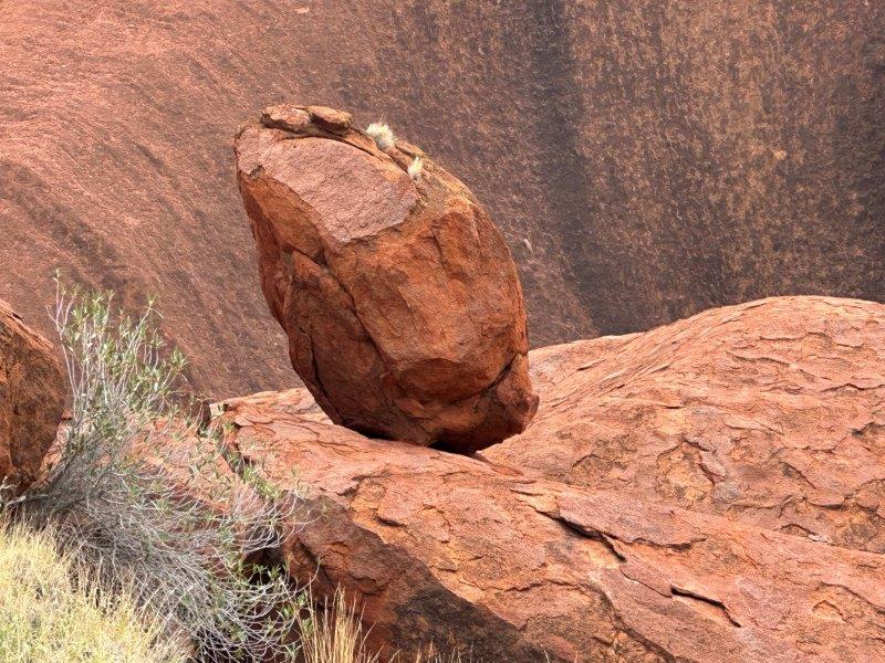
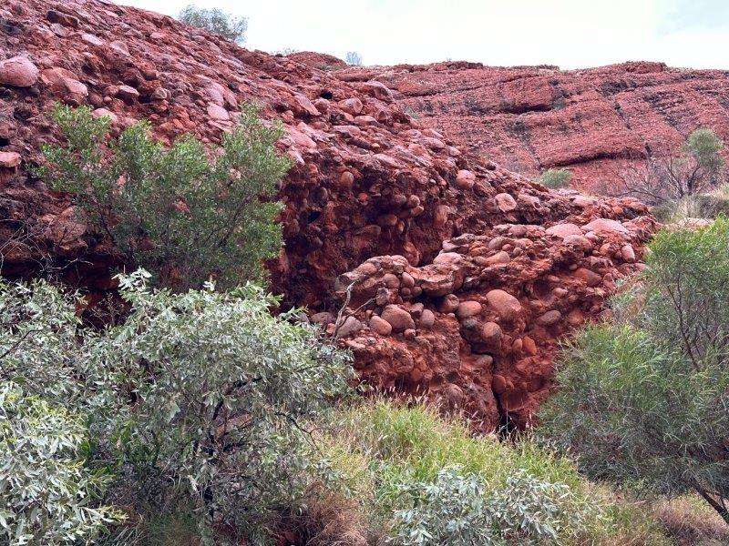
While Uluru was a single rock or monolith, the Olgas are conglomerates made up of many smaller rounded rocks.
The walking track meanders among the massive Olgas.
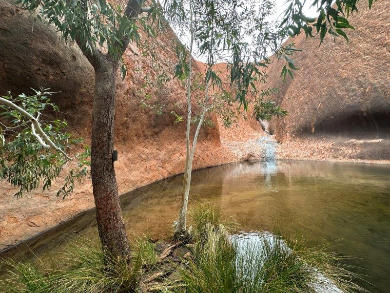
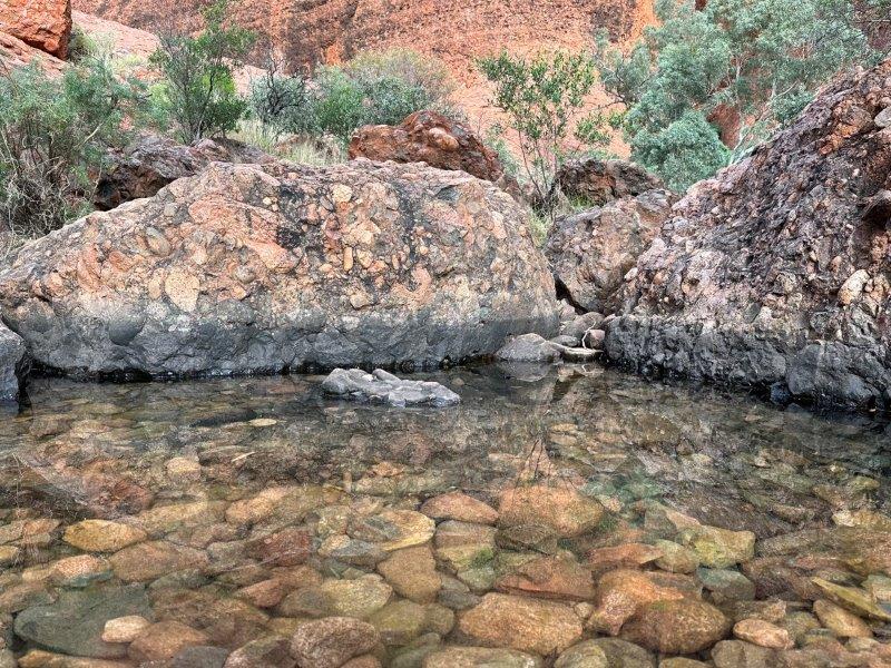
On the walk we crossed a few streams and crystal clear water ponds.
The reward at the top, was the view.
The Olgas did turn on the wildflowers while we were there.
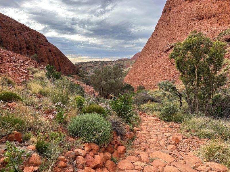
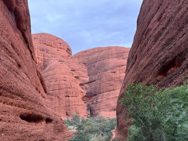
After the first walk we drove to the start of the the second walk, the Olgas Walpa Gorge walk. This 2.6km walk takes you to the end of the gorge and back.
The Olgas Walpa Gorge walk is lined with massive red rock walls on both sides of the gorge.
As we drove back to Yulara, we had a last glimpse at the magnificent Olgas.
We left Yulara and headed back east to the Stuart Highway. Once on the highway we continued our trip north and had a quick stop at Alice Springs.
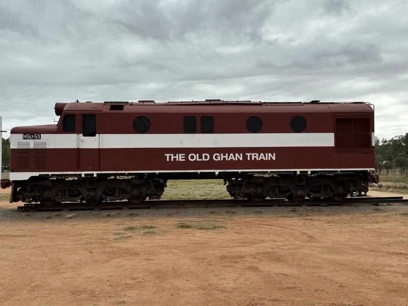
On the way into Alice we passed the old Gahn train locomotive. This railway line connected Adelaide and Darwin. This is still a very popular train journey. Today, the Gahn is a luxurious modern train with comfortable cabins, world class dining and price tag to match.
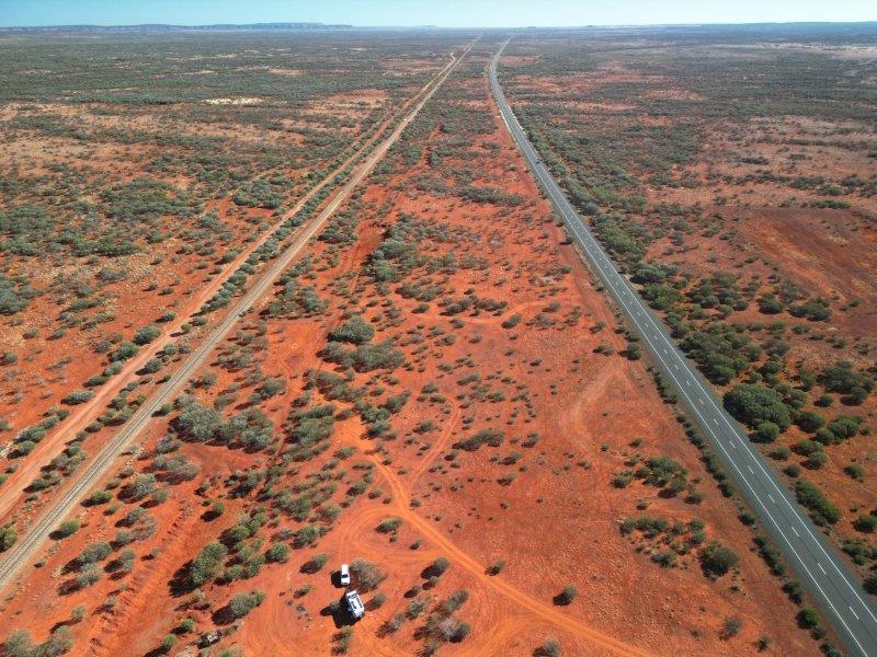
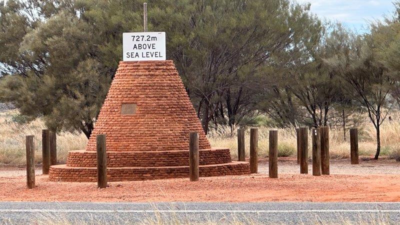
Just north of Alice, we passed the highest point of the Stuart highway between Adelaide and Darwin. The total trip is approximately 3000km with the highest point almost in the middle. Not really high, considering the distance from the coast.
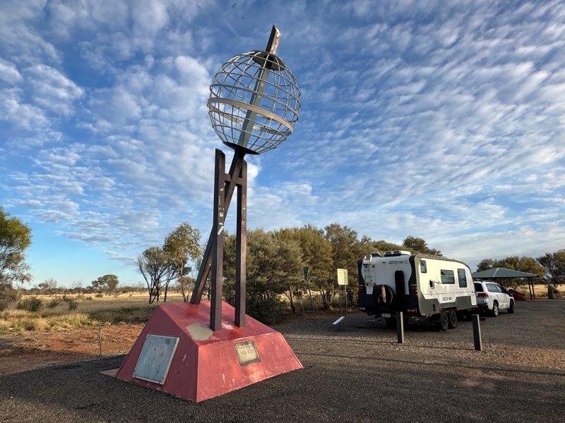
The Tropic of Capricorn was a great spot for us to stop for the night and we enjoyed another outback sunset.
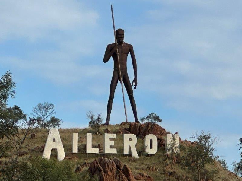
The next day we headed further north. After seeing this massive sculpture on the horizon, we had to stop. The sculpture is knows as Anmatjere Man at Aileron. This 17m structure is the creation of Mark Eagan, weighing in at 8 tones.
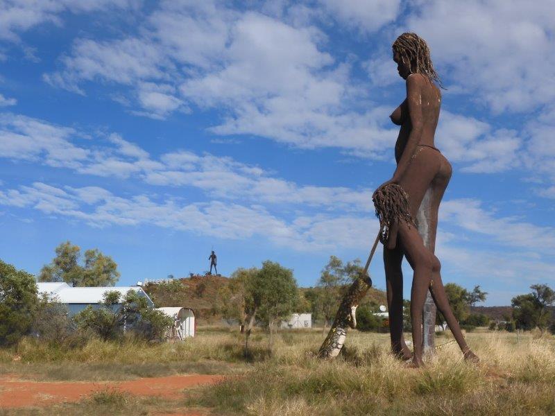
The Anmatjere Man looks down on a equally impressive sculpture, called Anmatjere woman and child.
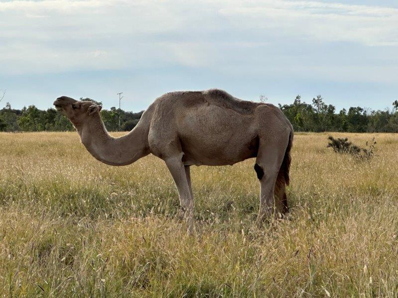
To top it off, there was a camel grazing across the road.
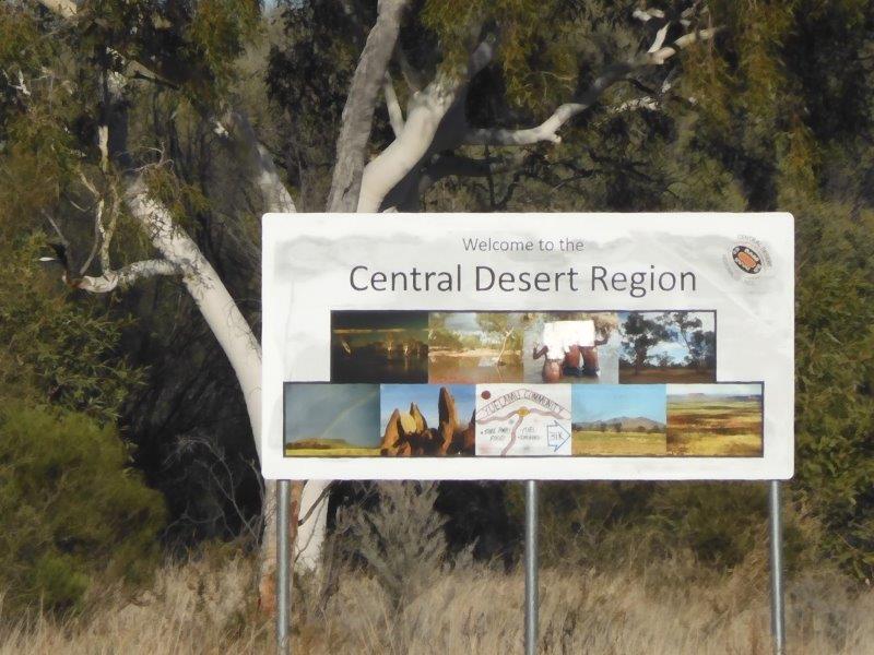
After Aileron we entered the Central Desert Region.
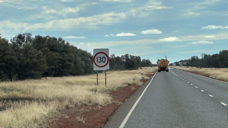
The speed limit up north is 130km per hour. With intermittent cattle crossings and large trucks on the road, we stayed well below the speed limit.
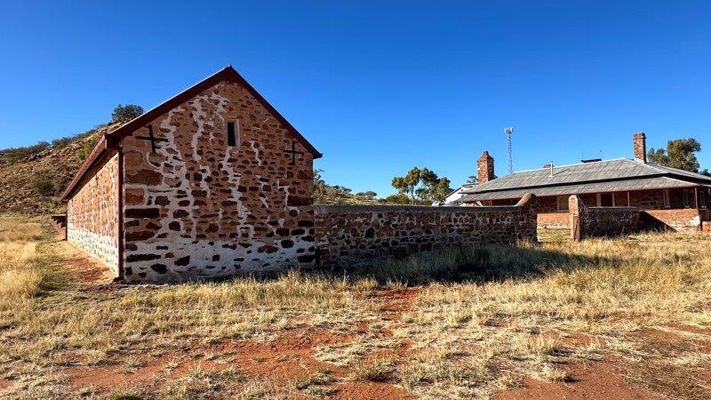
There was not really much to see on these roads. We stopped at Barrow Creek Telegraph Station. There were 12 telegraph repeater stations between Adelaide and Port Darwin. Dating back to 1871, Barrow Creek Telegraph Station is now a historical reserve.
As we were driving along the Stuart highway, we noticed new underground cables are being installed from Darwin to Adelaide. We understand that these cable are proposed to provide a high speed network capacity to key locations including Singapore, Indonesia, the Philippines and United States. This was the last place we would expect high speed low latency internet, to be installed.
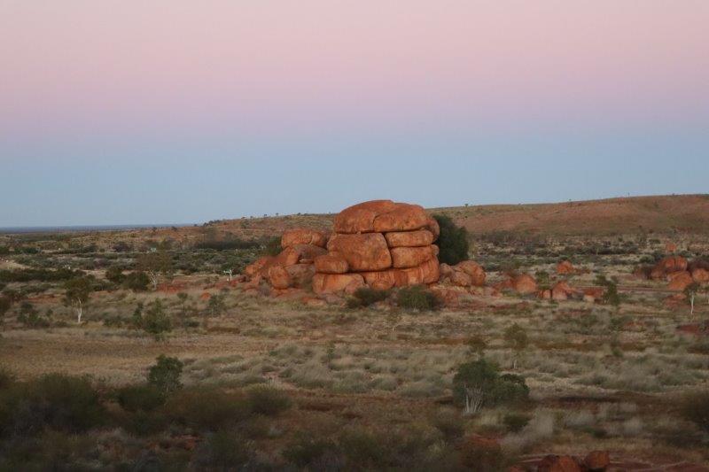
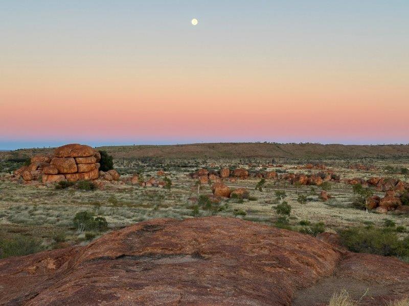
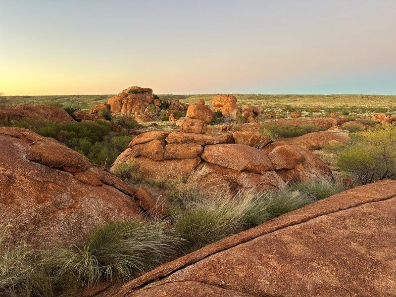
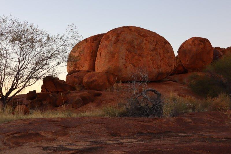
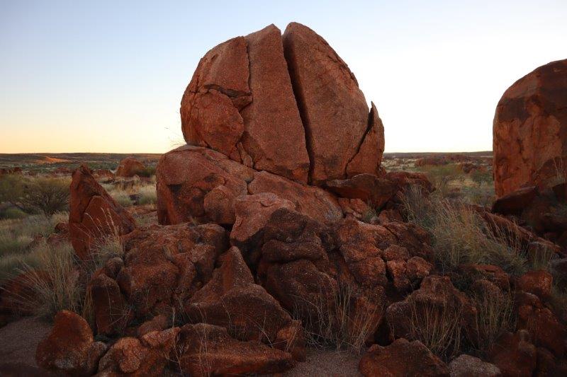
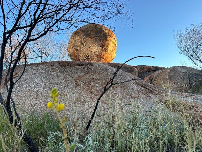
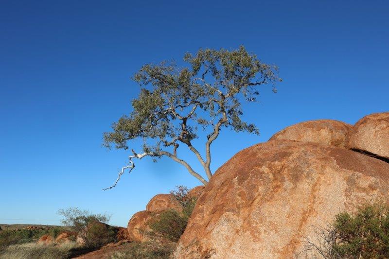
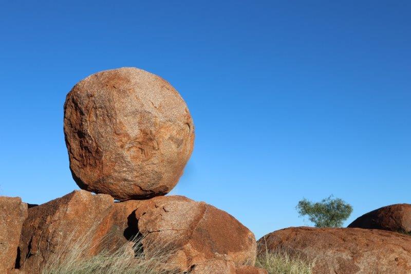
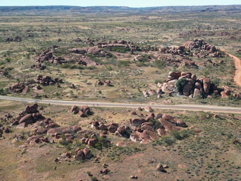
One of the last major attractions for our trip through the Northern Territory, was the Devils Marbles. We stayed at the Wauchope Rest Area for two days. This rest area was an easy drive to the Devils Marbles. Devils Marbles Conservation Reserve features random rock formations including many massive round boulders balanced on top of each other. The Devils Marbles is approximately 100km south of Tennant Creek.
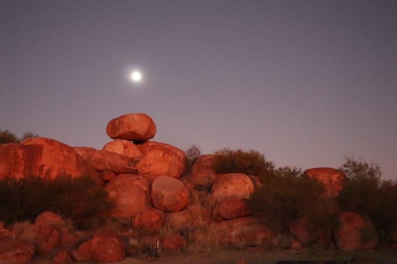
We arrived at the marbles before first light, to experience the sunrise.
Self guided walking tracks take you through the reserve. There are four tracks that we strung together in a 7.2km circuit to cover the reserve.
The views were expansive and the colours vibrant.
This was one of my favourites.
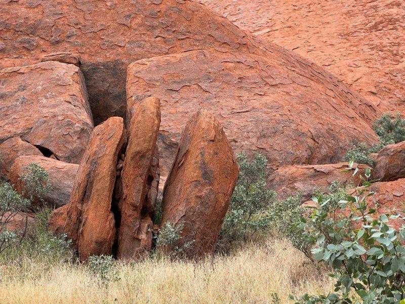
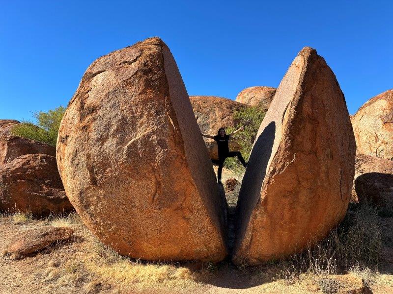
On one of the shorter tracks, we came across this massive split rock.
As we left the reserve we stopped to take a final photo of the Devils Marbles.
We drove north to Tennant Creek. At Tennant Creek we turned east towards Queensland.
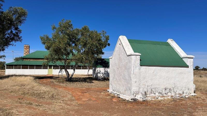
Just past Tennant Creek we visited the Tennant Creek Telegraph Station. This station once was a small settlement with an office, butcher, smokehouse, cellar and a weather station.
These Telegraph Stations supported the first colonial telegraph link with Britain and was established in 1872.
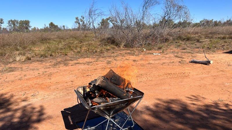
Our last thee nights in the Northern Territory was at 41 Mile Bore Rest Area on the Barkly Highway.
We enjoyed a few easy days around the campfire at 41 Mile Bore Rest Area, before crossing the border to Queensland.