In this blog we explore the Australian Capital Territory and complete the south eastern coast of New South Wales…
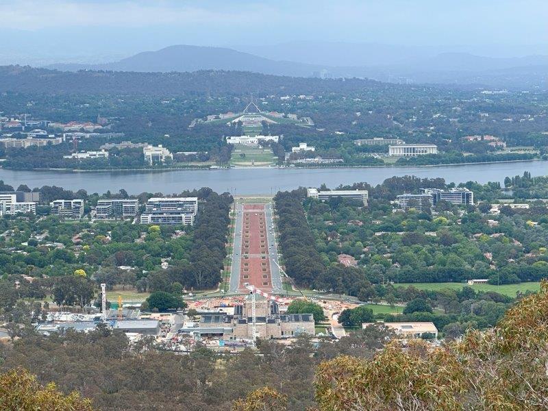
After we arrived in Canberra, we headed straight to the highest vantage point, Mount Ainsley. From Mount Ainsley we looked down on the commemorative way and ANZAC Parade linking the Australian War Memorial with the Australian Parliament House. From the onset you can see this is a modern 20th century city, where town planning preceded settlement.
After we walked the ANZAC parade, we drove to Parliament House and were lucky to get a car park right under the “new” Parliament House.
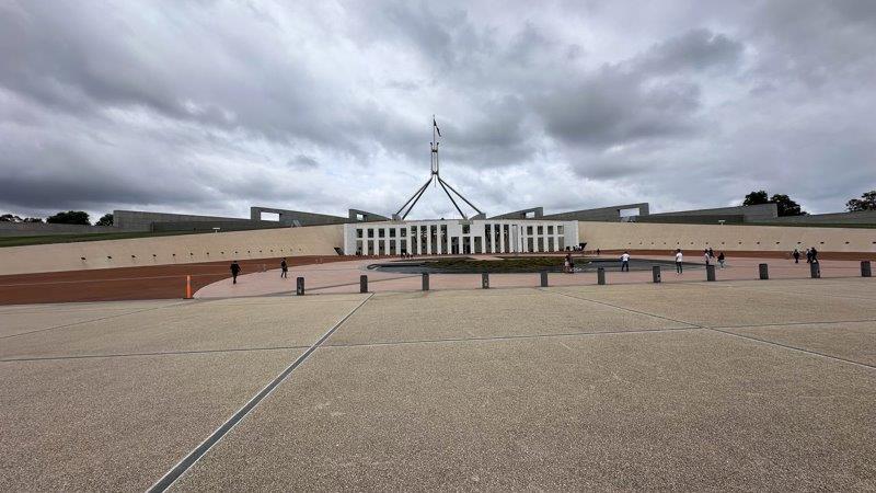
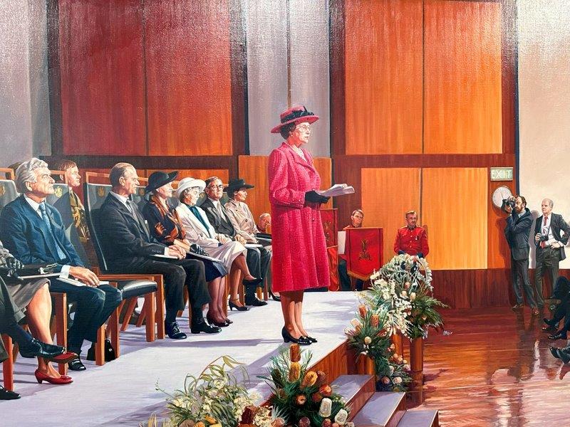
The history of this new parliamentary building is detailed in massive displays on the first floor of the building. The displays start with the opening of Parliament in 1988 by Queen Elizabeth II painted by Marcus Beilby.
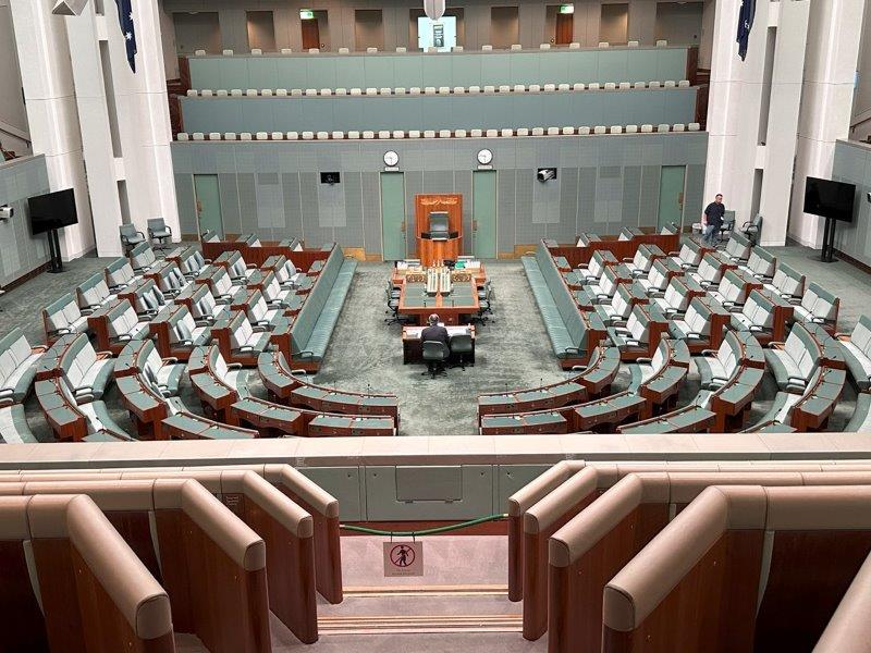
Educational displays explain how people of Australia are represented in parliament, and how the democratic system works. It also details, the legislative process and how hard politicians work to keep the machine running. The picture below is evidence to the “hard work” being done 🙂
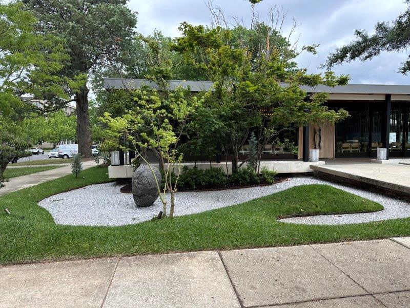
Many roads in Canberra, are lined with perfectly manicured parklands, formal and business gardens.
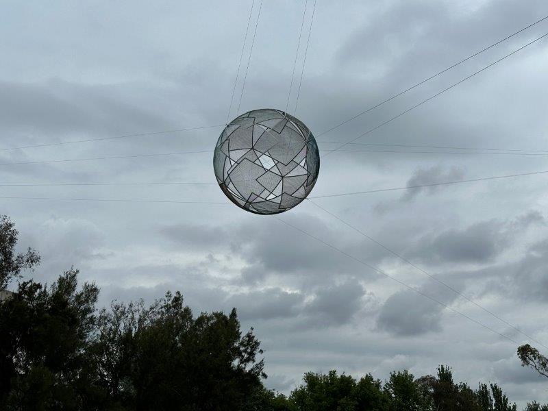
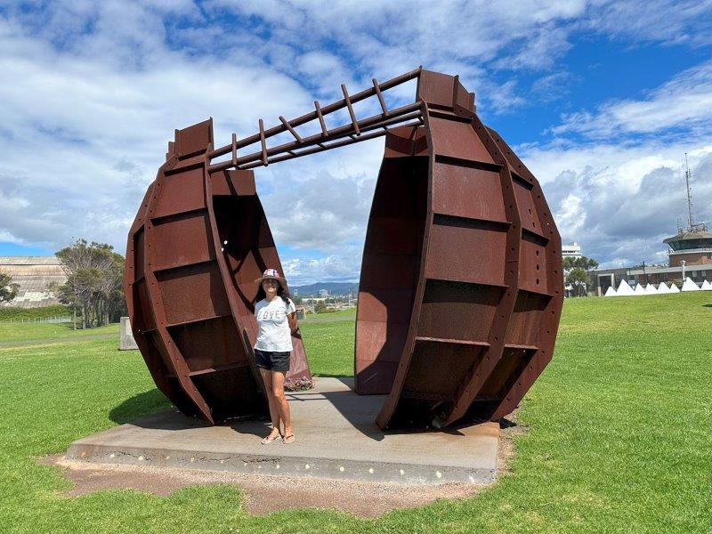
We saw this 4.5m glass ball suspended high above the road. This structure was titled “Diamonds” (2002) and created by Neil Dawson. The ball is suspended above the entrance to the National Gallery of Australia.
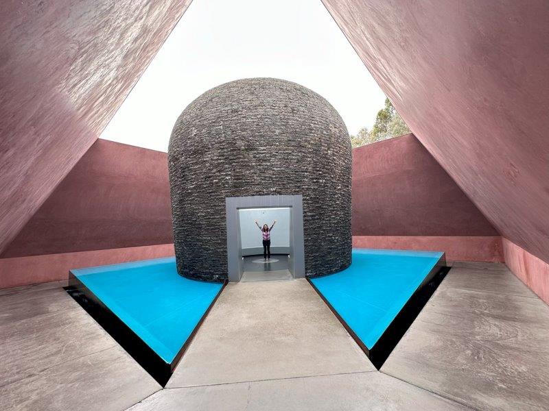
Outside the gallery, is a massive installation titled “Within Without” by James Turrell. You can walk inside the skyspace by following the footpath through the pond.
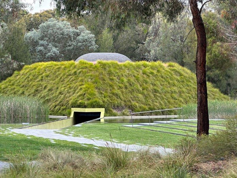
Once inside, there is another sky-blue pond with a grey cylinder shaped structure pointing to the roof’s pantheon.
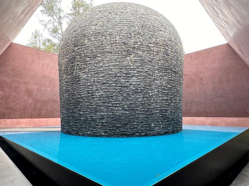
Walking around the pond takes you to an entrance into the cylinder. Just fascinating!
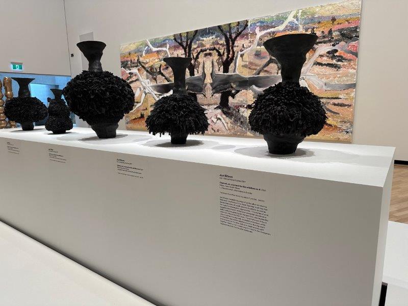
The gallery has a massive collection of early art and a few more modern pieces like the “Charred urn a lament for the wildfires” nrs 1 to 4 by Juz Kitson.
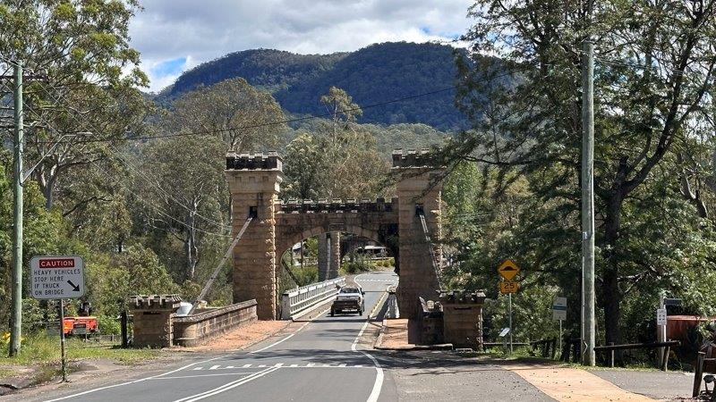
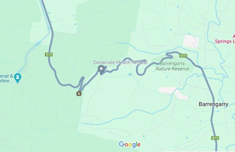
After a few days in Canberra, we headed back to the east coast. We opted for the fastest route on Google Maps via Kangaroo Road through the mountains. Spirts were high as we crossed the Heritage listed Hampden Suspension Bridge on the way to the Kangaroo Valley Road.
These high spirits, were quickly dampened by the worst mountain pass we have seen on our trip, the Kangaroo Valley pass. Once you committed, there is no turning back.
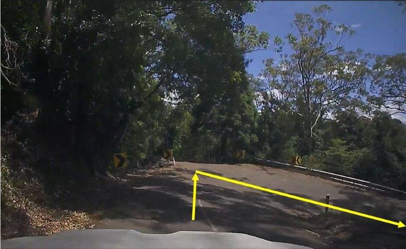
At many sections of the road it was impossible to pass oncoming traffic, resulting in vehicles reversing on the narrow road to get passage. It was almost impossible to get the 14m rig through some hairpin bends as shown in the photo below. We had to use the oncoming lane to turn the corner. While turning, we had 10cm between the car bonnet and the barrier and 4cm between the caravan and the corner post.
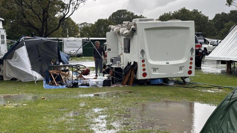
We were relieved to arrive in Berry. The next day we copped a storm with rain, wind and hail. A few of our fellow campers had severe damage, as shown below. We were lucky to escape without any damage.
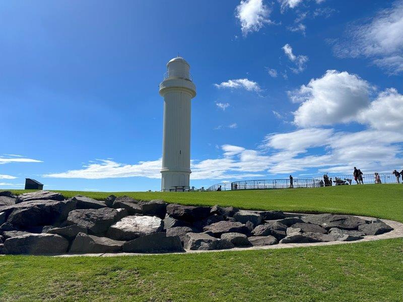
With the sun out, we headed north from Berry to Wollongong’s Flagstaff Point Lighthouse.
Just south of Wollongong is the suburb Port Kembla. Port Kembla is mostly known for coal export. A heritage park was established at the port showcasing different eras in its history. The Port Kembla
Breakwater Battery Military Museum is located at the heritage park adjacent to the white concrete tank barriers.
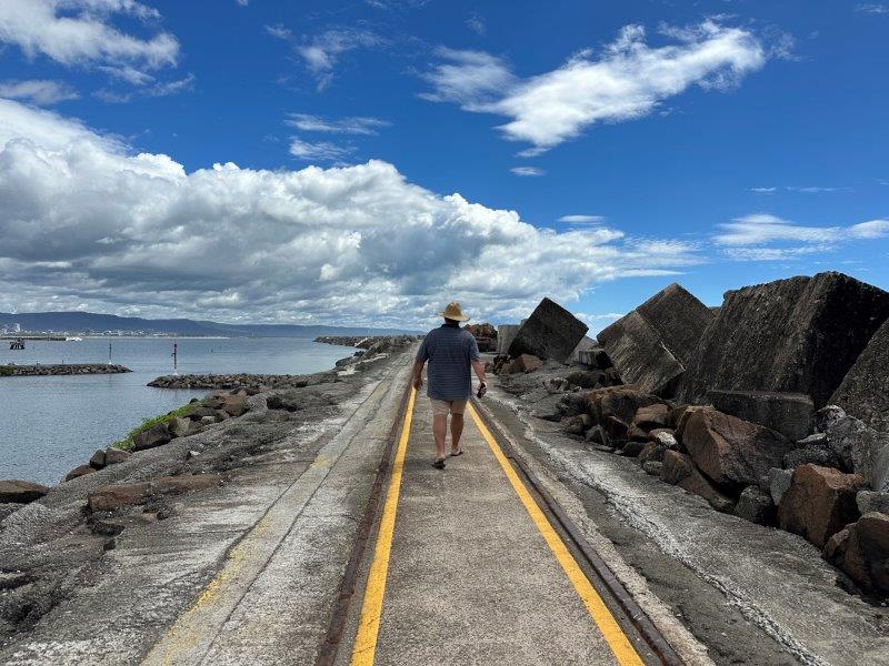
There is also al lot of maritime history close to the Eastern Breakwater. While we were there, the breakwater was open and we could walk 1060 meter to the end of the wharf.
Amongst the maritime exhibitions was a memorial for the dockers (wharfies), commemorating their 1938 strike. The dockers refused to load metal destined for Japan to manufacture weapons against China.
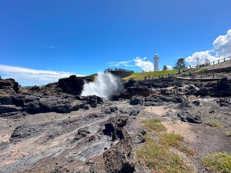
Further south was the town of Kiama. Kiama has attracted visitors to its blowholes, for the past 100 years. The main blowhole is 2.5m at the base and can blow up to 30m high. While we were there, the spout was 15m high, at best.
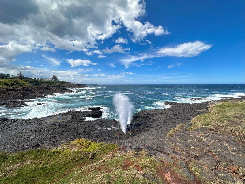
Not too far from the main blowhole is the “Little Blowhole”. This blowhole is much smaller, but packs a punch.
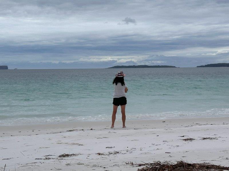
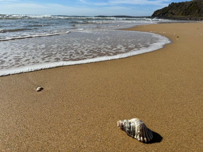
We spent a day exploring Jarvis Bay. On the way to Jarvis Bay we stopped at Hyams Beach. It is easy to see why this beach was number 10 on the “Enjoy Travel’s annual 50 Best Beaches in the World” list.
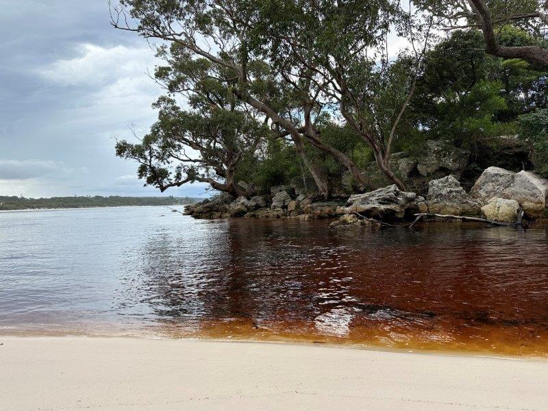
Next stop was the Jervis Bay Green Patch Beach. The inlet had sherry colored water running into the turquoise bay. Tannin from the tree roots and leaves in the surrounding hills stain the runoff water passing through the inlet.
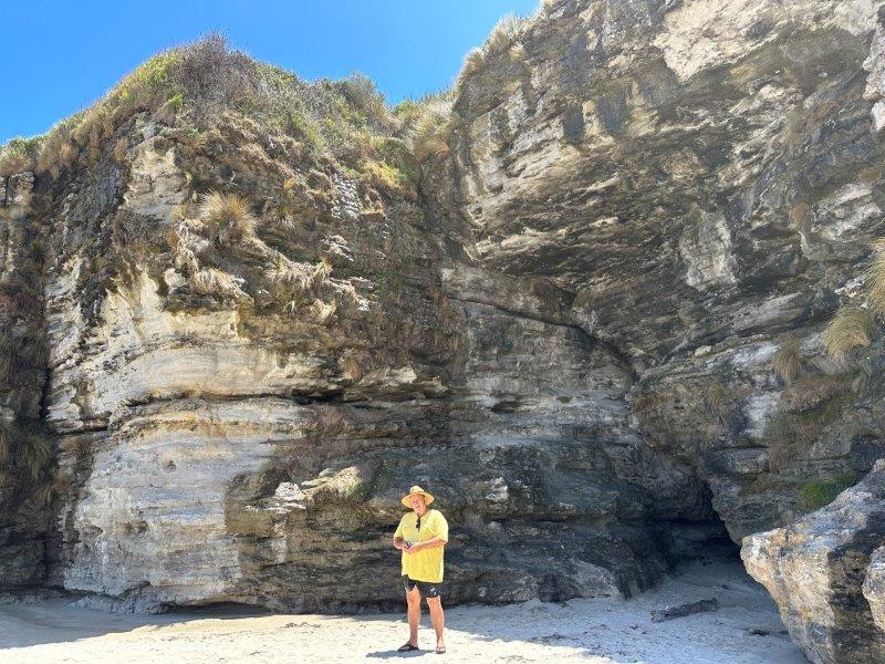
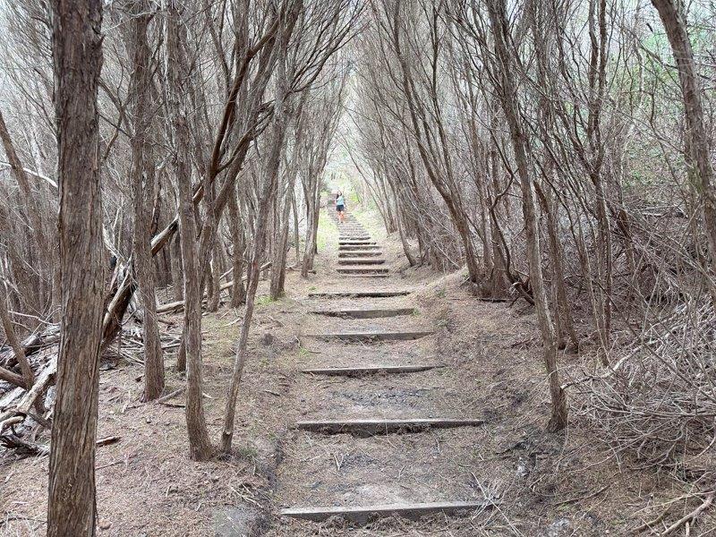
Cave Beach Walk in Booderee National Park in Jervis Bay was a great walk ending at two caves on the beach.
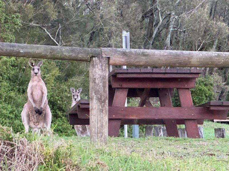
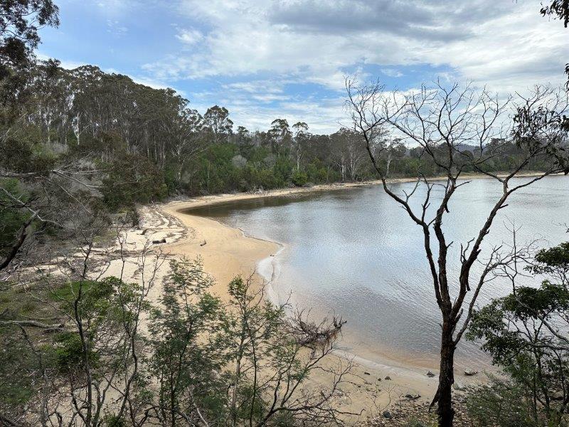
Our next stay was at Congo Campground near Moruya. This small campground is in the Eurobodalla National Park. This was a top spot, with a lagoon on the one side and a quiet beach on the other. There were lots of wildlife in the campsite.
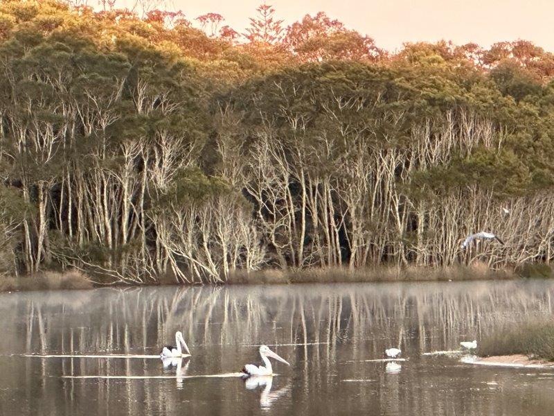
The lagoon had an abundance of birds and fish.
From the campsite, you can follow the lagoon around the sandstone bolder onto pristine beaches.
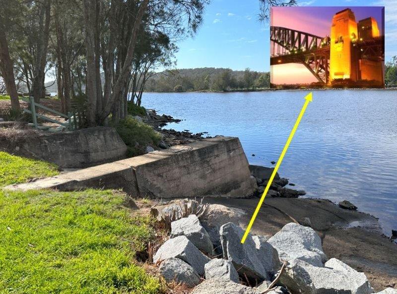
Not far from the Congo campsite, is the little settlement of Moruya. It is hard to believe that the granite found here, was used to built the 89m high pylons and piers of the Sydney Harbour Bridge. In the 1920s, 250 employees from 13 nationalities removed 173 000 granite blocks to face the two piers of the bridge. These blocks were moved from Moruya to Sydney by sea.
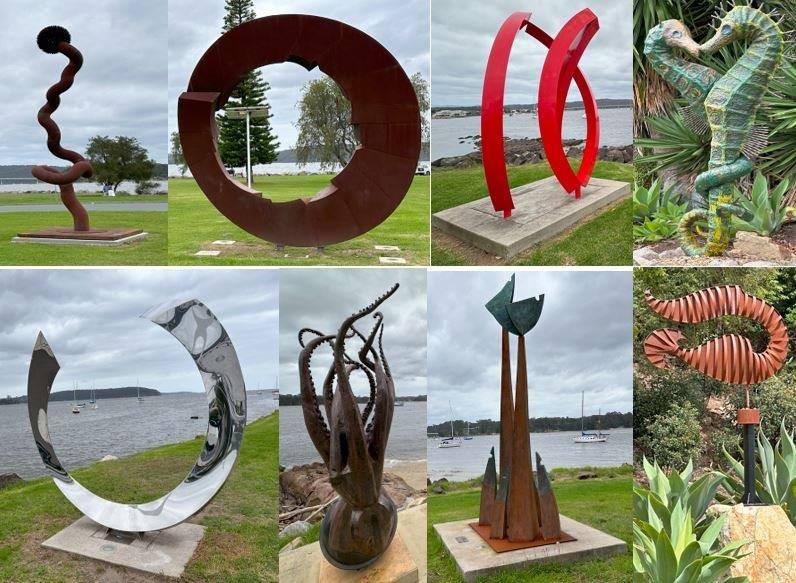
While camping up at the Congo, we did a day trip north to Murramarang National Park, through Batemans Bay. The main road through Batemans Bay is lined with interesting sculptures.
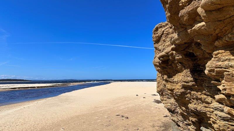
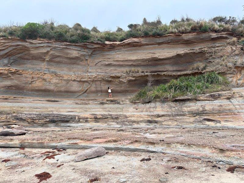
Murramarang National Park has many coves, beaches and rock formations. These points of interest are linked with a gravel roads and also required a fair bit of hiking. Some bays are lined by high cliff faces.
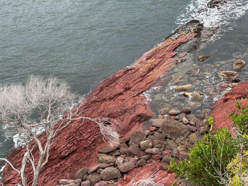
There were caves, crevasses and a rugged coastlines to explore at Wasp Head Rock.
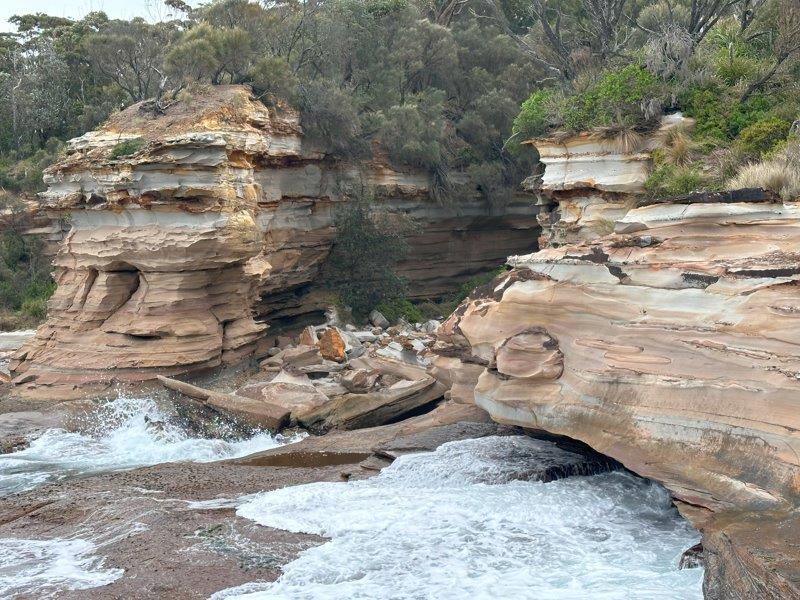
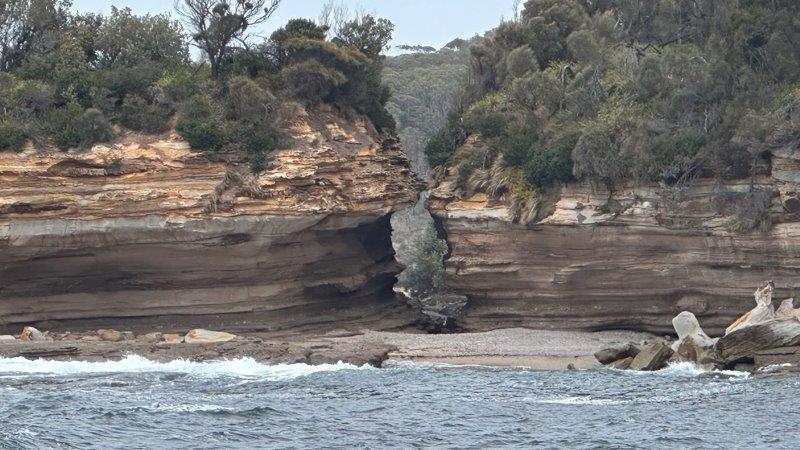
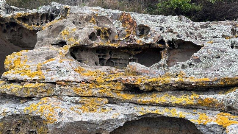
The rocks were lined with detailed formations.
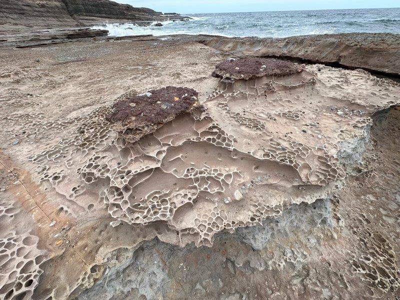
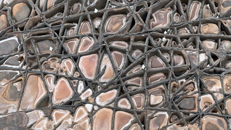
These rocks look like a box of chocolates!
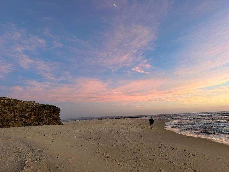
On the way back we stopped at Middle Beach in Merimbula. It was a steep decline from the road to the surf break.
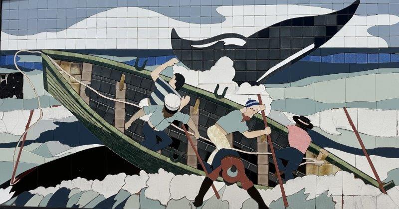
Eden was the most southern town in New South Wales, we visited. Eden is synonymous with whale hunting. Locals are quick to explain the whaling history and the role of “Old Tom” in Twofold Bay.
Eden was one of the first land based whaling stations on the Australian mainland. Old Tom was the leader of a pod killer whales that herded Humpback Whales into the bay and alarmed the whalers on shore. Five whalers would then jump into their wooden boat and row towards the Humpback whales, herded by the killer whales. The Humpback would then be hunted with a hand thrown harpoon. The Humpback whales’ carcasses would be left in the bay overnight to give the killer whales and opportunity to feast on the tongue and lips, before the remainder was used by the whalers.
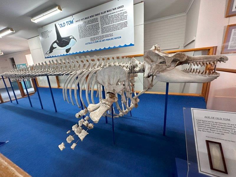
The skeleton of Old Tom is preserved in the Eden Killer Whale Museum. Old Tom was almost 7m long and weighed approximately 6 tones. Each killer whale had different spots and markings and were named by the whalers. Old Tom was easy to recognise as he had a much larger dorsal fin, measuring 173cm. Although Old Tom was the most famous killer whale in the bay, local kids knew the names of all killer whales working with the whalers and were able to distinguish them.
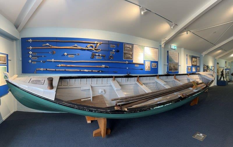
Looking at the primitive equipment used in the hunt, you realise that this was the time that boats were made wood and men were made of steel. There are many stories on men being protected by the killer whales when thrown overboard during a hunt.
There is a trail of whale related sites to explore outside of Eden. Davidson Whaling Station Historic site at Kiah Inlet near Beowa National Park was our next stop. The old Davidson family cottage has been preserved.
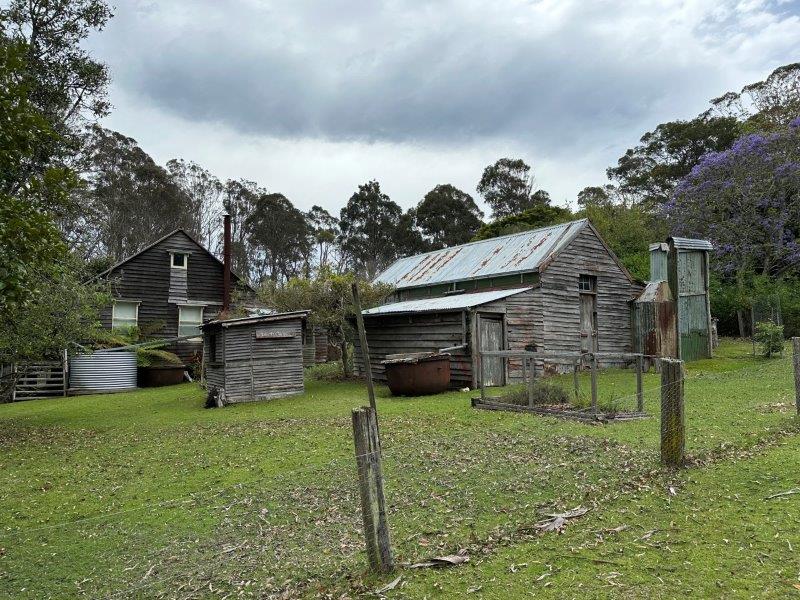
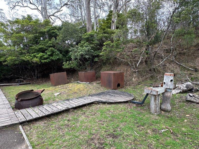
The actual whale processing station was covered with a shed. This shed was last used in 1920 and is long gone. Some pots to cook the blubber and holding tanks are still on display. You can still see the whale “wincher” to pull portions of the whale to the station. We were surprised to learn that only two to fifteen whales were processed in a season.
Looking at the bay today, it is hard to imagine its dark history.
Benjamin Boyd was a successful stock broker and entrepreneur with interests in cattle, wool, whaling and shipping. He grew his property portfolio rapidly with loans and grants. As he expanded his business interests, he envisaged and built Boydstown with it’s own hotel and a harbour.
He also commissioned the building of the Boyd’s tower to have visibility of the harbour with the ability to alert whalers of their passing prey.
Boyd ran into financial strife and left to the Californian goldfields.
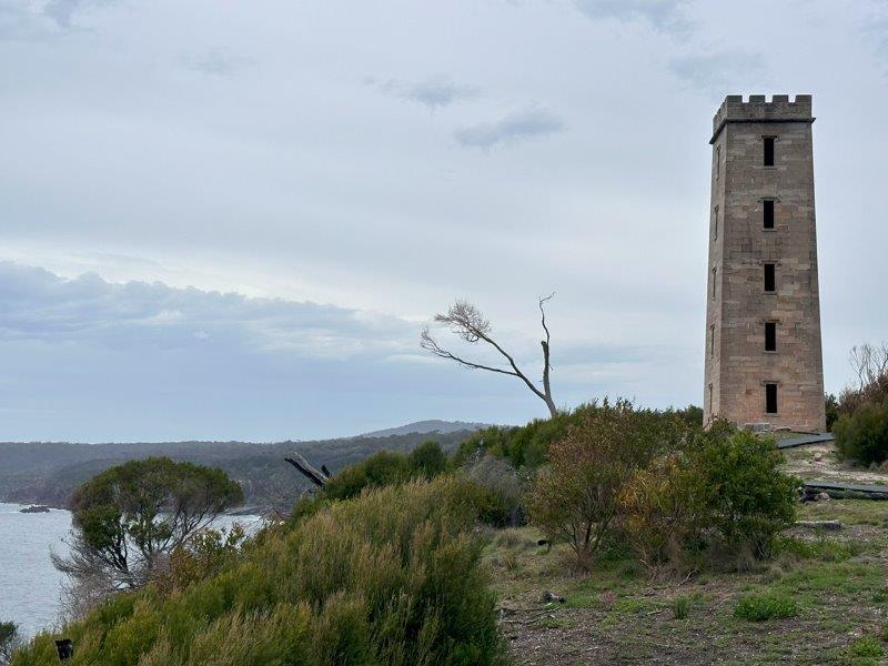
This impressive structure has great views all round.
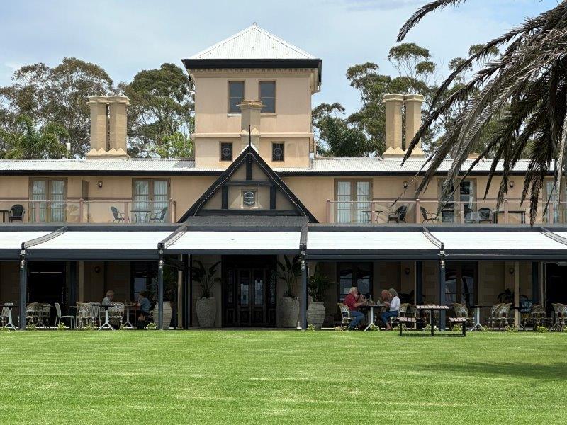
The ruins of Boydtown are still around. The Inn was built in 1840, and is the only building still in use. The name has been changed to the Seahorse Inn.
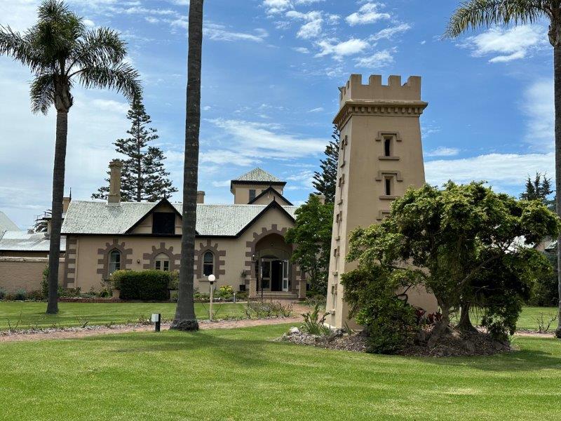
The Seahorse Inn offers accommodation, a restaurant and a gift shop. The Inn is still being used as a venue for events.
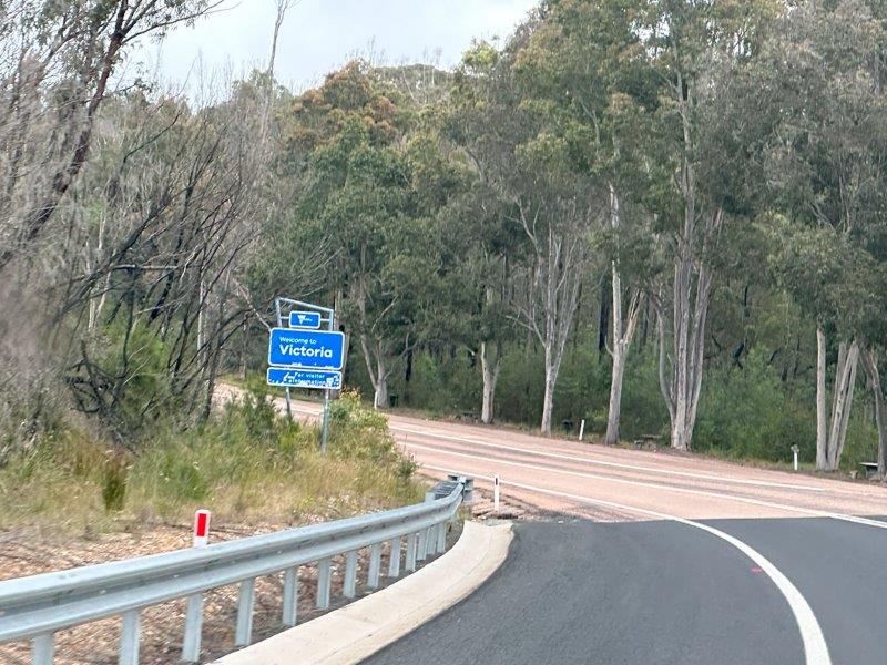
This was the end of our New South Wales trip as we entered our fourth state, Victoria.