
We continued further inland on the Wheatbelt Way to Wave Rock in the direction of Kalgoorlie in the Goldfields.
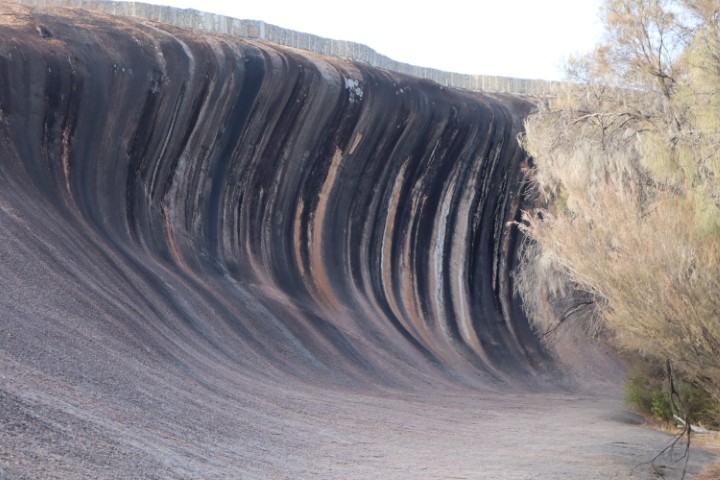
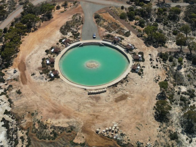
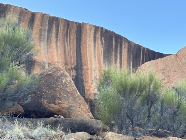
Wave Rock is a popular tourist attraction in the town of Hyden. It is primarily known for the rock forming a natural wave and Hippo’s Yawn.
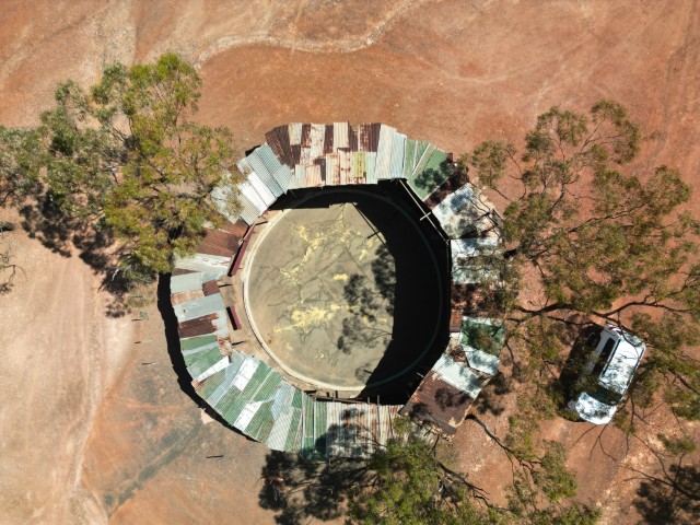
A concrete wall was built on top of the rock in 1920 to collect rainwater in a reservoir. This reservoir became a water supply for the town and farmers in this arid landscape.
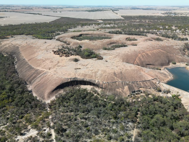
The rock is 15m high with an unmistakable wave shape.
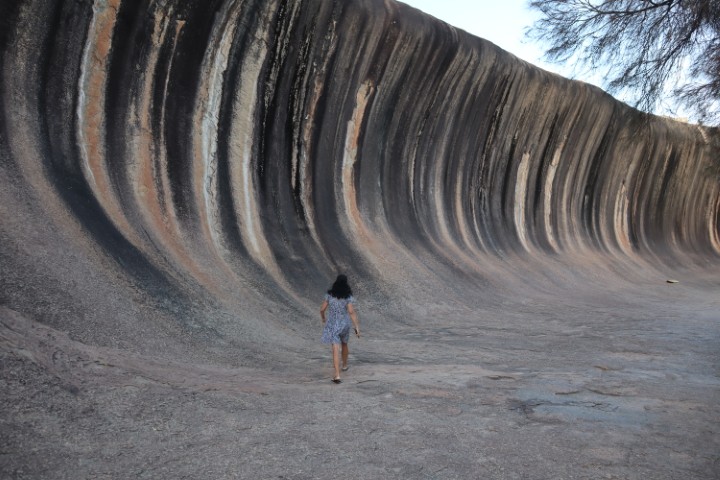
You can also access the top of the rock to explore the odd shaped boulders and enjoy great views over the surrounding landscape.
Not far from Wave Rock is another rock formation, fittingly dubbed Hippo’s Yawn.
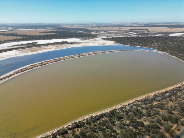
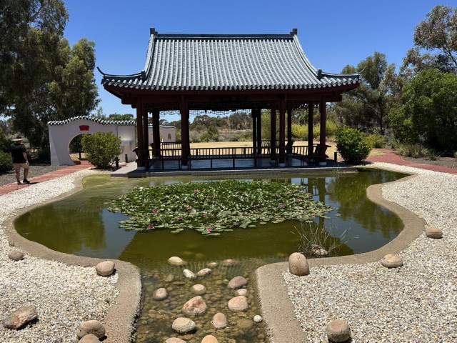
Lake Magic and its adjacent swimming pool is another point of interest in Hyden. The pool is 20m across and 6m deep. This mineral pool has a higher salt content than the Dead Sea and is known for effortless floating.
As we were leaving Hyden, we passed lake Gounter on our way to Mulka’s Cave.
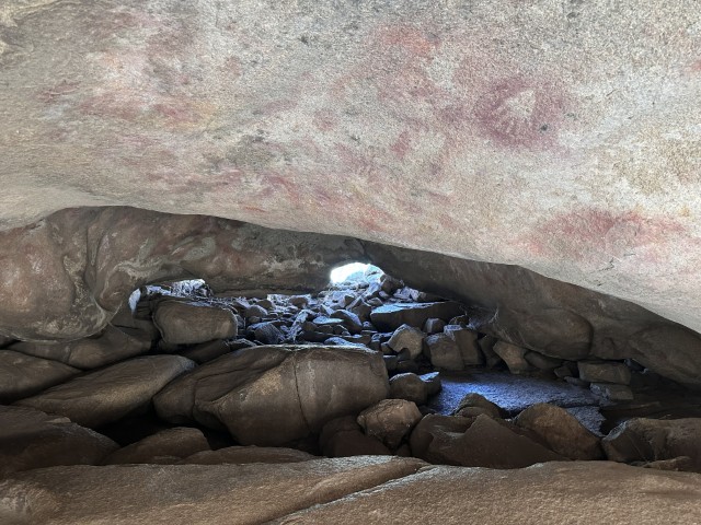
Mulka’s Cave is best known for its aboriginal art on the walls and ceiling.
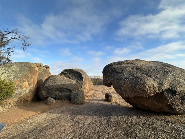
We walked the 1.8km Kalari Trail to the top of The Humps Rock. Kalari is an indigenous word for lizard. We saw almost ten small (about 15cm) dragon lizards on the rock. They are lightning fast and run on two rather than four legs, when they speed up.
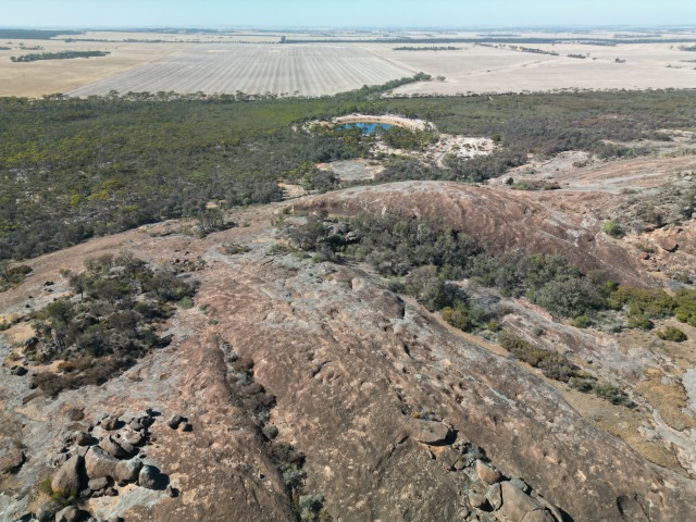
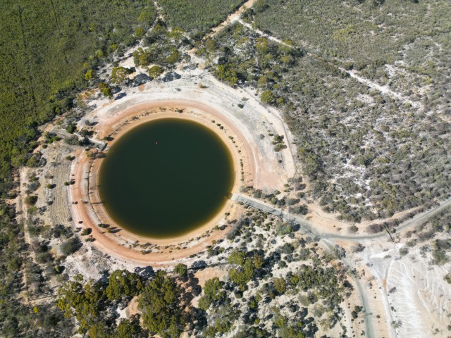
Like most rocks in this area, the rock is also used as a water catchment with a reservoir at the back.
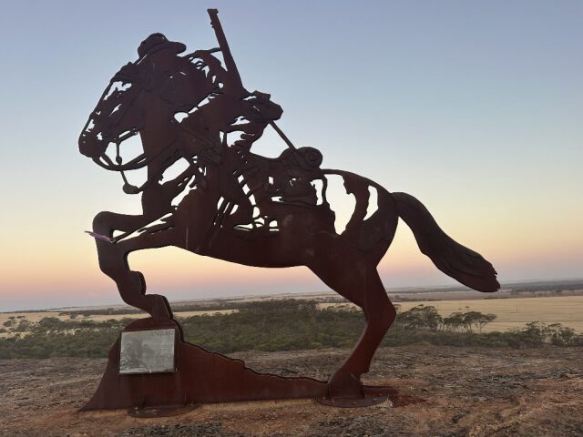
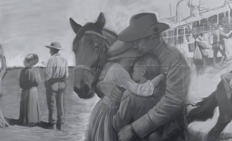
We went back to the small town of Kondinin. We enjoyed the sunset on Yeerakine Rock. You can drive to the top of the rock where the town’s water reservoir was built. An ANZAC Light Horse statue was placed on top of the rock in 2015.
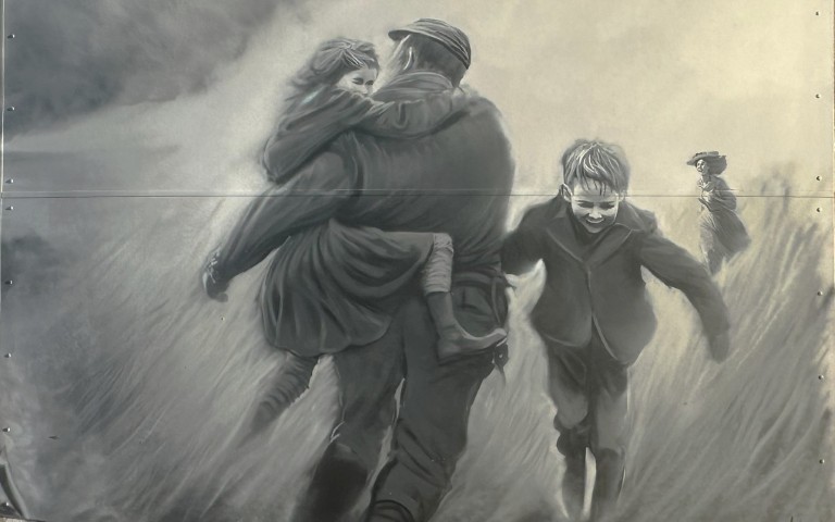
The water tank has a mural by Jacob Butler telling the story of a local leaving the farm to join the army in 1914 to fight in WWI. The mural has five scenes starting with the soldier leaving home.
The middle three murals detail life at war while the last mural pictures the returning farmer, welcomed back by his family.
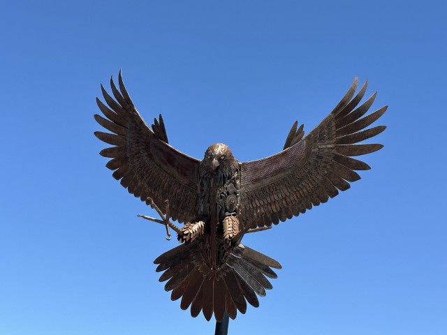
We continued through the wheatbelt stopping at Narembeen. The caravan park is walking distance from the town centre. The Narembeen Hawk Sculpture marks the recreational area.
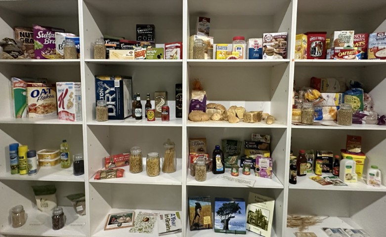
Inside the Narembeen Grain Discovery Centre is an informative display of the local wheat industry and its impact on our pantries.
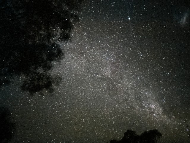
Next to the caravan park is a planisphere with instructions for astrophotography. The site has little light interference and almost no air pollution, making it ideal for night photography. You probably need a lower aperture and longer exposure than what we could achieve on our phones.
After Narembeen, we spent a few days at Westonia. The town has a mining history.
For a small town, Westonia has a lot to offer.
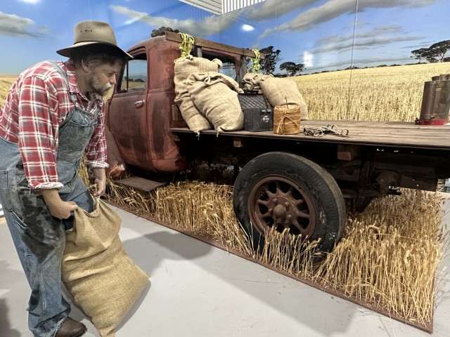
From the information centre we could access the Hood-Penn Museum. The museum features a collection of the Hood-Penn family. The family owned the general store in Burracoppin. The exhibitions and wax mannequins portray early life in Westonia with pub, bank, blacksmith and farming scenes.
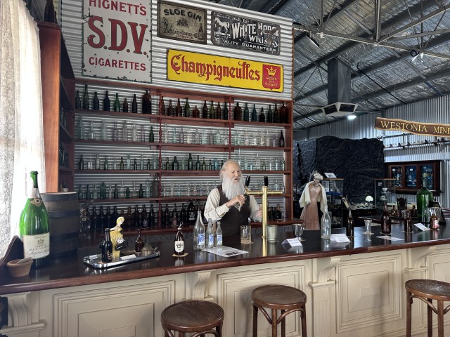
At the exit of the museum was an interactive experience simulating an explosion in an underground mine. The pitch black inside, extreme sound effects and vibrations were very impressive.
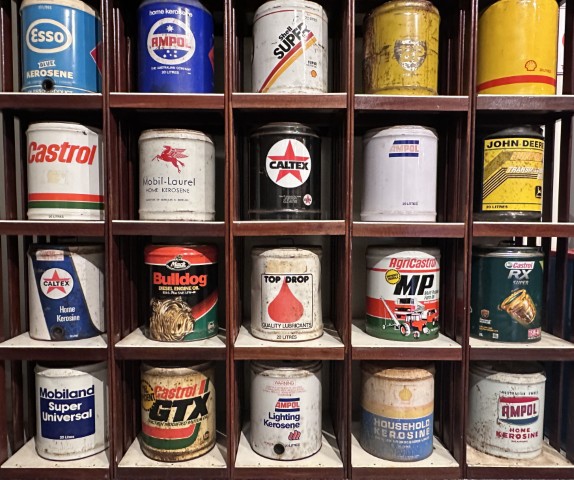
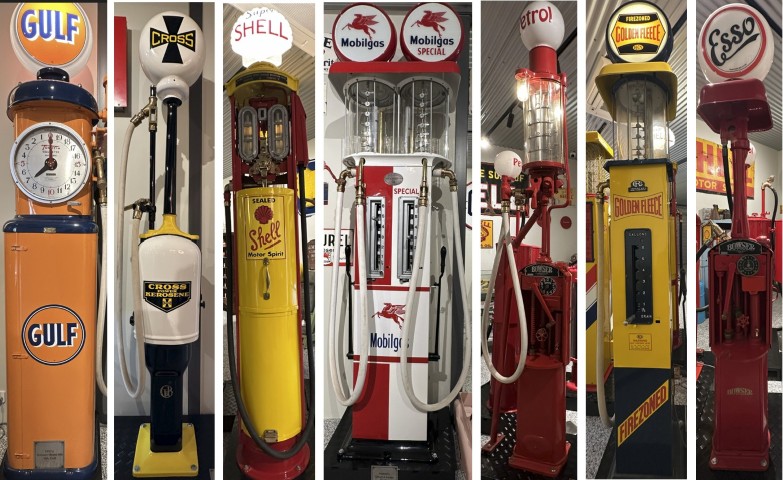
In addition to the Hood-Penn Museum, the Cooper’s Garage Museum is also on site. This museum displays a collection of early motoring memorabilia collected by Murray Cooper. Murray was a fuel truck driver for 40 years. He collected old vintage fuel pumps and motoring memorabilia. At its core, the museum is primarily about motor oil and fuel, but it has so much more. There were a few displays with oil containers from the last ten decades.
The museum has approximately 200 meticulously restored antique fuel bowsers.
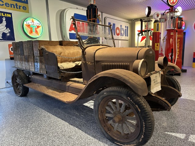
There are also motorbikes and vehicles on display.
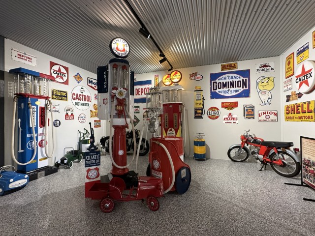
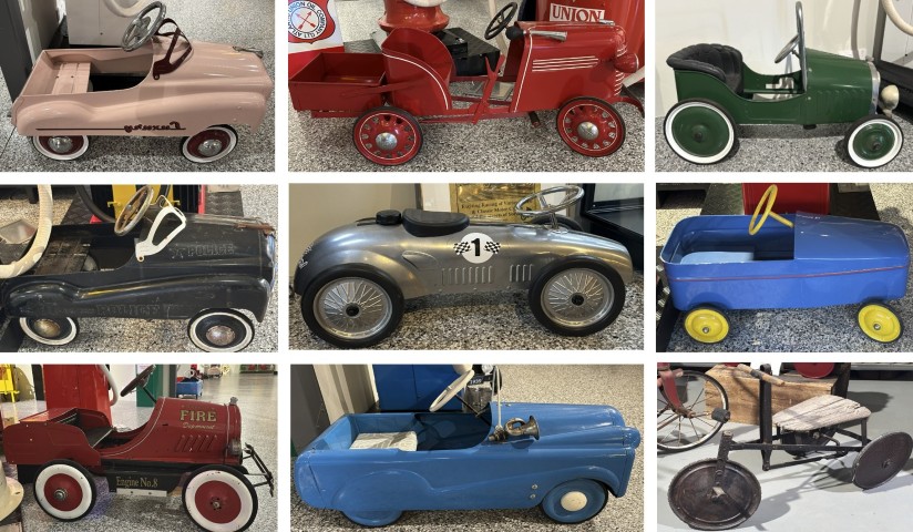
The museum features a large collection of restored pedal cars.
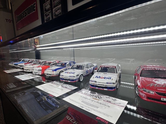
There is also a collection of scale die-cast racing cars on display.
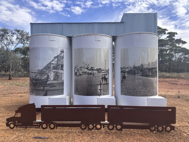
We have seen lots of silo art on our travels, but Westonia was our first introduction to mini silo art.
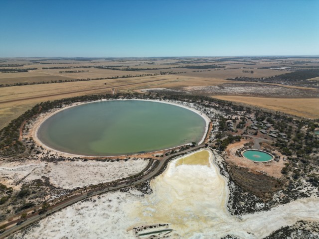
Our last stop on the way to Kalgoorlie was Karalee rocks and dam, close to Ghooli. This 1860 reservoir has a capacity of 50 million litres and is fed from Karalee rock via an aqueduct. It was a convenient overnight stay close to the Great Eastern Highway.
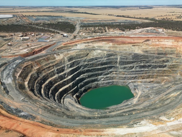
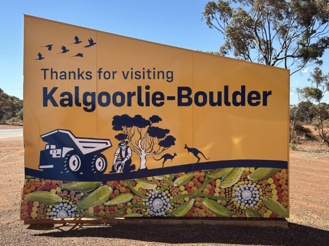
The mining towns of Kalgoorlie and Bolder amalgamated almost 40 years ago forming the city of Kalgoorlie-Bolder. The city is home to Australia’s largest open pit gold mine and has produced 600 million ounces of gold at the time of our visit.
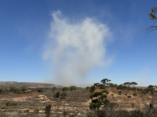
This open mining pit is known as the Super Pit. The Super Pit is a popular visitors attraction. While we were in Kalgoorlie the viewing platform was closed due to blasts directly below the platform.
Blasts in the Super Pit are generally scheduled for 1pm or 5pm daily. Some of the roads are closed off during blasting, prior to the explosion. You can hear the explosions across town and depending on where you are, you may even feel the vibrations.
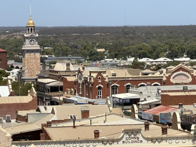
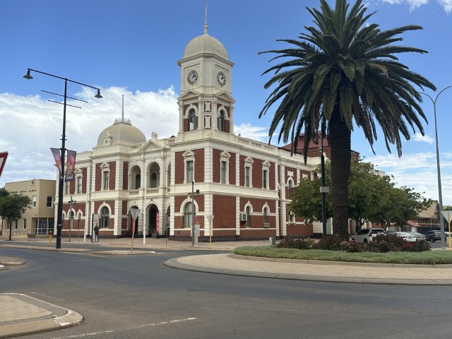
The city has two central business districts where the old affluence is obvious, based on the architecture. The gold cladded bell tower of Kalgoorlie still stands proud above the Victorian and Edwardian buildings.
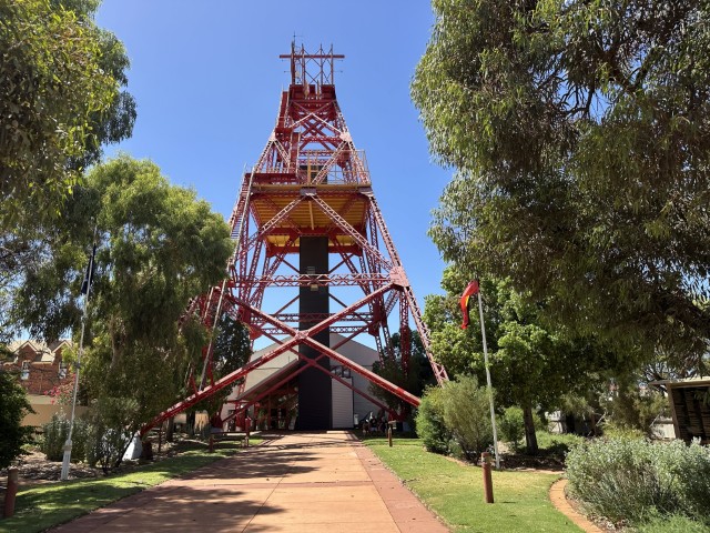
The Museum of the Goldfields was one of our first stops. The entrance to the museum takes you through the Red Ivanhoe Headframe. This was a fantastic experience with very knowledgeable staff, interesting guided tours and videos detailing the initial challenges and solutions. With water being one of the main challenges to grow mining, a pipeline known as the Goldfields Water Supply Scheme, saw the installation of a 566km pipeline from Perth to Kalgoorlie, completed in 1903.
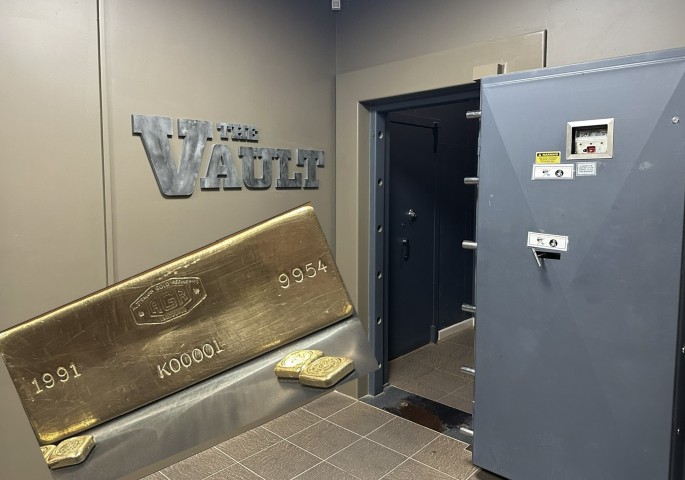
Inside the museum is a vault where many gold artefacts are protected, including the first stamped gold bar poured in Kalgoorlie in 1991.
During the early days, Kalgoorlie had 25 brothels, 93 hotels and 8 breweries. A few of these old pubs are still around where cold beers are served by revealingly dressed barmaids, called skimpies.
We also learned about Herbert Hoover, a 22 year old American engineer that played an important role in the early gold mining industry. After Hoover’s stint in Australia and later China, he became the President of America in 1929.
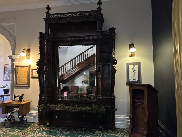
According to legend Hoover fell in love with a local barmaid at the Palace Hotel and after his departure gifted a mirror to the Palace Hotel with a poem he wrote of his beloved barmaid. The mirror is still in the foyer of the hotel with the framed poem, apparently written by Hoover.
The poem includes detailed descriptions of the love affair and meetings in local parks. In the poem he reflects on his life priorities by stating:
“I have fought my fight and triumphed, on the map I’ve writ my name, but I prize one hour of loving more than fifty years of fame.”
Even though this love story was reinforced by legend and a massive mural of the barmaid next to the Palace Hotel, it may be partly fictional. There are a few versions of the origin of the poem as detailed by an early historian Rica Ericson. In our later travels, we also met another historian and the author that compiled the centennial history of the Palace Hotel. According to her the mirror was listed on an inventory, predating Hoover. I guess we will never know the truth, but never let the truth spoil a great story 😉
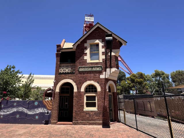
Tucked in next to the Museum of the Goldfields, is the British Arms Hotel. This hotel is believed to be the narrowest hotel in the southern hemisphere. Today the pub has become a museum with various antique displays.
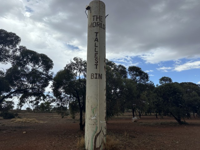
Directly in front of the British Arms pub is the World’s Tallest Bin, standing 8m tall.
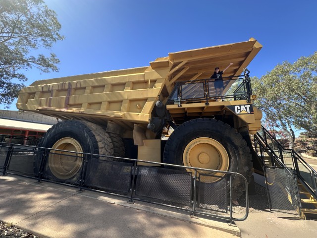
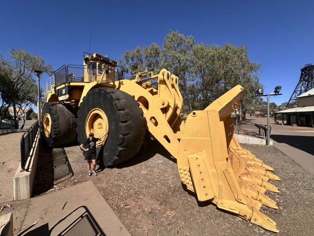
We kept a day open to visit the Hannans North Mine.
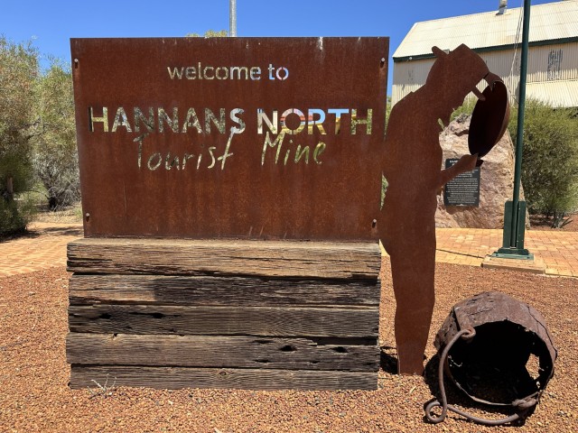
The mine has a display of mining history and equipment.
The experience starts with the most basic form of fossicking, called panning.
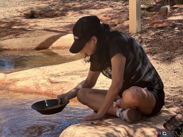
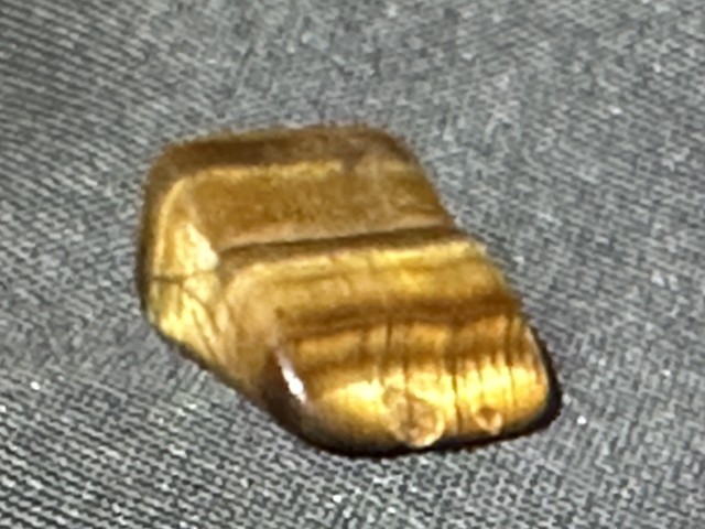
We had no luck with gold nuggets but at least walked away with a small tiger eye.
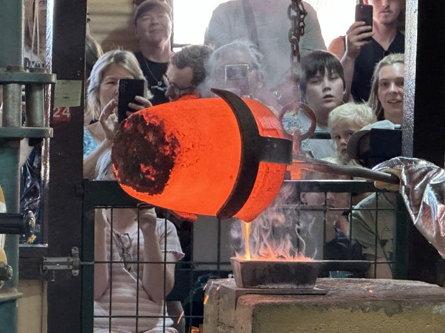
We visited the Chinese Garden of Remembrance, while waiting for the gold pouring demonstration.
The gold pouring demonstration was very popular with almost 50 visitors attending. The demonstration was very informative and the banter between the two old miners was quite entertaining.
To add to all the bad habits you could pick up in Kalgoorlie, gambling was also popular. Even today the two-up ring just outside town is still in use on weekends. After bets are placed, two pennies are thrown three meters into the air by one of the participants (the spinner) with a wooden paddle (kip) above the centre of the ring. The tail sides of the pennies are marked with a white cross. Participants (school) around the ring bet on double heads or tails or odds. Certain combinations result in the change of the spinner. The ringkeeper (boxer) is in charge of the betting process and keeping it fair and orderly.
Only Kalgoorlie and Broken Hill are licensed to play two-up in Australia. On ANZAC day, 25 April annually two-up can be played legally at any licensed venue to commemorate the diggers who often played this game to pass time.
Just outside the ring, we picked up two marked pennies.
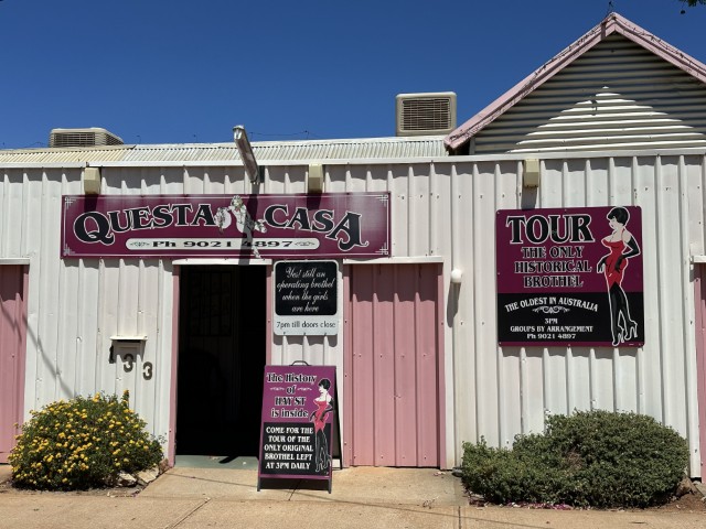
To finish the ancient mining trifecta of bars, gambling rings and brothels, we visited Questa Casa. Questa Casa is the oldest remaining brothel in the area and is still a registered brothel. They offer daily tours where the history of the town’s nightlife is explained by someone who lived it, Madam Carmel. The now 89 year old madam was running this 1890 brothel from age 55 and is one of the most knowledgeable people on Kalgoorlie’s history.
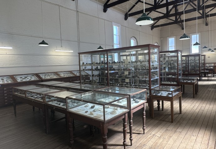
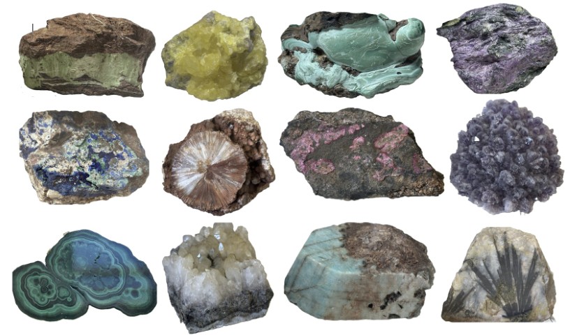
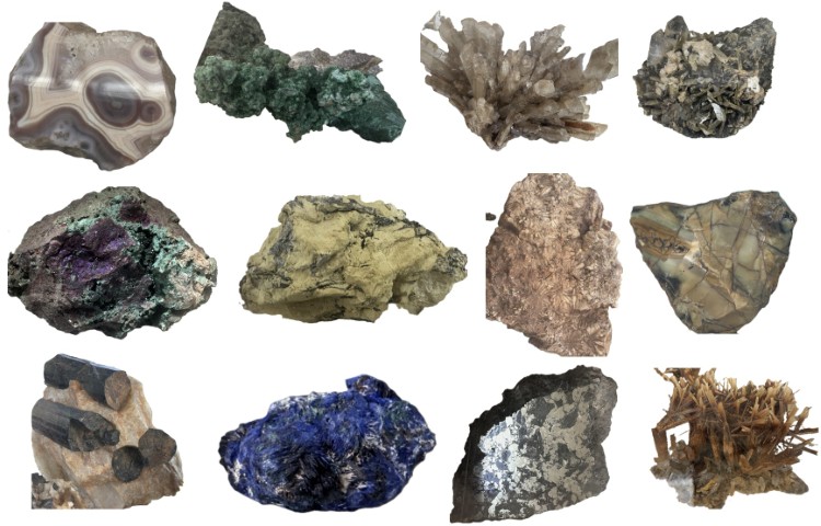
The WA School of Mines, Rocks and Minerals established the Museum of Gem Stones providing an insight in the local gemstones. We were very surprised by the amount of gemstones on display.
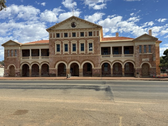
This was a fitting way to conclude our visit to Kalgoorlie. This was also, the most eastern city of Western Australia we visited. From Kalgoorlie we turned west in the direction of Perth. Our first town along the way was Coolgardie where we visited the Warden’s Court Building.
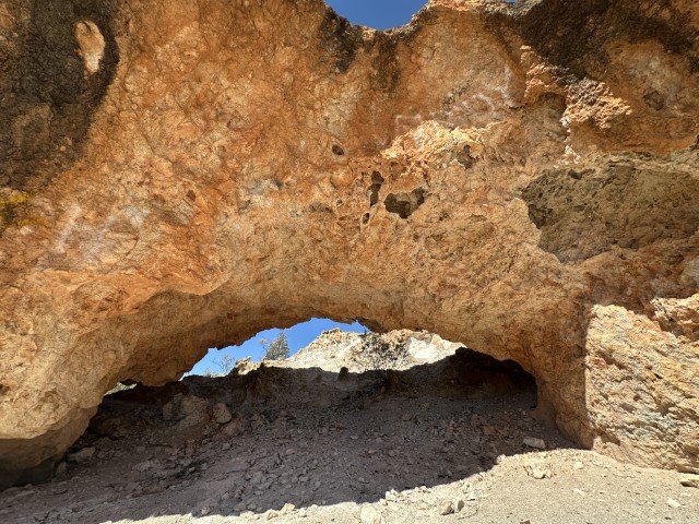
From Coolgardie we went to Bullfinch via Southern Cross. The Halfway Rock Natural Arch was a feature on our way.
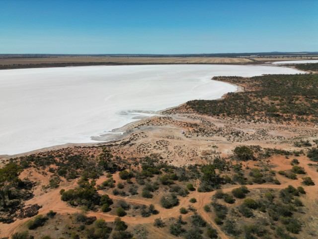
We passed Lake Julia, one of the salt lakes in the area.
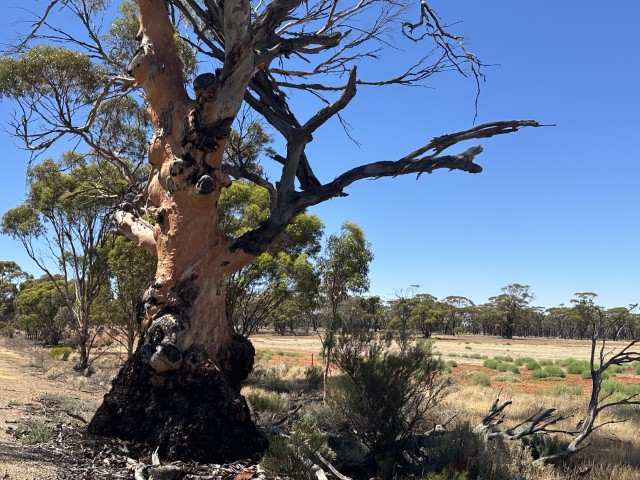
We could see the vegetation change as we headed north with a few old River Red Gum trees along the road.
Due to an extreme heatwave we decided to stop at Bullfinch settlement for a few days where we could plug in and run the aircon.
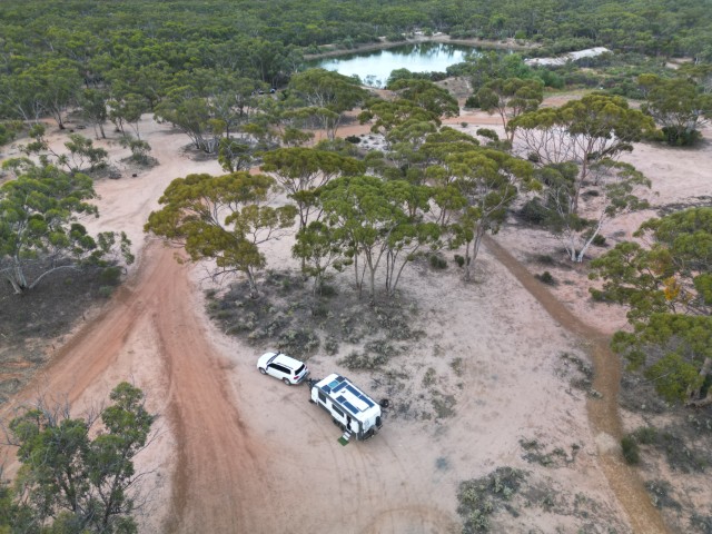
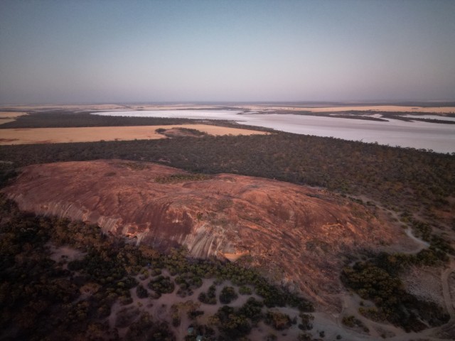
After four days in Bullfinch, we continued to Baladjie Nature Reserve. We set up camp between the rock and the lake.
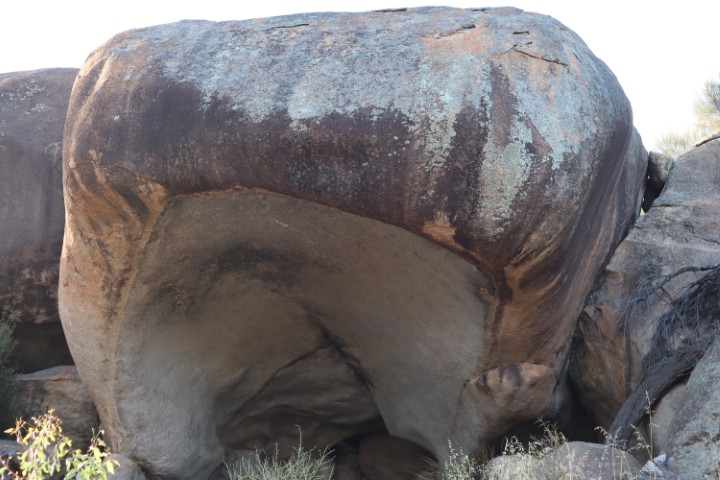
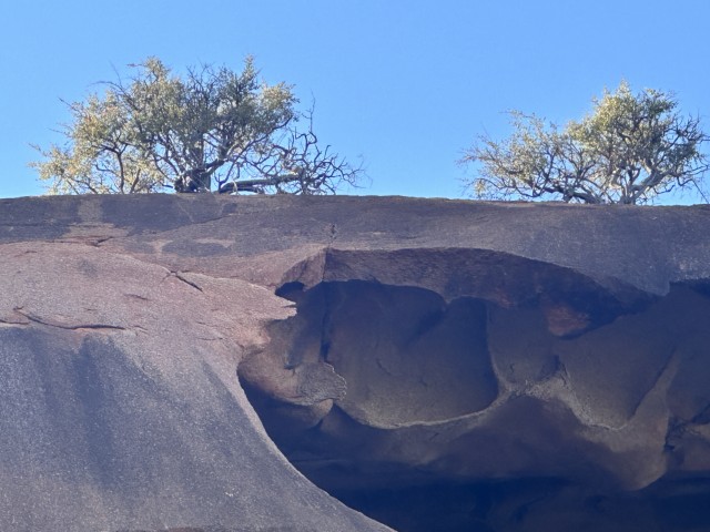
From the Baladjie Rock cave we could see our caravan in the distance.
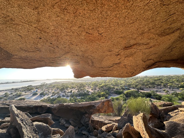
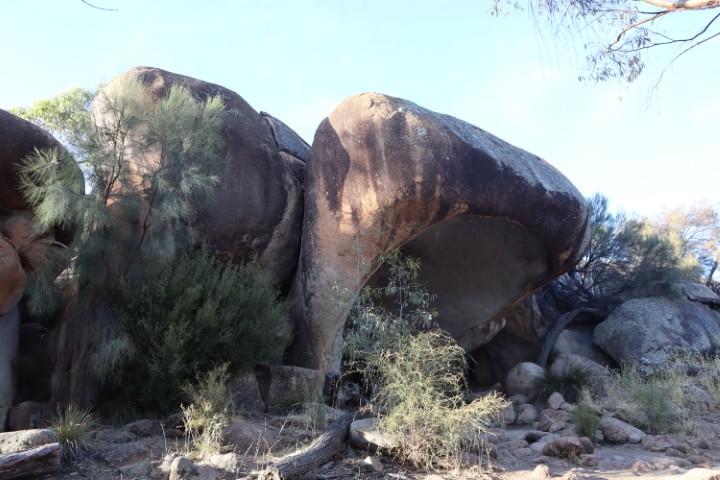
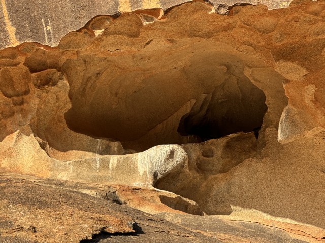
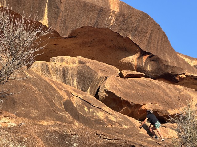
Baladjie Rock has many caves and outcrops to explore.
A few sections on the rock were extremely steep. These steep sections led to caves high up, where birds of prey nest. We have never seen birds so quick to spot and attack our drone as it ascended.
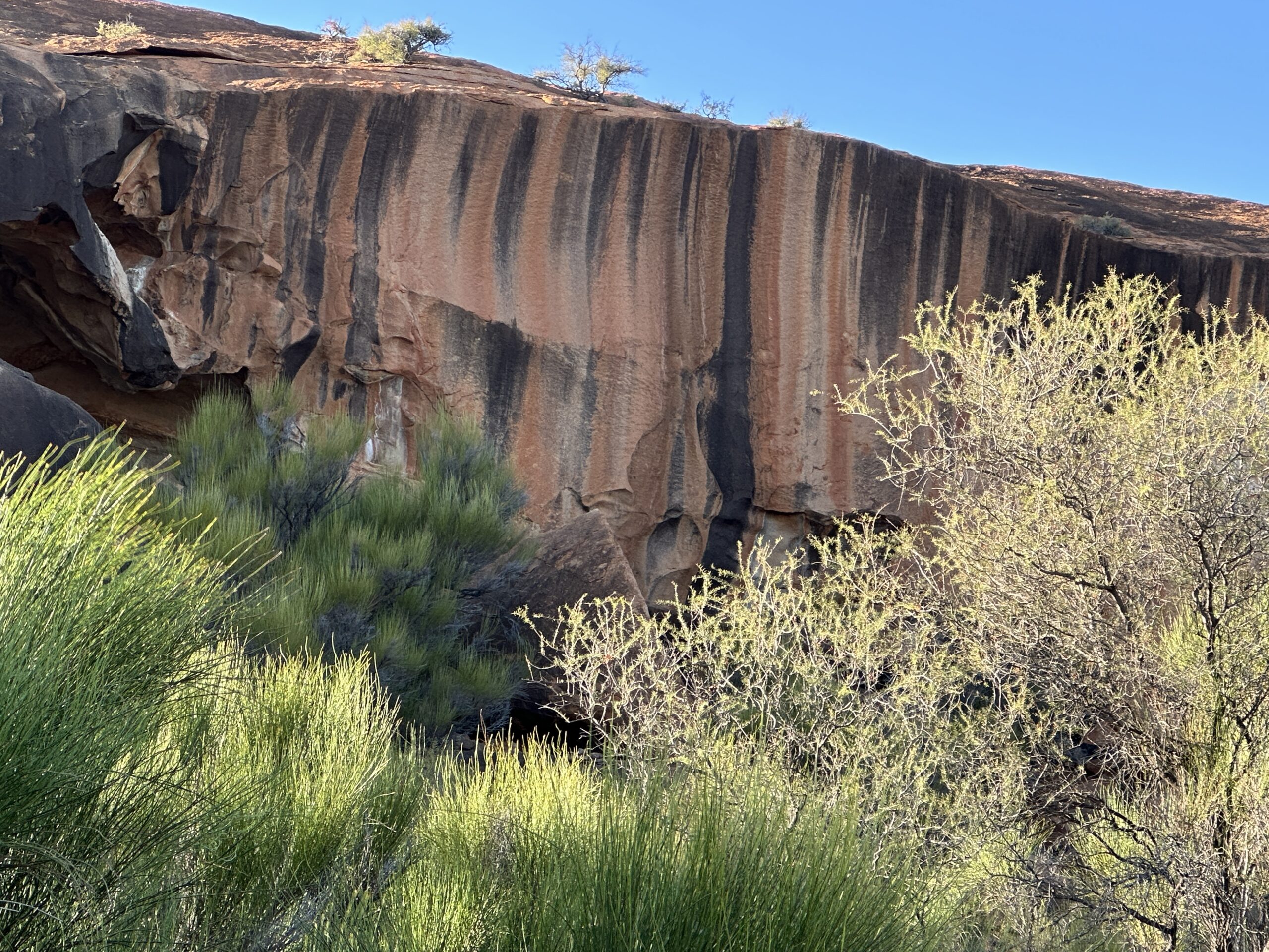
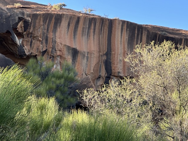
The colours and formations of the rock were even more impressive than Wave Rock.
The top of the rock has many small trees bonsaied by the shallow soil.
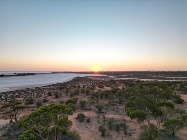
We enjoyed or last sunrise over Baladjie Lake before our next travel day.
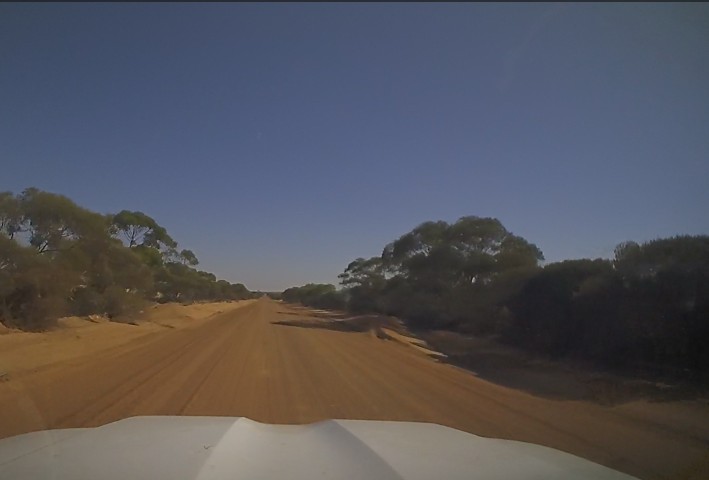
From Baladjie Nature Reserve rock and lake we took a dusty corrugated dirt road to Elachbutten Rock.
Elachbutten Rock was one of the destinations we were keen to explore.