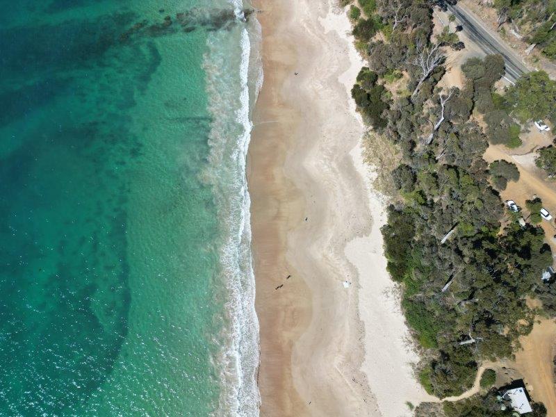
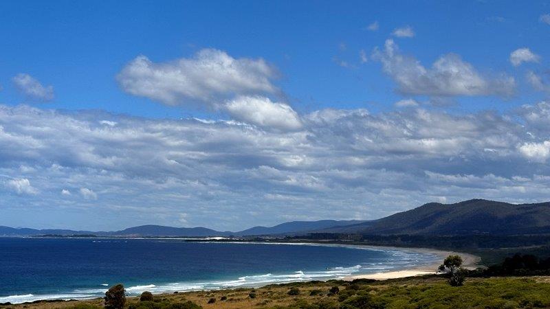
Moving north on the Tasmanian East Coast took us to one of our favourite campsites so far, Mayfield Bay Campsite. As you drive into the campsite, it is easy to see why this donation camp is so popular. It has great views of the beach and the turquoise waterline. We were lucky to snag the only available spot in the camp as another caravan was leaving on our arrival.
We bunkered down for a few days to enjoy the beach and the local towns around it.
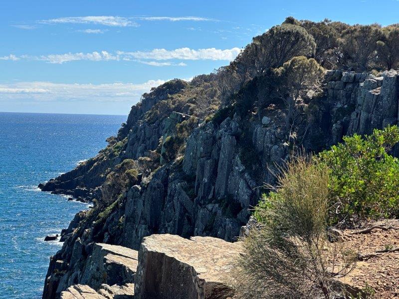
Orford is a small town just south of Mayfield Bay. The town has great views from its day use area and a walking track on top of the cliffs. We did the East Shelley Cliff Top Walk to a 19th-century sandstone quarry.
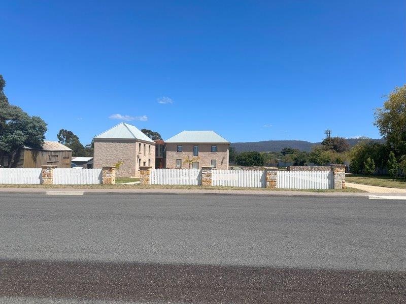
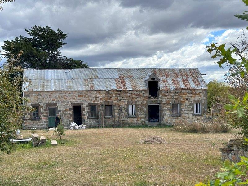
Triabunna is best known for its ferry connection to Maria Island and The Fish Van seafood take-away. On the way to The Fish Van, we passed the Barracks. The barracks are sandstone buildings and stables dating back to the 1840’s. It has since been redeveloped into modern accommodation.
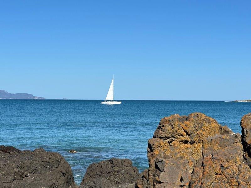
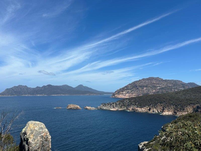
While in Mayfield Bay, we did a day trip north to Freycinet National Park. Our first stop was Coles Bay, looking towards the mountains we were about to explore.
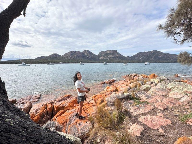
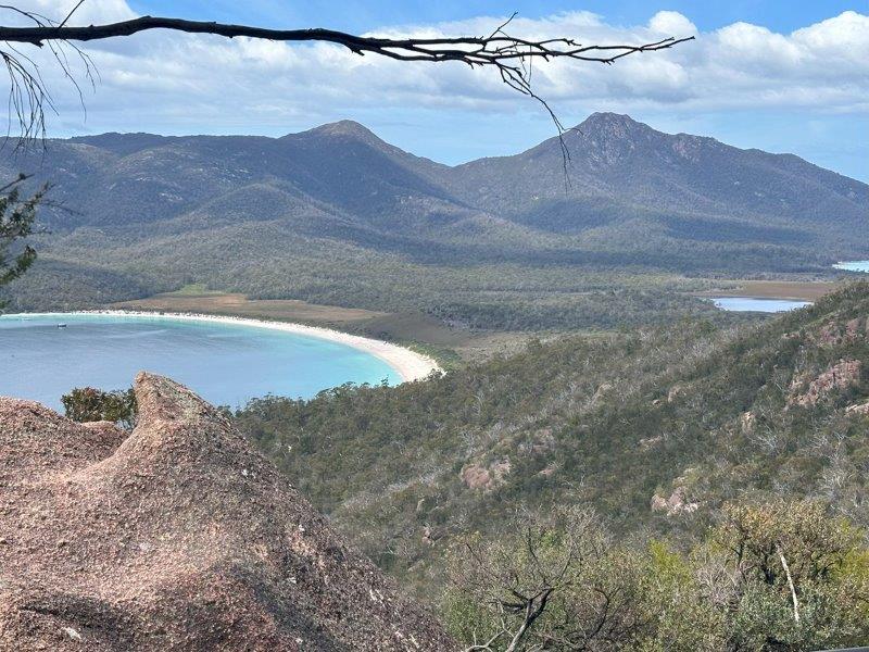
After a steep walk to the Wineglass Bay lookout, the views from the top made the uphill trek worthwhile. We were surprised with the amount of overseas visitors on the track.
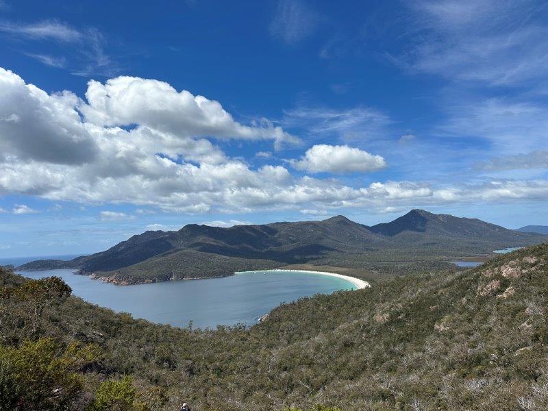
This was a great spot for lunch, looking down on Wineglass Bay with glimpses of Promise Bay to the right.
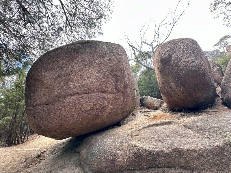
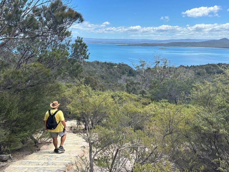
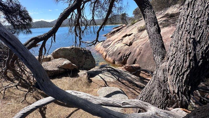
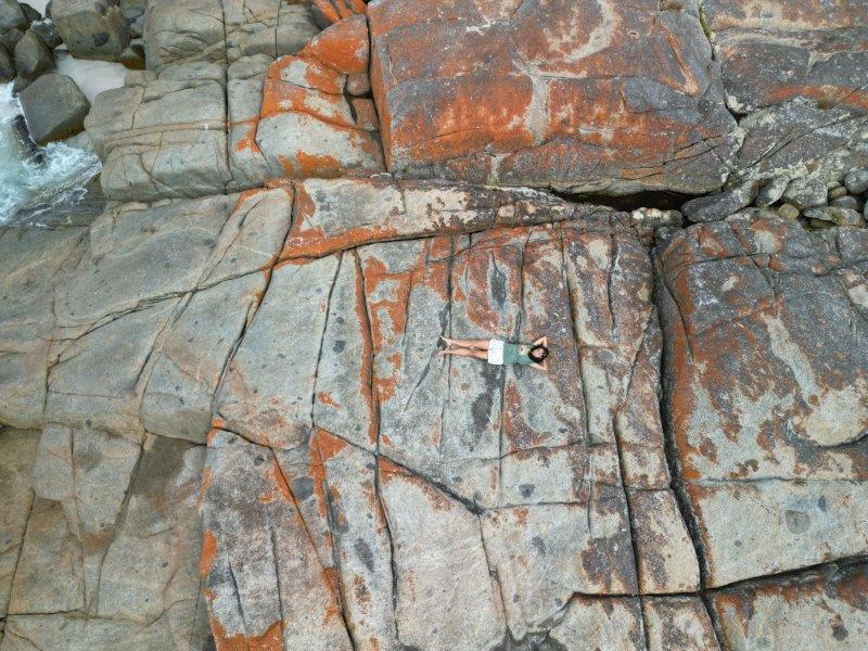
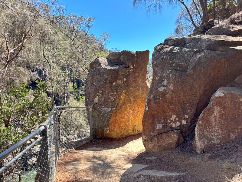
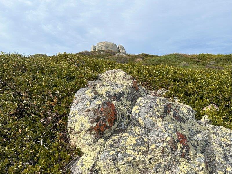
The walk to the top of Wineglass Bay is a circular route. On the way back down to the car park, we meandered through massive granite boulders and stopped a few times to enjoy the views.
Cape Tourville Lighthouse was close by and provided another great angle over Wineglass bay.
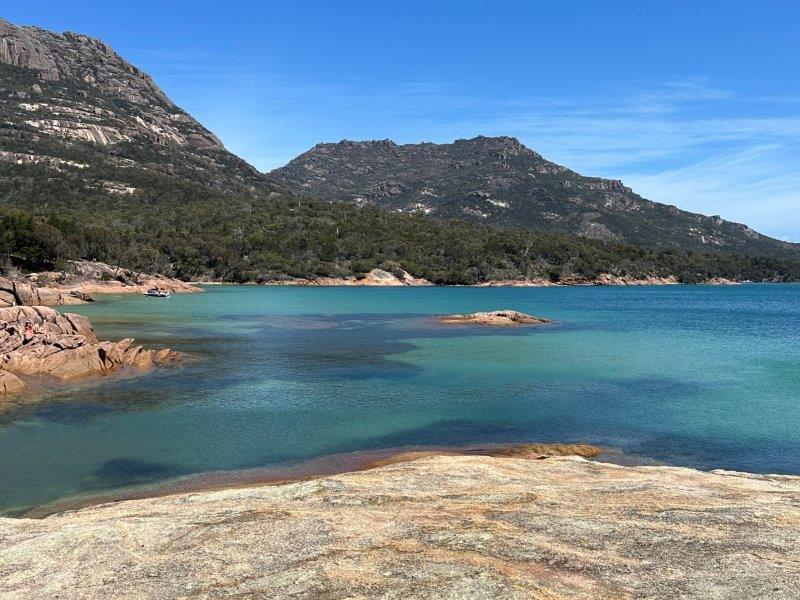
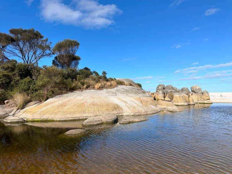
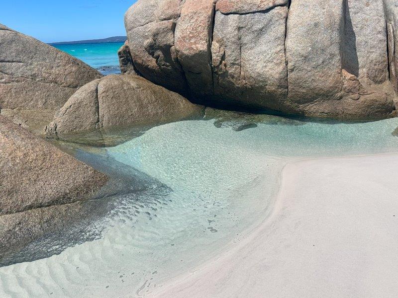
Honeymoon Bay is a very small beach enclosed by granite rocks. The water was crystal clear and warm. This spot is very popular with backpackers and its difficult to get a parking space nearby. It was up there with our favourite beaches so far.
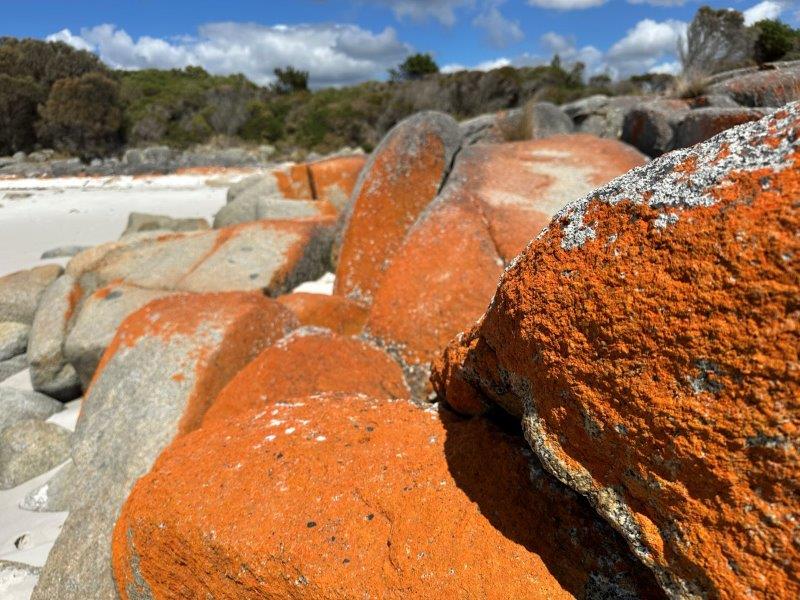
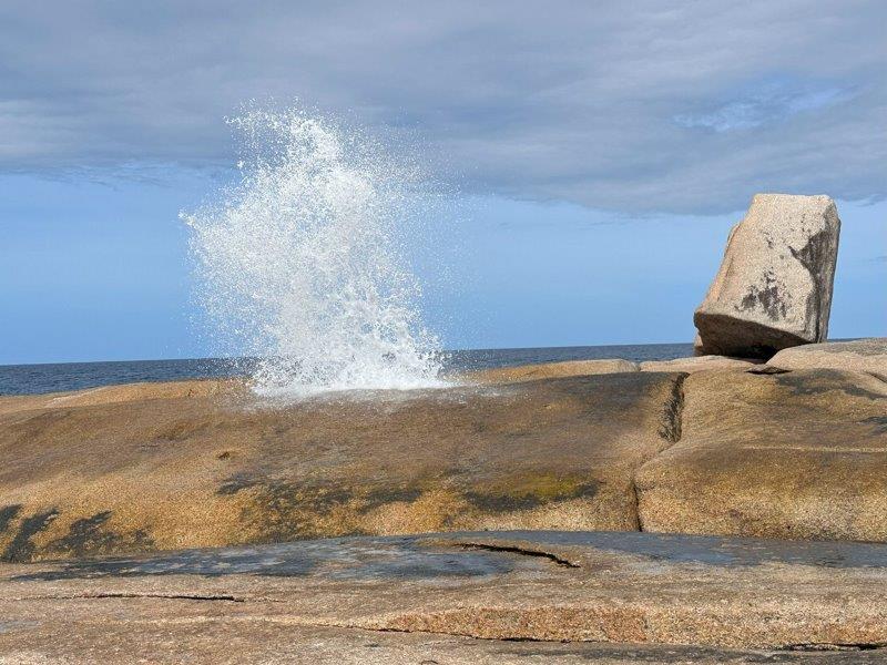
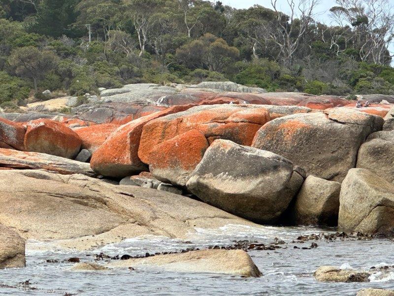
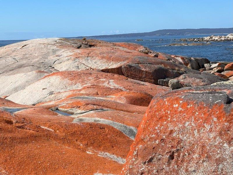
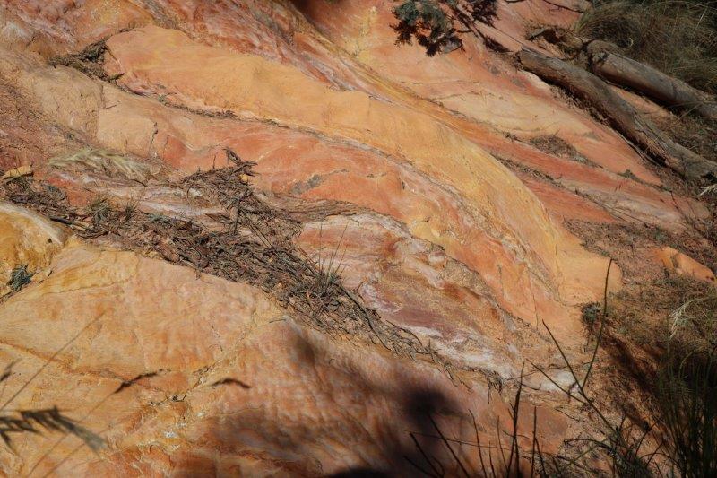
Just north of Freycinet is Bicheno, where we stopped to admire the blowholes, we had our first encounter with the orange rocks that the Bay of Fires is known for.
After Bicheno we went back to Mayfield Bay Campsite for our last night. Sadly we had to pack up and get ready to move further north the next day. Our next camp was Lagoons Beach Camp Ground at Chain of Lagoons.
From this campsite we focused on the inland areas around the Chain of Lagoons. There are two potential passes linking Chain of Lagoons with St Marys. It’s not recommended to tow larger vans through the Elephant Pass Road, so with the van being parked up, it was a great opportunity to drive the Elephant Pass Road to St Marys for a daytrip.
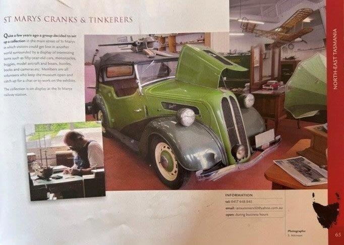
Cranks and Tinkerers Museum was our first stop and what a pleasant surprise. Filled with old cars to old magazines, and everything in between. We spent almost two hours with Ian Summers, the owner. Ian was happy to answer all our questions on the exhibition. Ian is a local who grew up in the district to become a teacher at the local school. He’s not only a collector and model ship builder, but has incredible local and general knowledge and a variety of interests and skills.
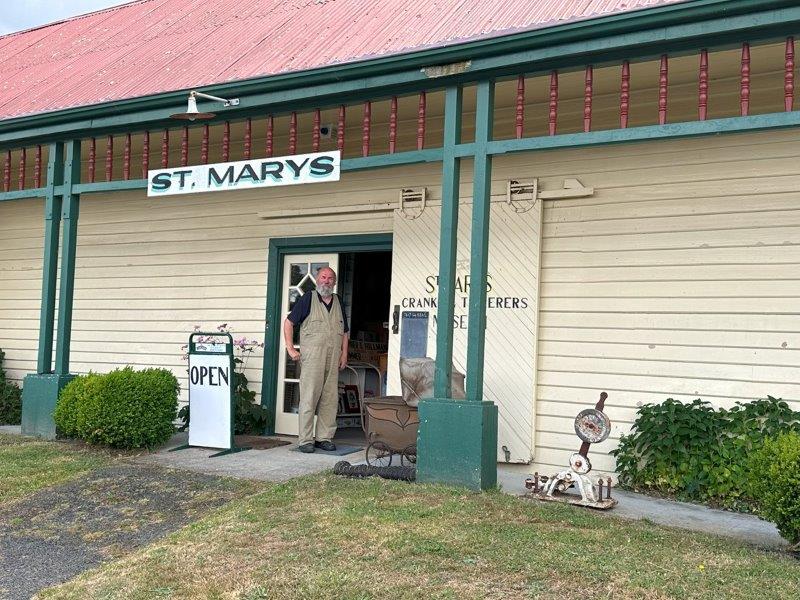
This museum in the old Railway Station has become a Tasmanian icon and is often referenced in Tasmanian travel sites and publications.
It felt as if Ian had a million items on display, and every item had an interesting story.
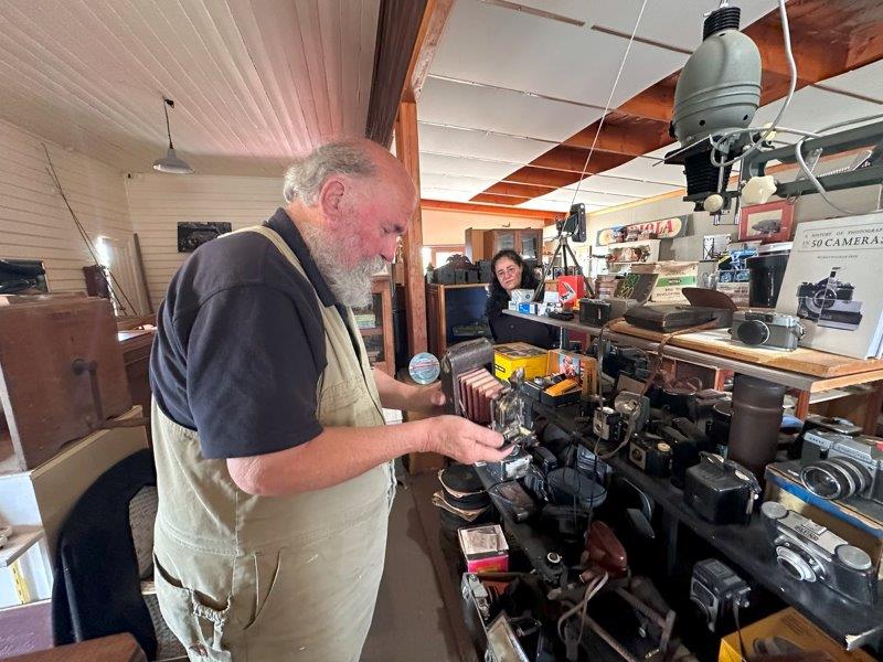
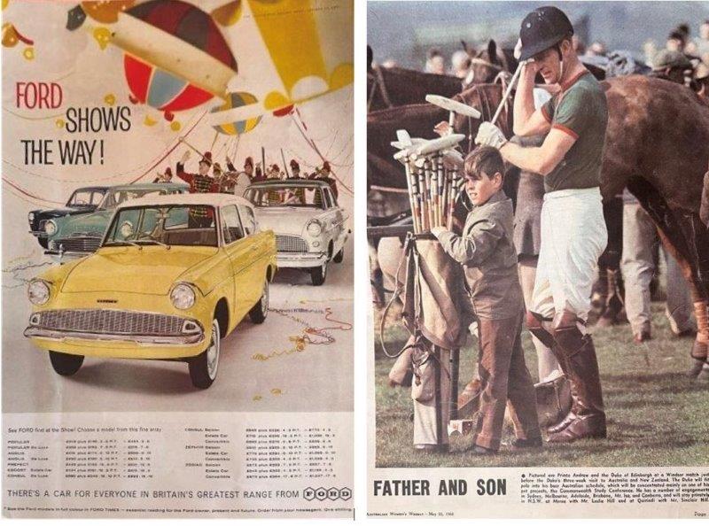
Old magazines dating back to when King Charles was still an ankle biter and Ford released the Anglia, were on display.
The next small town was Fingal where we saw the Prince of Wales stables from the main road. The stables were under renovation.
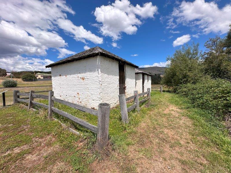
Further down the main road there were a few old convict cells built in 1842 on the Esk River, used to lock up recalcitrant prisoners.
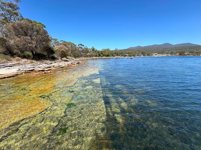
After the Chain of Lagoons, we moved to Swimcart Beach Camping area. This was the perfect spot to explore the Bay of Fires. Arriving in the Bay of Fires, you assume a link between its name and the reddish rocks. The Bay of Fires was apparently named by an early English explorer Tobias Furneaux in 1773, after seeing fires burning along the coast. Our first stop was at The Gardens where sand and rock tracks link the massive orange boulders.
We could not get enough of the orange rocks, turquoise water and white beaches. Our next stop was the Great Lagoon area.

Scotsman’s Creek is a private beach, where the creek meets the ocean.
Margerys Corner was our last secluded beach before heading back to our camp at the Swimcart Beach Camp.
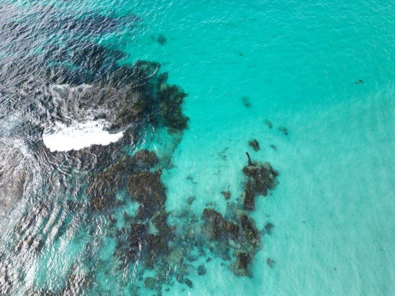
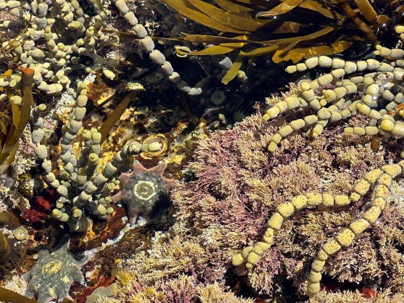
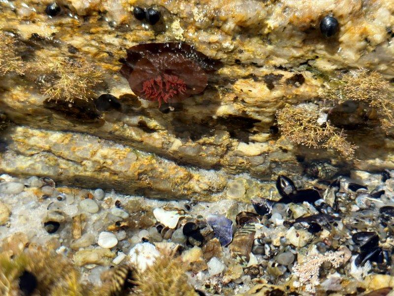
At low tide, we took a quick walk to the Starfish Garden. The underwater life was remarkable in term of colours, textures and details.
We extended our stay at Swimcart Beach Camp to seven days. It was conveniently close to St Helens’s shops and restaurants. The local council also provides a convenient potable water station. We were able to fill water tanks every time we visited St Helens, to extend our off-grid stay.
After the Bay of Fires we headed inland to Fingal. Fingal has a donation campground. Although it has space for about seven vans, there are two lucky sites with both a power and water hook-up on a first come, first serve basis. We were one of the two lucky ones. We generally run on solar power and our battery system. This was first time in 50 days we hooked the van up to a power supply. Fingal was surrounded by places of interest. We left Fingal early in the morning to explore the area, with our first stop being Halls Falls near Lottah. Here, an easy 2.5km walk from the carpark takes you to the falls.
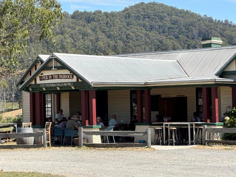
For lunch, we stopped at the Pub in the Paddock. This Pub is literally in the middle of remote paddocks, and extremely popular.
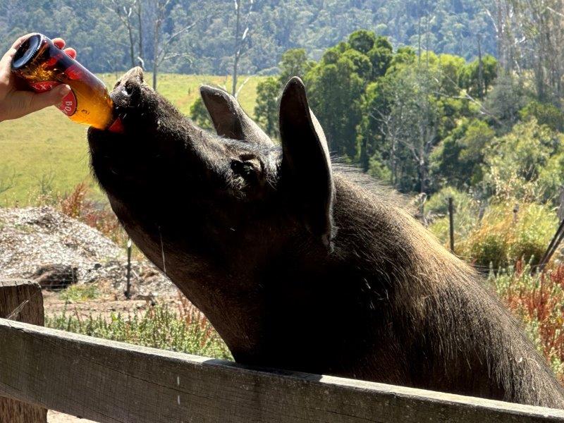
The Pub in the Paddock is also well know for the beer drinking pig. Just for the record, I believe it to be non-alcoholic beers. You can buy a beer from the pub to feed the pig. The pig storms the gate when patrons approach. Trust me, she sculls those bevvies.
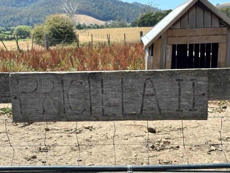
The name plate on the pigsty is “Pricilla II”. I was too scared to ask what happened to Pricilla I.
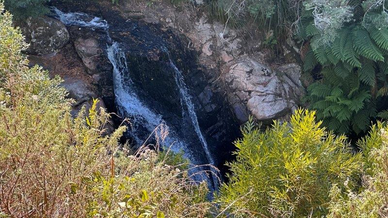
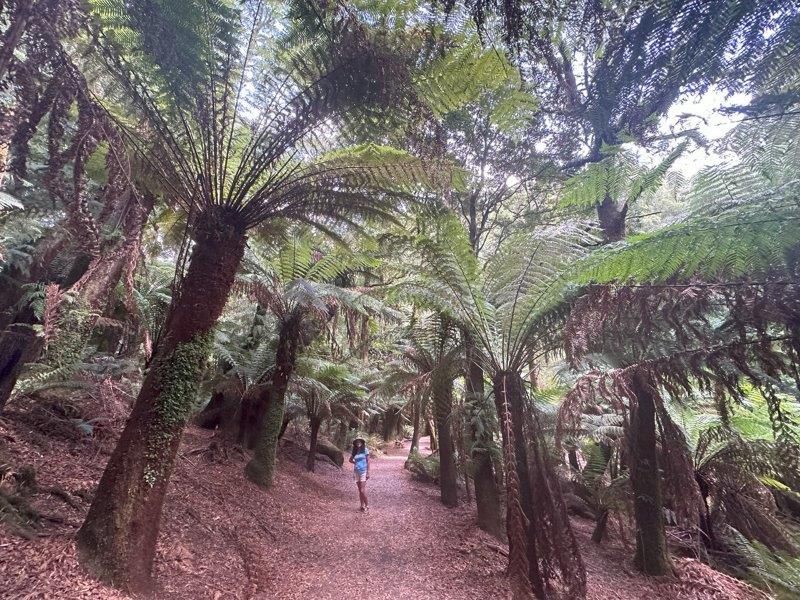
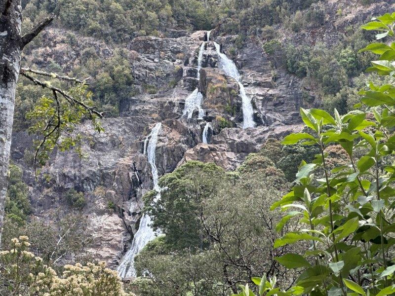
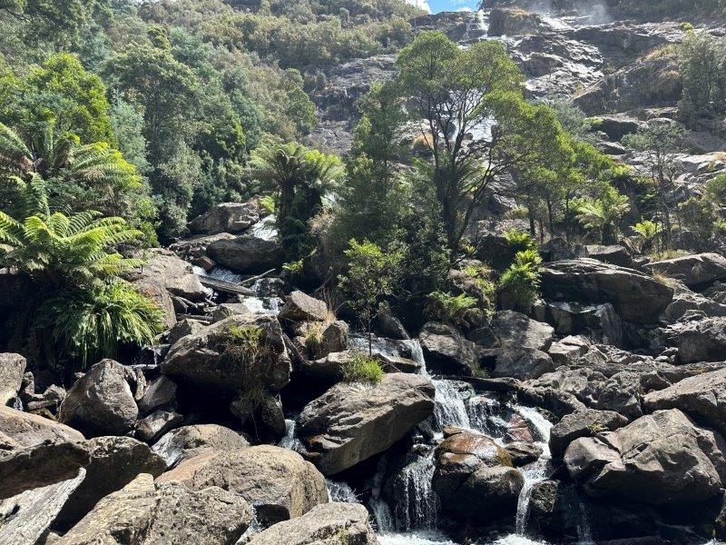
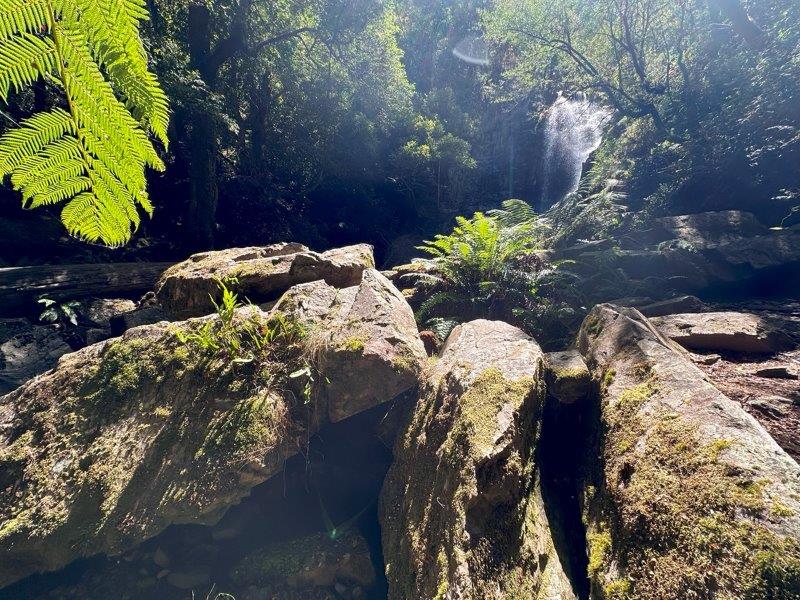
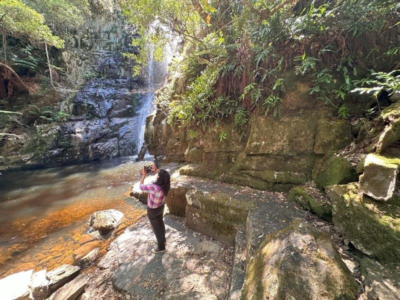
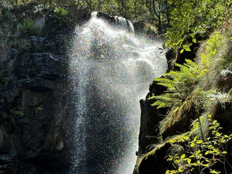
After lunch, we did the St Columbia Falls walk close to Pyengana. The 1.2km walk from the carpark takes you through ancient tree ferns. If your consider the rate at which these trees grow (25 – 50mm per year), these trees could be up to 200 years old.
The walk takes you to one of Tasmania’s tallest cascading waterfalls, measuring 90 meters.
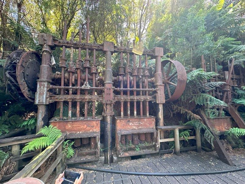
Our last stop for the day was the Anchor Stampers at an old tin mine near Lottah. A quick 500m walk takes you down to the isolated stampers. It is impossible to imagine that this was home to 150 mining families back in the day.
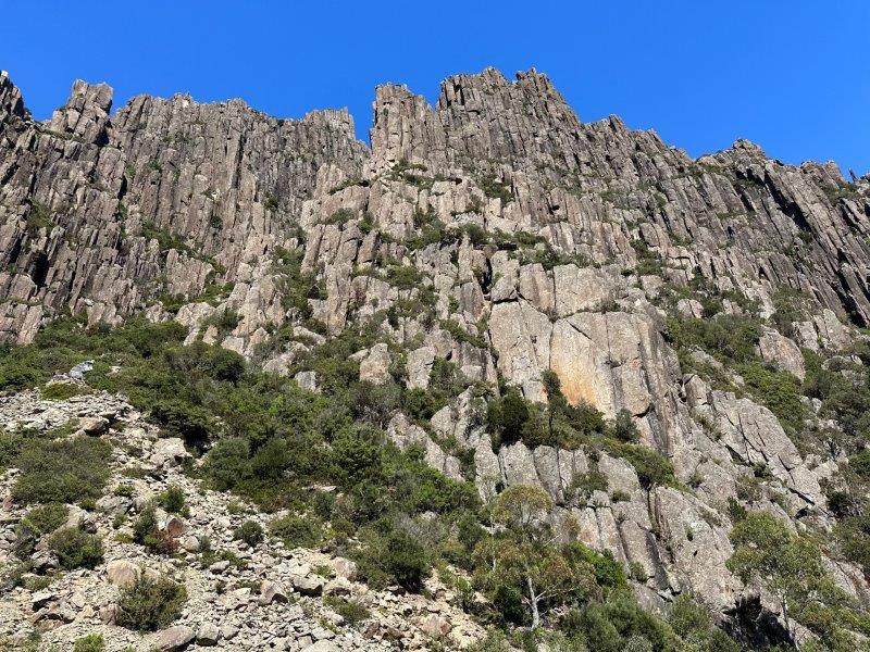
The next day we headed to Ben Lomond mountain and stopped at the painted walls close to Mathinna. These coloured rock formation has a soft, powdery texture.
Ben Lomond is best know for skiing in winter, the hair raising Jacob’s Ladder track and the alpine road. Ben Lomond is one of Tasmania’s two ski fields. Even without snow, its still an impressive mountain.
On the way back, we did the Mathinna Falls track. We were the only ones on the track and in the carpark.
This was a great spot to spent a few hours and have a picnic at the shaded falls.
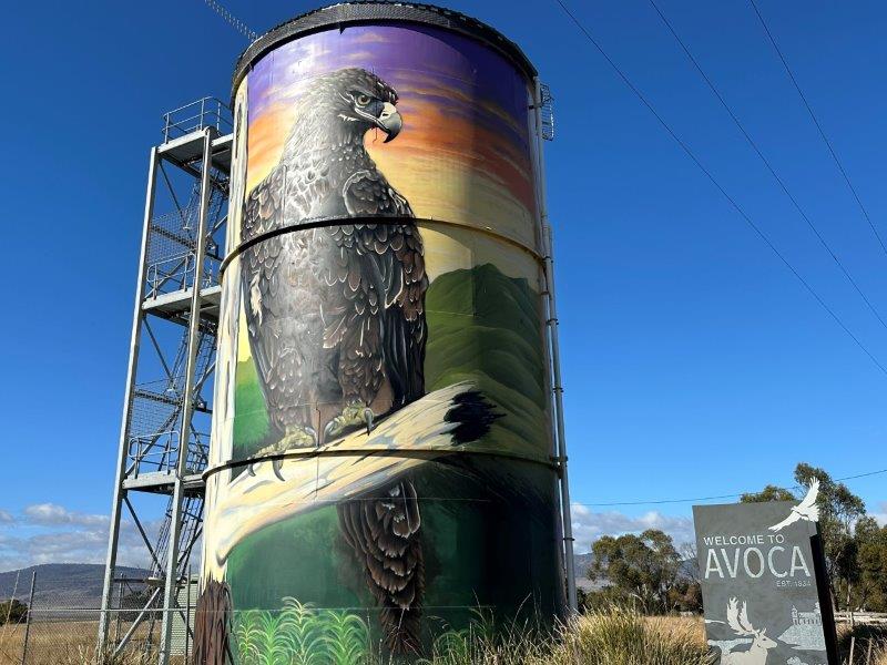
From Fingal, we headed west towards Launceston passing Avoca’s Wedge Tailed Eagle water tower art.
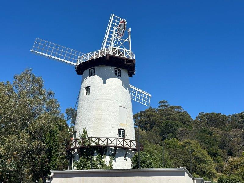
In Launceston, on the way to Cateract Gorge we passed the Penny Royal Windmill.
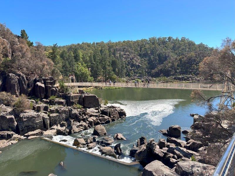
We then crossed the Alexandra Suspension Bridge in Cateract Gorge to do the Sentinel Lookout walk.
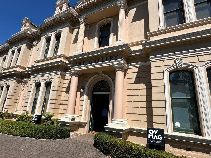
Our last stop for the day was the Queen Victoria Art Galley.
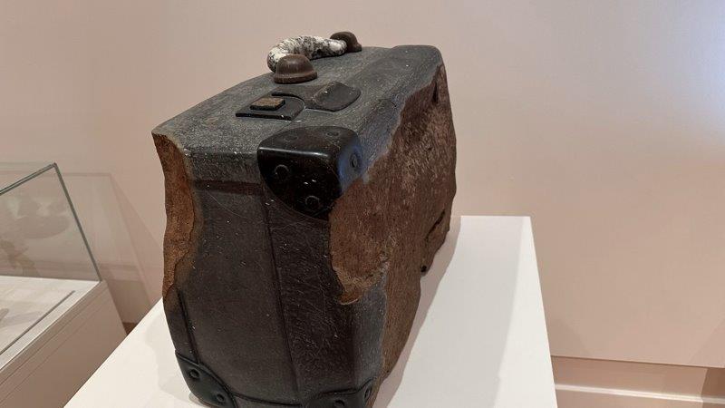
It looks like hard work to make a suitcase out of granite. This suitcase by Helmut Schwabe was on display during our visit. I wonder what the excess luggage charge would be at the airport…
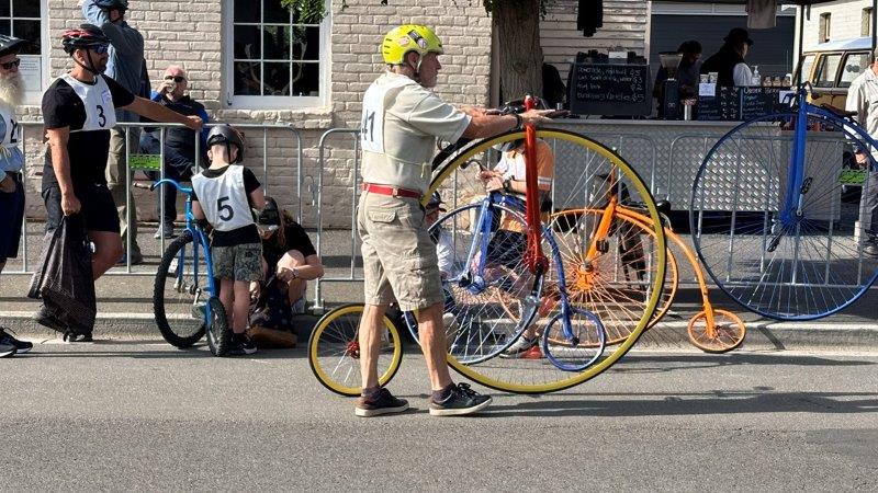
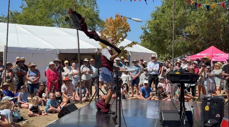
We were excited that our Tasmanian visit coincided with the 2024 Penny Farthing Championships in Evandale. There are few things in life that make people smile like a Penny Farthing gliding by.
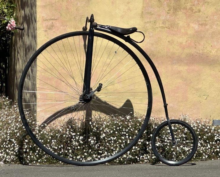
Enthusiasts and cyclists between 8 and 88 years old were competing in the different categories.
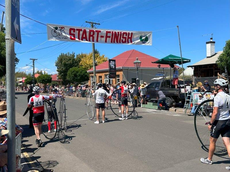
We were lucky to get a spot at the finish line for the male and female championships.
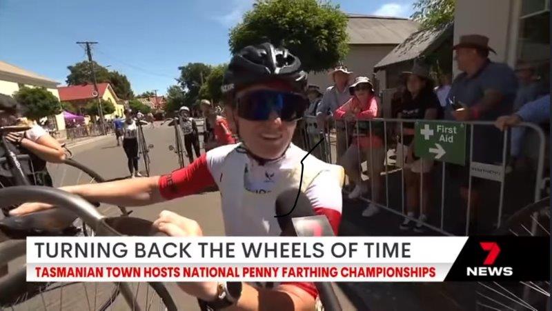
We even made it onto 7News that night standing behind Lizanne Wilmot, the female 2024 Champion during her post race interview.
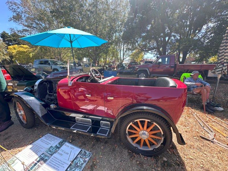
Evendale has put on a vintage car show and steam engine display for visitors. This award winning scale model of the 1920 Buick caught our eye.
During lunch a comedian Joel Salom wowed the crowd, with laughs all round.
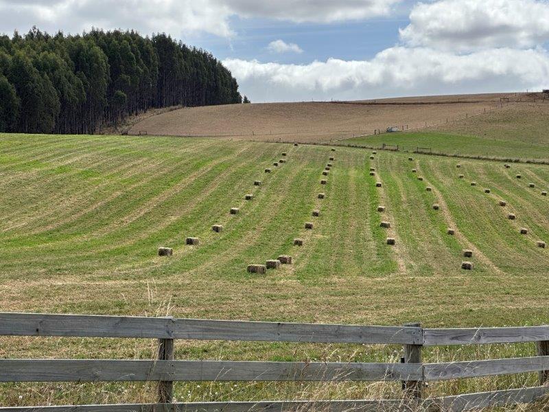
We went east for a few days to Scottsdale. This small town is surrounded by farmland and has a RV friendly campground with full amenities and water hookups. The park is next to the town’s day use area. The day use area has ponds where we spotted a few very active platypuses.
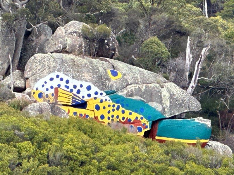
From Scottsdale we explored the local area. This area is known for mountain biking, trout fishing and the flouting saunas. On our way to Derby we saw this painted trout on the rocks.
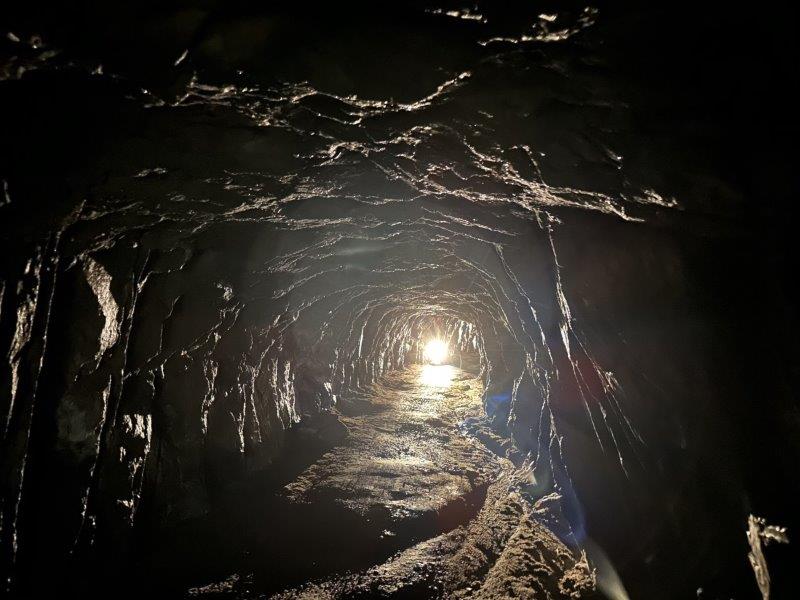
In 1880, a tin miner requested his neighbour to move tailings from his lease over the neighbour’s lease towards the town. After the neighbour declined the request, he dug a tunnel under his neighbour’s land. The tunnel is 2m high and 200m long. Today, the tunnel is part of a network of mountain biking tracks. We struggled to get the entrance to the tunnel. We took the wrong track to the tunnel and ended up walking a few kilometres on the mountain bike tracks. It felt like being a contestant on “The Wipeout Zone”. We had a few near misses with bikes flying past and over us.
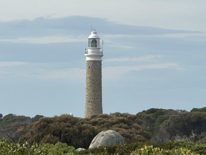
We also visited the 1889 Eddystone Point Lighthouse. After a dusty gravel road of about 40km and a close encounter with a cow crossing the road, we got to the most north eastern point of Tasmania. This is the only pink granite lighthouse we’ve seen so far.
A short bushwalk from the lighthouse took us to the rocks at Larc beach and a string of secluded and isolated beaches.
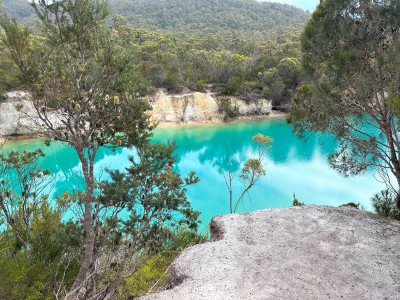
On the way back to Scottsdale, we stopped to walk around the Little Blue Lake at Gladstone. The vivid aqua blue lake is a natural phenomenon after water has filled an old mine hole. As inviting as it seems, its not recommended to swim in the lake, due to the high mineral content at its base.
We travelled from Scottsdale to Kelso Bay to explore Beaconsfield. To get to Beaconsfield we had to cross the Batman Bridge. We could not see the resemblance between the bridge and Batman, but after doing some research, we found that the bridge was actually named after John Batman, a local businessman and co-founder of Melbourne. John pushed to get Melbourne named Batmania in the early days. Go figure…
![]()
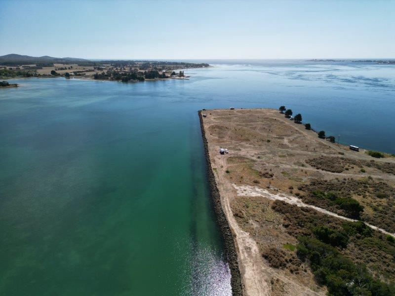
We had a free camp site on a little peninsula, called Kelso Bay Campsite. The camp was basic but conveniently located to the various points of interest we wanted to visit.
Beaconsfield Gold Mine made headlines worldwide on 25 April 2006 after a shaft collapsed with 17 miners in it. Fourteen miners got out unscathed, one passed away and 2 miners got trapped one kilometre below ground. Todd Russell and Brant Webb were trapped for 14 days with only Webb’s muesli bar to share between them. The world was watching as the two men were rescued on 9 May 2006.
![]()
Green Point was the closest town to our camp and we did the Green Point Loop Track. The walk had great views from the top.
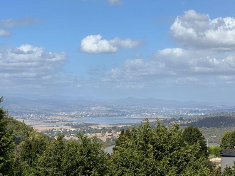
We also decided to visit Launceston again to see a few places we missed on our previous visit. Our first stop was Tamarhorn Lookout at Grindewald. The short walk to the top was rewarded with great views of the Tamar valley.
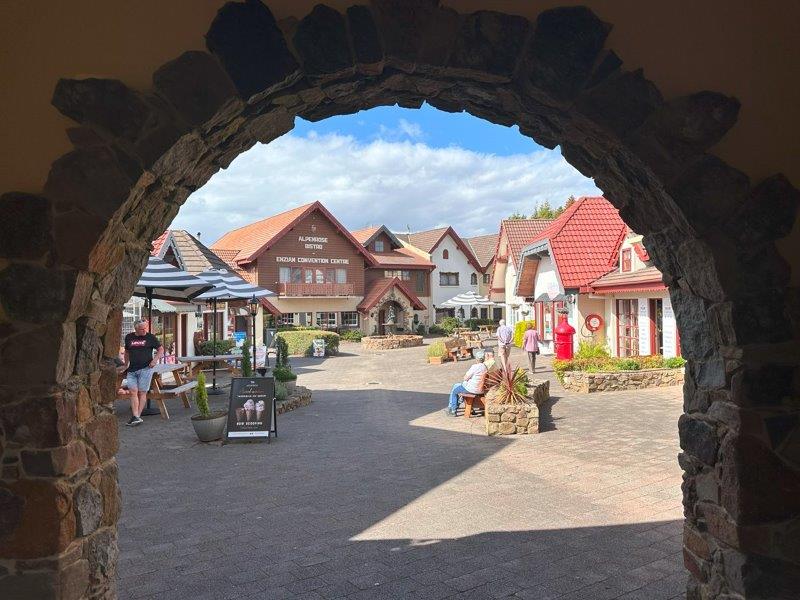
Grindewald is a Swiss inspired town, built in 1980 around an artificial lake. The village was the brainchild of a Dutch immigrant, Roelf Vos. Roelf sold his grocery store chain to Woolworths before starting to build his dream in Tasmania.
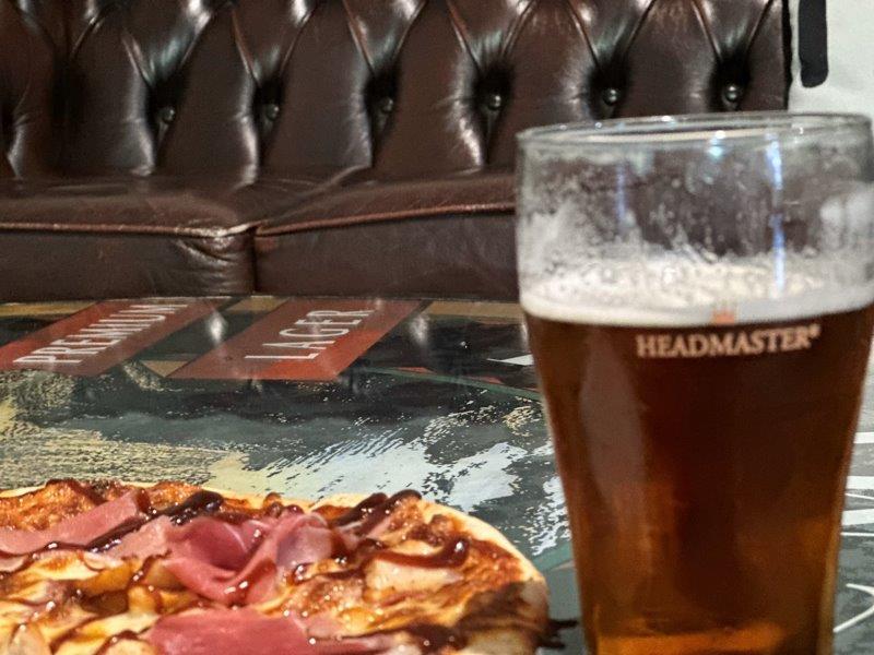
Tasmania is know for some of the cleanest water in the world. The water from the Esk river is the base ingredient of James Boug’s beer. They started brewing more than 150 years ago and are still operating from the same site.
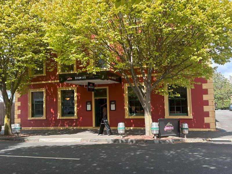
You can still have a beer brewed on the 150 year old recipe, or choose a more modern brew. We had one of each. This was a great spot to spend my birthday, before we headed west for our final leg of our Tasmanian trip.